The best running trails around Casas De Don Pedro
22
runners
4
runs
Jogging routes around Casas De Don Pedro are situated within the Siberia Extremeña region of Badajoz, Spain, characterized by diverse natural environments. The landscape features extensive dehesa ecosystems with holm and cork oaks, providing shaded paths, alongside more open fields and shrubland. Runners can find varied terrain, from gentle slopes near the Embalse de Orellana to more challenging areas. The region offers a mix of wooded trails and routes along reservoir shores, suitable for different running preferences.
Best jogging routes…
Last updated: July 11, 2026
2
runners
6.80km
00:49
170m
170m
Hard run. Good fitness required. Sure-footedness, sturdy shoes and alpine experience required.
12
runners
16.2km
01:58
210m
210m
Hard run. Very good fitness required. Sure-footedness, sturdy shoes and alpine experience required.

Sign up for free
5
runners
4.75km
00:29
20m
20m
Easy run. Great for any fitness level. Mostly paved surfaces. Suitable for all skill levels.
3
runners
13.0km
01:46
410m
410m
Hard run. Very good fitness required. Sure-footedness, sturdy shoes and alpine experience required.
Our route recommendations are based on thousands of hikes, rides, and runs completed by other people on komoot.
Start today with a free account
Your next adventure awaits.
Login or Signup
Tips from the Community

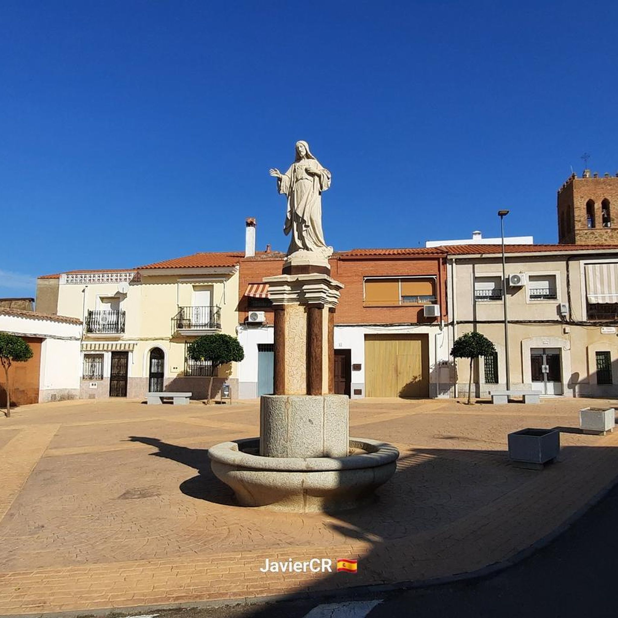
Cerro Masatrigo is a hill located in the municipality of Esparragosa de Lares. This hill is known for its almost perfect conical shape, which has earned it the nickname "the magic mountain" It rises 501 meters above sea level and 161 meters above the surrounding terrain. After the construction of the La Serena Dam, Cerro Masatrigo became a peninsula surrounded by the waters of the reservoir.
7
0
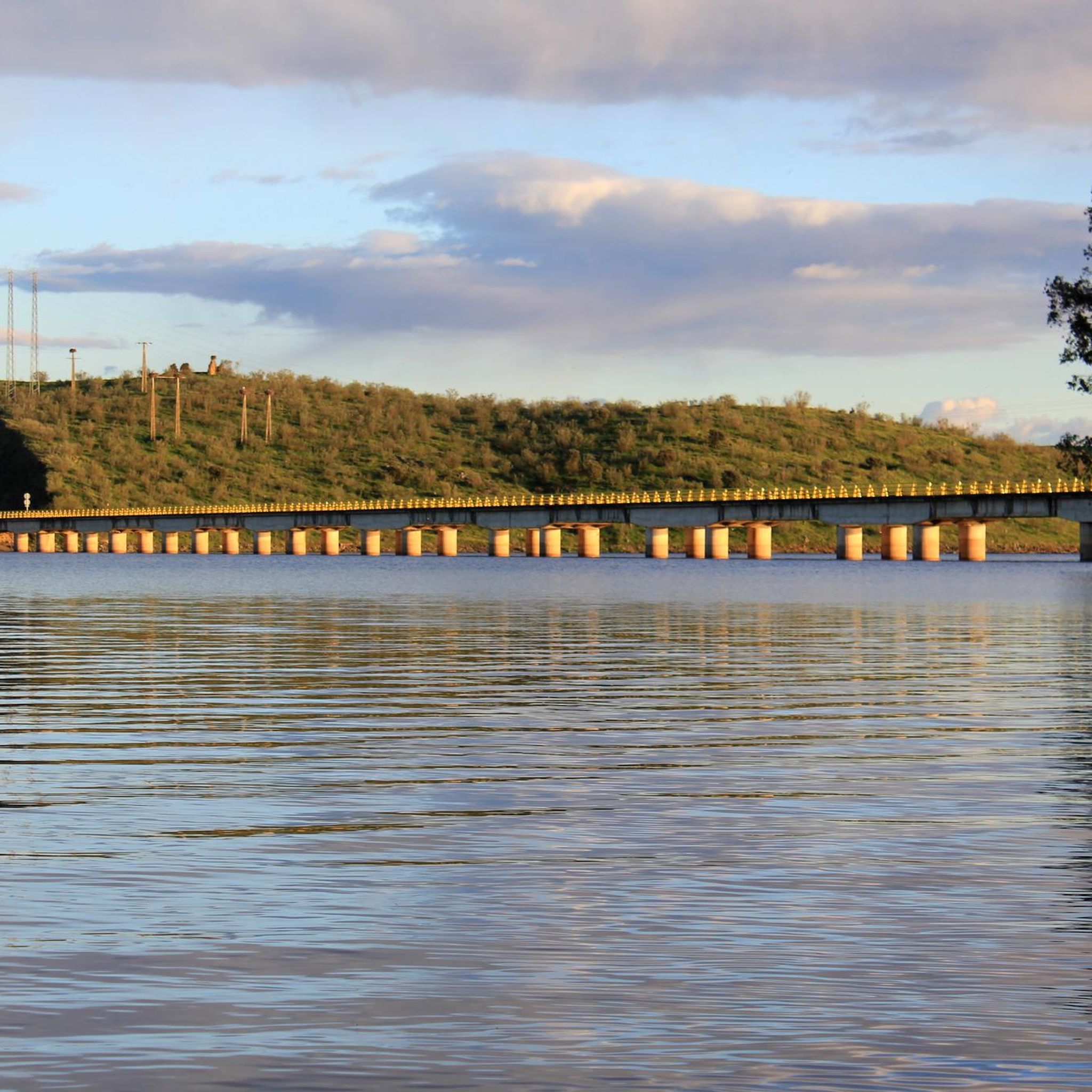
Built in 1985, this reservoir has a capacity of 15 cubic hectometres and is known for its recreational activities such as carp, royal carp and black bass fishing. In addition, the reservoir has a beach that has been awarded the Blue Flag in 2023, making it an attractive destination for visitors.
7
0

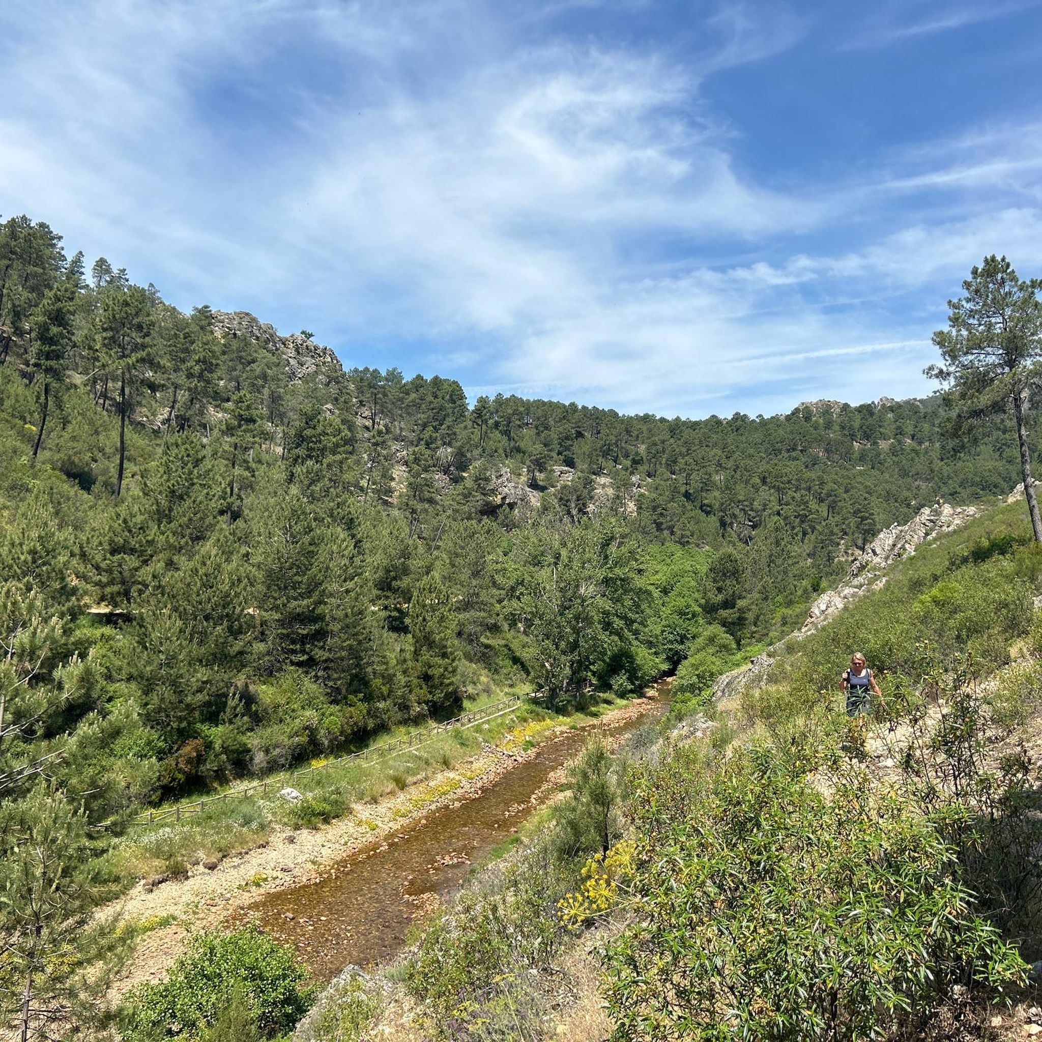
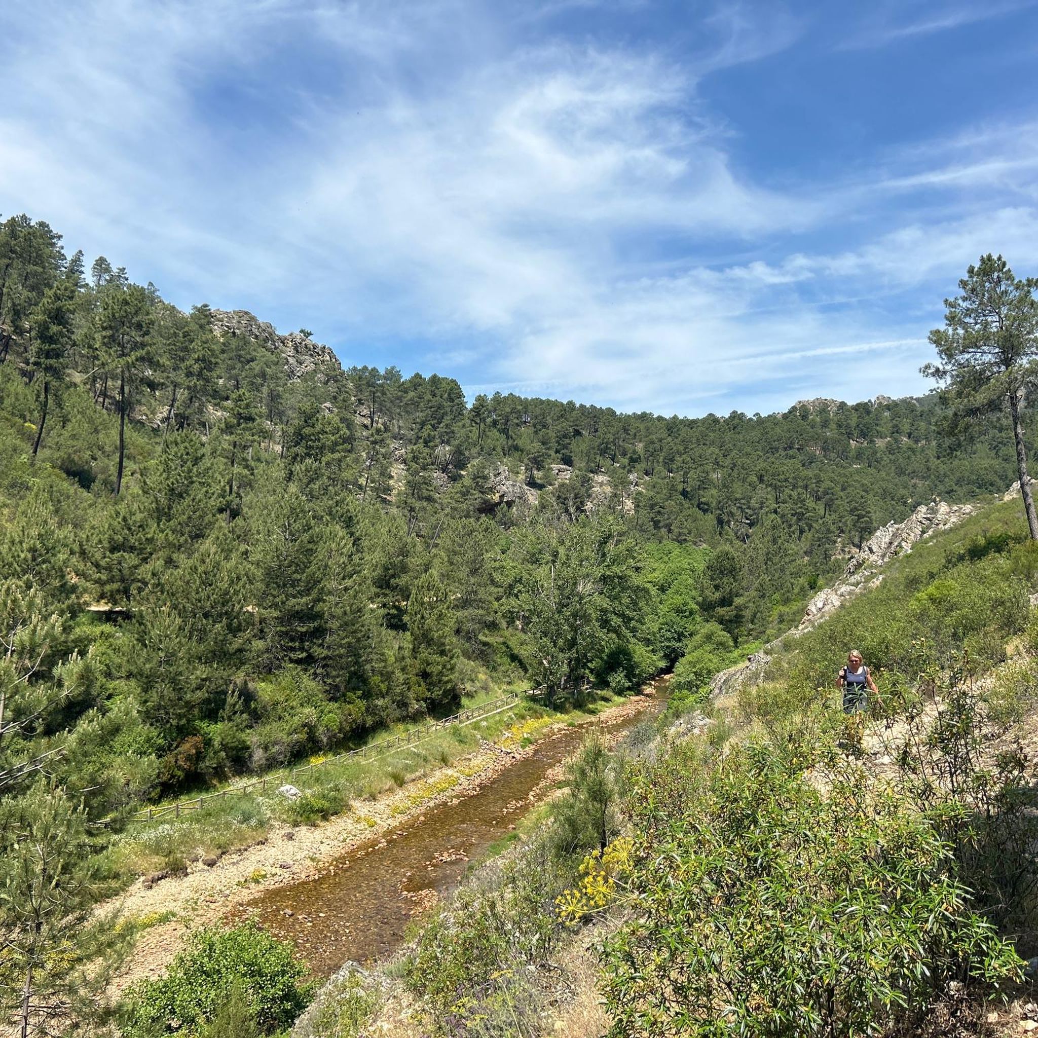
Within a set of mountain ranges such as the Sierra de Belén or Sancho where the Río Ruecas appears and at this point the Cancho del Fresno Reservoir appears.
1
0

Cañamero is a small town in the Villuercas-Ibores-Jara region to the south of Cáseres, bordering the province of Badajoz. Known for its pitarra wine and the remains of a medieval castle on the mountain that dominates the city.
1
0
The Cancho del Fresno Reservoir was created to contain the waters of the Ruecas River. Located near Cañamero, it is worth a visit and the detour to see this reservoir surrounded by green pine trees.
1
0

Located in the middle of the La Serena Reservoir and at 501 meters above sea level, it offers us wonderful views at 360 degrees. The Masatrigo hill, for sure, will surprise us with its shape and its curious name. It is called this way because for many its shape is assimilated to a pile of wheat.
1
1

Located in the middle of the La Serena Reservoir, the Masatrigo hill stands out for its shape and its curious name. It is called this way because for many its shape is assimilated to a pile of wheat. In addition to its curiosities, the top of the hill is 480 meters above sea level and offers wonderful views in all directions.
3
1
Cerro Masatrigo is so called because it looks like a pile of wheat, it is located in the La Serena reservoir, it is located at an altitude of about 500 meters and with views that are worth it.
14
1
Frequently Asked Questions
How many running routes are available around Casas De Don Pedro?
There are over 7 running routes around Casas De Don Pedro, offering a variety of distances and difficulty levels. These routes traverse the diverse landscapes of the Siberia Extremeña region, from dehesa woodlands to reservoir shores.
Are there any easy running routes for beginners or a quick jog?
Yes, for those seeking an easier run, the Running loop from Talarrubias is an excellent choice. This route is 2.9 miles (4.7 km) long with a gentle gradient, perfect for a quick and enjoyable jog through the local surroundings.
What kind of terrain can I expect on the running trails in this region?
The running trails around Casas De Don Pedro feature diverse terrain. You'll find paths through dehesa woodlands with holm and cork oaks, offering pleasant shade. There are also routes along the shores of reservoirs like Orellana, providing serene, flatter sections, and more accidented areas with varied elevations in the northern and central parts of the comarca.
Are there any circular running routes available?
Yes, many routes are circular, allowing you to start and finish in the same location. For example, the Cerro Masatrigo - running circular on the botanical trail (SL-BA 198) is a popular circular option, offering a challenging 4.2-mile (6.8 km) experience around the unique Cerro Masatrigo.
Can I find running routes that offer scenic views or pass by natural landmarks?
Absolutely. The region is rich in natural beauty. The Cerro Masatrigo - running circular on the botanical trail (SL-BA 198) offers views of the distinctive conical hill. You can also find routes near the Cancho del Fresno Reservoir and Garcia de Sola Reservoir, providing tranquil water views amidst Mediterranean vegetation.
Are there any longer or more challenging running routes for experienced runners?
For experienced runners seeking a challenge, routes like the Piscina Natural de Cañamero loop from Cañamero offer a significant distance of 16.5 miles (26.6 km) and considerable elevation gain, making it a difficult and rewarding option. Another challenging route is the Cancho del Fresno Reservoir loop from Cañamero, spanning 10.1 miles (16.2 km).
What are some interesting places to explore near the running trails?
Beyond the trails, you can explore several interesting sites. The Cancho del Fresno Reservoir and Garcia de Sola Reservoir are beautiful natural areas. You might also visit the historic Castle of Puebla de Alcocer or the La Chiquita Cave for a different kind of adventure.
Are there any running routes suitable for families with children?
While specific 'family-friendly' running routes are not explicitly categorized, the region's easy hiking and cycling trails can often be adapted for family jogs. The Running loop from Talarrubias, being shorter and with a gentle gradient, could be a suitable option for families looking for a less strenuous outing.
Can I bring my dog on the running trails around Casas De Don Pedro?
The Siberia Extremeña region is generally welcoming to outdoor activities. While specific dog-friendly rules for each running trail are not detailed, many natural areas and trails in Spain allow dogs, especially if kept on a leash. It's always advisable to check local signage or park regulations for specific routes to ensure compliance.
What is the best time of year to go jogging in Casas De Don Pedro?
The dehesa ecosystem, with its holm and cork oaks, provides pleasant shaded routes, which can be particularly appealing during warmer periods. Spring and autumn generally offer the most comfortable temperatures for running, with lush landscapes in spring and vibrant colors in autumn. Early mornings or late afternoons are ideal during summer to avoid the midday heat.
Are there any running routes that pass by water bodies or offer lakeside views?
Yes, the region is known for its impressive reservoirs. The shores of the Embalse de García de Sola and the Orellana reservoir offer serene and tranquil paths. The Playa de los Calicantos, a beach area on the Guadiana River near the Orellana reservoir, also suggests potential for scenic lakeside jogging.
What do other runners enjoy about the trails in Casas De Don Pedro?
Runners using komoot to explore Casas De Don Pedro often appreciate the varied terrain, from the unique features like Cerro Masatrigo to the tranquil reservoir paths. The natural beauty of the dehesa woodlands and the opportunities for different ability levels are frequently highlighted as positive aspects of the running experience in the region.
Most popular attractions around Casas De Don Pedro

Get inspired with the komoot mobile app


Explore more
Browse the best Running Trails & Routes in other regions.
