The best running trails around Guadalupe
71
runners
9
runs
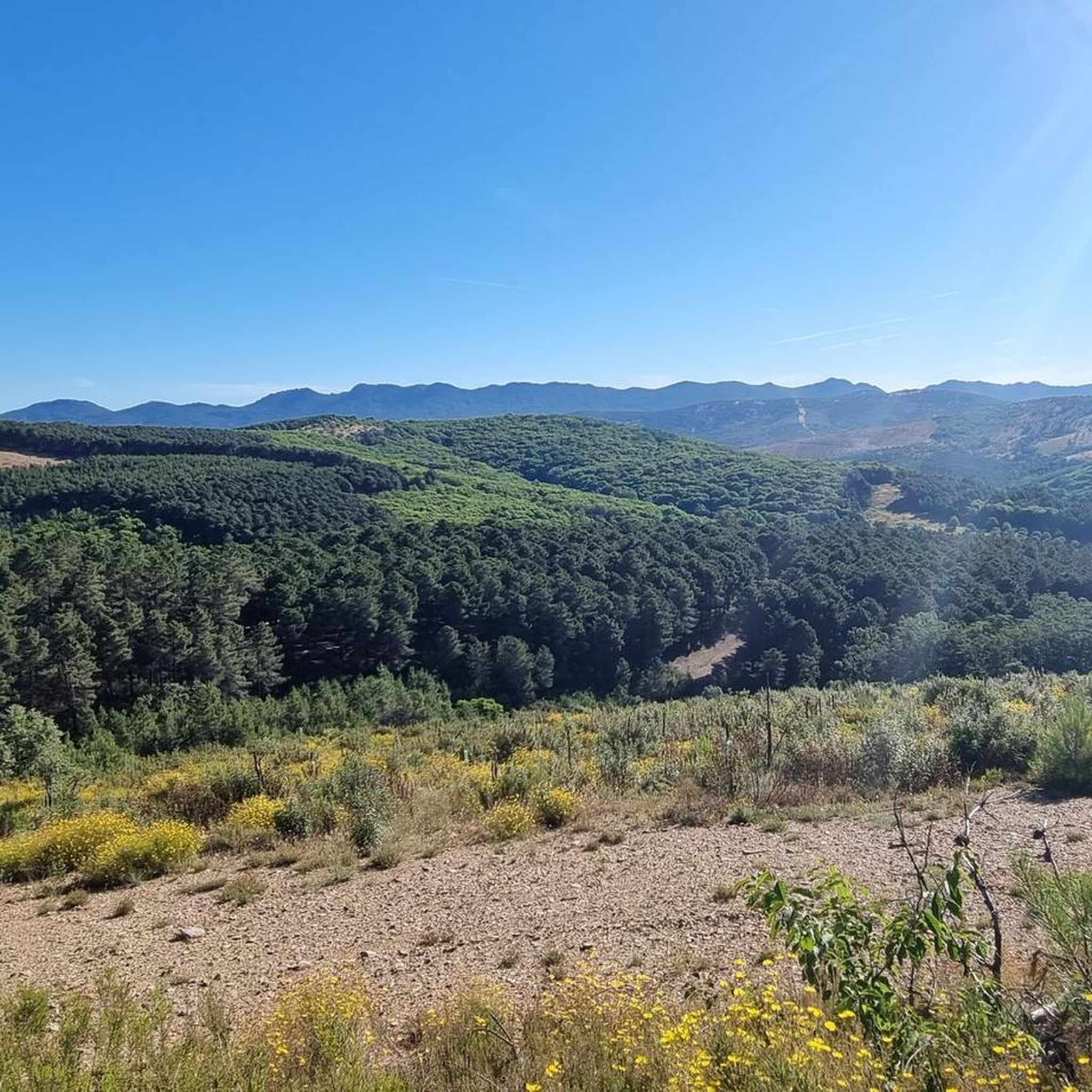
Jogging routes around Guadalupe traverse a landscape characterized by varied terrain, including rolling hills, dense woodlands, and open countryside. The region features a mix of moderate and challenging paths, with significant elevation changes in some areas. Rivers and reservoirs are often integrated into the routes, providing diverse natural features for runners.
Best jogging routes around Guadalupe
- The most popular jogging route is Running loop from Guadalupe, a 6.7 miles (10.9 km) trail that takes 1 hour 12 minutes to complete. This moderate route offers a balanced experience with some elevation gain.
- Another top favourite among local runners is Arch of Seville – Dye Arch loop from Guadalupe, a moderate 3.1 miles (5.1 km) path. This shorter route features gentle inclines and passes through local landmarks.
- Local runners also love the Galería de captación de agua loop from Guadalupe, a 16.6 miles (26.8 km) trail leading through varied terrain with significant elevation, often completed in about 3 hours 52 minutes.
- Jogging around Guadalupe is defined by rolling hills, woodlands, and open countryside. The network offers options for different ability levels, from moderate runs to more challenging long-distance routes.
- The guide includes highly-rated routes that showcase the best of the region's landscape. More than 60 runners have used komoot to explore Guadalupe's varied terrain.
Last updated: August 21, 2026
16
runners
26.7km
03:51
1,060m
1,060m
Hard run. Very good fitness required. Sure-footedness, sturdy shoes and alpine experience required.
10
runners
10.9km
01:12
240m
240m
Moderate run. Good fitness required. Mostly paved surfaces. Suitable for all skill levels.

Sign up for free
13
runners
Hard run. Very good fitness required. Mostly paved surfaces. Suitable for all skill levels.
12
runners
16.2km
01:58
210m
210m
Hard run. Very good fitness required. Sure-footedness, sturdy shoes and alpine experience required.
5
runners
5.06km
00:37
130m
130m
Moderate run. Good fitness required. Mostly paved surfaces. Suitable for all skill levels.
Get access to more routes and recommendations from other explorers.
Sign up for free
Already have an account?
Our route recommendations are based on thousands of hikes, rides, and runs completed by other people on komoot.
Start today with a free account
Your next adventure awaits.
Login or Signup
Tips from the Community

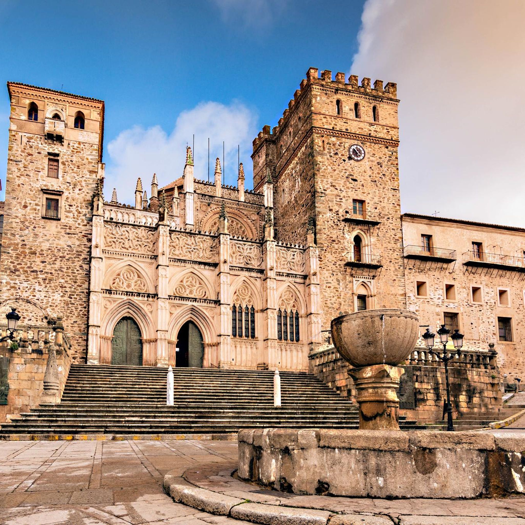
The Royal Monastery of Santa María de Guadalupe is an imposing 15th-century monastic complex located in Guadalupe, in the province of Cáceres, within the autonomous community of Extremadura, Spain. Declared a UNESCO World Heritage Site in 1993, the site combines four centuries of history and is a unique masterpiece of the Gothic-Mudéjar style.
0
0

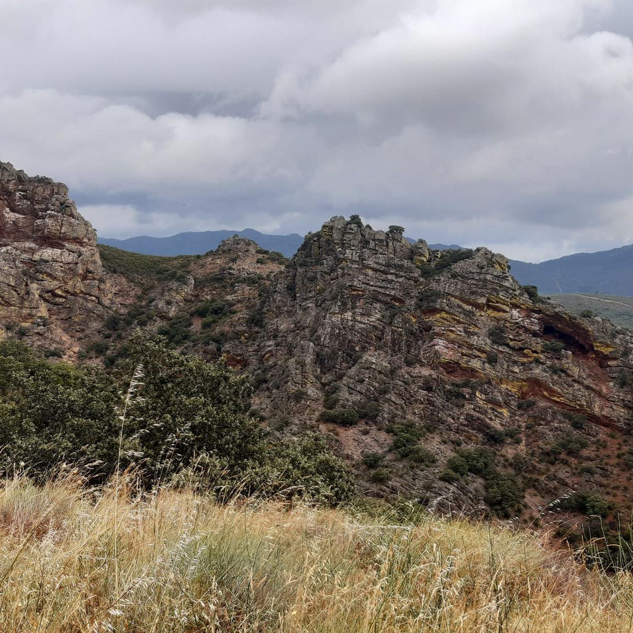
El Alto del Humilladero and Pico Villuercas, near Guadalupe (Cáceres), form one of the most spectacular mountain routes in Extremadura, within the Villuercas‑Ibores‑Jara UNESCO Geopark. It is the highest summit in Extremadura accessible by road.
2
0

In the multitude of Guadeloupe, there is little more information to be found than what is already here on the internet.
14
1
The floral decoration of the openings and the popular architecture of the adjacent houses give this gate one of the most unique images of the city. Continue further into Calle Sevilla to the fountain.
14
2
Gives the feeling of being on a film set or somewhere in Mexico. Perhaps not so strange, because the Virgin of Guadalupe is the patroness of Mexico. In the hills, the virgin is said to have been found seven centuries ago. Strictly forbidden to take photos inside the walls, monks walk with the group...
15
1
Arco del Tinte, the Verfpoort, was part of the network of gates that separated the upper and lower town at various points. This gave the population control over security and trade and gave the city the appearance of a medieval fortress.
13
2
The Royal Monastery of Santa María de Guadalupe is an imposing 14th-century monastic complex located in the municipality of Guadalupe, in the province of Cáceres, within the autonomous community of Extremadura, Spain. This extraordinary monument, declared a UNESCO World Heritage Site in 1993, represents an exceptional example of an architectural fusion between Gothic, Mudéjar, Renaissance, and Baroque styles. For four centuries, it was the most important monastery in the country, closely linked to the history of the Catholic Monarchs and the discovery of the Americas.
0
0
The New Church—also known as the Church of the Holy Trinity—is one of the most outstanding Baroque buildings in the monumental complex of Guadalupe (Extremadura). It represents one of the last major projects undertaken around the Monastery of Guadalupe. The New Church is notable for its monumental Baroque façade, characteristic of the Churrigueresque style. It features rich ornamentation, columns, and a large central relief.
20
0
Frequently Asked Questions
What kind of terrain can I expect on running routes around Guadalupe?
The region around Guadalupe is characterized by diverse terrain, including rolling hills, dense woodlands, and open countryside. Many routes feature significant elevation changes, and you'll often find rivers and reservoirs integrated into the landscape, providing varied natural features for your run.
Are there any easy running routes for beginners in Guadalupe?
While many routes in Guadalupe involve elevation, there are options suitable for those looking for a less strenuous run. For example, the Arch of Seville – Dye Arch loop from Guadalupe is a moderate 3.1-mile (5.1 km) path with gentle inclines, perfect for a balanced experience.
Can I find long-distance running trails in the Guadalupe area?
Yes, Guadalupe offers several long-distance running trails for those seeking a challenge. The Galería de captación de agua loop from Guadalupe is a notable example, spanning 16.6 miles (26.8 km) with significant elevation gain, typically taking nearly four hours to complete.
Are there any circular running routes available?
Absolutely. Many of the running routes in Guadalupe are designed as loops, allowing you to start and finish in the same location. A popular option is the Running loop from Guadalupe, which is 6.7 miles (10.9 km) long and offers a moderate challenge.
What are some scenic points or natural attractions I might see while jogging?
While running, you might encounter various natural monuments and points of interest. Keep an eye out for highlights like the Pico Villuercas Summit, offering expansive views, or the tranquil Cancho del Fresno Reservoir. The region also features unique spots like La Chiquita Cave and the impressive Viewpoint at the Estrecho de Peña Amarilla.
Are there any routes that pass by historical landmarks or interesting structures?
Yes, some routes incorporate historical or architectural points of interest. For instance, the Arch of Seville – Dye Arch loop from Guadalupe passes through local landmarks. You can also find attractions like the magnificent Royal Monastery of Santa María de Guadalupe and the Guadalupe Viaduct in the wider area.
What should I consider regarding difficulty when choosing a running route in Guadalupe?
Running routes in Guadalupe range from moderate to difficult. You'll find paths with gentle inclines, but also many with significant elevation changes, especially in the more challenging, longer routes. It's advisable to check the elevation profile and distance before heading out, particularly if you're looking for an advanced running experience.
Are there any routes that feature reservoirs or water bodies?
Yes, rivers and reservoirs are often integrated into the running routes around Guadalupe. The Cancho del Fresno Reservoir loop from Cañamero is a great example, offering scenic views of the water during your run.
What do other runners say about the trails in Guadalupe?
The komoot community highly values the diverse terrain around Guadalupe. Runners often praise the variety of options, from moderate runs to more challenging long-distance routes, and appreciate the blend of rolling hills, woodlands, and open countryside that defines the region's running experience.
How many running routes are available in the Guadalupe area?
There are over 8 dedicated running routes available in the Guadalupe area, catering to various fitness levels and preferences, from moderate loops to difficult long-distance trails.
What kind of clothing and gear should I consider for running in Guadalupe?
Given the varied terrain, including rolling hills and significant elevation changes, it's recommended to wear sturdy running shoes with good grip. Layered clothing is also advisable to adapt to changing conditions, especially on longer routes or those with considerable elevation gain.
Most popular attractions around Guadalupe

Get inspired with the komoot mobile app


Explore more
Browse the best Running Trails & Routes in other regions.
