The best walks and hikes around Caldes D'Estrac
4.5
(639)
4,103
hikers
204
hikes
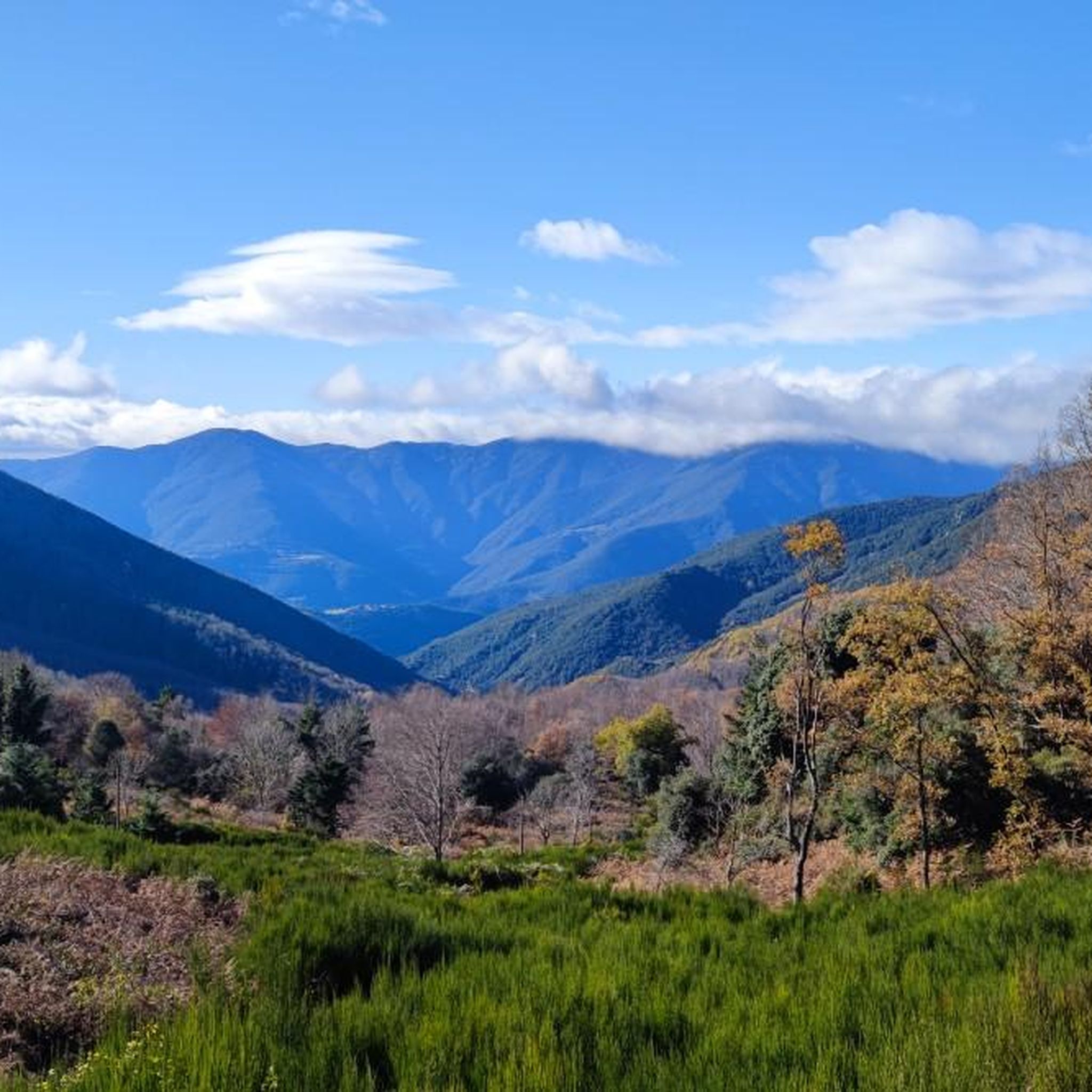
Hiking around Caldes D'Estrac offers a diverse landscape, blending coastal beauty with mountainous terrain. The region is characterized by its position between the Mediterranean Sea and the Litoral mountain range, providing both pristine beaches and elevated trails. Hikers can explore the extensive Montnegre i el Corredor Natural Park, which features rich biodiversity and dense forests of pines, holm oaks, and cork oaks. The area also includes significant hills like Montalt, offering varied elevation gains and scenic viewpoints.
Best hiking trails…
Last updated: August 22, 2026
4.5
(2)
29
hikers
14.2km
03:44
120m
120m
Moderate hike. Good fitness required. Easily-accessible paths. Suitable for all skill levels.
4.3
(6)
25
hikers
9.82km
03:13
450m
450m
Moderate hike. Good fitness required. Easily-accessible paths. Suitable for all skill levels.

Sign up for free
5.0
(4)
9
hikers
6.26km
01:48
160m
160m
Easy hike. Great for any fitness level. Easily-accessible paths. Suitable for all skill levels.
8
hikers
16.9km
05:17
640m
640m
Hard hike. Very good fitness required. Easily-accessible paths. Suitable for all skill levels.
18
hikers
Moderate hike. Good fitness required. Easily-accessible paths. Suitable for all skill levels.
Get access to more routes and recommendations from other explorers.
Sign up for free
Already have an account?
Our route recommendations are based on thousands of hikes, rides, and runs completed by other people on komoot.
Start today with a free account
Your next adventure awaits.
Login or Signup

Tips from the Community


The "Masía Corral d'en Forn" is a 17th and 18th century farmhouse located on the southwest side of the Turó de ca l'Amar. From an architectural point of view, it is not one of the most outstanding farmhouses, but, located at about 400 meters above sea level, it was one of the references in the mountain lifestyle. In this farmhouse, the Forn de Torrentbó family had their cattle, hence the name "Corral d'en Forn". In addition to the corral, different crops were grown there, such as the vine, which could be cultivated at this altitude thanks to its sunny location.
2
0

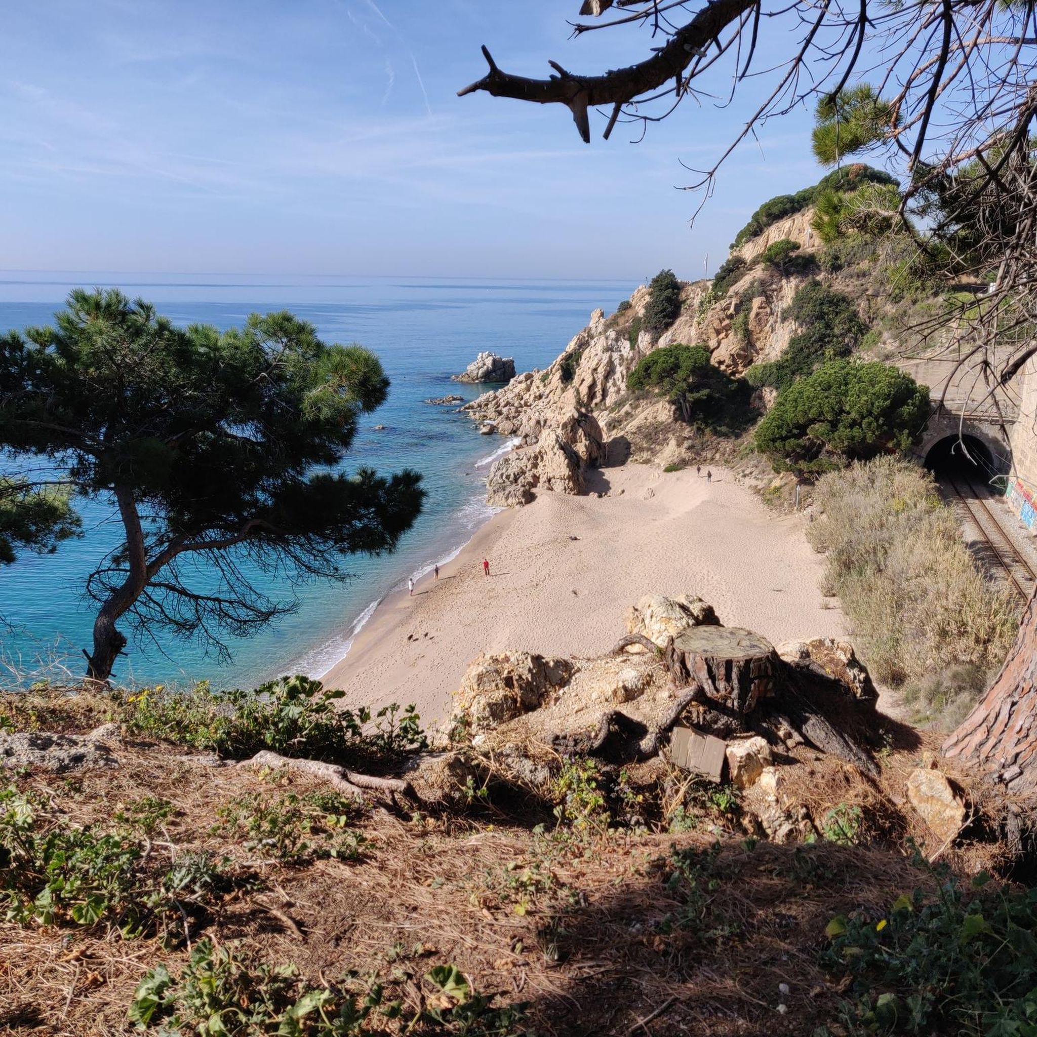
Although the Komoot map doesn't show a route here, you can get to Mataro along the railway line from Sant Andreu. However, be careful, you sometimes walk very close to the tracks (children, dogs,...) and in some places you should probably let the train pass.
1
0
Very busy weekend. https://youtu.be/7Spm5VJYhcw
3
0
Port Balís stands out, among other things, for its restaurants. In them you can enjoy, at any time of the year, quality gastronomy next to the Mediterranean Sea, and in a relaxed atmosphere full of nautical culture. You will find a diverse gastronomic offer suitable for different palates and moments. El Balís has 14 restaurants where you can taste traditional Mediterranean cuisine, local products, as well as Asian, Italian or Basque cuisine.
4
0

It is a large granite block located between Turó de Montalt (596 m) and Turó del Mig (550 m), a hill where the municipal limits of Arenys de Munt, Dosrius and Sant Vicenç de Montalt meet. Of the two stones, the smaller one has an engraving that seems to represent a horseshoe, although the meaning is unknown. It could be, for example, a mark to delimit the old parishes. Granite is a hard rock, with a granular texture, which in the Maresme has been used for construction. Fresh granite is known as "snake's eye" as it is made up of a black mica which, in contrast to the other components, is reminiscent of a snake's eye. In this environment and during the next section of the route, we will find small accumulations of granite blocks, disordered, heterometric and rounded, which accumulate in a horizontal or slightly inclined relief. These capricious formations have their origin in weathering. Later, the rainwater dissolves the feldspar and the large initial rock cracks and gives rise to rounded shapes and a kind of sand, called "sauló" in Catalan.
2
0
El Montalt is a mountain belonging to the Catalan coastal range, within the Sierra del Corredor and the protected natural area in which it is included. A few kilometers from the coast, the top is surrounded by forest. A common point to face the final meters of ascent is the Coll de la Ferradura, a pass located to the northeast. It is a crossroads of different paths and forest tracks and, from this point, the path to the summit is narrow and has a very steep slope. The northern slope enters completely into the natural park, with different plateaus, other peaks and the Creu de Rupit, an outstanding cross in the middle of the path. To the northeast is the Sanctuary of the Corridor, with a car park and a tourist service office. From this point, through forest tracks, To the south, we find two towns, Sant Andreu de Llavaneres and Sant Vicenç de Montalt, well connected by tracks and paths. In the same way possible starting points for the ascent, to the west is the municipality of Dosrius and its population center of Canyamars, while to the east is the town of Arenys de Munt. On the other hand, the first stage of the Camino del Norte, or GR 83 long-distance path, which begins in the town of Mataró, passes very close, along its northern slope. Its top houses a geodesic vertex and a mailbox, offering magnificent views of the entire Maresme coast.
1
0
Frequently Asked Questions
How many hiking trails are there in Caldes D'Estrac?
Caldes D'Estrac offers a wide variety of hiking opportunities, with nearly 200 routes available to explore. These trails range from easy coastal walks to more challenging ascents into the Litoral mountain range.
What types of terrain can I expect on hikes around Caldes D'Estrac?
The region's unique geography, nestled between the Mediterranean Sea and the Litoral mountain range, provides a diverse hiking experience. You can expect coastal paths with sea views, forested hills with pines, holm oaks, and cork oaks, and trails within the extensive Montnegre i el Corredor Natural Park.
Are there easy hiking trails suitable for beginners in Caldes D'Estrac?
Yes, there are 57 easy routes perfect for beginners or those looking for a relaxed stroll. An example is the Illuminated Mushroom Sculpture loop from Caldes d'Estrac, which takes you through local parks and residential areas.
What are some notable landmarks or natural features to see while hiking?
Hikers can discover several interesting points. Within Parc de Can Muntanyà, you'll find the historic Corredor Sanctuary. The area also features natural monuments like the Horseshoe Stone and the impressive Montalt peak, offering panoramic views.
Are there any challenging hikes in the area for experienced hikers?
Yes, for those seeking a challenge, there are 17 difficult routes. One such demanding trail is the Viewpoint – Caldes d'Estrac Beach loop from Caldes d'Estrac, which features significant elevation gain and covers a longer distance.
What do other hikers enjoy most about hiking in Caldes D'Estrac?
The hiking trails in Caldes D'Estrac are highly regarded by the komoot community, with an average rating of 4.5 stars from nearly 600 reviews. Hikers often praise the diverse landscape, which seamlessly blends coastal beauty with the tranquility of the Litoral mountain range, offering both sea views and shaded forest paths.
Are there circular hiking routes available in Caldes D'Estrac?
Many of the routes in Caldes D'Estrac are circular, allowing you to start and end your hike in the same location. An example is the Horseshoe Stone – Montalt loop from Sant Vicenç de Montalt, which provides a rewarding circular journey through the mountains.
Can I find hikes that offer coastal views?
Absolutely. Caldes D'Estrac is situated on the Maresme coast, offering numerous trails with stunning Mediterranean Sea views. The Balí Beach – Port Balís Marina loop from Caldes d'Estrac is a great option for enjoying coastal scenery and passing by marinas.
What is the best time of year to go hiking in Caldes D'Estrac?
Caldes D'Estrac offers pleasant hiking conditions for much of the year. Spring and autumn generally provide mild temperatures, ideal for exploring both coastal and mountain trails. Summer can be warm, making early morning or late afternoon hikes preferable, especially along the coast. Winters are typically mild, allowing for comfortable hiking.
Are there any trails that pass by beaches?
Yes, several routes incorporate the beautiful beaches of Caldes D'Estrac. The Balí Beach – Caldes d'Estrac Beach loop from Caldes d'Estrac is a shorter, easy option that allows you to enjoy the golden sands and crystal-clear waters.
Is Caldes D'Estrac known for any unique natural features besides its mountains and coast?
Beyond its coastal and mountainous landscapes, Caldes D'Estrac is historically recognized for its mineral-medicinal thermal waters, emerging at around 38 degrees Celsius. While not directly part of hiking trails, these natural springs contribute to the town's overall appeal as a wellness and nature destination.
Most popular routes around Caldes D'Estrac
Most popular attractions around Caldes D'Estrac

Get inspired with the komoot mobile app


Explore more
Browse the best Hikes in other regions.
