The best walks and hikes around Huéneja
4.7
(77)
453
hikers
25
hikes
Hiking trails around Huéneja are situated on the northern slopes of the Sierra Nevada, offering access to diverse landscapes within the National and Natural Park. The region is characterized by rugged terrain, including ravines and gorges, with the town itself built between two such features. Hikers can explore areas like the Peaks of Los Castaños and the Molino Bajo Recreation Area, which features ancient chestnut trees and varied flora. Huéneja is also part of the Granada Geopark, indicating significant geological…
Last updated: July 4, 2026
4.8
(17)
101
hikers
Hard hike. Very good fitness required. Sure-footedness, sturdy shoes and alpine experience required.
4.4
(16)
118
hikers
8.50km
04:26
550m
550m
Hard hike. Good fitness required. Sure-footedness, sturdy shoes and alpine experience required.

Sign up for free
5.0
(2)
9
hikers
Hard hike. Good fitness required. Sure-footedness, sturdy shoes and alpine experience required.
5.0
(1)
7
hikers
4.93km
01:45
160m
160m
Hard hike. Great for any fitness level. Sure-footedness, sturdy shoes and alpine experience required.
5.0
(1)
10
hikers
6.31km
01:54
180m
180m
Hard hike. Great for any fitness level. Sure-footedness, sturdy shoes and alpine experience required.
Get access to more routes and recommendations from other explorers.
Sign up for free
Already have an account?
Our route recommendations are based on thousands of hikes, rides, and runs completed by other people on komoot.
Start today with a free account
Your next adventure awaits.
Login or Signup
Tips from the Community


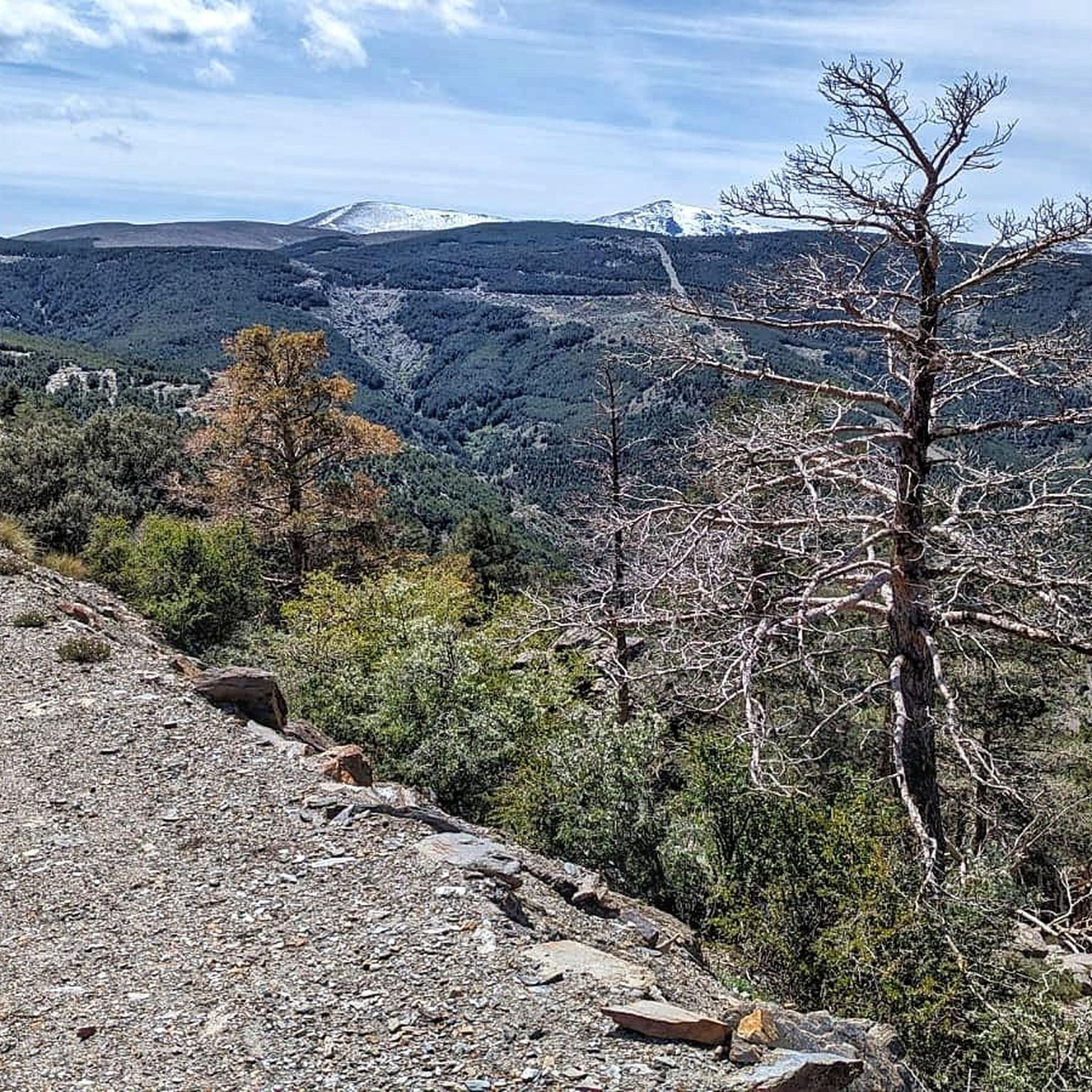
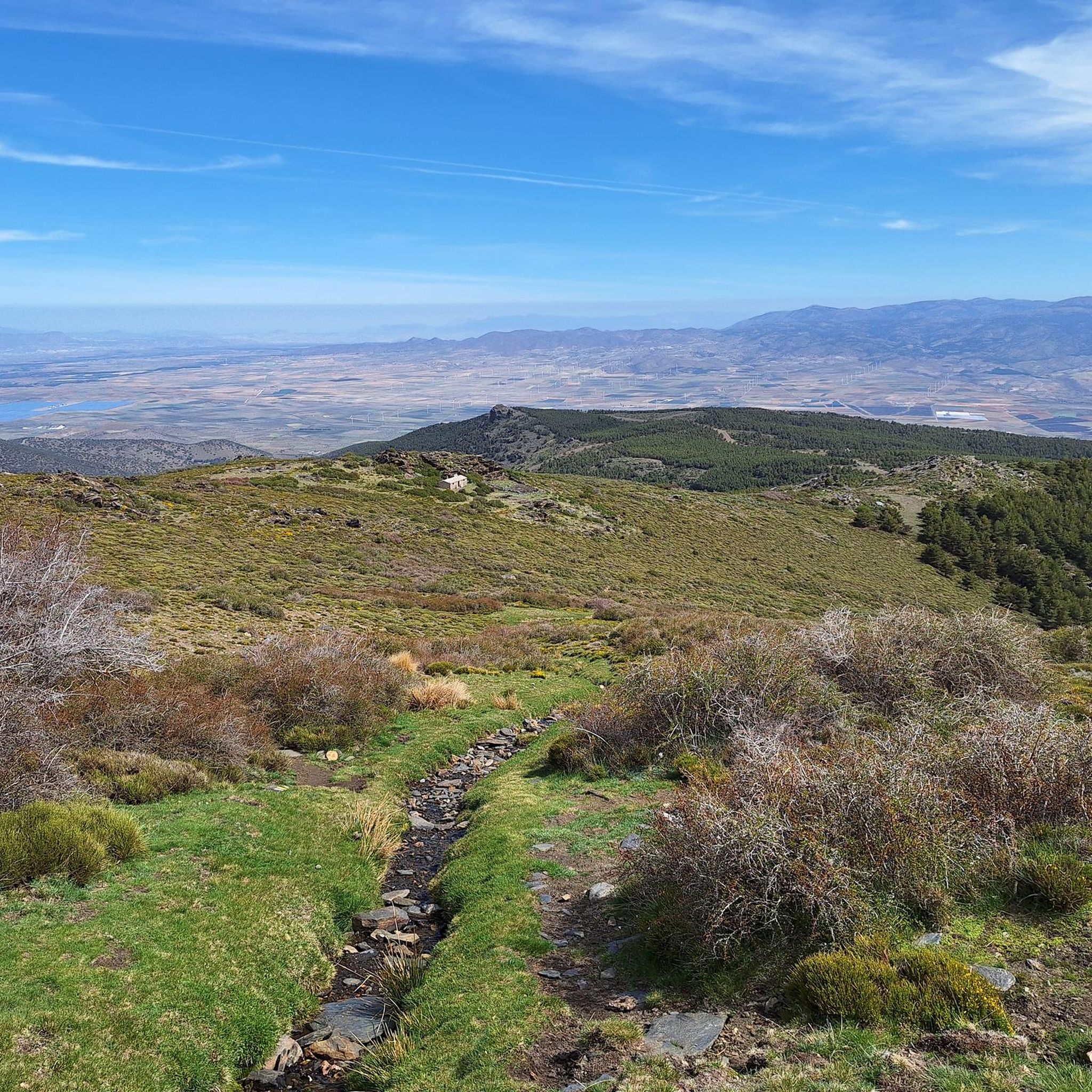
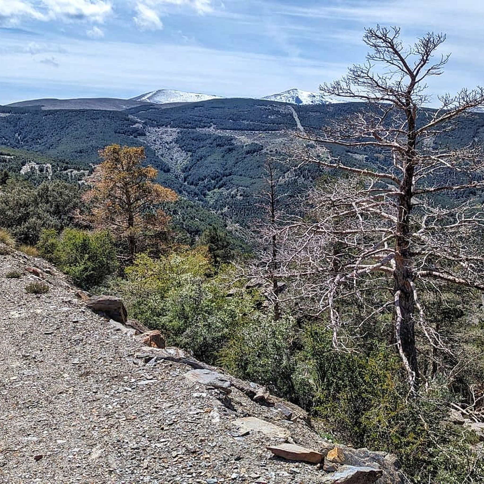
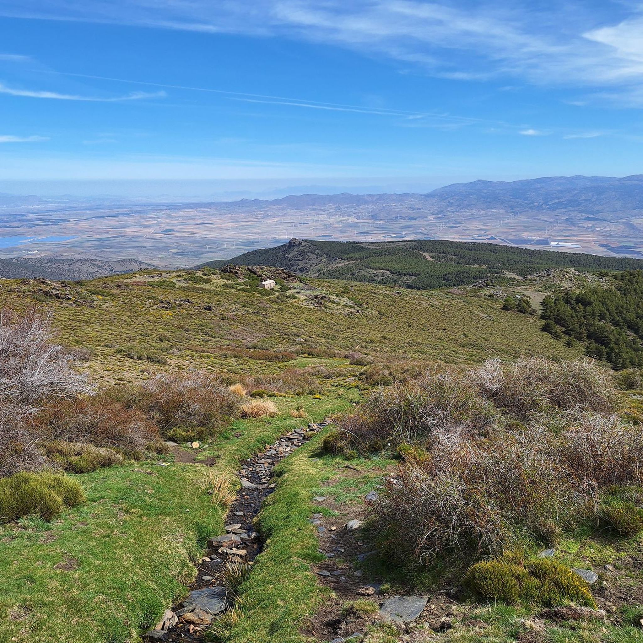
The Puerto de la Ragua marks the border between the provinces of Granada and Almería. The Sierra Nevada stretches on both sides, with the 3000m peaks on the Granada side. The highest mountain in the province of Almería, El Chullo, is, however, easily accessible from the Puerto de la Ragua. The Puerto de la Ragua is just over 2000m.
0
0


This car park, rest area and starting point for walks is located at an altitude of 2000 metres.
19
0

One of the few asphalt passes over 2,000m in the region. You just have to take it with you, even if it's not particularly "exciting" IMHO.
2
0

Located right at the highest point of the Raga pass (2000 meters), the Ragua refuge is a mountain refuge with a guard and capacity for 32 bunk beds. Currently (September 2023) it remains closed and waiting to carry out renovations in the facilities, which had been very deteriorated due to lack of maintenance.
0
0

The port of La Ragua is two thousand meters above sea level, a great height to start a race through the mountains of the Sierra Nevada National Park, going through peaks, forests and hills with magnificent views and paths ideal for trail running. In winter it is a Nordic ski resort. The port is on the border of the provinces of Granada and Almería and there are good trail routes on both sides. This time the route leaves the car park to the west in search of the Cuerda de los Morrones, on the Granada side. The path crosses the meadows of the port and continues along the path marked with the wooden milestones of the Sulayr GR-240 Trail. At the edge of the pine forest, the main path turns to the right and the long-distance path continues straight ahead along the slope of the Maja Caco ravine. The little sticks of the trail climb up the terraces of the pine trees and soon enter the territory of the Nevadan mid-mountains.
0
1

Breathtaking views up here over 2000m in the Sierra Nevada: https://youtu.be/DxUrMbFJmow
0
0
Frequently Asked Questions
How many hiking trails are there around Huéneja?
Huéneja offers a wide selection of routes, with over 25 hiking trails available. These range from easy walks to challenging mountain ascents, catering to various fitness levels.
What kind of landscapes can I expect to see while hiking near Huéneja?
Hiking around Huéneja immerses you in the diverse landscapes of the Sierra Nevada National and Natural Park. You'll encounter rugged high-mountain terrains, dramatic ravines, and gorges. The region is also part of the Granada Geopark, offering unique geological formations. Look out for areas rich in flora, including ancient chestnut trees in the Molino Bajo Recreation Area.
Are there any easy or beginner-friendly hiking trails in Huéneja?
While many routes in the immediate area are challenging, Huéneja does offer options for less experienced hikers. There are 5 easy and 8 moderate routes available, providing gentler paths to explore the region's beauty without the strenuous climbs.
Can I find circular hiking routes around Huéneja?
Yes, the area features several circular routes. For a challenging loop with extensive views, consider the Parque Nacional de Sierra Nevada – circular by El Chullo and Lagunilla Seca from La Ragua. Another option is the Chullo Peak – View from Puerto de la Ragua loop from Puerto de la Ragua, which offers panoramic vistas.
What are some notable natural attractions or landmarks to look out for on the trails?
The trails around Huéneja offer several natural highlights. You can ascend to Chullo Peak for stunning views. The region is also home to the Benéjar River, including its source in El Horcajo and the Confluence of the Rivers (Cruce de Los Ríos). Don't miss the ancient chestnut trees in the Molino Bajo Recreation Area or the Abrucena Holm Oak Forest.
What is the best time of year to go hiking in Huéneja?
Huéneja's location on the northern slopes of the Sierra Nevada means conditions can vary significantly by season. Spring and autumn generally offer the most pleasant temperatures for hiking. Summers can be hot, especially at lower elevations, while winter brings the possibility of snow and colder conditions, particularly on higher mountain trails.
Where can I find parking when hiking in Huéneja?
Parking availability varies by trailhead. For routes starting from Puerto de la Ragua, such as the View from Puerto de la Ragua – La Ragua Pass loop from Morrón de las Tres Lindes, there are designated parking areas. In Huéneja village itself, you can usually find parking in central areas, though it's advisable to check local signage.
Do I need any special permits to hike in the Sierra Nevada National Park near Huéneja?
For general day hiking on established trails within the Sierra Nevada National Park, permits are typically not required. However, for certain activities like overnight stays in unregulated areas or specific high-mountain ascents, permits might be necessary. It's always best to check the official Sierra Nevada National Park website for the most current regulations before your trip.
What do other hikers say about the trails in Huéneja?
The hiking trails around Huéneja are highly rated by the komoot community, with an average score of 4.7 stars from over 70 reviews. Hikers often praise the stunning high-mountain scenery, the challenging yet rewarding ascents, and the unique geological features found within the Granada Geopark.
Are there any places to eat or stay in Huéneja village after a hike?
Huéneja is a small village but offers basic amenities. You can find local cafes and small eateries to refuel after your hike. For accommodation, there are typically guesthouses or rural lodgings available, providing a comfortable base to explore the region.
Are there opportunities for wild swimming or water features along the hikes?
The region features the Río Izfalada and the Embalse de Huéneja-Isfalada (reservoir), which add to the scenic beauty. While specific wild swimming spots are not explicitly designated, these water bodies offer picturesque views and opportunities for enjoying the natural environment. Always exercise caution and respect local regulations if considering entering the water.
Most popular attractions around Huéneja

Get inspired with the komoot mobile app


Explore more
Browse the best Hikes in other regions.
