The best road cycling routes around Navezuelas
4.8
(8)
351
riders
22
rides
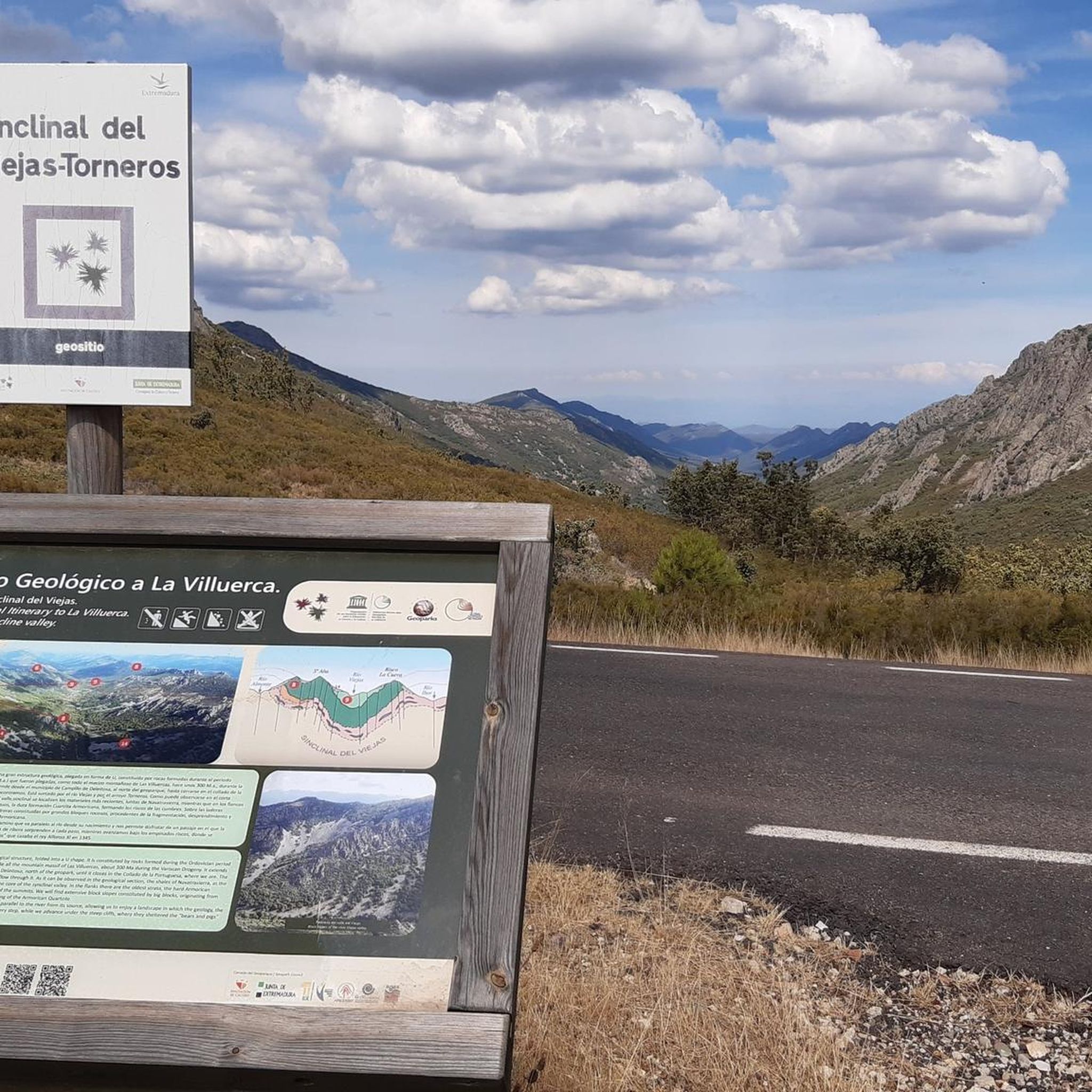
Road cycling around Navezuelas offers diverse terrain within the Villuercas-Ibores-Jara UNESCO Global Geopark, characterized by ancient, Appalachian-like landscapes. The region features a mix of mountains, valleys, and forests, with an average altitude of around 1,000 meters above sea level. Cyclists can expect challenging ascents to peaks like Pico de Villuercas and descents into river valleys such as the Guadarranque. This varied topography provides a dynamic environment for road cyclists.
Best road cycling routes around Navezuelas
- The most popular road cycling…
Last updated: June 26, 2026
40
riders
Hard road ride. Very good fitness required. Mostly well-paved surfaces and easy to ride.
5.0
(1)
40
riders
61.2km
03:59
1,440m
1,440m
Tackle the difficult Pico Villuercas Loop from Guadalupe, a 38.0-mile road cycling route with 4730 feet of elevation gain.

Sign up for free
12
riders
Hard road ride. Very good fitness required. Mostly well-paved surfaces and easy to ride.
14.0km
00:50
350m
350m
Moderate road ride. Good fitness required. Mostly well-paved surfaces and easy to ride.
5.0
(1)
29
riders
85.0km
05:12
2,060m
2,060m
Hard road ride. Very good fitness required. Mostly well-paved surfaces and easy to ride.
Get access to more routes and recommendations from other explorers.
Sign up for free
Already have an account?
Our route recommendations are based on thousands of hikes, rides, and runs completed by other people on komoot.
Start today with a free account
Your next adventure awaits.
Login or Signup

Tips from the Community

The Royal Monastery of Santa María de Guadalupe is an imposing 15th-century monastic complex located in Guadalupe, in the province of Cáceres, within the autonomous community of Extremadura, Spain. Declared a UNESCO World Heritage Site in 1993, the site combines four centuries of history and is a unique masterpiece of the Gothic-Mudéjar style.
0
0
The Royal Monastery of Santa María de Guadalupe is an imposing 14th-century monastic complex located in the municipality of Guadalupe, in the province of Cáceres, within the autonomous community of Extremadura, Spain. This extraordinary monument, declared a UNESCO World Heritage Site in 1993, represents an exceptional example of an architectural fusion between Gothic, Mudéjar, Renaissance, and Baroque styles. For four centuries, it was the most important monastery in the country, closely linked to the history of the Catholic Monarchs and the discovery of the Americas.
0
0

The Royal Monastery of Santa María de Guadalupe is a 14th-century monastery located in the Spanish town of Guadalupe, in the province of Cáceres. It was declared a UNESCO World Heritage Site in 1993. Inside, you can appreciate Gothic, Mudéjar, Renaissance, Baroque, and Neoclassical architectural styles. A place with a rich history and breathtaking architectural beauty! 🌟🏰
13
0

Stage 1. Guadalupe/Herrera del Duque 98 kilometers. 2,160 meters of elevation gain. The Cáceres town of Guadalupe has been a famous pilgrimage center since the late 13th century, when a local shepherd found the image of the Virgin hidden in a remote mountainous area of the Sierra de las Villuercas, building a hermitage for worship that gave rise to the site of La Puebla de Santa María de Guadalupe. The Order of Saint Jerome founded the Royal Monastery, and during the Middle Ages it was a notable sanctuary of popular devotion. It is the most important and outstanding monument in Guadalupe, with a beautiful Mudejar feel and a blend of Gothic, Renaissance, and Baroque elements. It was declared a World Heritage Site in 1993. The old town of La Puebla has been declared a Historic-Artistic Site and features arcades, stone fountains, folk architecture, and medieval alleyways in the old Jewish quarter. The cycle tour begins in the lively Plaza de Santa María along Calle Sevilla, passes through the Arco de Sevilla, which was one of the gates in the old wall protecting the monastery, continues past the Fuente de los Tres Chorros, one of the town's 17 fountains, and leaves Guadalupe along a cobbled path with slate slabs that requires some skill with the brakes due to the steep slope. On the outskirts, the first milestones of the Villuercas Nature Trail GR-116 appear. The path crosses the road at the rustic Angorrilla bridge and continues through the forest canyon of the Guadalupejo River. The pace is slow at first; the trail doesn't allow for fast pedaling, and the jungle of vegetation captivates the atmosphere. The path passes over the imposing viaduct of the old railway and finally enters the dirt tracks that climb towards the Villuercas mountains, descending back to the Guadalupejo riverbed, where there is a pedestrian bridge to cross the ford when floodwaters make it difficult to cross the river. Alía is the first village on the route, a good place to check your gear and bike after the rough ride before entering the toughest section of the stage, over the Puerto de San Vicente. The crossing of the Guadarranque Valley is a quintessential landscape in the unique geological realm of Las Villuercas, but on a bicycle, it's a significant challenge. At the river footbridges, a furious climb begins to the Manzano pass. The dirt surface of the Nature Trail crosses the road, descends through gravel forks to a stream, and continues along steep slopes to the Puerto de San Vicente pass. The easy option is to climb along the shoulder of the road and, in the village, rejoin the Las Villuercas Nature Trail to the Santa Quiteria station, the start/finish of the Vía Verde de la Jara. In the following section, there are no specific cycling route signs; it is essential to follow the track. The route runs along the foothills of the Altamira mountain range and the Rincón del Torozo Microreserve through holm oak forests, crosses the mountain range via Puerto del Rey, and descends to the Cíjara reservoir dam, one of the large artificial lakes on the middle course of the Guadiana River and borders Cáceres and Badajoz.
1
1
Built in 1985, this reservoir has a capacity of 15 cubic hectometres and is known for its recreational activities such as carp, royal carp and black bass fishing. In addition, the reservoir has a beach that has been awarded the Blue Flag in 2023, making it an attractive destination for visitors.
7
0

Within a set of mountain ranges such as the Sierra de Belén or Sancho where the Río Ruecas appears and at this point the Cancho del Fresno Reservoir appears.
1
0

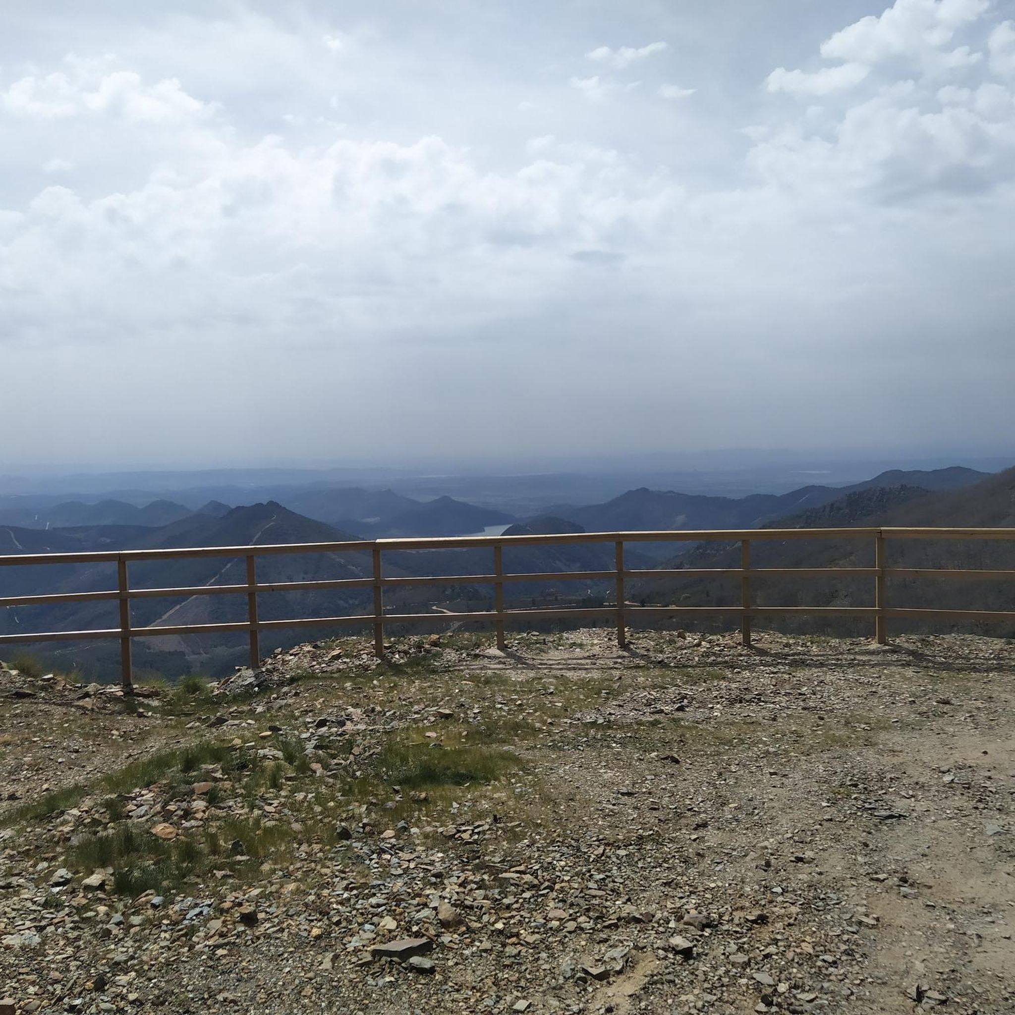
A small bridge over the Almonte river. Crossroads towards the Cabañas del Castillo. Surrounded by the huge cliffs and rock formations of the Villuercas Ibores La Jara Geopark.
1
0
An incredible fortress rose from the rocky cliffs. Muslim fortress from the 12th century, built to monitor and control the trade route between the Sierra de Ortijuela and the Berzocana river valley. The views are spectacular.
1
0
Frequently Asked Questions
How many road cycling routes are available around Navezuelas?
There are over 20 road cycling routes available around Navezuelas, offering a variety of experiences within the Villuercas-Ibores-Jara UNESCO Global Geopark. These routes cater to different preferences, from moderate rides to challenging climbs.
What kind of terrain can I expect when road cycling in Navezuelas?
Road cycling in Navezuelas features diverse terrain, characterized by the ancient, Appalachian-like landscapes of the Villuercas-Ibores-Jara UNESCO Global Geopark. You'll encounter a mix of mountains, valleys, and forests, with an average altitude of around 1,000 meters above sea level. Expect challenging ascents to peaks like Pico de Villuercas and scenic descents into river valleys such as the Guadarranque.
Are there road cycling routes for different skill levels in Navezuelas?
Yes, the Navezuelas area offers road cycling routes for various skill levels. While there are no easy routes listed, you'll find 7 moderate routes and 13 difficult routes. This ensures options for both those seeking a good workout and experienced cyclists looking for significant challenges.
What natural features can I see along road cycling routes in the Navezuelas area?
The region is rich in natural beauty. Along your rides, you can explore the unique geological formations of the Villuercas-Ibores-Jara Geopark, including the dramatic landscapes around the Estrecho de la Peña Amarilla. For a refreshing stop, consider visiting the Charco de la Nutria. Ambitious cyclists can also experience the panoramic views from the Pico Villuercas Summit.
Are there any historical or cultural landmarks to visit while road cycling near Navezuelas?
Absolutely. The area around Navezuelas is home to significant historical and cultural sites. A prominent landmark is the UNESCO World Heritage site, the Royal Monastery of Santa María de Guadalupe, which often features as a destination on cycling routes. You might also encounter the Guadalupe Viaduct or explore the region's mining heritage.
What is the best time of year for road cycling in Navezuelas?
The region's average altitude of around 1,000 meters above sea level provides pleasant conditions for cycling. While specific seasonal recommendations depend on personal preference, spring and autumn generally offer milder temperatures, making them ideal for exploring the diverse terrain without extreme heat or cold.
Are there any circular road cycling routes around Navezuelas?
Yes, many of the road cycling routes around Navezuelas are designed as circular tours, allowing you to start and end in the same location. An example is the challenging Pico Villuercas Loop from Guadalupe, which offers a significant climb and panoramic views.
What do other road cyclists enjoy the most about road cycling in Navezuelas?
The road cycling routes in Navezuelas are highly rated by the komoot community, with an average score of 5.0 stars from more than 7 reviews. Cyclists often praise the unique geological formations of the Villuercas-Ibores-Jara Geopark, the challenging ascents to Pico de Villuercas, and the scenic routes through valleys and along rivers.
Can I find long-distance road cycling routes in the Navezuelas area?
Yes, the Navezuelas area offers several long-distance road cycling routes for endurance riders. For instance, the Charco de la Nutria from Guadalupe – circular via Castillo de Cabañas and Castañar de Ibor is a challenging 76.2-mile (122.6 km) trail, typically completed in about 6 hours 51 minutes.
Are there road cycling routes that include significant climbs?
Navezuelas is known for its challenging ascents. The climb to Pico de Villuercas is a highlight for many, presenting a demanding route with substantial elevation gain. The Pico Villuercas Summit – Guadalupe Viaduct loop from Cabañas del Castillo is an example of a difficult route with over 2000 meters of elevation gain.
What is the most popular road cycling route in the Navezuelas region?
The most popular road cycling route in the region is the Carrascalejo from Guadalupe – circular through the Parque Natural Geoparque Villuercas-Ibores Jara. This difficult 69.8-mile (112.4 km) trail offers extensive riding through the natural park's varied landscapes and takes approximately 5 hours 38 minutes to complete.
Most popular attractions around Navezuelas

Get inspired with the komoot mobile app


Explore more
Browse the best Road cycling routes in other regions.
