The best walks and hikes around Beteta
4.5
(121)
818
hikers
14
hikes
Hiking around Beteta offers diverse natural landscapes within the Serranía de Cuenca. The region is characterized by spectacular fluvial canyons, such as the Hoz de Beteta, featuring vertical limestone cliffs and dense forests. Unique karstic formations, including colorful lagoons and sinkholes, are prominent features, alongside extensive pine and riverine forests. This varied terrain provides a rich environment for outdoor exploration.
Best hiking trails around Beteta
- The most popular hiking route is Laguna del Tobar Interpretive Trail, an easy 3.6…
Last updated: June 23, 2026
5.0
(2)
15
hikers
5.81km
01:29
30m
30m
Hike the easy 3.6-mile Laguna del Tobar Interpretive Trail loop to discover a unique meromictic lagoon and karst landscapes in Serranía de C
5.0
(1)
5
hikers
12.7km
03:33
250m
250m
Moderate hike. Good fitness required. Easily-accessible paths. Suitable for all skill levels.

Sign up for free
3.0
(1)
3
hikers
9.74km
02:46
200m
200m
Moderate hike. Good fitness required. Mostly accessible paths. Sure-footedness required.
16.4km
04:32
270m
270m
Hike the Mirador del Armentero via the Castillo Siete Condes route, a moderate 10.2-mile circular trail from El Tobar with panoramic views.
4.3
(3)
36
hikers
6.41km
02:21
230m
230m
Moderate hike. Good fitness required. Mostly accessible paths. Sure-footedness required.
Get access to more routes and recommendations from other explorers.
Sign up for free
Already have an account?
Our route recommendations are based on thousands of hikes, rides, and runs completed by other people on komoot.
Start today with a free account
Your next adventure awaits.
Login or Signup

Tips from the Community

The name brings back memories of when Merino sheep used to pass through here.
0
0

Breathtaking views. Whether you're walking, biking, or running, the place is beautiful.
0
0

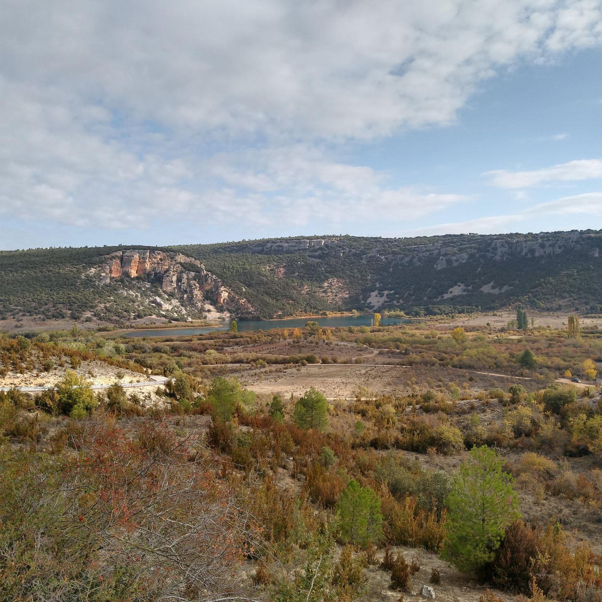
Laguna Grande is located near Masegosa, in the Serranía de Cuenca. It is part of the Lagunas de El Tobar, which also include Laguna Pequeña and Laguna Ciega. Laguna Grande has a perimeter of about three kilometres and a depth of approximately 20 metres in the centre. Laguna Grande is a wildlife refuge, where otters and various aquatic birds can be observed. It is also an authorised bathing area during the summer, making it a popular destination for visitors.
6
0

Short detour from our itinerary (Beteta - Laguna del Marchesado), a solitary and enchanting place, worth a visit.
1
0

Beautiful lagoon. Here you can linger, relax and swim.
1
0
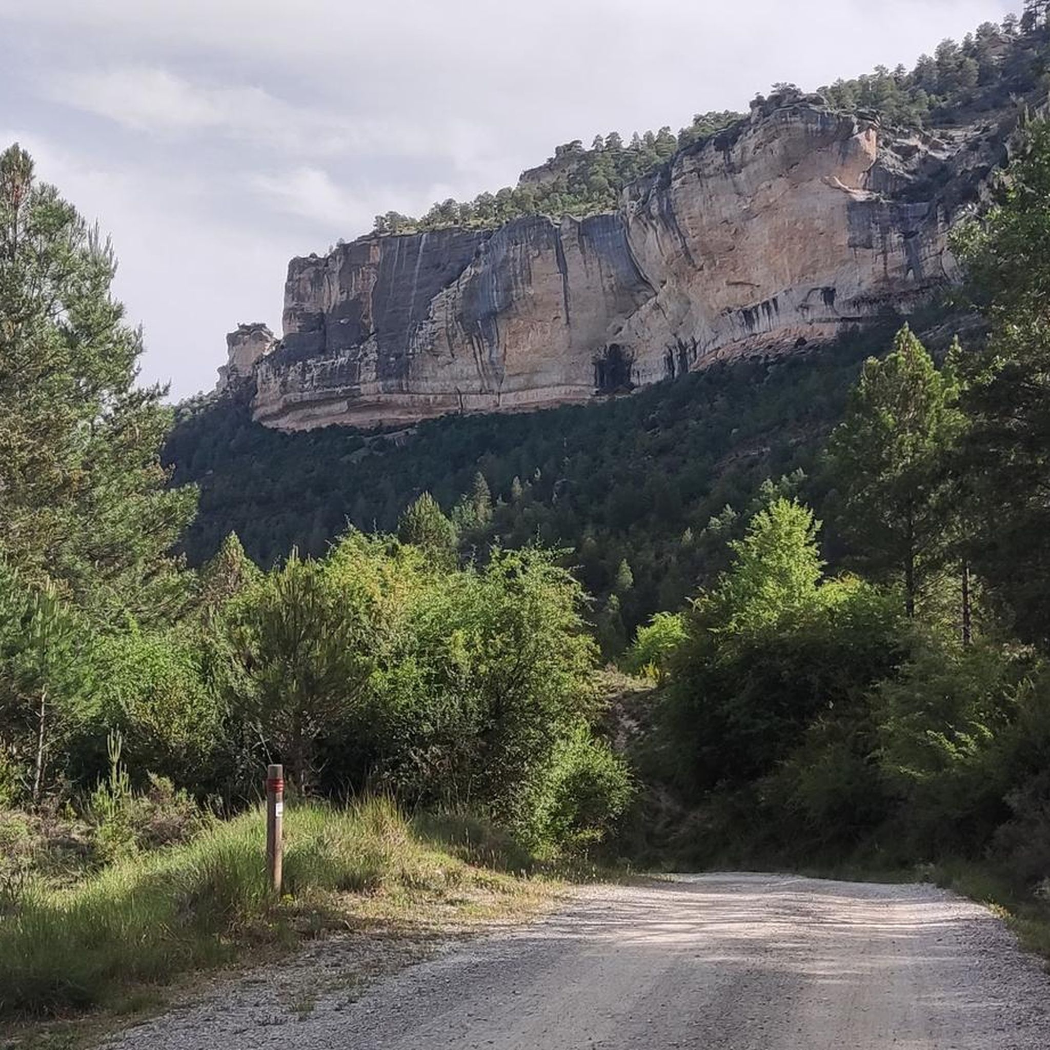
The cave of the Armentero. The steep drop is offset by the spectacular view from the Beteta viewpoint, the end point of the trail where one of the most beautiful anticlines of the Iberian system can be seen.
9
0

This lake is really beautiful. It is a wonderful place to camp.
1
0
They are made up of the Laguna Grande, the Laguna Pequeña and the Laguna Ciega, which has now disappeared.
7
0
Frequently Asked Questions
How many hiking trails are there in Beteta?
Beteta offers a diverse network of over 10 hiking trails, catering to various skill levels. These routes explore the region's unique landscapes, from dramatic canyons to tranquil lagoons.
What kind of terrain can I expect on hikes around Beteta?
The terrain around Beteta is incredibly varied, featuring spectacular fluvial canyons like the Hoz de Beteta with vertical limestone cliffs, extensive pine and riverine forests, and unique karstic formations such as colorful lagoons and sinkholes. You'll encounter paths alongside rivers, through dense woodlands, and over rocky areas with geological points of interest.
Are there any family-friendly hiking options in Beteta?
Yes, Beteta has several easy routes suitable for families. For instance, the Laguna del Tobar Interpretive Trail is an easy 3.6-mile (5.8 km) path that explores a unique lagoon environment, perfect for a leisurely family outing.
Can I hike with my dog in Beteta?
Generally, dogs are welcome on many trails in the Beteta area, especially in natural parks and rural settings. However, it's always advisable to keep them on a leash, especially in protected areas or near wildlife, and to check specific regulations for Natural Monuments like the Hoz de Beteta or Lagunas de Cañada del Hoyo to ensure compliance.
Are there circular hiking routes available in Beteta?
Yes, there are several circular routes. A popular option is the Presa de los Tilos – Hoz de Beteta Rock Formation loop from Área recreativa de la Casa de la Pradera, a 6.0-mile (9.6 km) trail that takes you through the dramatic Hoz de Beteta canyon.
What natural landmarks or viewpoints can I see while hiking in Beteta?
Beteta is rich in natural landmarks. You can explore the dramatic Hoz de Beteta canyon, the unique and colorful Lagunas de Cañada del Hoyo, and various geological formations like arches and 'skull stones' along trails such as the Muela Pinilla and El Puntal Interpretive Trail. The Armentero Cave and Beteta Viewpoint also offers panoramic views.
Are there any waterfalls or caves to explore near Beteta?
Absolutely. The region boasts several impressive natural features. You can visit the Source of the Cuervo River, which features beautiful waterfalls and travertine formations. Other notable waterfalls include the Salto de Poveda Waterfall and the Molino Waterfall. For caves, the Sima de Alcorón Cave and Roman Mine Cueva del Hierro are popular points of interest.
What is the best time of year to go hiking in Beteta?
Spring and autumn are generally the best seasons for hiking in Beteta, offering pleasant temperatures and vibrant natural colors. Spring brings lush greenery and blooming flora, while autumn showcases stunning foliage. Summer can be hot, especially at midday, but early mornings and late afternoons are still enjoyable. Winters are cooler, and some higher trails might have snow, but lower-altitude routes remain accessible.
Is parking available for hikers in Beteta?
Yes, parking facilities are generally available near popular trailheads and recreational areas in Beteta. For example, the Área recreativa de la Casa de la Pradera serves as a starting point for several routes and offers parking. It's always a good idea to check specific starting points for individual trails for the most convenient parking options.
Do I need any permits to hike in the Beteta area?
For most general hiking trails in the Beteta area, including those within the Serranía de Cuenca, permits are not typically required. However, for specific protected natural monuments or certain activities, it's always recommended to check with local tourism offices or park authorities for any specific regulations or access requirements that might be in place.
What do other hikers say about the trails in Beteta?
The trails in Beteta are highly rated by the komoot community, with an average score of 4.5 stars from over 100 reviews. Hikers frequently praise the dramatic canyons, unique karstic lagoons, and the extensive pine and riverine forests. Many appreciate the well-maintained paths and the diverse options available for different ability levels.
Are there any routes that follow the Tagus River?
Yes, the region is home to sections of the Tajo Natural Path, a long-distance route that traces the course of the Tagus River. This path offers views of mountains and native vegetation alongside the river's turquoise waters, providing a comprehensive experience of the Iberian Peninsula's inland landscapes.
Most popular attractions around Beteta

Get inspired with the komoot mobile app


Explore more
Browse the best Hikes in other regions.
