The best mountain hikes around Agüimes
5.0
(21)
129
hikers
10
hikes
Mountaineering routes around Agüimes traverse a landscape defined by dramatic volcanic formations, deep ravines, and high peaks. The region features iconic landmarks such as Roque Nublo, an 80-meter high rock formation, and Pico de las Nieves, the highest point on Gran Canaria at 1949 meters. These routes offer diverse terrain, from the scenic Barranco de Guayadeque with its unique cave dwellings to the striking red volcanic rock formations of Barranco de Las Vacas.
Best mountaineering routes around Agüimes
- The most popular mountaineering route is Roque Nublo – View of Roque Nublo loop from Gran Canaria, a 2.0 miles (3.2 km) moderate trail that takes 1 hour 8 minutes to complete. This route offers views of the iconic Roque Nublo, a significant natural monument.
- Another top favourite among local mountaineers is View of Roque Nublo – Roque Nublo Cave loop from Gran Canaria, a moderate 5.0 miles (8.1 km) path. This route explores the area around Roque Nublo, known for its impressive rock monoliths and historical significance.
- Local mountaineers also love the Pico de las Nieves – View of Roque Nublo loop from Pico de las Nieves, a 3.7 miles (6.0 km) trail leading through high-altitude terrain, often completed in about 1 hour 53 minutes.
- Mountaineering around Agüimes is defined by volcanic peaks, deep ravines, and diverse rock formations. The network offers options for moderate to challenging routes, catering to various ability levels.
- The routes in Agüimes are highly rated by the komoot community with an average score of 5.0 stars from more than 20 reviews. More than 100 mountaineers have used komoot to explore Agüimes's varied terrain.
Last updated: June 26, 2026
5.0
(2)
10
hikers
5.98km
01:53
230m
230m
Moderate mountaineering route. Great for any fitness level. Mostly accessible paths. Sure-footedness required.
5.0
(2)
10
hikers
Moderate mountaineering route. Good fitness required. Easily-accessible paths. Suitable for all skill levels.

Sign up for free
5.0
(3)
14
hikers
6.96km
02:38
410m
410m
Moderate mountaineering route. Good fitness required. Mostly accessible paths. Sure-footedness required.
5.0
(3)
7
hikers
8.05km
03:27
510m
510m
Hard mountaineering route. Good fitness required. Sure-footedness, sturdy shoes and alpine experience required.
5.0
(1)
9
hikers
Hard mountaineering route. Very good fitness required. Mostly accessible paths. Sure-footedness required.
Get access to more routes and recommendations from other explorers.
Sign up for free
Already have an account?
Our route recommendations are based on thousands of hikes, rides, and runs completed by other people on komoot.
Start today with a free account
Your next adventure awaits.
Login or Signup

Tips from the Community

Located in the heart of Gran Canaria, La Culata is part of the municipality of Tejeda. It is made up of traditional houses built on the cliff face from which it gets its name. From the heights of the village, you can see the distribution of the houses and the terraced crops that adapt to the hills.
0
0
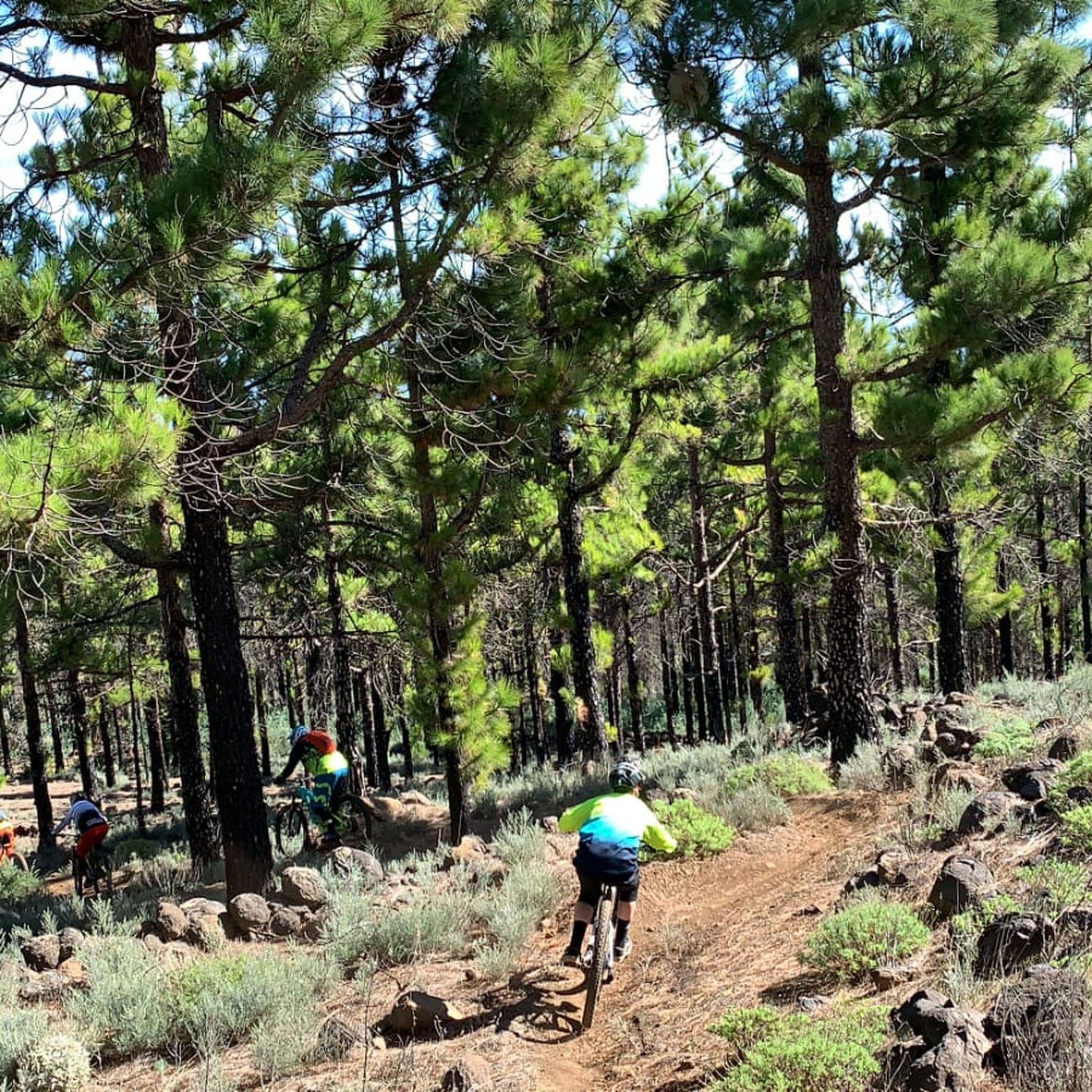
In a magnificent location in the middle of pine forests, you can choose here to take the upper or lower hiking trail to climb to Pico de las Nieves.
0
0

Our path to Roque Nublo leads here through a sparse pine forest.
0
0
In clear weather, the view from here extends all the way to Tenerife.
0
0

From here you have a wonderful view.
1
0
Beautiful view of the island's highest mountain.
0
0
From here we have a beautiful view of the Roque Nublo.
1
0
Frequently Asked Questions
How many mountaineering routes can I explore around Agüimes?
Agüimes offers a diverse selection of over 10 mountaineering routes, catering to various skill levels. These routes traverse dramatic volcanic formations, deep ravines, and high peaks, providing a rich outdoor experience.
What are the typical difficulty levels for mountaineering routes in Agüimes?
The mountaineering routes around Agüimes range from moderate to challenging. While there are 3 moderate routes, the majority, 8 routes, are considered difficult, often requiring alpine experience due to the high-altitude terrain and varied landscapes. Always check the route details before heading out.
Are there any circular mountaineering routes in Agüimes?
Yes, many routes in Agüimes are designed as loops, allowing you to start and finish at the same point. For example, the Roque Nublo – View of Roque Nublo loop from Clouded Rock offers a scenic circular journey through the iconic landscape.
What unique natural landmarks or attractions can I see along the mountaineering routes?
Agüimes is rich in natural wonders. You can encounter the iconic Roque Nublo, an 80-meter high rock formation, or reach the Pico de las Nieves summit, the highest point on Gran Canaria. Some routes also pass by beautiful waterfalls, such as the Small Waterfall or the Large Waterfall.
What do other mountaineers enjoy most about the routes in Agüimes?
The mountaineering routes in Agüimes are highly rated by the komoot community, with an impressive average score of 5.0 stars from more than 20 reviews. Users frequently praise the dramatic volcanic landscapes, the breathtaking panoramic views from high peaks like Pico de las Nieves, and the unique geological features such as the red volcanic rock formations of Barranco de Las Vacas.
Are there any less crowded mountaineering routes or hidden gems in the Agüimes area?
While popular spots like Roque Nublo attract many, exploring areas like the Barranco de Guayadeque offers a unique experience with its cave dwellings and scenic routes, especially outside peak season. The Tamadaba Natural Park also provides diverse landscapes and numerous trails, some of which are less frequented, offering a sense of solitude amidst pine forests and dramatic cliffs.
When is the best time of year for mountaineering in Agüimes?
Agüimes offers good mountaineering conditions for much of the year. However, the almond blossom season in January and February makes routes in areas like Barranco de Guayadeque particularly scenic. Given the high-altitude nature of some routes, it's always advisable to check weather forecasts, especially for wind, and be prepared with appropriate gear.
Can I find routes that offer archaeological or historical interest?
Absolutely. The region is rich in history. Barranco de Guayadeque is known for its intriguing cave dwellings, some still inhabited, and an Interpretation Centre. La Montaña de Agüimes also holds significant archaeological finds, including ancient native cave drawings and petroglyphs at sites like Morro del Cuervo.
Are there any options for more adventurous climbing challenges in Agüimes?
For those seeking a greater challenge, Agüimes caters to more adventurous climbing. The Via Ferrata Amor & Odio, for instance, allows participants to ascend rock faces using fixed ropes and metal bars, providing breathtaking views of Gran Canaria's southern mountains.
Are there any routes suitable for families with children?
While many mountaineering routes in Agüimes are moderate to difficult, some sections or shorter trails can be suitable for families. The path to Roque Nublo, for example, is generally accessible, though its high altitude can make it windy. For a visually striking but relatively short experience, the primary trail through Barranco de Las Vacas with its red volcanic formations can be a good option for families.
What kind of terrain can I expect on the mountaineering routes around Agüimes?
The terrain around Agüimes is incredibly diverse, characterized by dramatic volcanic formations, deep ravines, and high peaks. You'll encounter everything from the striking red volcanic rock of Barranco de Las Vacas to the lush pine forests of Tamadaba Natural Park and the rugged, high-altitude paths leading to Pico de las Nieves.
Are there any routes that offer panoramic views extending to Mount Teide?
Yes, from the summit of Pico de las Nieves, the highest point on Gran Canaria, you can enjoy unparalleled panoramic vistas. On clear days, these views extend all the way to Mount Teide on the neighboring island of Tenerife, making it a truly rewarding destination for mountaineers.
Most popular attractions around Agüimes

Get inspired with the komoot mobile app


Explore more
Browse the best Mountain Hikes & Routes in other regions.
