The best mountain hikes around Sant Llorenç Des Cardassar
4.5
(3)
8
hikers
2
hikes
Mountaineering around Sant Llorenç Des Cardassar is characterized by the varied terrain of eastern Mallorca, nestled within the Serra de Llevant mountain range. The region features diverse landscapes, from the hilly formations of the Llevant Peninsula Nature Reserve to the coastal trails of the Punta de n'Amer Protected Natural Area. Elevation gains vary, with routes offering both moderate ascents and more challenging sections for experienced mountaineers.
Best mountaineering routes around Sant Llorenç Des Cardassar
- The most popular mountaineering route is Puig de sa Creu – Talaia Freda de Morell loop from puig Genet, a 4.7 miles (7.5 km) trail that takes 2 hours 33 minutes to complete. This route offers moderate difficulty with notable elevation gains within the Serra de Llevant.
- Another top favourite among local mountaineers is Torre d'en Matzoc loop from Canyamel, a moderate 4.5 miles (7.3 km) path. This trail provides varied terrain and views, often including coastal elements near Canyamel.
- Local mountaineers also love the Beach Promenade – Punta de n'Amer loop from punta de n’Amer, a 5.2 miles (8.4 km) trail leading through the Punta de n'Amer Protected Natural Area, often completed in about 2 hours 11 minutes.
- Mountaineering around Sant Llorenç Des Cardassar is defined by mountainous formations of the Serra de Llevant, coastal paths, and diverse natural features. The network offers options for different ability levels, from moderate trails to routes with significant elevation.
- The routes in Sant Llorenç Des Cardassar are highly rated by the komoot community with an average score of 4.5 stars from over 3 reviews. More than 10 mountaineers have used komoot to explore Sant Llorenç Des Cardassar's varied terrain.
Last updated: July 10, 2026
5.0
(1)
5
hikers
7.53km
02:35
320m
320m
Moderate mountaineering route. Good fitness required. Mostly accessible paths. Sure-footedness required.
1
hikers
7.74km
02:32
270m
270m
Moderate mountaineering route. Good fitness required. Mostly accessible paths. Sure-footedness required.

Sign up for free
4.0
(2)
2
hikers
8.39km
02:12
60m
60m
Moderate mountaineering route. Good fitness required. Easily-accessible paths. Suitable for all skill levels.
Our route recommendations are based on thousands of hikes, rides, and runs completed by other people on komoot.
Start today with a free account
Your next adventure awaits.
Login or Signup
Popular around Sant Llorenç Des Cardassar
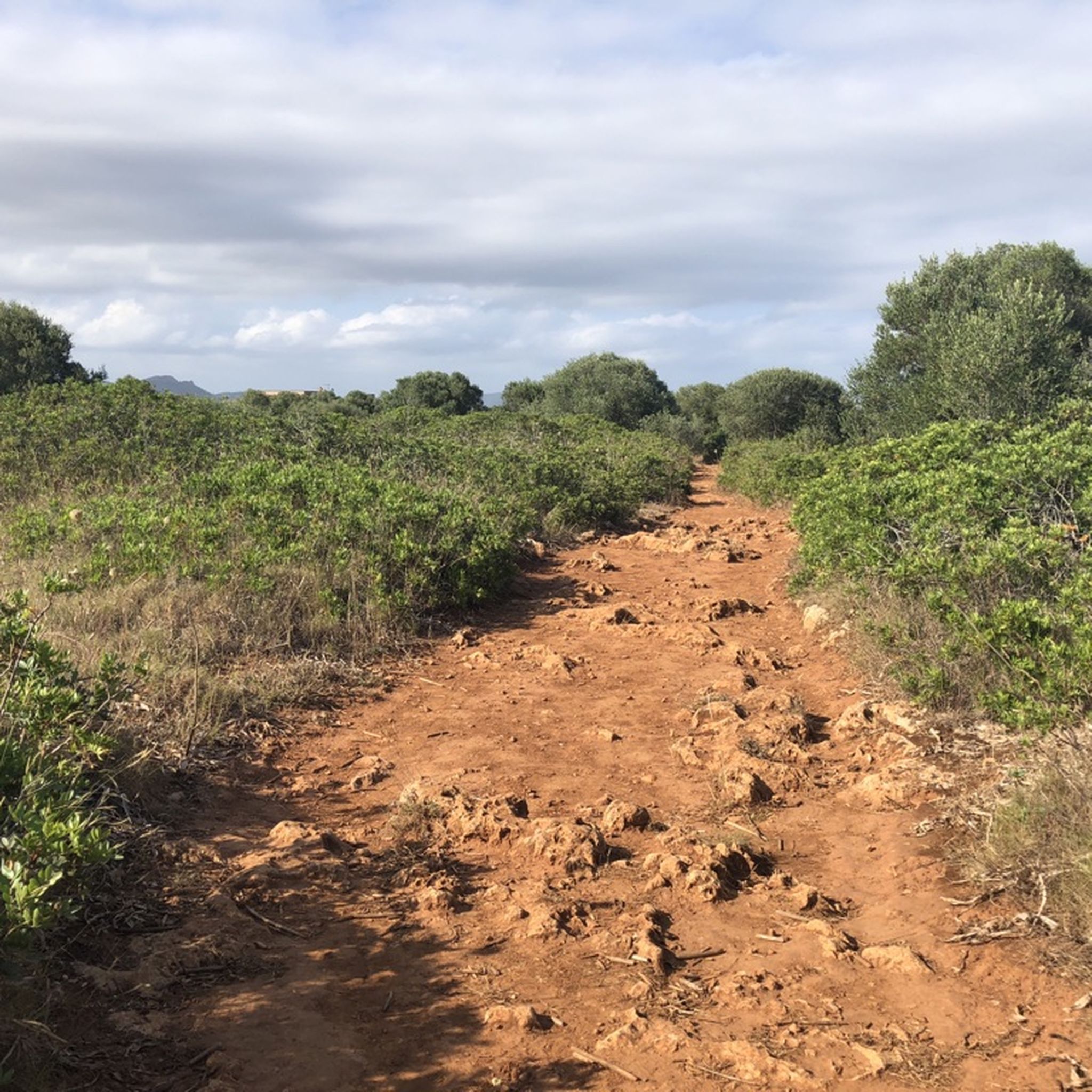

Tips from the Community

Beautiful hiking trails with good signage.
0
0

A fantastic hiking area with breathtaking sea views. Due to bird breeding season, some areas are only accessible during certain times of the year.
0
0

This is an ideal beach, especially for children - but very busy during the holiday season
1
0

The path from Freda in a southwesterly direction can be found by searching and navigating. It's an adventurous descent, rocky and relatively close to the edges. But the uneasy feeling of taking the wrong path is confirmed. After the two smaller peaks, the descent comes to a wall crossing. There's a no-trek sign there, indicating that you're leaving an area closed to hikers. The sign is missing at Freda, so you'd have to return the same way (east). This is now a bird sanctuary.
1
1

Purpose built cycle / walking / buggy path that runs along the beautiful Eastern coast of Mallorca
0
0

As has been mentioned several times, the entrance is not visible from the main path. Even from close range, you can't see it if you look towards the sea. It's best to walk the route relatively close to the edge and look towards land. If possible, you can use the geographical coordinates in a pinch: N 39°34.5887' E 003°23.8346' Have fun exploring!
0
0

Tipptop…, will come again no question… 👌 we recommend
0
0
Tipptop against…, Again no question… 👌
0
0
Frequently Asked Questions
How many mountaineering routes are available in Sant Llorenç Des Cardassar?
There are a few dedicated mountaineering routes around Sant Llorenç Des Cardassar, offering diverse experiences within the Serra de Llevant. These routes are generally rated as moderate in difficulty.
What kind of terrain can I expect on mountaineering routes in Sant Llorenç Des Cardassar?
The terrain varies significantly, ranging from the hilly formations of the Serra de Llevant to coastal paths. You'll encounter diverse landscapes, including stone pines, olive groves, and unique rock formations. Some routes involve moderate ascents, while others offer more challenging sections with notable elevation gains.
Are there any family-friendly mountaineering routes in Sant Llorenç Des Cardassar?
For families looking for a less strenuous option, the Punta de n'Amer Castle – Punta de n'Amer loop is a great choice. This moderate 3.1-mile (5 km) route takes you through the protected natural area, offering scenic views and the chance to explore the historic Punta de n'Amer Castle.
Can I find circular mountaineering routes in this region?
Yes, several routes are designed as loops. For instance, the Puig de sa Creu – Talaia Freda de Morell loop from puig Genet is a popular circular trail covering 4.7 miles (7.5 km) with moderate difficulty. Another option is the Torre d'en Matzoc loop from Canyamel, which offers varied terrain and coastal views.
What are some notable landmarks or attractions I might see along the mountaineering routes?
Many routes offer access to interesting landmarks. For example, the Beach Promenade – Punta de n'Amer loop takes you through the Punta de n'Amer Protected Natural Area, where you can visit the 17th-century Castell de sa Punta de n'Amer. The region also features other historical sites like Torre de Canyamel.
Are there any routes that offer coastal views?
Absolutely. The municipality extends to coastal areas, and routes like the Beach Promenade – Punta de n'Amer loop provide excellent opportunities to combine mountain and sea views. This trail leads through the Punta de n'Amer Protected Natural Area, offering stunning vistas of the coastline.
What do other mountaineers enjoy most about the routes in Sant Llorenç Des Cardassar?
The routes in Sant Llorenç Des Cardassar are highly rated by the komoot community, with an average score of 4.5 stars. Reviewers often praise the diverse terrain, the blend of mountain and coastal scenery, and the opportunities for both moderate and more challenging hikes within the beautiful Serra de Llevant.
Are there any routes with significant elevation gain for a more challenging experience?
While most routes are moderate, the region's location within the Serra de Llevant means some trails involve notable elevation gains. For example, the Puig de sa Creu – Talaia Freda de Morell loop features an ascent of over 320 meters, offering a good workout and rewarding views.
Is it possible to access mountaineering routes using public transport?
While specific public transport connections directly to trailheads can vary, Sant Llorenç des Cardassar is connected by local bus routes. For routes starting closer to coastal towns like Cala Millor or Sa Coma, public transport options might be more readily available. It's advisable to check local bus schedules for the most up-to-date information.
Are there any permits required for mountaineering in Sant Llorenç Des Cardassar?
Generally, permits are not required for hiking on established trails in the public areas around Sant Llorenç Des Cardassar, including within the Punta de n'Amer Protected Natural Area. However, always respect private property and any posted regulations, especially if venturing off marked paths.
What is the best time of year for mountaineering in Sant Llorenç Des Cardassar?
The spring (March to May) and autumn (September to November) months are generally considered the best time for mountaineering in Mallorca. The weather is milder, and the landscapes are vibrant. Summers can be very hot, making early morning or late afternoon hikes preferable, while winters are generally mild but can bring occasional rain.
Are there any routes that follow a former railway line?
Yes, the Vía Verde (Greenway) is a combined cycling and hiking path that follows a former railway line. While not strictly a mountaineering route, it offers an accessible and traffic-free option for enjoying the natural surroundings and connects towns like Sant Llorenç des Cardassar, Son Carrió, and Artà.
Most popular routes around Sant Llorenç Des Cardassar
Most popular attractions around Sant Llorenç Des Cardassar

Get inspired with the komoot mobile app


Explore more
Browse the best Mountain Hikes & Routes in other regions.
