The best walks and hikes around Villa Del Campo
5.0
(5)
21
hikers
8
hikes
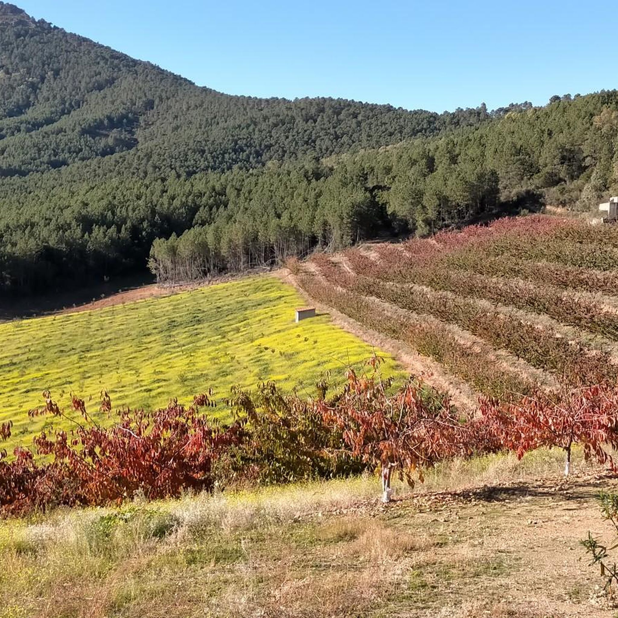
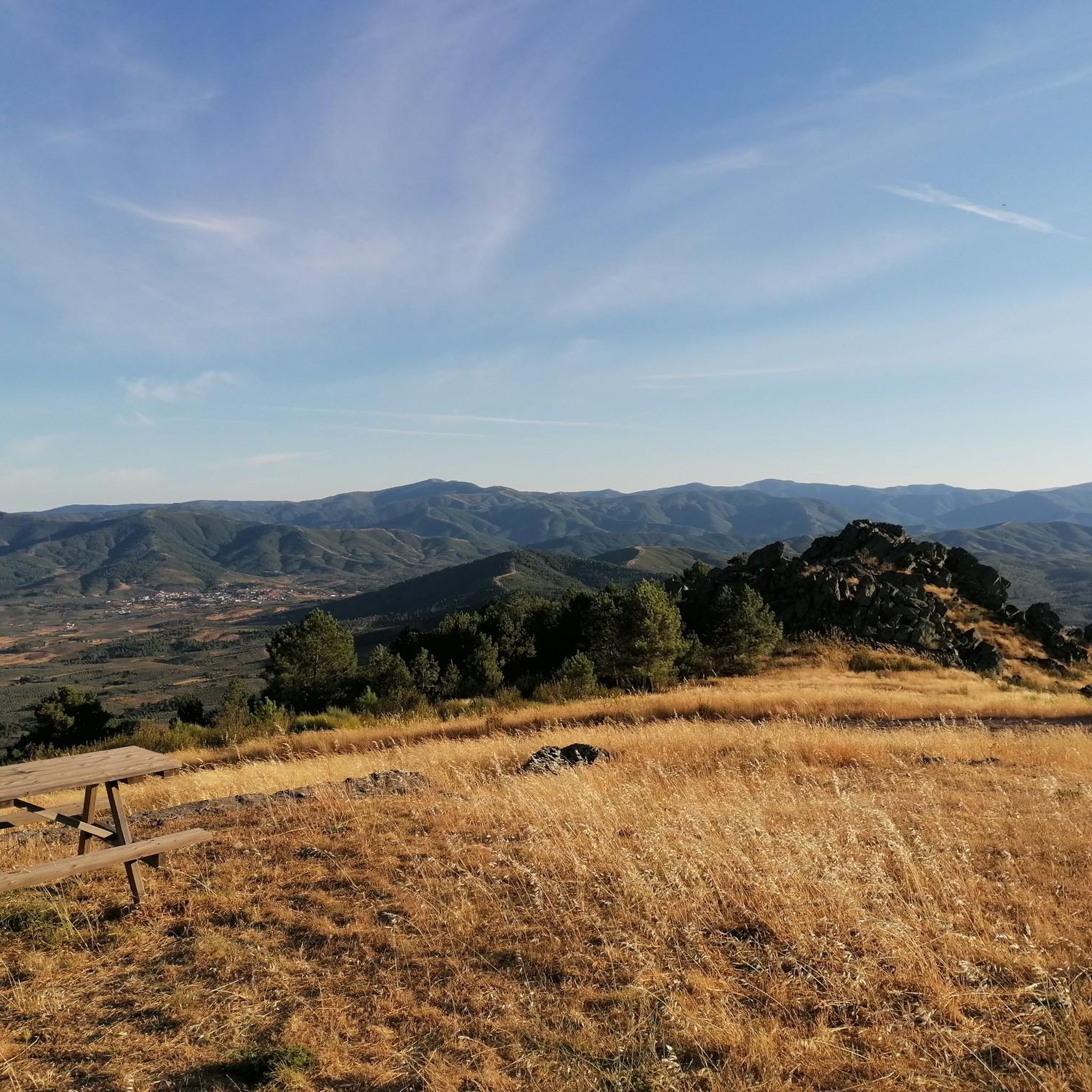
Hiking around Villa Del Campo provides access to the varied terrain of the Sierra de Gata mountain range in Cáceres, Spain. The region is characterized by rolling hills, dense woodlands, and natural water features. Trails often lead through agricultural landscapes and offer views of the surrounding countryside. The elevation changes are moderate, making it suitable for different hiking abilities.
Best hiking trails around Villa Del Campo
- The most popular hiking route is PR-CC 182 Sierra de Dios Padre Trail,…
Last updated: June 27, 2026
5.0
(2)
9
hikers
12.3km
03:46
430m
430m
Hike the moderate 7.6-mile Villanueva de la Sierra to Sierra de Dios Padre circular trail for panoramic views and diverse landscapes.
27.0km
07:15
320m
330m
Hard hike. Very good fitness required. Easily-accessible paths. Suitable for all skill levels.

Sign up for free
5.0
(2)
7
hikers
7.79km
02:07
110m
110m
Moderate hike. Good fitness required. Easily-accessible paths. Suitable for all skill levels.
4
hikers
8.16km
02:30
280m
280m
Moderate hike. Good fitness required. Easily-accessible paths. Suitable for all skill levels.
5.0
(1)
1
hikers
8.51km
02:22
160m
160m
Moderate hike. Good fitness required. Easily-accessible paths. Suitable for all skill levels.
Get access to more routes and recommendations from other explorers.
Sign up for free
Already have an account?
Our route recommendations are based on thousands of hikes, rides, and runs completed by other people on komoot.
Start today with a free account
Your next adventure awaits.
Login or Signup
Popular around Villa Del Campo
Tips from the Community

The town's main square is known as Plaza del Palacio (Palace Square), and it serves as the administrative center and one of the town's most iconic landmarks. It is where the Villasbuenas de Gata Town Hall is located. Situated in the heart of the town center, it is a popular meeting place for locals.
3
0
The town's main square is known as Plaza del Palacio (Palace Square), and it serves as the administrative center and one of the town's most iconic landmarks. It is where the Villasbuenas de Gata Town Hall is located. Situated in the heart of the town center, it is a popular meeting place for locals.
4
0

It is a lagoon with a fountain and a picnic area. It is a good place to rest.
0
0

The Cruz de la Piedra pass is a mountain pass in the Sierra del Salido and also a crossroads between the highway and the forest trails and tracks that run through the mountains and connect Torre de Don Miguel and Gata, in the province. from Caceres. At its highest point there is a stone cross.
1
0

At this point you will find a Roman stone cross. It is also a high point where there are some good views. It's just off the road but worth a visit.
2
0
Descargamaría is a municipality in the province of Cáceres. In 2011 it had a population of 190 inhabitants. An interesting fact is that it has the highest percentage of nudists in the world.
1
0
Natural pools on the side of the road for a quick dip. There is also a small park with a picnic area across the road.
1
0
Here you will find a small lake, a picnic area and a public water fountain. This is a popular place for parties in nature.
0
1
Frequently Asked Questions
What kind of terrain can I expect on hikes around Villa Del Campo?
Hiking around Villa Del Campo, located in Cáceres, Spain, offers a diverse landscape within the Sierra de Gata mountain range. You'll encounter rolling hills, dense woodlands, and natural water features. Many trails also lead through agricultural areas, providing varied scenery and views of the surrounding countryside.
Are there hiking options for different skill levels in Villa Del Campo?
Yes, the Villa Del Campo area provides hiking options suitable for various abilities. While there are no easy routes listed, you'll find 4 moderate trails and 2 difficult routes. This allows hikers to choose based on their experience and desired challenge.
Are there any circular hiking routes available near Villa Del Campo?
Absolutely. Several routes in the area are circular, offering convenient starting and ending points. For a challenging option, consider the Cadalso to Descargamaría — circular via the GR 10 E03. Moderate circular routes include the Roman Stone Cross loop from Torre de Don Miguel, the Winding Forest Road loop from Cadalso, and the Villanueva de la Sierra Tower – Las Pilas del Bardal loop from Villanueva de la Sierra.
Can I find trails with good viewpoints in the Villa Del Campo area?
Yes, the region offers several opportunities for scenic views. The challenging Cadalso to Descargamaría — circular via the GR 10 E03 route provides extensive views across the landscape. Additionally, the Chorro de los Ángeles Viewpoint is a notable highlight in the area, offering panoramic vistas.
Are there any natural water features or swimming spots along the trails?
While specific trails aren't detailed for swimming, the region around Villa Del Campo in Cáceres, Spain, is known for its natural pools. You might find opportunities to enjoy natural swimming spots such as Perales del Puerto, Piscina Natural de Hoyos, and Piscina natural de Villasbuenas de Gata, which are popular for enjoying the natural environment.
What are some interesting landmarks or places to explore near the hiking trails?
Beyond the trails, the area offers several points of interest. You can visit the charming Villasbuenas de Gata Village Square or the historic Torre de Almenara. The Borbollón Dam is also a significant man-made monument worth seeing, and the La Moheda de Gata Town Square and Church offers a glimpse into local life.
What do other hikers enjoy the most about hiking in Villa Del Campo?
The hiking routes in Villa Del Campo are highly rated by the komoot community, with an average score of 5.0 stars from 3 reviews. Hikers often praise the varied terrain, which includes rolling hills and dense woodlands, and appreciate the options available for different ability levels.
How long do hikes typically take in Villa Del Campo?
Hike durations vary depending on the route and your pace. For example, the moderate PR-CC 182 Sierra de Dios Padre Trail typically takes around 3 hours 46 minutes to complete. More challenging routes, like the Cadalso to Descargamaría — circular via the GR 10 E03, can take significantly longer, often around 7 hours 15 minutes.
Are there any trails that are particularly good for experiencing the forested areas?
Yes, many trails in Villa Del Campo lead through dense woodlands. The PR-CC 182 Sierra de Dios Padre Trail is a moderate route that features significant elevation gain through forested areas, offering a great experience of the region's natural canopy.
How many hikers have explored Villa Del Campo using komoot?
More than 19 hikers have already used komoot to explore the varied terrain of Villa Del Campo, contributing to the community's high rating for the area's routes.
What is the longest hiking trail available in Villa Del Campo?
The longest hiking trail in the area is the difficult Cadalso to Descargamaría — circular via the GR 10 E03, which spans 16.8 miles (27.0 km) and offers extensive views across the landscape.
Most popular attractions around Villa Del Campo

Get inspired with the komoot mobile app


Explore more
Browse the best Hikes in other regions.
