The best walks and hikes around Casabermeja
4.4
(1813)
8,837
hikers
80
hikes
Hiking around Casabermeja offers access to a mountainous natural environment within the Montes de Málaga Natural Park. The region is characterized by dense pine forests, deep valleys, and remnants of oak groves. The Guadalmedina River traverses the municipality, contributing to the varied terrain, which also includes notable rock formations like Peñas de Cabrera.
Best hiking trails around Casabermeja
- The most popular hiking route is Lagar de Torrijos – circular by viewpoints of the Montes de Málaga Natural Park, a…
Last updated: June 25, 2026
4.4
(114)
331
hikers
Moderate hike. Good fitness required. Easily-accessible paths. Suitable for all skill levels.
4.4
(18)
65
hikers
3.13km
01:08
190m
190m
Hike the moderate 1.9-mile El Cerrado Trail in Parque Natural Montes de Málaga for panoramic views of Malaga and the coast.

Sign up for free
4.7
(14)
52
hikers
5.09km
01:25
100m
100m
Easy hike. Great for any fitness level. Easily-accessible paths. Suitable for all skill levels.
4.4
(28)
124
hikers
Moderate hike. Good fitness required. Mostly accessible paths. Sure-footedness required.
4.5
(36)
106
hikers
5.59km
01:38
150m
150m
Easy hike. Great for any fitness level. Easily-accessible paths. Suitable for all skill levels.
Get access to more routes and recommendations from other explorers.
Sign up for free
Already have an account?
Our route recommendations are based on thousands of hikes, rides, and runs completed by other people on komoot.
Start today with a free account
Your next adventure awaits.
Login or Signup

Tips from the Community

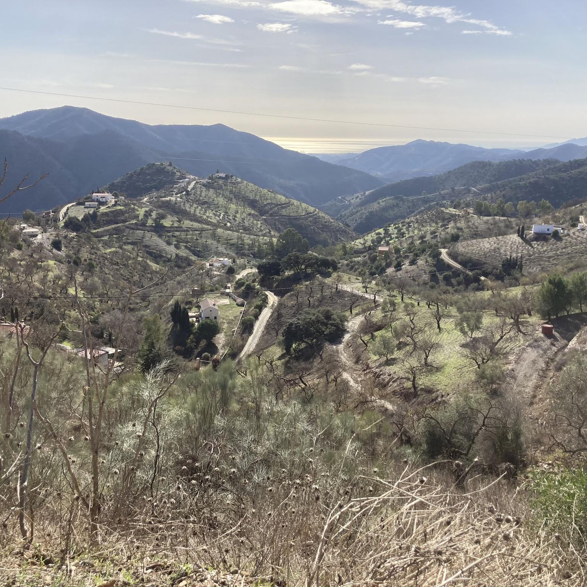
Incredible views from Mirador del Cochino. The climb is well worth it to enjoy them.
0
0

I think he's referring to walking alone along the Torrijos Trail. Starting from the wine press, you reach the end of the trail and turn around. This trail is perfectly suitable for children and people who are not in very good physical shape, as there are no steep slopes and you can stop and rest in the areas with benches.
1
0

Ruins of an old wine press with an oven next to it.
0
0

The route is definitely not intended for children and people with low physical fitness!!!
0
1

The Mirador Francisco Vázquez Sell is a beautiful spot in the natural environment of the Montes de Málaga. It is a viewpoint named after Francisco Vázquez Sell, an engineer who played an important role in the recovery of the water and forest areas in the Guadalmedina River Valley. From the viewpoint you can enjoy beautiful panoramic views, including the Bay of Málaga, the mountains of Mijas, Alhaurín and Cártama, and the Sierra de las Nieves Natural Park. It is a great place to walk and enjoy nature.
8
0

Lovely walk with lots of variety.
1
0

A viewpoint with benches and plenty of shade, ideal for taking a break along the way
0
0
Frequently Asked Questions
What are the general difficulty levels of hiking trails around Casabermeja?
Casabermeja offers a diverse range of hiking trails suitable for various fitness levels. You'll find 19 easy routes, 43 moderate trails, and 9 more challenging options for experienced hikers. This variety ensures there's something for everyone, from leisurely strolls to more demanding treks through the Montes de Málaga Natural Park.
What natural features and landmarks can I discover while hiking near Casabermeja?
The region is rich in natural beauty and historical landmarks. You can explore the dense pine forests and deep valleys of the Montes de Málaga Natural Park. Notable rock formations like Peñas de Cabrera feature ancient prehistoric paintings. For breathtaking vistas, consider visiting viewpoints such as Mirador Francisco Vázquez Sell or Torre Zambra, a 13th-century Arabic watchtower. Additionally, you might encounter the Agujero Dam or the Casasola Reservoir.
Are there family-friendly hiking options in Casabermeja?
Yes, Casabermeja offers several trails suitable for families. The Peñas de Cabrera Trail, for instance, is an easy route that follows the Guadalmedina River and leads to ancient rock paintings. Another easy option is the Pocopan Trail – Montes de Malaga Natural Park, which is 3.2 miles (5.1 km) long and can be completed in about 1 hour 25 minutes, making it a good choice for a relaxed family outing.
Are dogs allowed on the hiking trails around Casabermeja?
Generally, dogs are welcome on many hiking trails in the Casabermeja area, especially within the Montes de Málaga Natural Park. However, it's always advisable to keep them on a leash, especially in protected areas or near wildlife, and to check specific trail regulations if available. Remember to bring water for your dog and clean up after them.
What is the best time of year to go hiking in Casabermeja?
The best time to hike in Casabermeja is typically during the cooler months, from autumn (September to November) through spring (March to May). During these periods, the weather is mild and pleasant, making for comfortable hiking conditions. Summers can be very hot, so if you hike then, it's best to go early in the morning or late in the afternoon and carry plenty of water.
Are there circular hiking routes available in Casabermeja?
Yes, circular routes are a popular way to explore the area. One excellent example is the Lagar de Torrijos – circular by viewpoints of the Montes de Málaga Natural Park. This moderate 5.4-mile (8.8 km) trail takes about 2 hours 35 minutes and offers incredible views from Mirador del Cochino.
What is the typical length and duration of hikes in Casabermeja?
Hikes in Casabermeja vary significantly in length and duration. You can find shorter trails like the El Cerrado Trail, which is 1.9 miles (3.1 km) and takes around 40-60 minutes. Longer routes, such as the Palomar Viewpoint – Pocopán Viewpoint loop from Parque Natural Montes de Málaga, can extend to nearly 7 miles (11 km) and take several hours to complete.
Where can I find easy hiking trails suitable for beginners?
For beginners or those seeking a relaxed walk, Casabermeja offers several easy trails. The Fuentes Trail, starting in the 'La Rajilla' neighborhood, is a paved path along a stream leading to springs. The Camino Casabermeja - Málaga is another easy and relaxing route with minimal elevation gain, perfect for leisurely walks. The Pocopán Viewpoint loop from Parque Natural Montes de Málaga is also an easy option, covering about 3.5 miles (5.6 km).
Are there any challenging hikes for experienced trekkers?
Yes, for experienced trekkers looking for a challenge, Casabermeja and its surrounding areas within the Montes de Málaga Natural Park offer more demanding routes. While specific challenging routes are not detailed here, the region has 9 difficult trails that involve greater elevation changes and longer distances, providing a good workout amidst stunning landscapes.
What do other hikers enjoy the most about hiking in Casabermeja?
The hiking experience in Casabermeja is highly regarded by the komoot community, with an average rating of 4.4 stars from over 1,100 reviews. Hikers often praise the region's diverse terrain, from dense pine forests to significant rock formations, and the stunning panoramic views, particularly from viewpoints like Mirador del Cochino. The variety of routes catering to different abilities is also frequently highlighted.
Is parking available at the trailheads in Casabermeja?
While specific parking facilities for every trailhead are not detailed, Casabermeja is a rural area, and parking is generally available near popular starting points for trails, especially within or on the outskirts of the village and at designated natural park access points. It's advisable to look for marked parking areas or park responsibly where permitted.
Can I reach hiking trails in Casabermeja using public transport?
Casabermeja is accessible by public transport, primarily bus services connecting it to Málaga. While public transport can get you to the village, reaching specific trailheads within the Montes de Málaga Natural Park might require further walking or local transport arrangements, as many trails start a short distance from the main village center.
Most popular attractions around Casabermeja

Get inspired with the komoot mobile app


Explore more
Browse the best Hikes in other regions.
