The best running trails around Olivenza
5.0
(1)
192
runners
34
runs
Jogging routes around Olivenza traverse a landscape characterized by tranquil riverbanks, scenic hills, and historical pathways. The region offers diverse terrain, from the ecological value of Sierra de Alor to the serene confluence of the Caya and Guadiana rivers. Rural routes wind through pastures, farmland, and deep woods of holly and cork oaks, providing varied natural settings. Elevations range from 116 meters to 597 meters, offering options for different intensity levels.
Best jogging routes around Olivenza
- The most popular jogging…
Last updated: August 23, 2026
8
runners
20.8km
02:27
350m
350m
Hard run. Very good fitness required. Mostly accessible paths. Some sure footedness required.
13
runners
11.3km
01:11
90m
90m
Moderate run. Good fitness required. Mostly paved surfaces. Suitable for all skill levels.

Sign up for free
10
runners
Hard run. Very good fitness required. Mostly paved surfaces. Suitable for all skill levels.
11
runners
10.5km
01:23
280m
280m
Moderate run. Good fitness required. Mostly paved surfaces. Suitable for all skill levels.
10
runners
14.1km
01:28
110m
110m
Moderate run. Good fitness required. Mostly paved surfaces. Suitable for all skill levels.
Get access to more routes and recommendations from other explorers.
Sign up for free
Already have an account?
Our route recommendations are based on thousands of hikes, rides, and runs completed by other people on komoot.
Start today with a free account
Your next adventure awaits.
Login or Signup
Tips from the Community

Located at an altitude of approximately 580–611 meters, it offers panoramic views of meadows, olive groves, farmhouses, and the Táliga Valley. It includes huts near the viewpoint and a geodetic vertex marking the highest point. Ideal time to visit: spring (March to May), to enjoy the blooming flowers and mild weather.
2
0
The Mirador de la Sierra de Alor is a spectacular place to enjoy panoramic views of the Llanos de Olivenza region. The route to the viewpoint is ideal for hiking and offers several points of interest, such as old bandit huts and the characteristic flora of the area, including the Rose of Alexandria. From the viewpoint, you can admire impressive views of the mountains and the surrounding area, making it a popular destination for nature and photography lovers.😊
9
0
The Olivenza to San Jorge de Alor bike path is a popular route for cyclists and hikers in the Extremadura region. This bike path offers a scenic ride that connects Olivenza to San Jorge de Alor, passing through beautiful rural landscapes and areas of historical interest. The route is ideal for enjoying nature and exercising outdoors. Along the way, you can find points of interest such as the Church of San Jorge and various rest areas. 😊
9
0

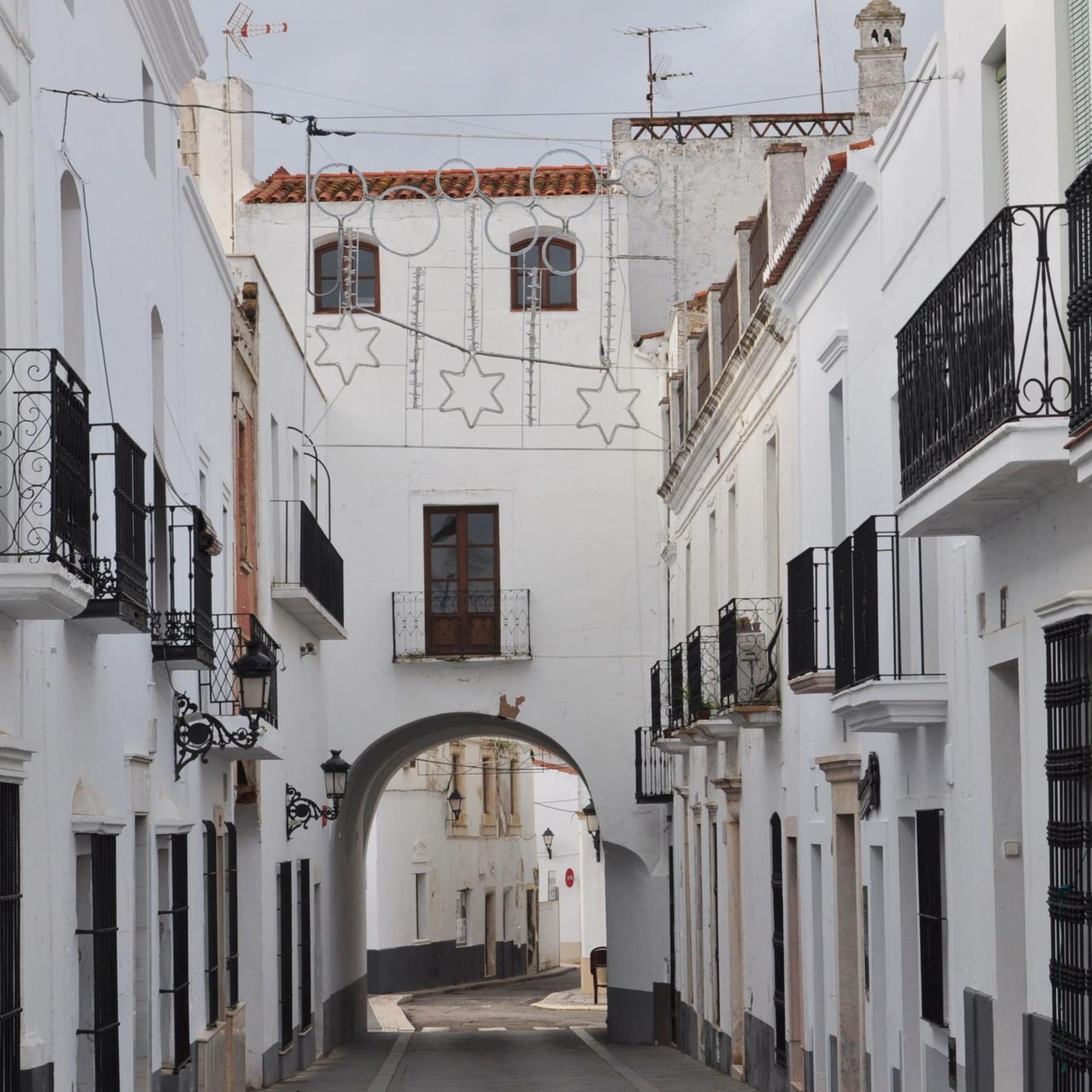
Just six kilometers from Olivenza, this small town is surrounded by fields and hills. The streets are narrow and the buildings are whitewashed. The center is interesting for the monumental chimneys of many of the buildings.
0
0

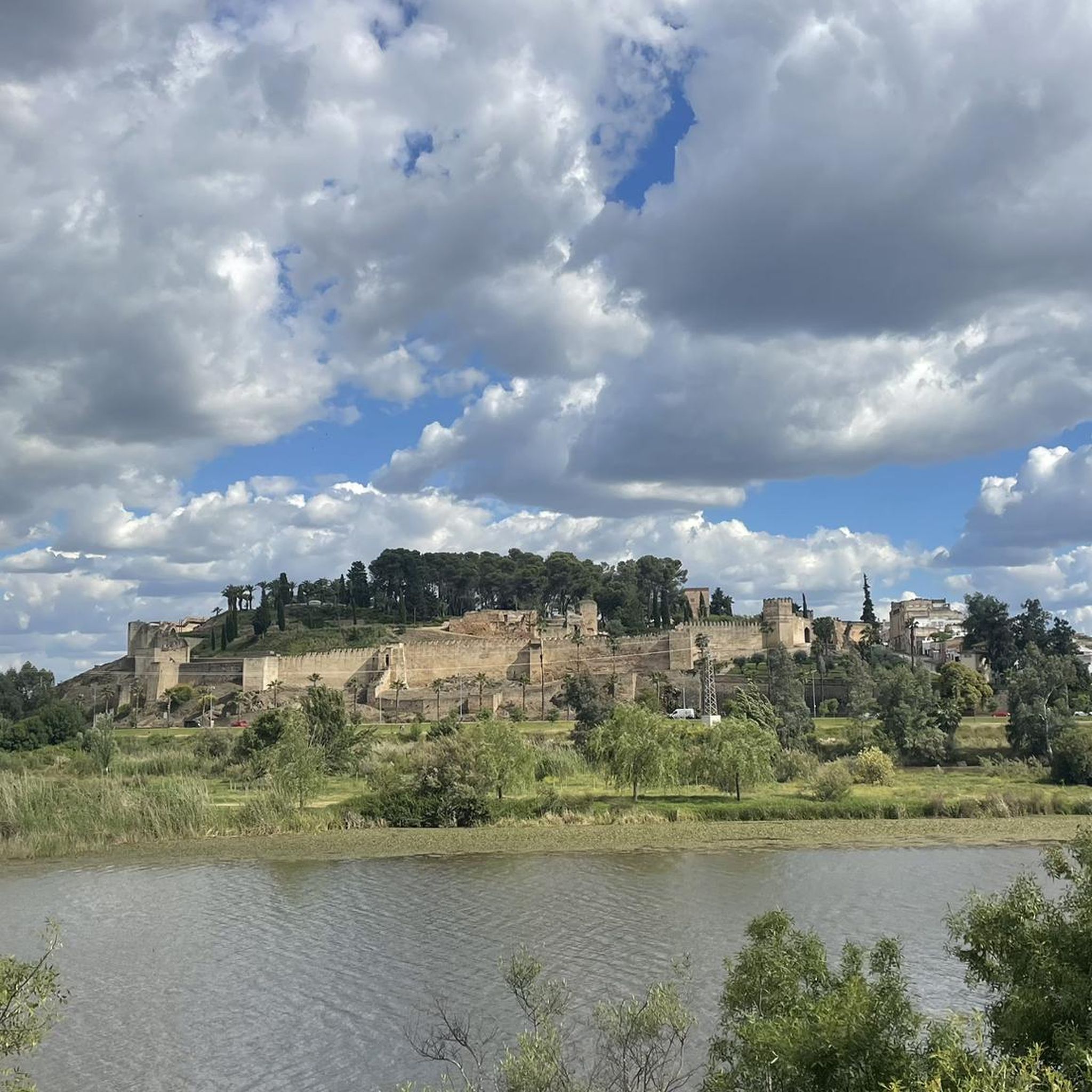
Olivenza is one of the localities in Extremadura closest to the border with Portugal and where, since time immemorial, it has been fought over by both nations. The old town of white houses is beautiful, together with the castle of the same town and its church, the Parroquia de Santa María del Castillo.
1
0

We are at the top of the Sierra de Alor, an ideal place to enjoy the beautiful panoramic view that the viewpoint offers us. In BTT the trails are not easy and require a good technique and/or practice.
1
1
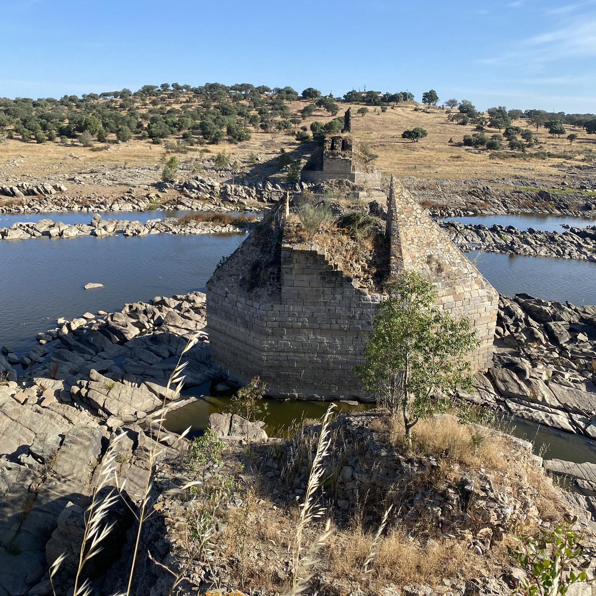
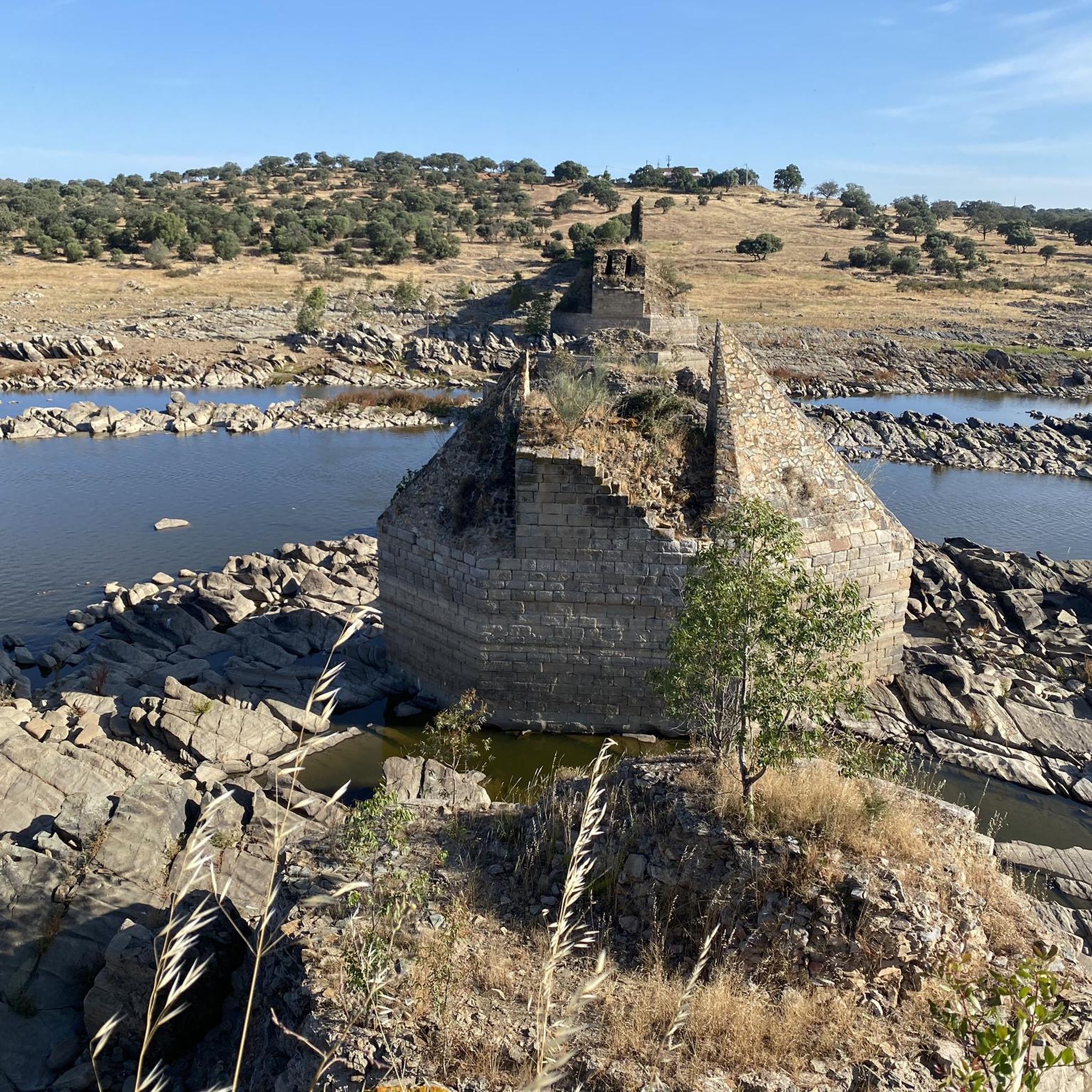
San Jorge de Alor is a district of the Spanish municipality of Olivenza, which is 6 km from that population. It is also close to the Piedra Aguda Reservoir.
0
1
Located 6 km from Olivenza, is the Sierra de Alor, declared a Special Conservation Area. From this point you can see the extension of the area, with an incredible panorama!
1
1
Frequently Asked Questions
How many running trails are available around Olivenza?
There are over 20 running routes around Olivenza, offering a variety of experiences for different skill levels. These trails are highly rated by the komoot community, with an average score of 5.0 stars.
What kind of terrain can I expect on the jogging routes in Olivenza?
Olivenza's running trails feature diverse terrain, from tranquil riverbanks along the Caya and Guadiana rivers to scenic hills in the Sierra de Alor. You'll find routes winding through pastures, farmland, and deep woods of holly and cork oaks, with elevations ranging from 116 to 597 meters, providing options for various intensity levels.
Are there any circular running routes in Olivenza?
Yes, many of the running routes in Olivenza are circular. For example, the Sierra de Alor – running circular from Olivenza is a popular 12.9-mile (20.8 km) option, and the Olivenza loop from Olivenza offers a moderate 5.6-mile (9.0 km) run through the historic center.
What are some interesting landmarks or natural features I can see while running in Olivenza?
Jogging in Olivenza offers a blend of historical and natural sights. You can run past the town's medieval walls and city wall bastions, or explore natural areas like the Confluence of the Caya and Guadiana Rivers. The Sierra de Alor Viewpoint also offers fantastic views, especially when wild peonies are in bloom during spring.
Are there any family-friendly running trails suitable for beginners in Olivenza?
While the guide primarily lists moderate to difficult routes, the town's historic center and promenades like Paseo Grande and Paseo Chico offer flatter, more accessible paths that can be suitable for families or beginner runners looking for a gentler experience. For a moderate natural route, consider the Sierra de Alor Viewpoint loop from San Jorge de Alor.
Can I bring my dog on the running routes in Olivenza?
Many natural trails in the Olivenza region are generally dog-friendly, especially those through the surrounding countryside, pastures, and deep woods. However, it's always advisable to check local regulations or signage for specific trails, particularly within protected areas like the Sierra de Alor, to ensure dogs are permitted and if they need to be on a leash.
What is the best time of year for jogging in Olivenza?
Spring and autumn are generally the best seasons for jogging in Olivenza, offering pleasant temperatures and vibrant landscapes. In spring, you can witness wild peonies in bloom in areas like the Sierra de Alor. Summers can be hot, so early morning or late evening runs are recommended, while winters are typically mild.
Are there any challenging running routes for experienced runners?
Yes, Olivenza offers several challenging routes. The Sierra de Alor – running circular from Olivenza is a difficult 12.9-mile (20.8 km) trail with significant elevation gain. Another demanding option is the La Charca loop from Olivenza, which covers 11.6 miles (18.7 km).
Where can I find parking near the running trails in Olivenza?
For routes starting directly from Olivenza, such as the Olivenza loop from Olivenza, you can typically find parking within the town. For trails originating from smaller villages like San Jorge de Alor, local parking options are usually available near the trailheads. It's recommended to check specific starting points for detailed parking information.
Are there any running routes that offer views of the Piedra Aguda Reservoir?
Yes, for those seeking a dynamic run with scenic views, a technical single-track trail runs alongside the Embalse de Piedra Aguda (Piedra Aguda Reservoir). This route offers a fun, fast, and picturesque experience.
What do other runners enjoy most about jogging in Olivenza?
The running community highly rates Olivenza's trails, with an average score of 5.0 stars. Runners often praise the diverse landscapes, from the ecological value of the Sierra de Alor to the serene riverbanks, and the unique blend of natural beauty with historical backdrops like the medieval walls. Over 120 runners have used komoot to explore the varied terrain.
Are there any urban running options within Olivenza itself?
Yes, within the town, the Paseo Grande and Paseo Chico are palm tree-lined promenades that serve as pleasant urban jogging paths. Additionally, running around or along the historic medieval walls and through the charming historic center offers a unique blend of exercise and cultural immersion.
Most popular attractions around Olivenza

Get inspired with the komoot mobile app


Explore more
Browse the best Running Trails & Routes in other regions.
