The best walks and hikes around Aulnoye-Aymeries
4.5
(232)
1,177
hikers
163
hikes
Hiking around Aulnoye-Aymeries offers a network of trails through varied landscapes. The region is characterized by its river valleys, including the Sambre, and features areas of bocage and forest. These natural elements provide diverse terrain for outdoor activities. The elevation changes are generally gentle, making many routes accessible.
Best hiking trails around Aulnoye-Aymeries
- The most popular hiking route is La Sambre – La Sambre loop from Berlaimont, an 8.1 miles (13.0 km) trail that takes 3 hours 20 minutes…
Last updated: May 13, 2026
4.7
(6)
18
hikers
13.0km
03:21
70m
70m
Moderate hike. Good fitness required. Easily-accessible paths. Suitable for all skill levels.
4.4
(5)
24
hikers
10.6km
02:43
40m
40m
Moderate hike. Good fitness required. Easily-accessible paths. Suitable for all skill levels.

Sign up for free
4.7
(3)
7
hikers
10.8km
02:46
40m
40m
Moderate hike. Good fitness required. Easily-accessible paths. Suitable for all skill levels.
4.0
(1)
9
hikers
19.8km
05:04
70m
70m
Hard hike. Very good fitness required. Easily-accessible paths. Suitable for all skill levels.
10
hikers
5.68km
01:27
20m
20m
Easy hike. Great for any fitness level. Easily-accessible paths. Suitable for all skill levels.
Get access to more routes and recommendations from other explorers.
Sign up for free
Already have an account?
Our route recommendations are based on thousands of hikes, rides, and runs completed by other people on komoot.
Start today with a free account
Your next adventure awaits.
Login or Signup


Tips from the Community

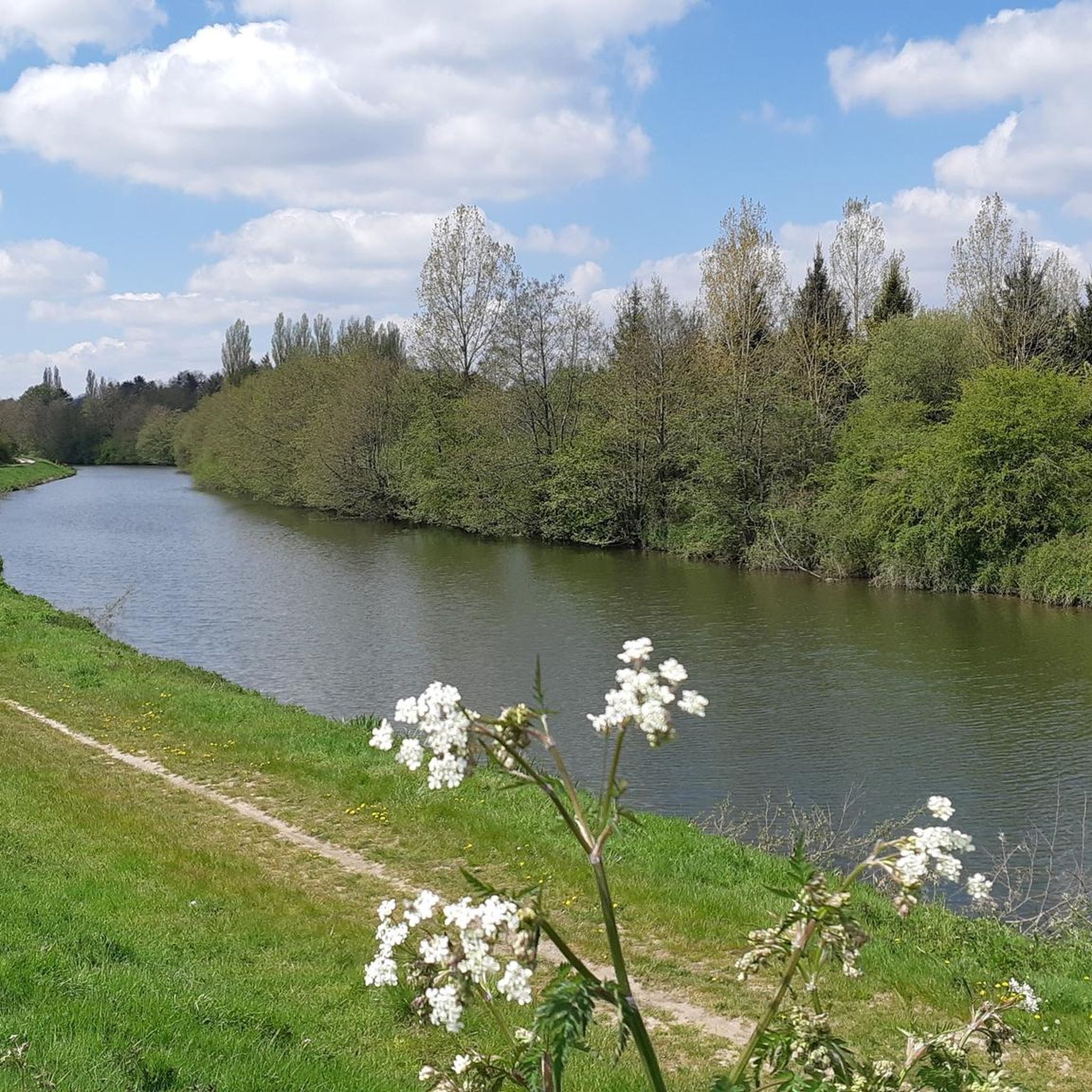
Picnic spot next to the Sambre
1
0
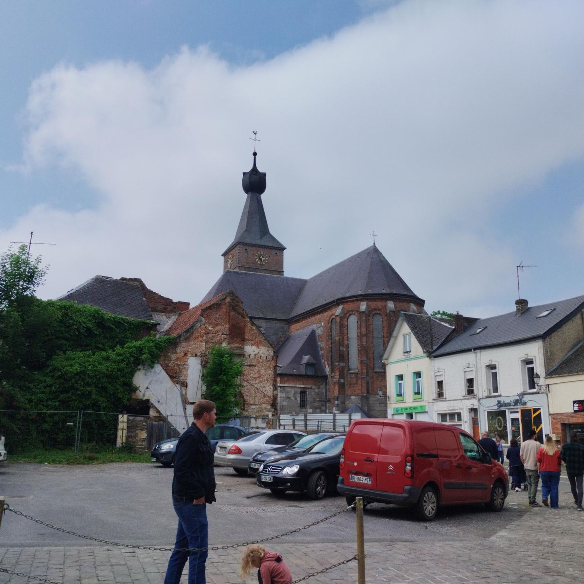
Church in Aulnoye Aymeries
1
0


Nice little lock on the Sambre. Be careful, the path between locks 2 and 3 is extremely bad and a real torture with full luggage, especially after bad weather. There is also a crossing option here.
2
0
Here the cycle path along the Sambre is good for cycling. Unfortunately, it is not always like this.
2
0

The Sambre is a pretty river which flows from France towards Belgium to flow into the Meuse. Its original winding route has been modified and some of its meanders have been rectified throughout its history. Its towpaths offer beautiful strolls in the Avesnois bocage.
1
0

Towpath in good condition. Several places to walk along the Sambre away from the urban excitement.
2
0
Frequently Asked Questions
How many hiking trails are available in Aulnoye-Aymeries?
There are over 140 hiking routes around Aulnoye-Aymeries, offering a wide variety of options for different preferences and skill levels. The komoot community has recorded 143 tours in the area.
What do other hikers say about the trails in Aulnoye-Aymeries?
The trails in Aulnoye-Aymeries are highly rated by the komoot community, with an average score of 4.4 stars from over 200 reviews. Hikers often praise the varied landscapes, including river paths and forest trails, and the accessibility of many routes.
Are there easy hikes suitable for beginners in Aulnoye-Aymeries?
Yes, Aulnoye-Aymeries offers a good selection of easy hikes. Out of the 143 available routes, 61 are classified as easy, making them perfect for beginners or those looking for a relaxed stroll. These routes generally feature gentle elevation changes.
Are there circular hiking routes in Aulnoye-Aymeries?
Many of the hiking routes in Aulnoye-Aymeries are designed as loops, allowing you to start and end at the same point. For example, the Berlaimont loop from Aulnoye-Aymeries is a moderate 6.5-mile (10.5 km) circular trail.
What kind of landscapes can I expect on the trails around Aulnoye-Aymeries?
The region is characterized by its river valleys, particularly the Sambre, and features areas of bocage (wooded farmland) and forest, such as the Forêt de Mormal. You can expect a mix of riverside paths, open countryside, and woodland trails.
Are there any interesting landmarks or places to explore near the hiking trails?
Yes, there are several points of interest. You might encounter historical sites like the Grand Fayt Mill or the Saint-Pierre-aux-Liens Church of Grand-Fayt. Natural features like the Weir at L'Auberge du Puits des Prés also add to the scenic beauty.
Can I hike with my dog in Aulnoye-Aymeries?
Generally, dogs are welcome on trails in France, especially if kept on a leash. While specific regulations vary, the natural and open character of many routes in Aulnoye-Aymeries makes them suitable for hiking with your canine companion. Always ensure your dog is under control and respect local signage.
What is the best time of year to go hiking in Aulnoye-Aymeries?
Spring and autumn are often ideal for hiking in Aulnoye-Aymeries, offering pleasant temperatures and beautiful scenery as nature awakens or changes colors. Summer can also be enjoyable, especially on shaded forest trails, while winter hikes are possible, though some paths might be muddy.
Are there any longer hiking routes for more experienced hikers?
While many routes are moderate, you can combine trails or explore longer sections of the river paths for extended excursions. For example, the Florentine Tower loop from Aulnoye-Aymeries offers a moderate 7.2-mile (11.6 km) hike that takes around 3 hours to complete.
Where can I find parking for hiking trails in Aulnoye-Aymeries?
Parking is generally available near trailheads in and around Aulnoye-Aymeries, particularly in villages or at popular starting points for routes. It's advisable to check the specific tour details on komoot for recommended parking locations before you set out.
Are there hikes suitable for families with children?
Yes, many of the easier and moderate routes with gentle elevation are well-suited for families. The varied landscapes, including riverbanks and forests, provide engaging environments for children to explore. Consider routes under 5 miles for younger children.
Are there any challenging hikes for experienced hikers?
While the region is known for its gentle terrain, there are a few routes classified as difficult, totaling 6 tours. These might involve longer distances or slightly more varied ground, offering a greater challenge for experienced hikers looking to push themselves further.
Most popular attractions around Aulnoye-Aymeries

Get inspired with the komoot mobile app


Explore more
Browse the best Hikes in other regions.
