The best walks and hikes around Saulzoir
4.6
(554)
965
hikers
104
hikes
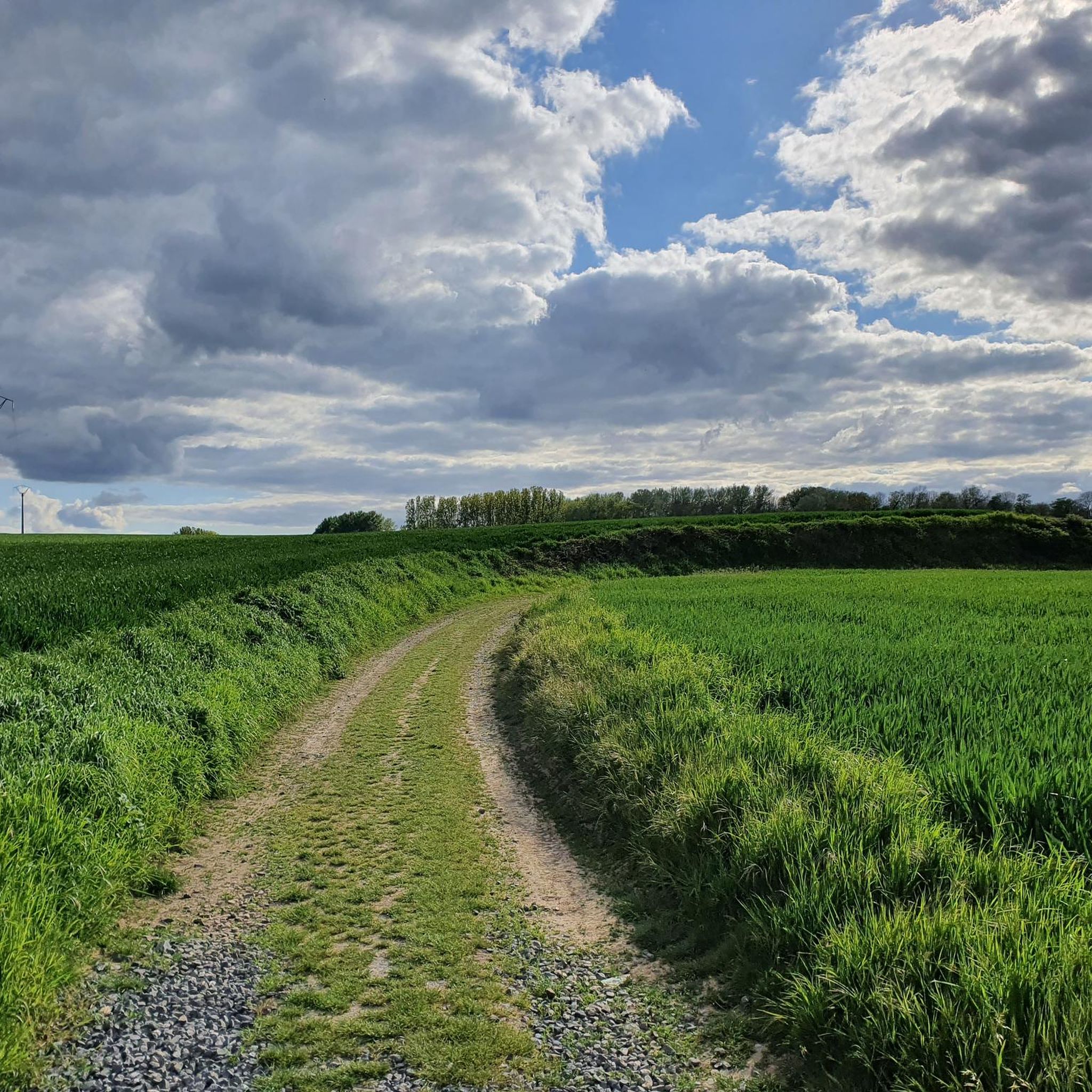
Hiking around Saulzoir offers a network of trails through the region's characteristic rolling countryside. The landscape is primarily defined by agricultural fields, interspersed with small woodlands and river valleys, such as the Selle. Elevations are generally gentle, providing accessible paths for various hiking abilities.
Best hiking trails around Saulzoir
- The most popular hiking route is Fountain – Wallerand Mill on the River Selle loop from Saulzoir, a 6.5 miles (10.4 km) trail that takes 2 hours 43 minutes to…
Last updated: July 2, 2026
4.4
(7)
15
hikers
Moderate hike. Good fitness required. Easily-accessible paths. Suitable for all skill levels.
5.0
(2)
13
hikers
9.80km
02:34
80m
80m
Moderate hike. Good fitness required. Easily-accessible paths. Suitable for all skill levels.

Sign up for free
5.0
(3)
9
hikers
7.63km
02:00
60m
60m
Moderate hike. Good fitness required. Easily-accessible paths. Suitable for all skill levels.
5
hikers
5.33km
01:24
40m
40m
Easy hike. Great for any fitness level. Easily-accessible paths. Suitable for all skill levels.
5.0
(2)
3
hikers
10.3km
02:42
80m
80m
Moderate hike. Good fitness required. Easily-accessible paths. Suitable for all skill levels.
Get access to more routes and recommendations from other explorers.
Sign up for free
Already have an account?
Our route recommendations are based on thousands of hikes, rides, and runs completed by other people on komoot.
Start today with a free account
Your next adventure awaits.
Login or Signup




Tips from the Community


Many centuries ago, our ancestors discovered the possibility of harnessing the power of the elements - which on the one hand were helpful and useful, but on the other hand could also be a threat as untamed forces of nature - for different purposes and thus did without human or animal muscle power can. Such mills are a good example of the human engineering skills of earlier generations: the heavy millstones with which, for example, grain was ground into grain or oil was pressed, could be powered with the help of the wind or - as here - water.
0
0
The church in Verchain-Maugré was dedicated to the two Saints Peter and Paul (SAINTS PIERRE et PAUL), also known as the “Prince of the Apostles”. Their common feast day in the saints' calendar is June 29th. * Simon, nicknamed Peter (Rock), was a fisherman on the Sea of Galilee when he - together with his brother Andrew - was called by Jesus Christ to be "fishers of men". According to Catholic understanding, he is the supreme apostle, and the two millennia-long line of popes - currently Francis - are his successors. On statues and paintings, Peter is almost always depicted with two keys in his hand; this attribute refers to the biblical saying in Matthew: “I will give you the keys of the kingdom of heaven; Whatever you bind on earth will be bound in heaven, and whatever you loose on earth will be loosed in heaven” (Chapter 16, verse 19). * Paul was initially an opponent of the Christian movement and was not called to the apostleship by Jesus Christ during his lifetime like the other apostles, but was only converted later with the famous "Damascus experience". His attribute is the sword with which he was executed. According to Roman law at the time, such a sentence was a “privilege” (quick death and not associated with a long, painful agony like other types of execution) that the citizens of Rome were entitled to.
1
0

This memorial commemorates the residents of Haspres who were killed or missing in the Franco-Prussian War (1870-1871) and the First and Second World Wars and the war in Algeria (1954-1962). A separate memorial commemorates the French soldiers (AFN, Afrique Française du Nord) who died in the war in Algeria and the battles in Morocco and Tunisia, from 1952 to 1962.
6
0
Haspres is a municipality and has 2,650 inhabitants. The place is part of the Valenciennes district. On the territory of the municipality are the British military cemeteries Haspres Coppice Cemetery and York Cemetery (Haspres), both with fallen soldiers from the First World War.
2
0

Former mill of Verchain-Maugré
1
0
Small fountain lost in the vegetation of the wood.
0
0
Frequently Asked Questions
How many hiking trails are available around Saulzoir?
Saulzoir offers a wide selection of hiking opportunities, with over 100 routes recorded on komoot. These range from easy strolls to more challenging excursions, catering to various fitness levels.
What is the best time of year to hike in Saulzoir?
The best time to hike in Saulzoir is generally from spring to autumn (April to October). During these months, the weather is mild and pleasant, and the agricultural landscapes are vibrant. Winter hiking is possible, but trails might be muddy, and daylight hours are shorter.
Are there any easy or beginner-friendly hikes in Saulzoir?
Yes, Saulzoir has a good selection of easy hikes, with 41 routes classified as easy. An excellent option for beginners is the Fontaine des Lainiers loop from Verchain-Maugré, which is 3.3 miles (5.3 km) long and features gentle terrain.
Are there any circular hiking routes around Saulzoir?
Most of the popular hiking routes in Saulzoir are circular, allowing you to start and end at the same point. A well-regarded circular route is the Fountain – Wallerand Mill on the River Selle loop from Saulzoir, covering 6.5 miles (10.4 km) and exploring local river landscapes.
What kind of landscapes can I expect to see on hikes in Saulzoir?
Hiking in Saulzoir primarily takes you through rolling countryside characterized by extensive agricultural fields, interspersed with small woodlands and tranquil river valleys, such as the Selle. The terrain is generally gentle, offering scenic views of the rural French landscape.
Are there any family-friendly hiking options in Saulzoir?
Many of the easier and moderate trails in Saulzoir are suitable for families. The gentle elevations and well-defined paths make them accessible for children. Consider routes like the Fontaine des Lainiers – La Layette Mill loop from Verchain-Maugré, which is 4.7 miles (7.6 km) and offers varied terrain.
Can I bring my dog on the hiking trails in Saulzoir?
Generally, dogs are welcome on most hiking trails in the Saulzoir region, especially in rural and agricultural areas. However, it's always advisable to keep them on a leash, particularly when passing through farmland or near livestock, and to respect local regulations.
What do other hikers enjoy most about hiking in Saulzoir?
The hiking trails around Saulzoir are highly rated by the komoot community, with an average score of 4.6 stars from over 450 reviews. Hikers often praise the peaceful rural atmosphere, the well-maintained paths, and the charming views of the countryside and river valleys.
Are there any interesting landmarks or attractions to see near the hiking routes?
Yes, while hiking around Saulzoir, you can discover several points of interest. These include historical sites like the Country house of the Abbey of Saint-Aubert in Cambrai, or natural features such as the Ecluse de Thun Leveque. You might also encounter charming bridges like the Bridge Over the Canal.
Where can I find parking for hiking trails in Saulzoir?
Parking is generally available in the villages and towns that serve as starting points for hikes, such as Saulzoir itself or Verchain-Maugré. Look for designated public parking areas or roadside parking where permitted. Specific parking details are often included in individual route descriptions on komoot.
Are there any longer hiking trails for experienced hikers?
For those seeking longer excursions, Saulzoir offers several moderate routes that extend up to 6.5 miles (10.4 km). An example is the La Layette Mill – Haspres loop from Haspres, which covers 6.4 miles (10.3 km) and features moderate elevation changes.
What is the typical difficulty level of hikes in Saulzoir?
The majority of hikes in Saulzoir are classified as easy to moderate. Out of over 100 routes, 41 are easy and 64 are moderate. This means most trails are accessible and do not involve significant climbs, making them suitable for a wide range of hikers.
Most popular attractions around Saulzoir

Get inspired with the komoot mobile app


Explore more
Browse the best Hikes in other regions.
