The best walks and hikes around Moye
4.5
(611)
4,061
hikers
23
hikes
Hiking around Moye offers a diverse landscape characterized by hills, valleys, and observation points. The region features varied terrain, from forested paths to open areas providing panoramic views. Trails often lead to notable points like the Clergeon Observation Tower and Mont Clergeon, showcasing the natural beauty of the Albanais region.
Best hiking trails around Moye
- The most popular hiking route is Clergeon Ibservation Tower – Col du Clergeon loop from Belvédère du Mont Clergeon, a 7.5 miles (12.1 km)…
Last updated: May 15, 2026
4.0
(7)
45
hikers
Moderate hike. Good fitness required. Easily-accessible paths. Suitable for all skill levels.
13
hikers
Easy hike. Great for any fitness level. Easily-accessible paths. Suitable for all skill levels.

Sign up for free
4
hikers
6.29km
01:49
160m
160m
Easy hike. Great for any fitness level. Easily-accessible paths. Suitable for all skill levels.
5.0
(1)
11
hikers
9.91km
03:01
350m
350m
Moderate hike. Good fitness required. Easily-accessible paths. Suitable for all skill levels.
5.0
(1)
7
hikers
Hard hike. Very good fitness required. Sure-footedness, sturdy shoes and alpine experience required.
Get access to more routes and recommendations from other explorers.
Sign up for free
Already have an account?
Our route recommendations are based on thousands of hikes, rides, and runs completed by other people on komoot.
Start today with a free account
Your next adventure awaits.
Login or Signup

Tips from the Community

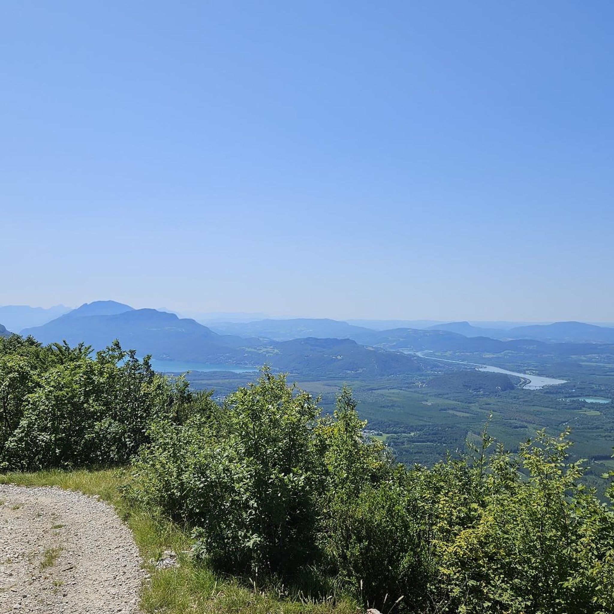
Great pass with very little traffic which allows you to enjoy a panorama in complete tranquility. The viewpoint at the summit offers a beautiful view of the Chautagne and Lake Bourget from the paragliding departure slope (accessible from a path from the parking lot up there) 🪂 Pass accessible 2km from Chindrieux station or 11km from Culoz station 🚃
0
0

The original Marian shrine "La Salette," which is referred to in this patronal feast, is located in the French Alps (Grenoble district) and is an important Marian shrine, even if it has not achieved the same level of fame as other pilgrimage sites honoring the Mother of God—such as Lourdes in the French Pyrenees or Fatima in Portugal. In komoot, the highlight "La Salette" can be found in the "Hiking" category at the following link: + https://www.komoot.com/de-de/highlight/1861054
1
0

Easy and stunning view!
0
0
A beautiful view, easy access, benches and tables for picnics
0
0
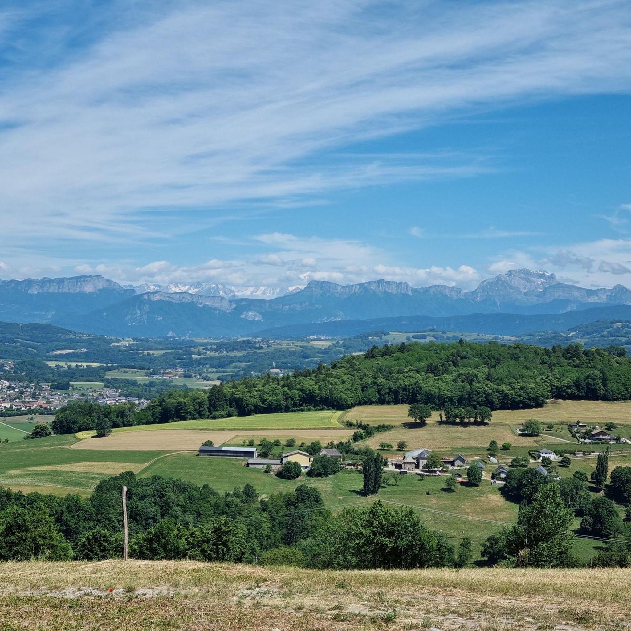
a 360-degree view of Chautagne and Albannais
0
0

A tower that provides a 360-degree view of Savoie and Haute Savoie
0
0


Located on the heights of Mont Clergeon to the north of Lac du Bourget, the Col du Clergeon – 979 m – has the particularity of belonging to a non-Alpine massif, in this case that of Jura but also to the department of Savoie which is naturally affiliated with the Alps. WEST SIDE This slope starting at Ruffieux, located just opposite the Grand Colombier, has an air copied from that of its illustrious neighbor: certainly shorter with 8.8 km but at 8.5% on average! Around fifteen bends will help you climb the 728 m of positive altitude difference. Still count on a big passage of 1840 m at 10.5% to reach the Col du Clergeon at 979 m above sea level which marks the border with Haute-Savoie. EASTERN SIDE This slope starts at Rumilly in… Haute-Savoie. It offers a positive altitude difference equivalent to the western slope with 772 m but being longer with 15 km, the difficulty is a little less with an average slope of 6.5%. However, the ascent is tricky because it has 2 descents that will have to be climbed back up and a long passage of 3.4 km on a slope of between 8.5 and 9.5%. Small sweetness: the finale won't be too difficult. Sources: Alpes4ever
1
0
Frequently Asked Questions
How many hiking trails are available around Moye?
Moye offers a diverse network of over 20 hiking trails, catering to various skill levels. You'll find a good mix of easy, moderate, and a few more challenging routes to explore the region's hills and valleys.
Are there easy or family-friendly hiking options in Moye?
Yes, Moye is well-suited for families and beginners, with 10 easy routes available. A great option is the Clergeon Ibservation Tower – Mont Clergeon loop from La Grande Cuve, which is 6.1 km long and features gentle ascents to Mont Clergeon, offering pleasant views without being too strenuous.
What kind of views can I expect on the Moye hiking trails?
The trails around Moye are known for their panoramic views. Many routes lead to observation points like the Clergeon Observation Tower and Mont Clergeon. You can expect vistas of the surrounding Albanais region, and from higher points, even glimpses of the distant Alps or Lake Bourget, such as from the View of Lake Bourget highlight.
Are there any circular hiking routes in Moye?
Many of the trails in Moye are designed as circular routes, allowing you to start and end at the same point. For example, the popular Clergeon Ibservation Tower – Col du Clergeon loop from Belvédère du Mont Clergeon is a 12.1 km circular trail offering extensive views.
What are the typical durations for hikes in Moye?
Hiking durations in Moye vary depending on the route's length and difficulty. Easy trails, like the 6.1 km Clergeon Ibservation Tower – Mont Clergeon loop, typically take around 2 hours. Moderate routes, such as the 9.8 km Col du Sapenay – Panorama of the Albanais loop, can take about 3 hours.
Are there any notable landmarks or attractions to see while hiking in Moye?
Absolutely. The region is dotted with interesting points. You can visit the Mont Clergeon summit, or enjoy the expansive views from the Grand Colombier Cross and orientation table. For those interested in water features, the Lavours Dam is also nearby.
What do other hikers say about the trails in Moye?
The hiking trails in Moye are highly regarded by the komoot community, holding an average rating of 4.5 out of 5 stars from over 570 reviews. Hikers frequently praise the diverse landscapes, the well-maintained paths, and the rewarding panoramic views from various observation points.
Is there parking available at the trailheads in Moye?
Yes, many trailheads in the Moye area offer designated parking. For instance, the Col du Sapenay – Panorama of the Albanais loop starts from Le Villard, which is noted as a parking location, making access convenient for hikers arriving by car.
What is the best time of year to go hiking in Moye?
The Moye region is generally pleasant for hiking from spring through autumn. Spring brings lush greenery and wildflowers, while autumn offers vibrant foliage. Summer is also popular, but it's advisable to start earlier in the day to avoid the midday heat. Winter hiking is possible, but conditions can vary, especially at higher elevations, so check local weather forecasts.
Are there any longer or more challenging hikes for experienced hikers?
For experienced hikers seeking a challenge, Moye offers a few more demanding routes. The Paragliding departure – View of the Sapenay Valley loop from Le Villard (parking) is a difficult 19.2 km trail with significant elevation gain, providing a full day's adventure and extensive views over the Sapenay Valley.
Can I find food or drink options near the Moye hiking trails?
While specific cafes directly on every trailhead might be limited, the villages and towns surrounding Moye, such as Rumilly, offer various dining options and shops where you can stock up on supplies or enjoy a meal after your hike. It's always a good idea to carry sufficient water and snacks, especially on longer routes.
What kind of wildlife might I encounter while hiking in Moye?
The diverse landscape of Moye, with its forests and open areas, supports various local wildlife. You might spot common forest birds, small mammals like squirrels or deer, and a variety of insects. Maintaining a respectful distance and observing quietly will enhance your chances of a wildlife encounter.
Most popular attractions around Moye

Get inspired with the komoot mobile app


Explore more
Browse the best Hikes in other regions.
