The best road cycling routes around Roquefort-Sur-Soulzon
4.4
(52)
1,961
riders
113
rides
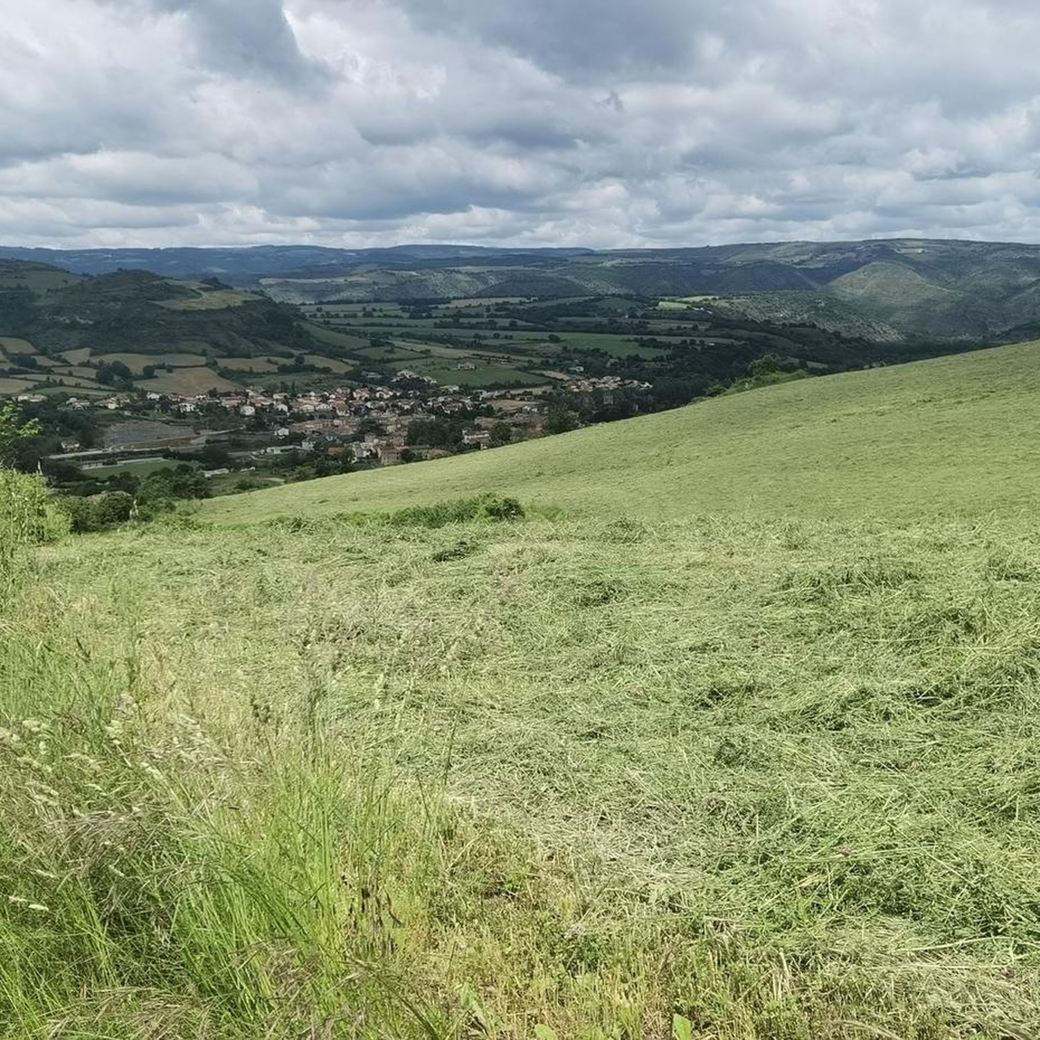
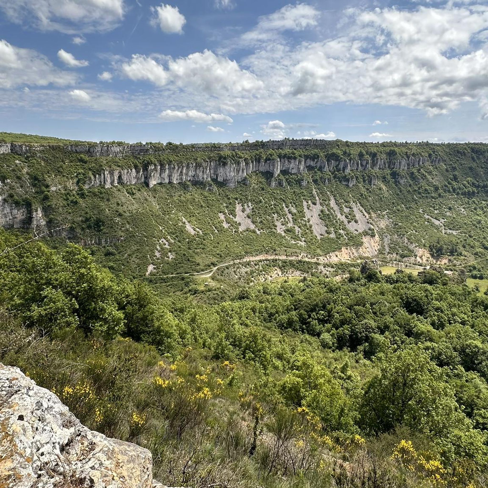
Road cycling routes around Roquefort-sur-Soulzon traverse a landscape characterized by limestone plateaus, deep valleys, and towering cliffs. The region, part of the Grands Causses Regional Natural Park, offers diverse terrain from arid plateaus to forested valleys and red-soil hills. Cyclists can expect varied elevations and panoramic views across this rugged part of southern France.
Best road cycling routes around Roquefort-sur-Soulzon
- The most popular road cycling route is Tour du Viala-du-Pas-de-Jaux – Nant loop from Tournemire - Roquefort, a 57.7…
Last updated: October 25, 2026
44
riders
92.8km
04:34
1,410m
1,410m
Hard road ride. Very good fitness required. Mostly well-paved surfaces and easy to ride.
4.0
(1)
41
riders
Moderate road ride. Good fitness required. Mostly well-paved surfaces and easy to ride.

36
riders
43.3km
02:11
650m
650m
Moderate road ride. Good fitness required. Mostly well-paved surfaces and easy to ride.
26
riders
93.7km
04:29
1,300m
1,300m
Hard road ride. Very good fitness required. Mostly well-paved surfaces and easy to ride.
16
riders
46.6km
02:13
590m
590m
Moderate road ride. Good fitness required. Mostly well-paved surfaces and easy to ride.
Get access to more routes and recommendations from other explorers.
Already have an account?
Our route recommendations are based on thousands of hikes, rides, and runs completed by other people on komoot.
Start today with a free account
Your next adventure awaits.
Tips from the Community

Built between 1818 and 1821, the Lerouge bridge became one of the main structures for crossing the Tarn in Millau. It replaced the Pont Vieux, several arches of which had been destroyed by a flood in 1758, leaving the town without a permanent bridge for over sixty years. During this long period, crossing the Tarn was mainly done by ferry. The project was launched on the initiative of the prefect of Aveyron, d’Estourmel. The plans were drawn up by Pierre-Jacques Le Rouge, an engineer for the district. The first stone was laid on June 20, 1818, and the bridge was opened to traffic in January 1821. Its name therefore comes from its designer, not from the color of its stones. A curious detail: its construction was largely financed by private individuals, and a toll was collected until 1875. This tax even caused tensions with the inhabitants of Creissels, some of whom continued to cross the Tarn on foot or by boat to avoid paying it.
3
0

Commissioned in 1929, the Pinet dam is a 175-meter-long and 41-meter-high concrete gravity dam. Its reservoir of over 10 million m³ forms the Lac de Pinet, a narrow but spectacular body of water stretching for 12 kilometers at the bottom of deep gorges, while its power station produces around 105 GWh of electricity per year.
0
0
The Raspes du Tarn, from the Occitan "raspar" (grated), are gorges set in schist, covered with chestnut trees, white oaks, broom, and heather. Wild due to their relief but tamed by several hydroelectric dams, they offer an unusual landscape, dotted with waterfalls and old perched villages like Peyre or Saint-Rome-de-Tarn, which can be discovered by cruise, on foot, or from the roads overlooking the valley.
0
0
From this bridge, Saint-Izaire reveals all its history. The Dourdou in the foreground, the bishops' castle, the church and the village houses form a whole where each element recalls the past of the place. This location is not accidental: the river has shaped local life, while the castle bears witness to the major religious and political role this village played for several centuries.
2
0
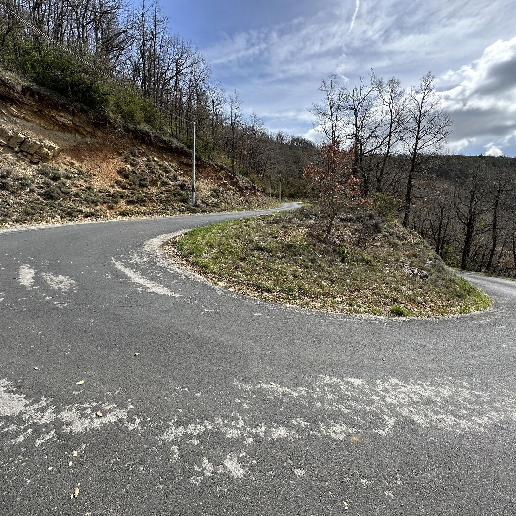
After Lauras, the D23 gradually gains height. Then, in the third bend, the view opens up to the Combalou which emerges, like a limestone tooth placed above the meadows of the causse. Massive, cut, almost sculptural, it dominates Roquefort-sur-Soulzon and marks the entrance to its mineral universe.
2
0

Nice unusual bridge, which resembles a railway bridge although I don't see any sign of trains nearby...
0
0
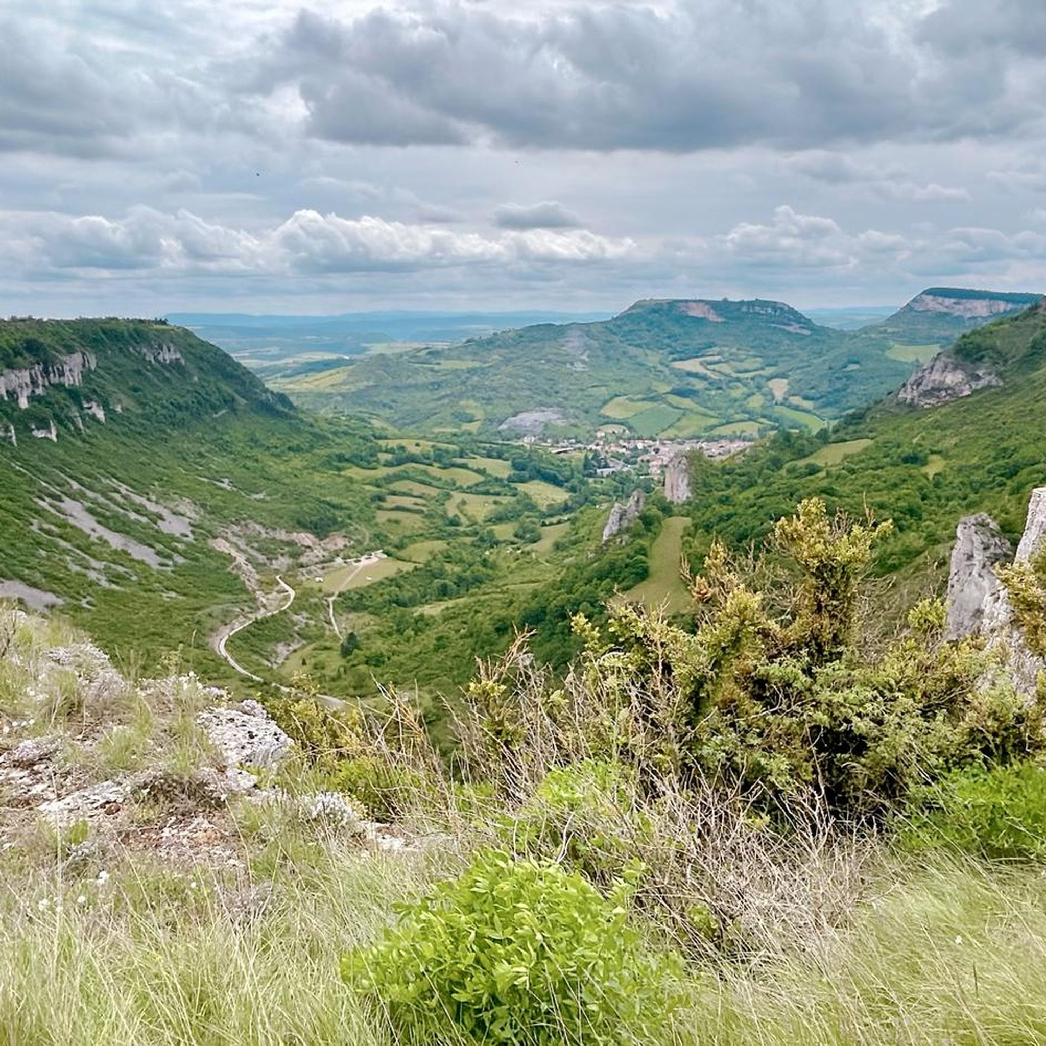
After the descent from the causse, this turn offers one of the most beautiful rewards of the route: a breathtaking view of Saint-Eulalie-de-Cernon. The Templar village is revealed nestled in the valley. An almost mandatory photo stop before reaching the village.
2
0
Behind its perfectly preserved ramparts lies an astonishing Templar heritage. Founded in the 12th century, the commandery of Saint-Eulalie-de-Cernon was a strategic center of the Order of the Temple on the Larzac. A remarkably preserved village!
3
0
Frequently Asked Questions
What kind of terrain can I expect when road cycling around Roquefort-sur-Soulzon?
The region offers a diverse and dramatic landscape for road cyclists. You'll encounter limestone plateaus, deep valleys, towering cliffs, and red-soil hills. Routes often traverse arid plateaus, forested valleys, and lush green areas, providing varied elevations and panoramic views throughout your ride.
How many road cycling routes are available in the Roquefort-sur-Soulzon area?
There are over 115 road cycling routes around Roquefort-sur-Soulzon. These routes cater to various skill levels, from moderate rides to challenging sporting endeavors, ensuring options for different abilities.
Are there any easy road cycling routes suitable for beginners?
While many routes feature significant elevation changes, there are 5 easy road cycling routes available. These provide a gentler introduction to the region's beautiful landscapes.
What are some challenging road cycling routes for experienced riders?
For experienced riders seeking a challenge, there are 61 difficult routes. One such demanding option is the Sainte-Eulalie-de-Cernon – Lac de Bouloc loop from Tournemire - Roquefort, which covers over 120 km with more than 2000 meters of elevation gain.
What natural features or landmarks can I see along the road cycling routes?
The routes often pass through the stunning Grands Causses Regional Natural Park, offering views of dramatic limestone cliffs like the Combalou rock. You might also encounter unique geological formations such as the natural caves (fleurines) that are integral to Roquefort cheese production. Notable highlights include the Cliffs of the Cirque du Boundoulaou and the Cirque de Tournemire.
Are there any scenic viewpoints or attractions near the cycling routes?
Yes, the region is rich in scenic spots. You can find breathtaking views from places like Le Combalou. Additionally, the Cascade des Raspes du Tarn offers a beautiful natural attraction. For cultural exploration, the famous Roquefort cheese caves are a unique experience intertwined with the region's geology.
What is the best time of year for road cycling in Roquefort-sur-Soulzon?
The region's climate makes it suitable for cycling for much of the year. Spring and autumn generally offer pleasant temperatures and beautiful scenery. Summer can be warm, but the varied terrain provides opportunities for rides in different microclimates. Always check local weather conditions before heading out.
Are there circular road cycling routes available?
Yes, many of the road cycling routes in the area are designed as loops, allowing you to start and finish in the same location. An example is the Roquefort-sur-Soulzon – La Bastide Pradines loop from Massergues, a moderate 49.6 km path.
What do other cyclists say about road cycling in Roquefort-sur-Soulzon?
The road cycling routes in Roquefort-sur-Soulzon are highly rated by the komoot community, with an average score of 4.6 stars from over 30 reviews. Cyclists often praise the stunning panoramic views, the diverse terrain, and the well-maintained roads that wind through picturesque villages.
Is there parking available for cyclists in Roquefort-sur-Soulzon?
Yes, you can typically find parking in and around Roquefort-sur-Soulzon and the surrounding villages, which serve as common starting points for many routes. Specific parking availability may vary by location, so it's advisable to check local information for your chosen starting point.
Are there any routes that pass by interesting historical or cultural sites?
Many routes wind through picturesque villages, offering glimpses into the authentic character of the Roquefort region. You might pass by sites like the Saint-Affrique Church and Bridge over the Sorgues. The region's history is also deeply tied to its geology, with the famous Roquefort cheese caves offering a unique cultural experience.
What other outdoor activities can be combined with a road cycling trip to Roquefort-sur-Soulzon?
Beyond cycling, the region offers a wealth of outdoor activities. You can explore well-marked hiking trails, enjoy water activities like canoeing or kayaking in the nearby Tarn Gorges, or try climbing and via ferrata on the local cliffs. The area is also known for its unique natural caves and cultural experiences related to Roquefort cheese.
Most popular routes around Roquefort-Sur-Soulzon
Most popular attractions around Roquefort-Sur-Soulzon

Get inspired with the komoot mobile app


Explore more
Browse the best Road cycling routes in other regions.
