Top 9 Mountain Passes around Gigors-Et-Lozeron
Best mountain passes around Gigors-Et-Lozeron are located in the Drôme department of France, offering a selection of elevated areas. The region is appealing for outdoor activities such as hiking and cycling due to its scenic routes. Local passes provide rewarding views and opportunities to explore the natural landscape. These routes offer a blend of physical challenge and natural beauty.
Best mountain passes around Gigors-Et-Lozeron
- The most popular mountain pass is Jérôme Cavalli Pass, 842 m, a mountain pass that…
Last updated: May 13, 2026
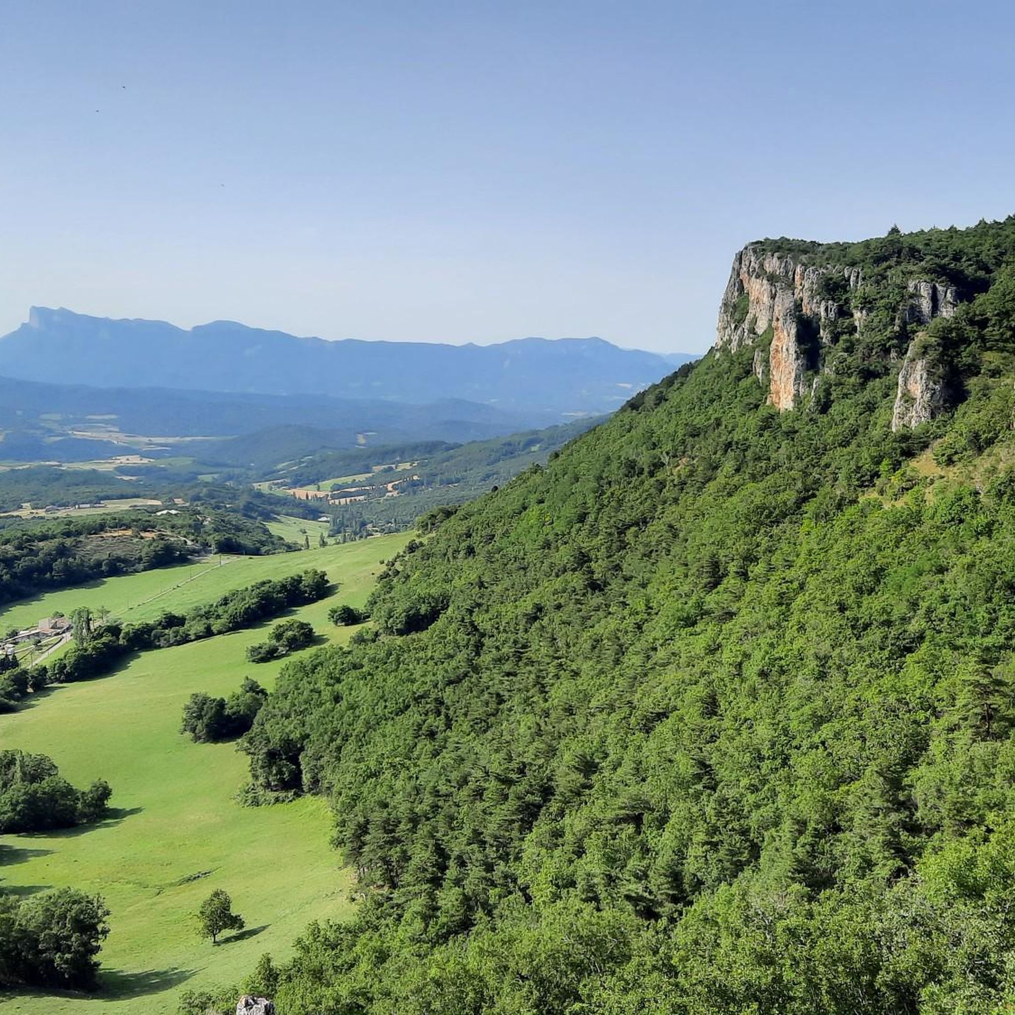
Jérôme Cavalli Pass, 842 m
Highlight • Mountain Pass
A nice warm-up before the future steeper passes!
Translated by Google •
Tip by

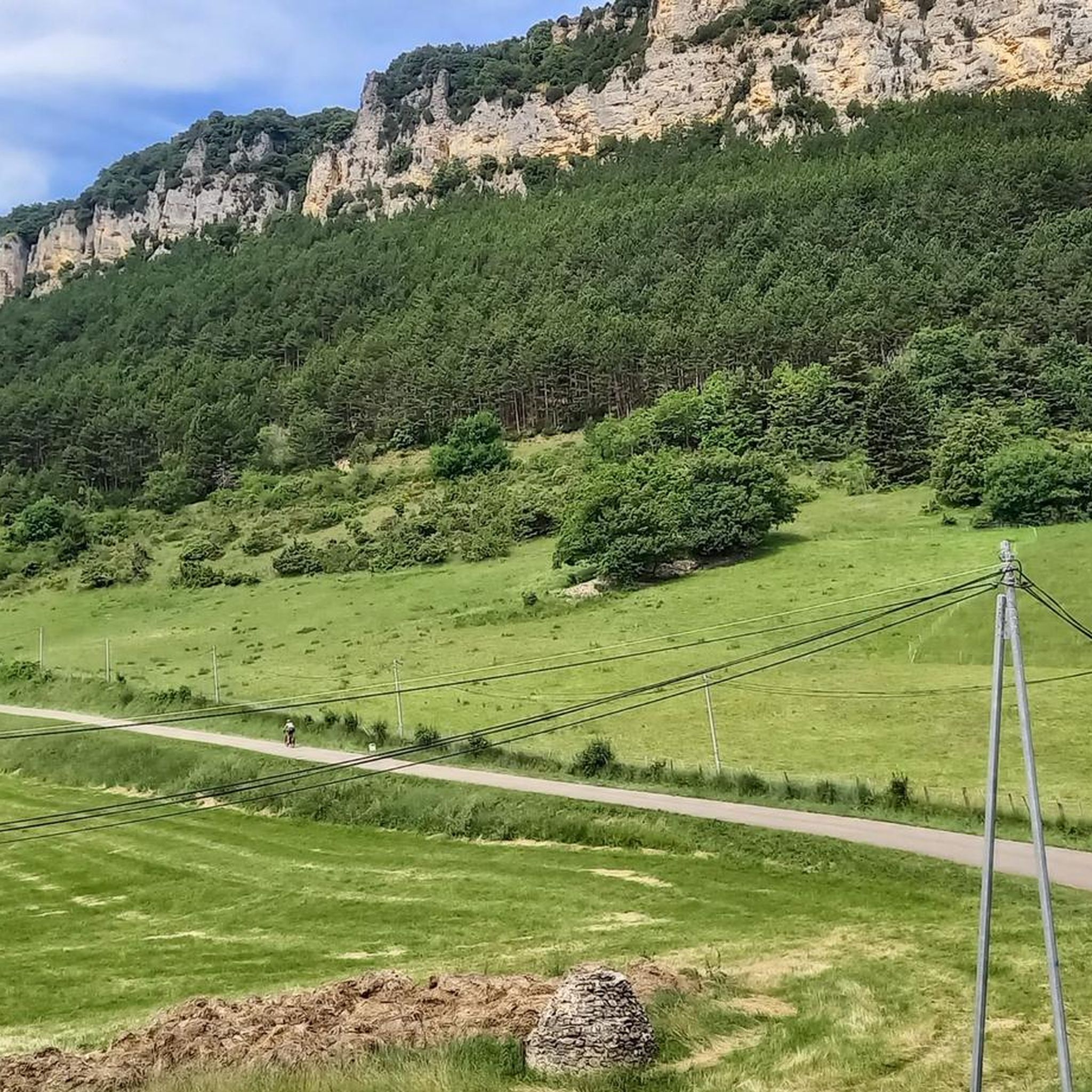
Col de la Croix (746 m)
Highlight • Mountain Pass
Translated by Google •
Tip by

Sign up now to discover places like this
Get recommendations on the best single tracks, peaks, & plenty of other exciting outdoor places.
Sign up for free
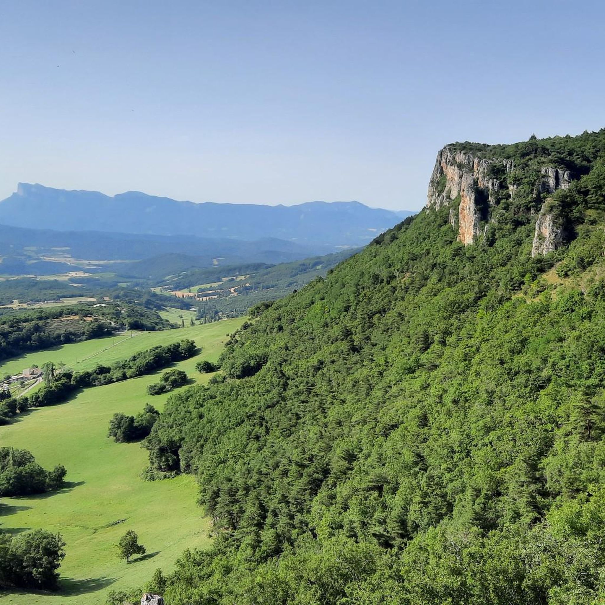
Col de Bacchus
Highlight • Mountain Pass
Translated by Google •
Tip by

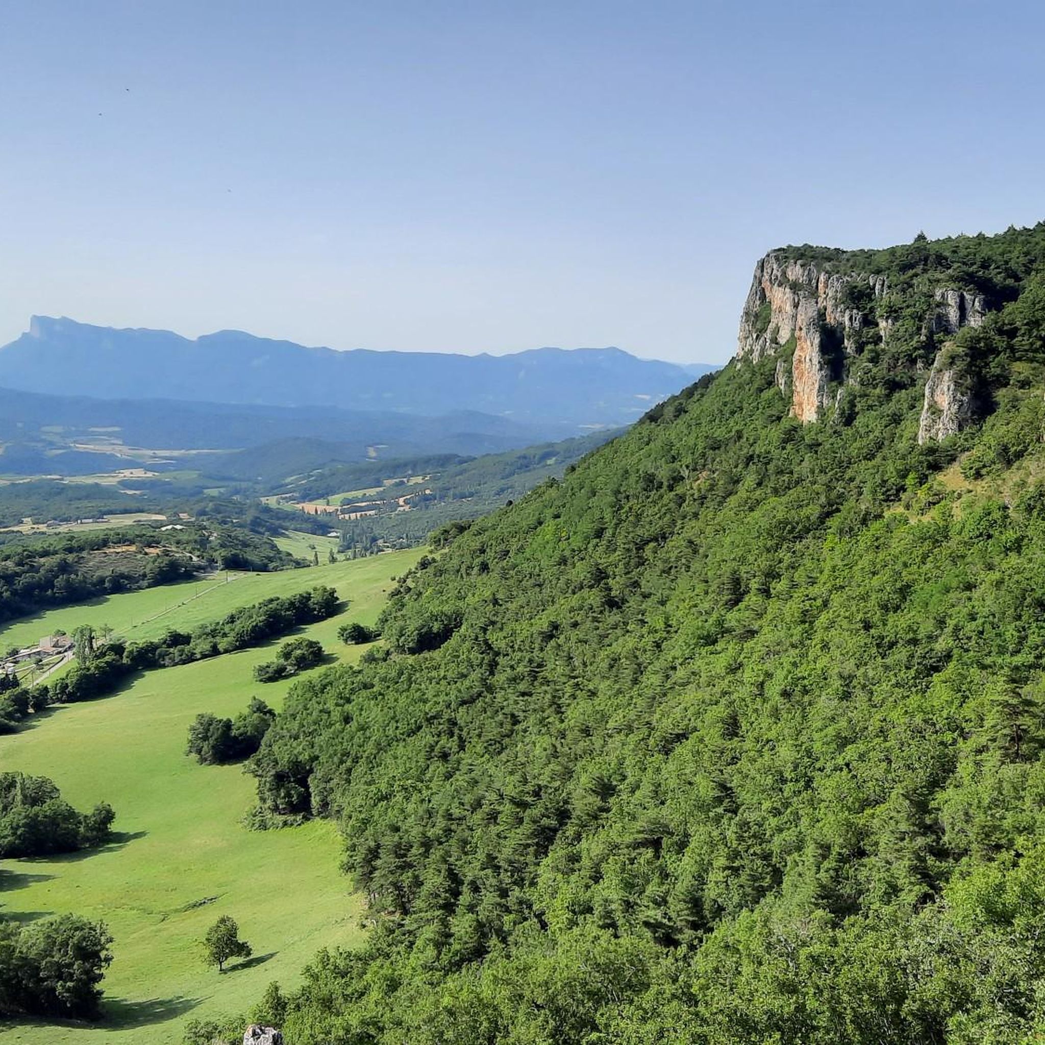
Col de la Bataille
Highlight • Mountain Pass
Translated by Google •
Tip by

Boîte Pass
Highlight • Viewpoint
Translated by Google •
Tip by

Sign up for free to discover even more mountain passes around Gigors-Et-Lozeron.
Sign up for free
Already have an account?
Start today with a free account
Your next adventure awaits.
Login or Signup

Tips from the Community

Gentle climb. Wine in the bottle for the Bacchus Pass!
0
0

This mountain pass is named after one of the great aviation pioneers of France. There are several ways to reach this pass, but whichever you choose, you will always have a beautiful view from this place.
0
0

Hello friends and congratulations to you
0
0

The climb on the other side is no less strenuous, but it's nice to have made it.
0
0
After a climb of 4.5 km, after crossing the Gervanne river, you will reach the pass called Col de la Boite. The climb has an average gradient of 4.5% and the steepest 100 meters have an gradient of 9.2%. From the pass you have a beautiful view of the surroundings and a beautiful descent through the Charsac valley awaits you.
0
0

Cafe / Resto at the bottom. Nothing at the top. The road has just been resurfaced so the descent is great. Be careful though, especially in the wet as water drains across the surface in places, typically on or just before the corners. Plenty of coffee and cake in Chabeuil. If you wanted to add a bit more you could descend to Beaufort-sur-Gervanne, which is a good option if the boulangerie is open, or loop across the top from Cavalli to Col des Limouches. It's over 1000 meters altitude and the descent is more technical. Some shaded picnic tables too.
0
1

Nice little pass essentially allowing you to avoid the main road from the Crest valley to Die. This road is very little used and the pass, starting from Die, is divided into two small climbs: Col de Marignac then La Croix
1
0

Col de la Bataille is a climb in the Drôme region. It has a length of 12.8 kilometers and a climb of 381 vertical meters with a slope of 3% on average, which implies a difficulty level of 253. The top of the climb is located at 1,302 meters above sea level.
1
0
Frequently Asked Questions
What kind of mountain passes can I expect around Gigors-Et-Lozeron?
The mountain passes around Gigors-Et-Lozeron offer charming routes and rewarding views, appealing to both hikers and cyclists. While not featuring the high-altitude challenges of the greater French Alps, they provide a blend of physical challenge and natural beauty, suitable for various levels of outdoor enthusiasts.
Are there mountain passes suitable for cycling in the area?
Yes, several passes are well-suited for cycling. For instance, the Jérôme Cavalli Pass is described as a good 'warm-up' for more challenging routes, spanning over 9 kilometers with slopes up to 6%. Col de Bacchus also features a gradual climb from the Isère valley, offering a scenic green descent towards Plan de Baix, making it ideal for cycling. You can find more cycling routes in the area by visiting the Cycling around Gigors-Et-Lozeron guide.
Where can I find panoramic views of the region?
For exceptional panoramic views, consider visiting Montagne de Lozeron. From the 'Plateau des Chaux,' you can enjoy a 260° vista. Another remarkable spot is Col de la Croix (746 m), which offers superb views of the Vercors. Additionally, Croix du Vellan provides a unique view over the Gervanne Valley and the Massif des Trois Becs from a rocky promontory at 1000 meters altitude.
What are some notable natural features or botanical diversity in the mountain areas?
Montagne de Lozeron is particularly notable for its rich botanical diversity, including rare orchid species like the Drôme ophrys and the tridentate orchis, both nationally protected. The area around Croix du Vellan also features a picturesque passage between rock and cliffs, offering stunning natural scenery.
Are there hiking trails near these mountain passes?
Absolutely. The region is very popular for hiking. Montagne de Lozeron, for example, has various hiking trails, such as those starting from Jozonières, which lead through preserved agricultural plains. You can explore a variety of hiking routes by checking the Hiking around Gigors-Et-Lozeron guide.
What do visitors enjoy most about the mountain passes in Gigors-Et-Lozeron?
Visitors frequently praise the scenic beauty and the quiet, less-trafficked roads. For instance, the Col de la Croix (746 m) is appreciated for its superb views of the Vercors and being a pleasant alternative to main roads. The Col de Bacchus is enjoyed for its gradual climb and spectacular descent views.
Is there an intermediate mountain pass that is relatively easy to experience?
Yes, Col de la Bataille is considered an intermediate pass that is comparatively easy to experience from Léoncel. It offers worthwhile views towards Gorge d'Omblèze and the Tête de la dame, with an average slope of 3% over 12.8 kilometers.
Can I find a mountain pass with a good view after a moderate climb?
The Boîte Pass is an excellent choice. After a 4.5 km climb with an average gradient of 4.5%, you'll reach the pass which offers beautiful views of the surroundings and a scenic descent through the Charsac valley.
What is the best time to visit the mountain passes around Gigors-Et-Lozeron?
The region is generally appealing for outdoor activities like hiking and cycling. Spring and autumn typically offer pleasant temperatures for exploring. While specific seasonal details for all passes are not provided, these periods usually avoid the peak heat of summer and potential winter conditions at higher elevations, making them ideal for enjoying the natural beauty and physical challenges.
Are there any running trails near the mountain passes?
Yes, the area around Gigors-Et-Lozeron also offers various running trails. You can find several challenging running loops, for example, starting from Gigors-et-Lozeron, Boussière, Mourrat, or Beaufort-sur-Gervanne. For detailed routes, refer to the Running Trails around Gigors-Et-Lozeron guide.
Are there any passes that serve as a good 'warm-up' for more challenging routes?
The Jérôme Cavalli Pass is specifically highlighted as a good 'warm-up' for more challenging passes. It covers over 9 kilometers with a positive elevation of 486 meters and slopes up to 6%, providing a solid start for cyclists and hikers.
Most popular routes around Gigors-Et-Lozeron
Most popular attractions around Gigors-Et-Lozeron

Get inspired with the komoot mobile app


Explore more
See even more epic mountain passes by checking out these guides around Gigors-Et-Lozeron:
