The best walks and hikes around Saint-Maurice-De-Rotherens
4.5
(836)
4,818
hikers
153
hikes
Hiking around Saint-Maurice-De-Rotherens offers diverse landscapes across a forested and agricultural plateau, situated on the southern slopes of Mont Tournier. The region features varied terrain, including hills, woodlands, and open fields, providing panoramic views of the Rhône River, the Jura mountains, and the Chartreuse Massif. Notable natural features include the Belvédère des Fils viewpoint and the confluence of the Rhône and Guiers rivers.
Best hiking trails around Saint-Maurice-De-Rotherens
- The most popular hiking route is Sons' Lookout – Mount Tournier loop…
Last updated: June 25, 2026
4.6
(12)
70
hikers
11.4km
03:21
330m
320m
Moderate hike. Good fitness required. Easily-accessible paths. Suitable for all skill levels.
4.8
(10)
19
hikers
8.10km
02:32
300m
300m
Moderate hike. Good fitness required. Easily-accessible paths. Suitable for all skill levels.

Sign up for free
5.0
(3)
16
hikers
6.79km
01:57
170m
160m
Easy hike. Great for any fitness level. Easily-accessible paths. Suitable for all skill levels.
4.0
(1)
8
hikers
Moderate hike. Good fitness required. Easily-accessible paths. Suitable for all skill levels.
7
hikers
5.70km
01:40
160m
160m
Easy hike. Great for any fitness level. Easily-accessible paths. Suitable for all skill levels.
Get access to more routes and recommendations from other explorers.
Sign up for free
Already have an account?
Our route recommendations are based on thousands of hikes, rides, and runs completed by other people on komoot.
Start today with a free account
Your next adventure awaits.
Login or Signup

Tips from the Community

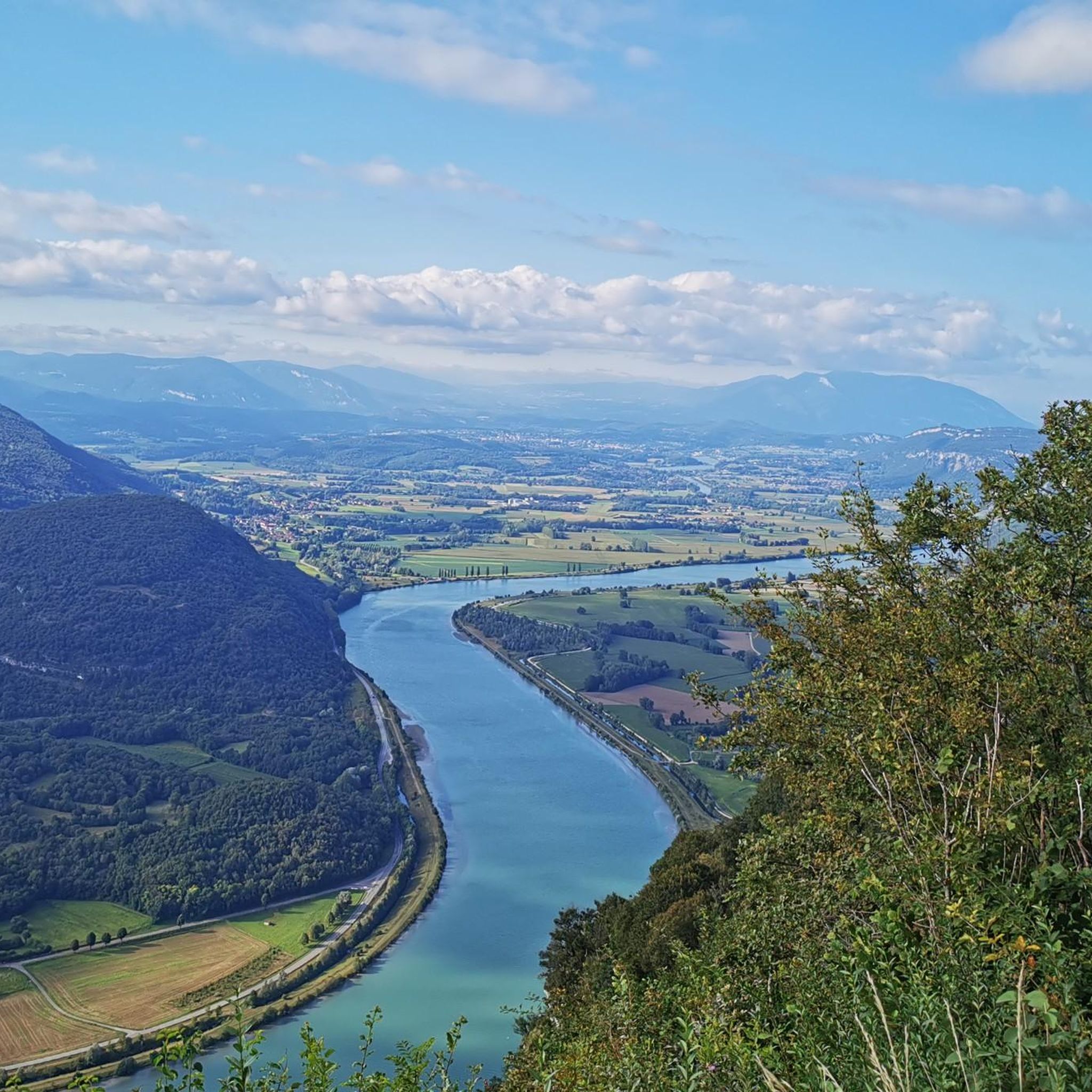
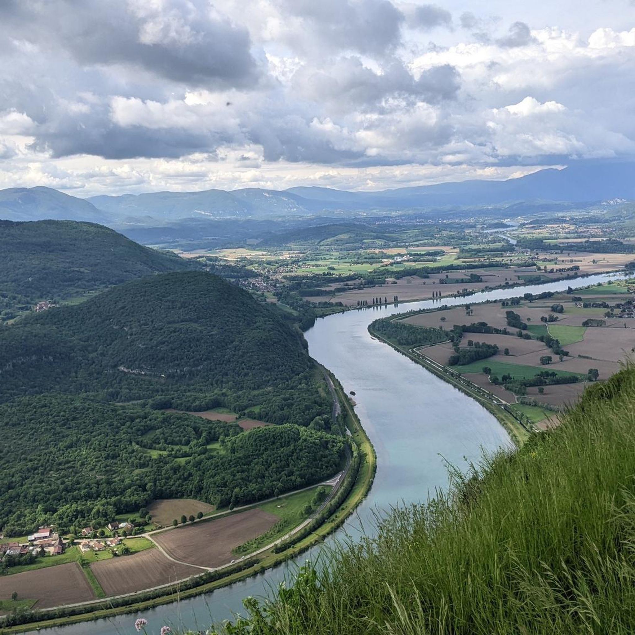
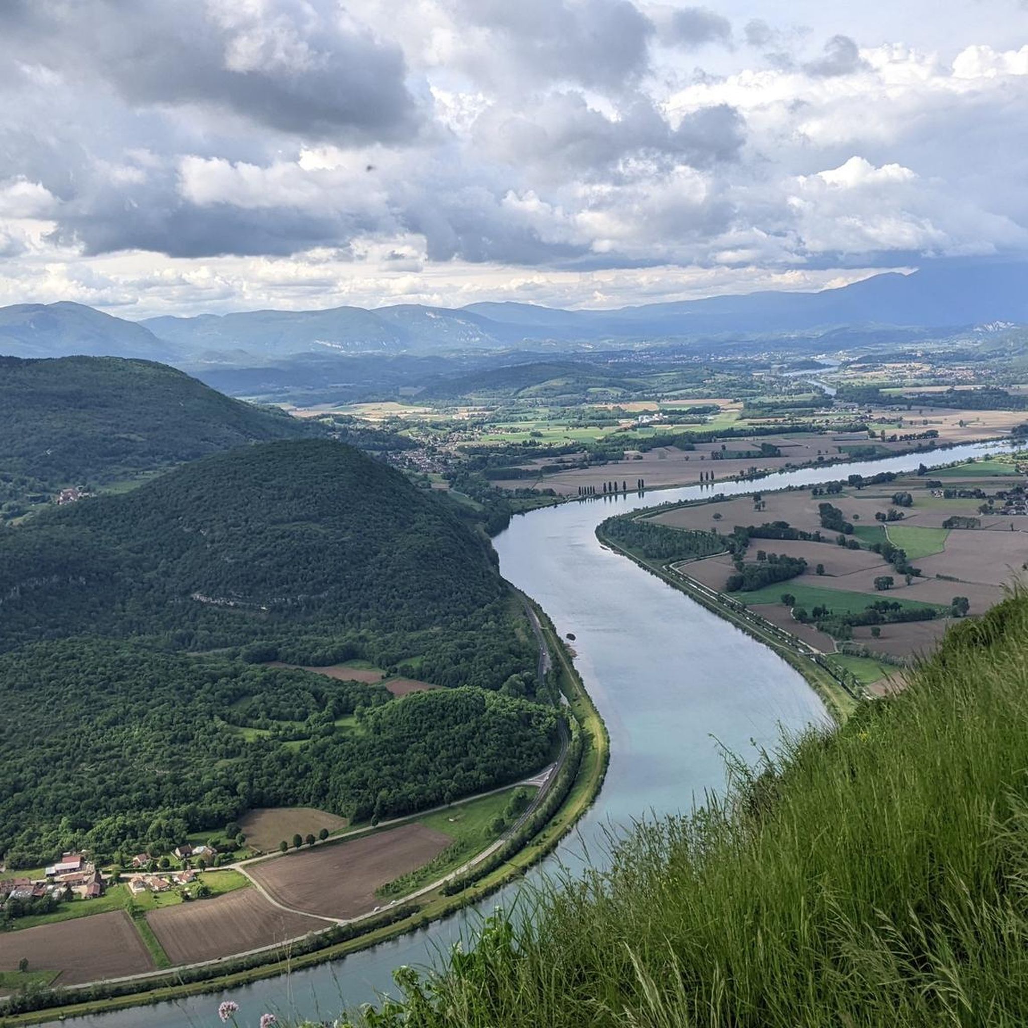
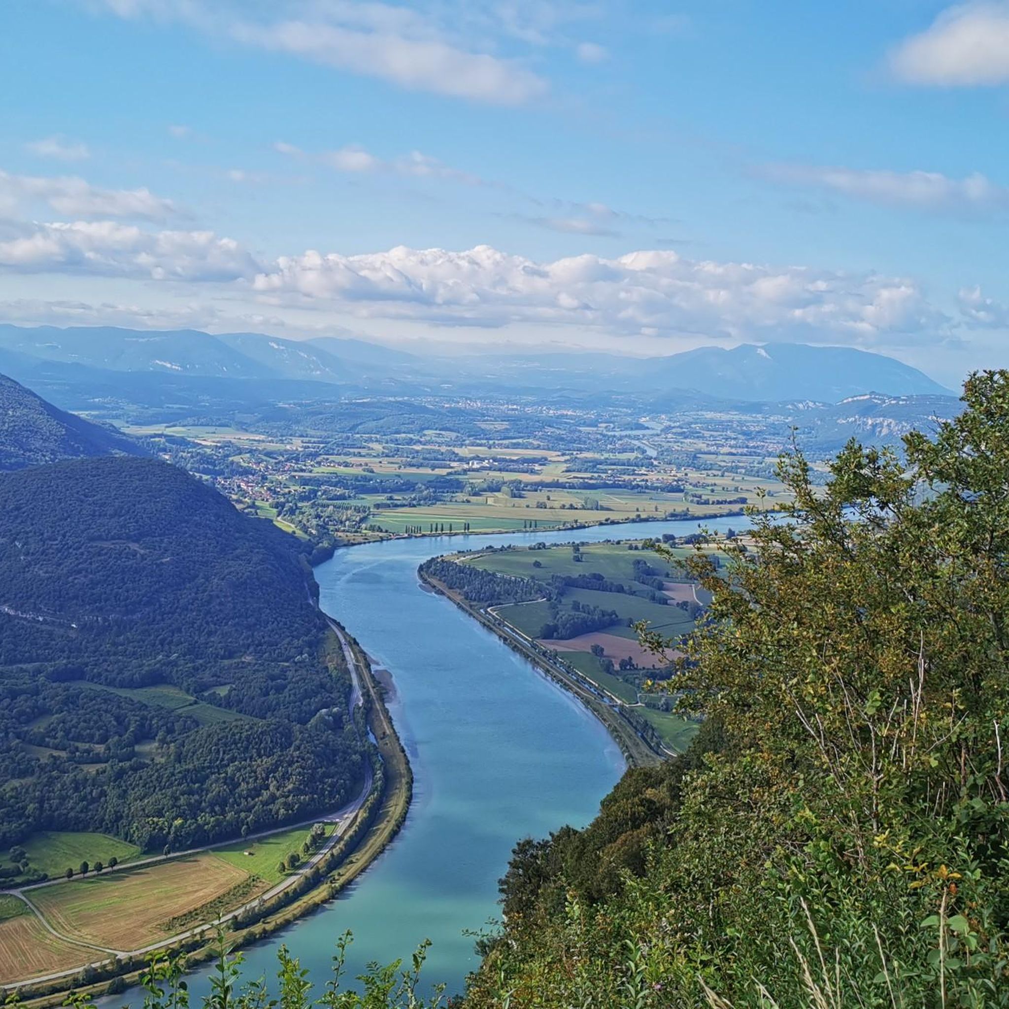
Dizzying belvedere from the top of Mont Tournier, view of the Grand Thur, the Grand Colombier and of course the Rhône.
1
0


Very nice rest area with a magnificent view over the Rohne valley.
4
0

Wonderful viewpoint high above the Rhone
2
0
The Col du Mont Tournier – 851 m – is located in the Savoyard Avant-Pays but belongs, from a geological point of view, to the Jura Massif.
2
0

The Col de la Lattaz offers beautiful views. Located at an altitude of 754 meters, the climb from the Mont Tournier pass is rather gradual. The road continues around the summit of Mount Chaffaron.
1
0

Great view of the Rhone and the valley. Perfect for a little break.
3
0
Frequently Asked Questions
How many hiking trails are available around Saint-Maurice-De-Rotherens?
There are over 150 hiking trails around Saint-Maurice-De-Rotherens, offering a wide range of options for all skill levels. This includes more than 50 easy routes, over 80 moderate trails, and a selection of challenging hikes for experienced trekkers.
Are there any easy hiking trails suitable for beginners or families?
Yes, Saint-Maurice-De-Rotherens offers numerous easy trails perfect for beginners or families. One popular option is the Sons' Lookout loop from Saint-Maurice-de-Rotherens, an easy 6.9 km trail that can be completed in under 2 hours, leading through varied terrain.
What kind of terrain can I expect on the hiking trails?
The hiking trails around Saint-Maurice-De-Rotherens traverse a diverse landscape. You can expect a mix of forested areas, open agricultural plateaus, and hills, particularly on the southern slopes of Mont Tournier. The varied terrain provides both shaded woodland paths and open sections with panoramic views.
Are there any circular hiking routes in the area?
Yes, many of the trails around Saint-Maurice-De-Rotherens are circular, allowing you to start and end at the same point. Examples include the moderate Sons' Lookout – Mount Tournier loop from Saint-Maurice-de-Rotherens, which combines a prominent viewpoint with an ascent of Mont Tournier, or the Mount Tournier – Pierre Vire loop from Saint-Maurice-de-Rotherens, which takes you past the intriguing natural rock formation.
What are the best viewpoints or scenic spots along the trails?
The region is renowned for its stunning viewpoints. The Belvédère des Fils offers a spectacular 180-degree panorama over the winding Rhône River, with views extending to the Jura mountains and parts of the Savoie and Ain departments. Mont Tournier itself provides breathtaking views of the Grand Thur, the Grand Colombier, and the Rhône River. You can experience these views on routes like the Sons' Lookout – Mount Tournier loop from Saint-Maurice-de-Rotherens.
Are there any historical sites or landmarks to see while hiking?
Absolutely. The area combines natural beauty with rich history. The popular "Les balcons de Saint-Maurice-de-Rotherens" circuit passes by historical vestiges such as the ruins of Mauchamp Castle, the Old Presbytery (Vieille Cure), and the medieval Tower of Conspectus (11th century). The Belvédère des Fils also has historical significance as a Celtic alert fire location and a site for early telegraphy.
What do other hikers say about the trails in Saint-Maurice-De-Rotherens?
The hiking routes in Saint-Maurice-De-Rotherens are highly rated by the komoot community, with an average score of 4.4 stars from over 800 reviews. Hikers often praise the varied terrain, the stunning panoramic views, and the well-marked paths that cater to different ability levels. Over 4,000 hikers have used komoot to explore this region.
Are there any lakes or water features near the hiking trails?
While the trails themselves focus on the plateau and river views, there are beautiful lakes nearby. You can find highlights such as Lac d'Aiguebelette and Lac de Barterand, which are popular spots for relaxation and water activities, often offering scenic viewpoints like the View of Lac d'Aiguebelette from Saint-Alban-de-Montbel Church.
Can I find mountain passes or higher elevations for more challenging hikes?
Yes, the region offers access to several mountain passes and higher elevations. While Mont Tournier itself rises to 877 meters, you can also explore nearby passes like Épine Pass, Col du Banchet, and the Col du Mont Tournier (851 m), which provide opportunities for more challenging ascents and expansive views.
Is Saint-Maurice-De-Rotherens a good destination for long-distance hiking?
Saint-Maurice-De-Rotherens serves as a significant junction for two major long-distance hiking routes, the GR9 and the GR65. This makes it an excellent base for those looking to embark on longer treks or explore sections of these renowned trails, offering extensive networks beyond the local loops.
Are there any specific natural rock formations to look out for?
Yes, one notable natural feature is the Pierre qui Vire, an intriguing rock formation steeped in local legend. You can incorporate this into your hike by following routes such as the Mount Tournier – Pierre Vire loop from Saint-Maurice-de-Rotherens.
What are the views like towards the Chartreuse Massif?
To the south of Saint-Maurice-De-Rotherens, the landscape opens up to offer beautiful and clear views of the majestic Chartreuse Massif. These vistas add another dimension to the already diverse scenery you'll encounter on the trails.
Most popular routes around Saint-Maurice-De-Rotherens
Most popular attractions around Saint-Maurice-De-Rotherens

Get inspired with the komoot mobile app


Explore more
Browse the best Hikes in other regions.
