The best walks and hikes around Brett
4.4
(185)
1,026
hikers
105
hikes
Hiking around Brett offers diverse terrain characterized by a southwest to northeast-oriented ridge and valley system, shaped by glacial activity. The area features two significant ridges, the East Ridge and West Ridge, with moderate side slopes and numerous rock outcrops. Extensive wetlands have developed in the long, narrow valleys, and the region is predominantly forested with upland deciduous vegetation.
Best hiking trails around Brett
- The most popular hiking route is Cows in the Countryside – Other oak loop from Autrechêne…
Last updated: May 24, 2026
3.7
(3)
15
hikers
9.05km
02:20
50m
50m
Moderate hike. Good fitness required. Easily-accessible paths. Suitable for all skill levels.
3.7
(3)
15
hikers
9.15km
02:22
50m
50m
Moderate hike. Good fitness required. Easily-accessible paths. Suitable for all skill levels.

Sign up for free
4.0
(2)
13
hikers
10.4km
02:41
50m
50m
Moderate hike. Good fitness required. Easily-accessible paths. Suitable for all skill levels.
5.0
(1)
11
hikers
8.23km
02:07
40m
40m
Moderate hike. Good fitness required. Easily-accessible paths. Suitable for all skill levels.
4.0
(3)
6
hikers
11.6km
03:03
90m
90m
Moderate hike. Good fitness required. Easily-accessible paths. Suitable for all skill levels.
Get access to more routes and recommendations from other explorers.
Sign up for free
Already have an account?
Our route recommendations are based on thousands of hikes, rides, and runs completed by other people on komoot.
Start today with a free account
Your next adventure awaits.
Login or Signup



Tips from the Community

Iconic oak tree, creatively decorated like a hobbit treehouse with painted wooden boards. The rest area has picnic tables and sunny and shady spots.
2
0

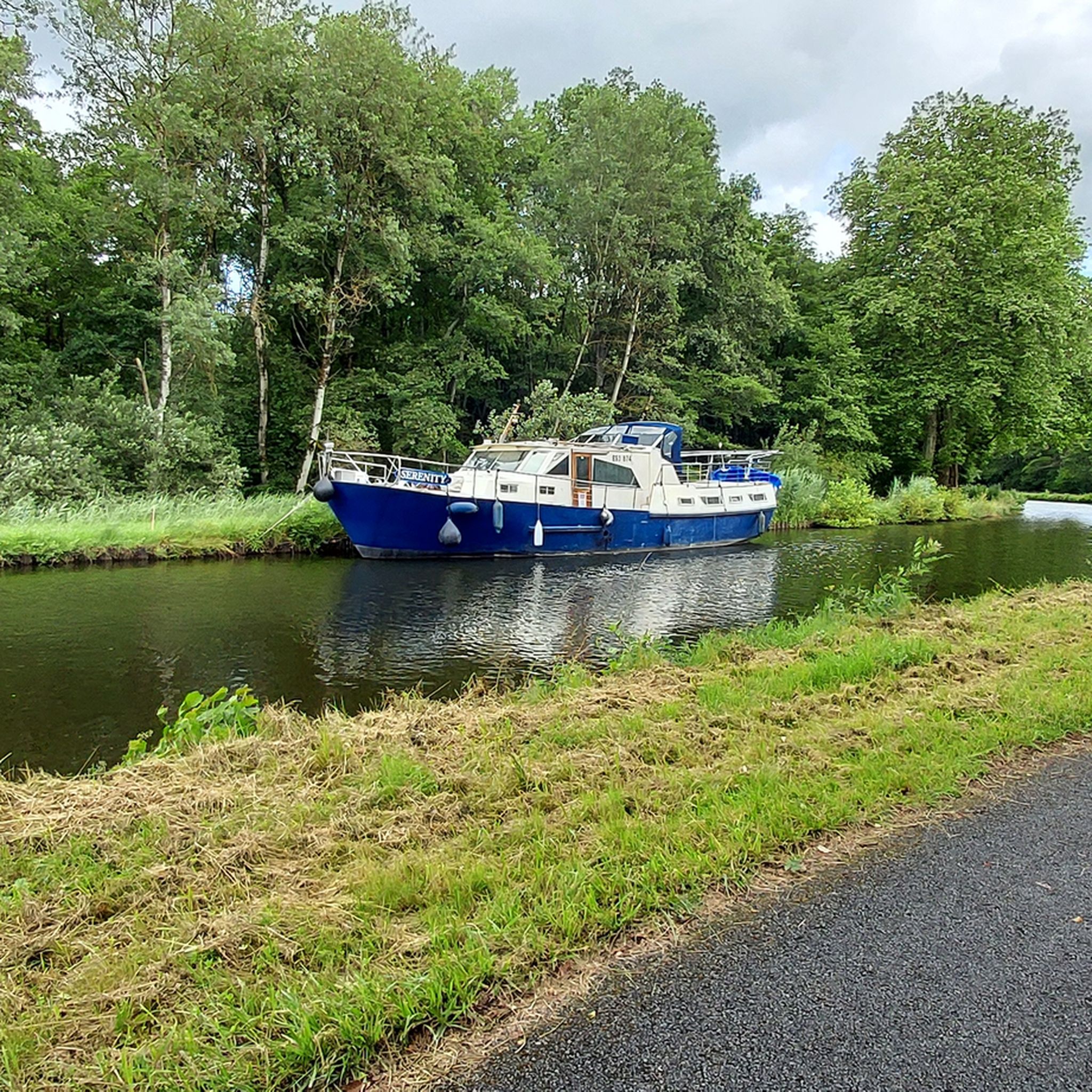
Beautiful and large pond. Many footbridges are installed. No doubt for fishermen. But bring a pair of binoculars, there are many waterbirds.
0
0

The pond found here is a great place to take a break and appreciate the flora and fauna found on the banks of the water. The trees along the banks tower over the water, creating interesting places to stop and enjoy the lake.
2
0

History: The history of Novillard begins before 1251 but it is only on this date that we find the name of the village mentioned in an act concerning the priory of Froidefontaine in the form of Nueviller. The stronghold was part of the seigniory of Rougemont-le-Château in 1125, when Frederick I of Ferrette endowed the monastery of Valdieu, currently in the department of Haut-Rhin. A church then existed in Novillard, whose parish also included Eschêne, Autrage and Rechotte, all three currently grouped together in the commune of Autrechêne. Novillard was also the chief town of a town hall depending on the seigniory of Rougemont (of which it marked the southern limit) then the provostship of Angeot, seigniory of Belfort. The fate of the village generally follows that of the surrounding villages: attachment to the domains of the House of Austria from 1350 to 1648. The Saint-Julien church was built in the 1770s. In 1803 the population was 171 inhabitants, and 210 in the 1999 census. The activity of the commune is essentially agricultural.
0
0
The village is located southeast of Belfort, 11km from the latter. Its territory, which covers 116 hectares, is bordered to the north by the Belfort-Mulhouse railway line. It is crossed by the small river La Madeleine which has its source in the Vosges massif, in the village of La Madeleine precisely. The average altitude is 350m. History: The history of Novillard begins before 1251 but it is only on this date that we find the name of the village mentioned in an act concerning the priory of Froidefontaine in the form of Nueviller. The stronghold was part of the seigniory of Rougemont-le-Château in 1125, when Frederick I of Ferrette endowed the monastery of Valdieu, currently in the department of Haut-Rhin. A church then existed in Novillard, whose parish also included Eschêne, Autrage and Rechotte, all three currently grouped together in the commune of Autrechêne. Novillard was also the chief town of a town hall depending on the seigniory of Rougemont (of which it marked the southern limit) then the provostship of Angeot, seigniory of Belfort. The fate of the village generally follows that of the surrounding villages: attachment to the domains of the House of Austria from 1350 to 1648. The Saint-Julien church was built in the 1770s. In 1803 the population was 171 inhabitants, and 210 in the 1999 census. The activity of the commune is essentially agricultural.
1
0
the first stone was laid in 1748 and the building was inaugurated in 1769. This church is original because it belongs to the two communes of Novilkard and Autrechene.
0
0

Frequently Asked Questions
What kind of terrain can I expect when hiking around Brett?
The terrain around Brett is quite diverse, characterized by a southwest to northeast-oriented ridge and valley system, shaped by glacial activity. You'll encounter two significant ridges, the East Ridge and West Ridge, with moderate side slopes, numerous ledge outcrops, and rock faces. The trail surfaces vary, including packed earth, wet soil, loose gravel, rock, boardwalks, and grassy areas.
Are there hiking trails suitable for all skill levels in Brett?
Yes, Brett offers an extensive trail network catering to various skill levels. Out of over 100 routes, you'll find approximately 51 easy trails, 47 moderate trails, and a few more challenging options, ensuring there's something for everyone from casual walkers to experienced hikers.
Are dogs allowed on the hiking trails in Brett?
Brett Woods Open Space Area is generally welcoming to dogs. As a conservation area, it's a great place to bring your canine companion, though it's always recommended to keep them on a leash to protect wildlife and ensure a pleasant experience for all visitors.
Are there any family-friendly hiking options in Brett?
Many of the trails in Brett are suitable for families, especially the easier routes. The diverse environment, including forests and wetlands, offers an engaging outdoor classroom for children. Consider exploring some of the 51 easy trails available for a pleasant family outing.
What natural features or water bodies can I see along the trails?
You'll find significant drainage corridors and extensive wetlands in the valleys between the ridges. A prominent feature is the Brett Woods Pond, located north of a power line right-of-way, which flows northward into the Aspetuck River. Further south, the large wooded wetland known as Catamount Swamp also adds to the area's natural beauty.
Are there any circular hiking routes available in Brett?
Yes, many of the trails in Brett are designed as loops, offering convenient circular routes. For example, you could try the Saint-Julien Church loop from Petit-Croix, which is a moderate 7.2-mile hike, or the Pont Arromanches – Cratsch Pond loop from Petit-Croix, a moderate 6.5-mile route.
What are some nearby attractions or points of interest to explore after a hike?
Beyond the trails, you can explore several interesting spots. Consider visiting the Port of Dannemarie or the Valdieu-Lutran lock scale. The Canal du Rhône au Rhin also offers scenic views, and the Saint Christopher Cathedral is a notable landmark.
What do other hikers enjoy most about the trails in Brett?
The trails in Brett are highly rated by the komoot community, with an average score of 4.2 stars from over 140 reviews. Hikers often praise the diverse terrain, the extensive network of trails, and the peaceful, undisturbed environment, which makes it an excellent spot for wildlife observation and enjoying nature.
Is Brett Woods Open Space suitable for winter hiking?
While primarily known for hiking in warmer months, Brett Woods Open Space is also used for cross-country skiing, suggesting that some trails may be suitable for winter hiking, depending on snow conditions. Always check local conditions and dress appropriately for cold weather.
Are there any educational opportunities within Brett Woods Open Space?
Yes, Brett Woods is considered an undisturbed environment that serves as an outdoor classroom. It's an excellent place for studying local vegetation, wildlife, and natural features, making it ideal for those interested in ecological observation.
What is the best time of year to hike in Brett?
The area is predominantly forested with upland deciduous vegetation, including oak and beech communities. This suggests that spring, with new growth, and autumn, with vibrant fall foliage, would be particularly scenic times to visit. Summer offers lush greenery, while winter provides a different, quieter experience for those prepared for colder conditions.
How many hiking routes are there in total around Brett?
There are over 100 hiking routes available around Brett, offering a wide variety of choices for explorers. These routes range in difficulty and length, ensuring options for every preference.
Most popular attractions around Brett

Get inspired with the komoot mobile app


Explore more
Browse the best Hikes in other regions.
