The best road cycling routes around Mittelbergheim
4.4
(391)
8,739
riders
224
rides
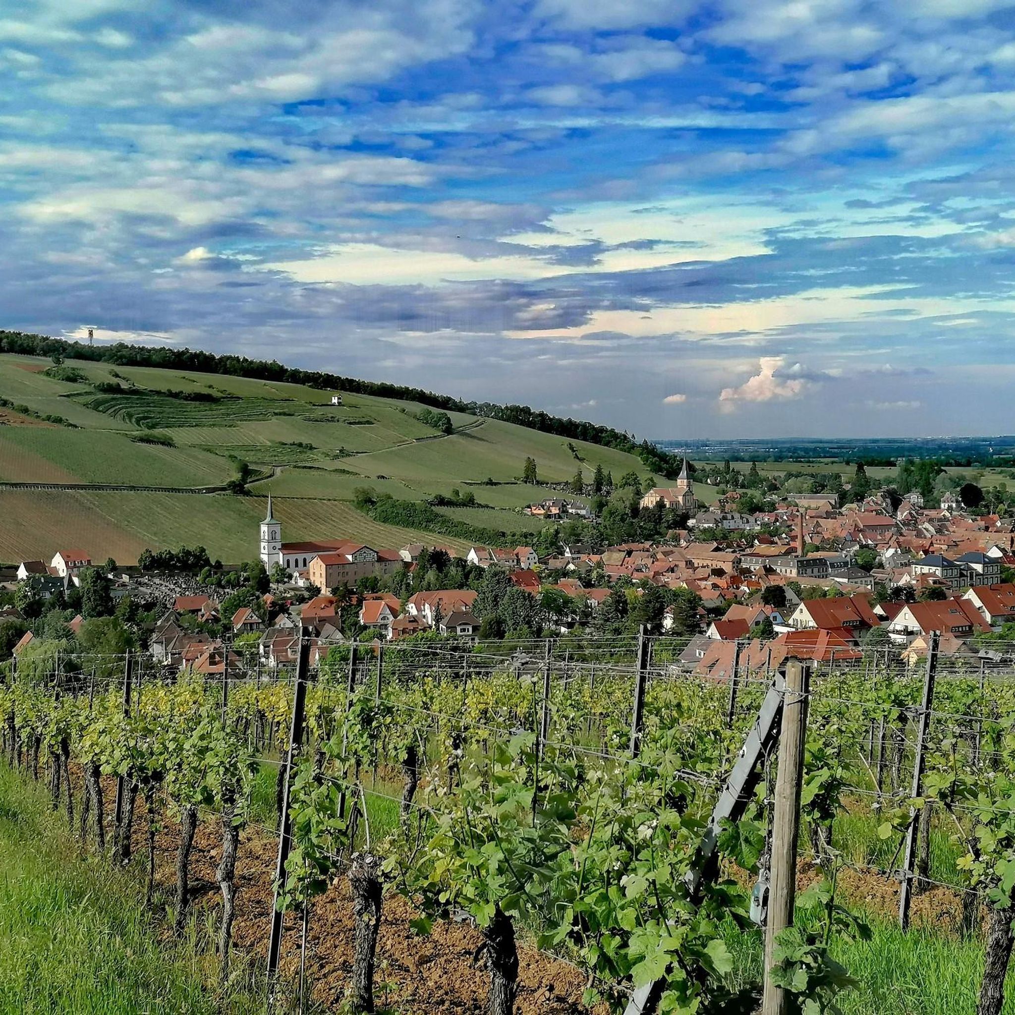
Road cycling around Mittelbergheim features routes through the scenic Alsace Wine Route vineyards and into the foothills of the Vosges mountains. The region is characterized by rolling hills, notable passes, and forested areas, offering varied terrain for road cyclists. Elevations range from gentle ascents through valleys to more challenging climbs up to mountain passes. This landscape provides diverse road cycling experiences, from leisurely vineyard loops to demanding mountain ascents.
Best road cycling routes around Mittelbergheim
- The most popular road cycling…
Last updated: August 13, 2026
4.4
(12)
283
riders
57.5km
02:57
800m
800m
Moderate road ride. Good fitness required. Some segments of this route may be unpaved and difficult to ride.
4.8
(5)
107
riders
77.5km
04:05
1,110m
1,110m
Hard road ride. Very good fitness required. Some segments of this route may be unpaved and difficult to ride.

Sign up for free
5.0
(6)
127
riders
Easy road ride. Great for any fitness level. Mostly well-paved surfaces and easy to ride.
4.9
(10)
116
riders
28.9km
01:43
640m
640m
Moderate road ride. Good fitness required. Some segments of this route may be unpaved and difficult to ride.
4.5
(2)
70
riders
24.2km
01:35
600m
600m
Moderate road ride. Good fitness required. Some segments of this route may be unpaved and difficult to ride.
Get access to more routes and recommendations from other explorers.
Sign up for free
Already have an account?
Our route recommendations are based on thousands of hikes, rides, and runs completed by other people on komoot.
Start today with a free account
Your next adventure awaits.
Login or Signup

Other adventures around Mittelbergheim

Tips from the Community

The Odilienberg (763 m) in Alsace is the most important spiritual center of the region. Founded around 690 by Saint Odilia, the monastery attracts hundreds of thousands of pilgrims annually. The centerpiece of the complex is the Basilica of the Assumption of Mary (1687–1692) with the burial chapel, where the relics of the patron saint rest in an 8th-century sandstone sarcophagus. Directly on the panoramic terrace are the Chapel of Tears and the Chapel of Angels (12th century), known for their luminous gold mosaics from 1935. Inside the basilica, there is also a fine wooden inlaid Way of the Cross by Charles Spindler. Below the monastery rocks runs a magnificent hiking trail. It leads past the monumental, colorful ceramic Way of the Cross (14 stations) and the Lourdes Grotto, both integrated directly into the red sandstone by Léon Elchinger in the 1930s. About a 15-minute walk further down, the Odilien spring emerges in the forest, its water traditionally sought for eye ailments. The entire mountain plateau is enclosed by the Heidenmauer, a mysterious, 11-kilometer-long prehistoric defensive wall. Following the hiking trails further south, you reach the Maennelstein (817 m), the highest point of the ridge, which offers a wide panoramic view over the Rhine plain to the Black Forest. The monastery grounds are open all year round and admission is free. Would you like to use this short text for a brochure or are you still looking for information on how to get there for your tour? AI answers may contain errors. For legal advice, you should consult an expert. More information
0
0
The monumental ceramic Way of the Cross on Mont Sainte-Odile (French: Chemin de Croix du Mont Sainte-Odile) was created between 1933 and 1935 by the renowned Alsatian artist and master ceramicist Léon Elchinger (1871–1942). From an art historical perspective, it is considered one of the most significant and ambitious masterpieces of sacred ceramic art in Alsace.
0
0
The Heidenmauer (French: Mur Païen) is a monumental, eleven-kilometer-long fortification from the early Middle Ages that encloses the high plateau of Mont Sainte-Odile in Alsace. For centuries, the imposing structure has fascinated archaeologists and visitors alike with its sheer dimension and construction method. Around 300,000 irregularly hewn sandstone blocks were stacked without mortar to form a dry-stone wall up to two meters wide. To give the huge blocks stability, the builders connected them with swallowtail-shaped wooden clamps made of oak. This extraordinary technique secured the structure against the shifting of stones on the steep forest terrain. For a long time, the facility was surrounded by great mystery. Due to the name Pope Leo IX gave the wall in the 11th century, its origin was suspected to be prehistoric, Celtic, or Roman times. Modern scientific investigations finally brought clarity: using dendrochronology (tree-ring analysis), the wooden connecting wedges could be precisely dated to the late 7th or early 8th century AD. The wall thus originated in the Merovingian era. To this day, research puzzles over the exact purpose of this gigantic facility. The most likely theory is that the wall served as a mighty refuge for the population in times of political unrest. At the same time, the monumental structure demonstrated the claim to power and prestige of the then Dukes of Alsace, to whose family Saint Odilia also belonged. Today, the Heidenmauer is a protected cultural monument and a popular destination for hikers. A well-signposted circular trail leads in the shade of the trees directly along the historical remains and connects the ruins with mystical places such as the Druid's Grotto and the monastery on the mountain summit.
0
0

This beautiful, idyllic spot in Blienschwiller (formerly Blienschweiler) is located in the town center on the Route des Vins or the Euro Vélo 5 or EV5, which runs here along the D35. According to the 2023 census, about 300 inhabitants live in Blienschwiller. The town is located at the eastern foot of the Northern Vosges in the Bas Rhin department in the arrondissement of Sélestat-Erstein. The main economic sector of the town is arable and wine farming.
1
0

There are freshly squeezed juices, cakes, coffee. Perfect for a short break.
0
0

A place with a very special atmosphere.
0
0

Very nice place with running water
0
0
abandoned road with beautiful view.
0
0
Frequently Asked Questions
How many road cycling routes are available around Mittelbergheim?
Mittelbergheim offers a wide selection of road cycling routes, with over 200 options recorded on komoot. These routes cater to various skill levels, from leisurely rides through vineyards to challenging mountain ascents.
Are there road cycling routes suitable for beginners in Mittelbergheim?
Yes, Mittelbergheim has approximately 55 easy road cycling routes. These typically involve gentler ascents through the scenic Alsace Wine Route vineyards, providing a pleasant experience for those new to road cycling or looking for a relaxed ride.
What are some challenging road cycling routes near Mittelbergheim?
For experienced road cyclists seeking a challenge, there are about 55 difficult routes. Options like the Au Champ du Feu – Champ du Feu loop from Barr feature substantial elevation gain, leading to the Champ du Feu summit. Another demanding option is the Salcée Pass – Col de Steige loop from Eichhoffen, known for its significant climbs.
Are there family-friendly road cycling options around Mittelbergheim?
While dedicated 'family' road cycling routes are less common due to the nature of road biking, many of the easier routes through the vineyards can be suitable for families with older children who are comfortable with road cycling. These routes often have less traffic and gentler gradients.
What is the best time of year for road biking in Mittelbergheim?
The spring and autumn months are generally ideal for road cycling in Mittelbergheim. During these seasons, the weather is typically mild, and the vineyards offer beautiful scenery. Summer can also be pleasant, though it can get warm, especially in the valleys. Winter conditions can be challenging due to colder temperatures and potential for ice or snow in higher elevations.
Can I find circular road cycling routes in Mittelbergheim?
Yes, many of the road cycling routes around Mittelbergheim are designed as loops, allowing you to start and finish at the same point. Examples include the popular Kreuzweg Pass – Alsace Wine Route Vineyards loop from Barr and the Mont Sainte-Odile Abbey – Heathen Wall Loop loop from Eichhoffen.
What scenic viewpoints can I expect along road bike routes near Mittelbergheim?
Road cycling routes in the region often pass through or near stunning viewpoints. You might encounter panoramic views of the Alsace Wine Route vineyards, the Rhine plain, and the Vosges mountains. Notable spots include areas around Mount Sainte-Odile and the Hering Tower on Ungersberg, which offer expansive vistas.
Are there any interesting landmarks or attractions to see while road cycling?
Absolutely. The routes often weave through historic villages and past significant sites. You can cycle past the ancient Mont Sainte-Odile Abbey and the mysterious Heathen Wall. Natural monuments like Saint Odile's Spring and unique rock formations such as Rocher des Géants are also accessible along some routes.
What do other road cyclists enjoy most about road cycling in Mittelbergheim?
The komoot community highly rates road cycling in Mittelbergheim, with an average score of 4.5 stars from over 280 reviews. Cyclists frequently praise the diverse terrain, which ranges from picturesque vineyard roads to challenging mountain passes, as well as the well-maintained routes and the stunning natural beauty of the Alsace region.
Are there options for cafe stops or refreshments along the routes?
Yes, the region is dotted with charming villages and towns along the Alsace Wine Route, many of which offer cafes, bakeries, and restaurants perfect for a mid-ride stop. You'll find opportunities to refuel and enjoy local specialties in places like Barr, Eichhoffen, and other communities along your chosen route.
What are the typical starting points for road cycling routes in Mittelbergheim?
Common starting points for road cycling routes in the Mittelbergheim area include nearby towns such as Barr and Eichhoffen. These locations often provide convenient access to both the vineyard routes and the more challenging ascents into the Vosges foothills, and may offer parking facilities.
How long are the road bike trails near Mittelbergheim?
The length of road bike trails near Mittelbergheim varies significantly. You can find shorter loops, such as the Mont Sainte-Odile Abbey – Heathen Wall Loop loop from Barr at around 24 km, which can be completed in about 2 hours. Longer routes, like the Salcée Pass – Col de Steige loop from Eichhoffen, extend to over 70 km and can take 4 hours or more to complete, depending on your pace and elevation gain.
Most popular routes around Mittelbergheim
Most popular attractions around Mittelbergheim

Get inspired with the komoot mobile app


Explore more
Browse the best Road cycling routes in other regions.
