The best walks and hikes around Wiesweiler
4.4
(2812)
12,594
hikers
699
hikes
Hiking around Wiesweiler offers diverse terrain characterized by picturesque hills, expansive fields, and dense forests. The region features the scenic Glan and Lauter valleys, providing varied routes and panoramic views towards the Hunsrück and Donnersberg. Hikers can explore areas with former vineyards, adding to the varied landscape. The elevation changes provide options for different fitness levels.
Best hiking trails around Wiesweiler
- The most popular hiking route is Saar Coal Canal at Dieding – Saar loop from Zetting, a 5.0…
Last updated: May 20, 2026
4.6
(5)
35
hikers
8.01km
02:09
100m
100m
Moderate hike. Good fitness required. Easily-accessible paths. Suitable for all skill levels.
4.5
(6)
23
hikers
11.4km
03:09
180m
180m
Moderate hike. Good fitness required. Easily-accessible paths. Suitable for all skill levels.

Sign up for free
4.3
(7)
39
hikers
9.28km
02:37
190m
190m
Moderate hike. Good fitness required. Easily-accessible paths. Suitable for all skill levels.
5.0
(1)
24
hikers
9.52km
02:37
150m
150m
Moderate hike. Good fitness required. Easily-accessible paths. Suitable for all skill levels.
5.0
(1)
22
hikers
5.45km
01:30
90m
90m
Easy hike. Great for any fitness level. Easily-accessible paths. Suitable for all skill levels.
Get access to more routes and recommendations from other explorers.
Sign up for free
Already have an account?
Our route recommendations are based on thousands of hikes, rides, and runs completed by other people on komoot.
Start today with a free account
Your next adventure awaits.
Login or Signup
Tips from the Community

Excavations to look at, also with a nice rest area
0
0

also a very nice rest area with space for a hiking group
1
0


This fascinating Gallo-Roman villa was discovered in 1967 by a villager. It is worth a visit during an outing in the Grosswald forest.
1
0

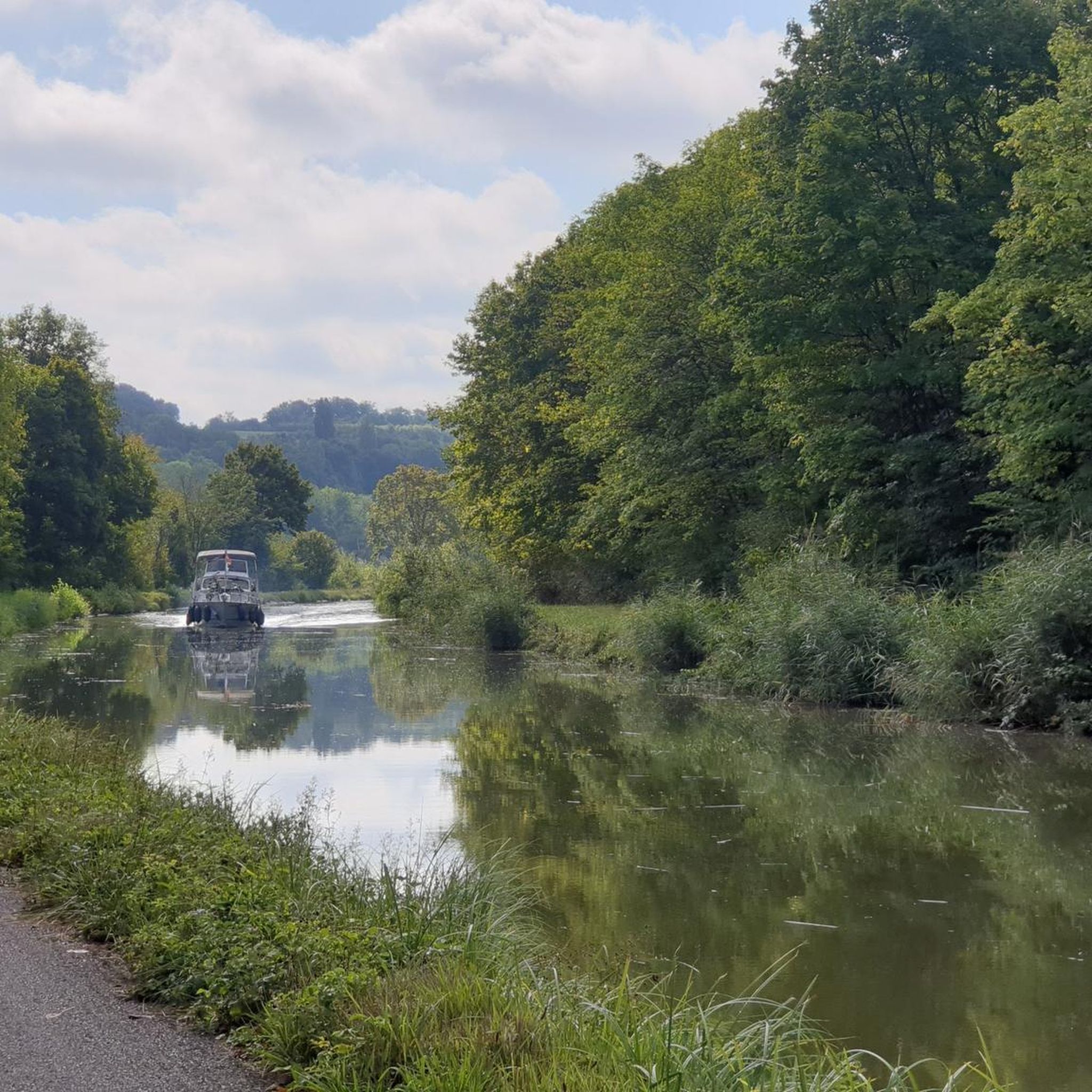
The Saar is getting "younger". On the left hand side the river and on the right hand the canal.
3
0

cycling along the Saar-Coal Canal with a view of the Saar. Nice here!
3
0

Beautiful valley where the Saar River and the canal flow right next to each other.
3
0

The Saar coal mine canal owes its name to its origins. It was created to transport coal from the Saarbrücken deposit. It joins the Marne-Rhine canal at Gondrexange. These two canals are now bordered by the EuroVelo 5 cycle path.
4
0
Frequently Asked Questions
How many hiking trails are available around Wiesweiler?
The Wiesweiler region offers a wide variety of hiking opportunities, with over 700 routes available. These trails cater to all skill levels, from easy strolls to more challenging excursions through diverse landscapes.
What kind of terrain can I expect on hikes near Wiesweiler?
Hiking around Wiesweiler features picturesque hills, expansive fields, and dense forests. You'll encounter the scenic Glan and Lauter valleys, offering varied routes and panoramic views towards the Hunsrück and Donnersberg. Some areas also include former vineyards, adding to the diverse scenery.
Are there easy hiking trails suitable for beginners or casual walkers in Wiesweiler?
Yes, Wiesweiler has numerous easy trails perfect for beginners or those seeking a relaxed walk. Over 400 routes are classified as easy. An example is the Zetting Church – Outdoor Classroom of Zetting loop from Zetting, which is a 5.4 km (3.4 miles) trail that takes about 1 hour 30 minutes to complete.
Are there more challenging or difficult hikes around Wiesweiler?
For experienced hikers, there are over 27 difficult routes and 260 moderate routes available. These trails often feature more significant elevation changes and cover longer distances, providing a good workout. The region's diverse terrain, including the Glan and Lauter valleys, offers plenty of options for those seeking a challenge.
What natural features or landmarks can I see while hiking in the Wiesweiler region?
The region around Wiesweiler is rich in natural beauty and historical sites. You can explore highlights such as the Orchid Trail Gersheim, the tranquil Mühlenwald Pond, or the impressive Devil's Pulpit viewpoint. Additionally, the area features the Giant Sequoia Natural Monument at Allenberg and the historical European Archaeological Park Bliesbruck-Reinheim.
Are there any family-friendly hiking options in Wiesweiler?
Many of the easy and moderate trails around Wiesweiler are suitable for families. The varied landscapes, including forests and open fields, provide engaging environments for children. Consider routes like the Zetting Church – Outdoor Classroom of Zetting loop from Zetting, which is relatively short and passes by an outdoor classroom, offering an educational element.
Can I bring my dog on the hiking trails around Wiesweiler?
Generally, dogs are welcome on most hiking trails in the Wiesweiler region. The diverse terrain, from forests to open fields, provides excellent opportunities for walks with your canine companion. However, it's always advisable to keep dogs on a leash, especially in nature reserves or near livestock, and to check for any specific local regulations along your chosen route.
Are there circular hiking routes available near Wiesweiler?
Yes, many of the trails around Wiesweiler are circular, allowing you to start and end at the same point. Examples include the Mown Forest Trail – Kuhne Kritz loop from Wiesviller, a moderate 9.5 km (5.9 miles) path, or the easier Mown Forest Trail – Kuhne Kritz loop from Woelfling-lès-Sarreguemines, which is 5.8 km (3.6 miles).
What do other hikers enjoy most about hiking in Wiesweiler?
The komoot community highly rates the hiking experience in Wiesweiler, with an average score of 4.4 stars from over 2,600 reviews. Hikers often praise the region's diverse terrain, including picturesque hills, dense forests, and the scenic Glan and Lauter valleys, which offer panoramic views and varied routes for all fitness levels.
What is the best time of year to go hiking in Wiesweiler?
The region around Wiesweiler is beautiful throughout the year, but spring and autumn are particularly popular for hiking. In spring, the landscape comes alive with lush greenery and blooming wildflowers, while autumn offers stunning foliage colors. Summer provides warm weather for longer excursions, and even winter can be appealing for crisp, clear walks, though some trails might be more challenging due to conditions.
Are there any historical sites or castles to visit near the hiking trails?
Absolutely. A significant historical attraction in the vicinity is Lichtenberg Castle, an impressive 13th-century structure that now houses a museum. Walks through the forest surrounding Lichtenberg Castle are highly recommended. Additionally, some routes pass by Protestant and Catholic churches and historic Jewish cemeteries, offering glimpses into the region's cultural heritage.
Is public transport available to access hiking trails in Wiesweiler?
While specific public transport connections to every trailhead can vary, the region around Wiesweiler does have some connections. For instance, the 'Veldenz hiking trail' can be accessed from Lauterecken station. It's advisable to check local bus and train schedules for the most up-to-date information on reaching specific starting points for your chosen hike.
Are there opportunities for combining hiking with other outdoor activities?
Yes, the Wiesweiler region offers connections to various cycle paths, such as the Glan-Blies Cycle Path, which often runs parallel to former railway lines. This provides excellent opportunities to combine hiking with cycling, or simply enjoy the diverse landscapes from a different perspective.
Most popular routes around Wiesweiler
Most popular attractions around Wiesweiler

Get inspired with the komoot mobile app


Explore more
Browse the best Hikes in other regions.
