The best walks and hikes around La Bernerie-En-Retz
4.3
(136)
1,088
hikers
28
hikes
Hiking around La Bernerie-En-Retz offers routes along the Atlantic coast, characterized by sandy beaches and coastal paths. The terrain generally features low elevation changes, making many trails accessible. Inland sections may include agricultural landscapes and small wooded areas, providing a mix of open views and sheltered paths.
Best hiking trails around La Bernerie-En-Retz
- The most popular hiking route is Port du Collet – Guitteny Cross loop from La Bernerie-en-Retz, a 6.0 miles (9.7 km) trail that takes 2 hours…
Last updated: July 9, 2026
4.7
(6)
32
hikers
Moderate hike. Good fitness required. Easily-accessible paths. Suitable for all skill levels.
4.8
(5)
102
hikers
6.78km
01:44
30m
30m
Easy hike. Great for any fitness level. Easily-accessible paths. Suitable for all skill levels.

Sign up for free
5.0
(5)
48
hikers
Easy hike. Great for any fitness level. Easily-accessible paths. Suitable for all skill levels.
4.8
(63)
460
hikers
Moderate hike. Good fitness required. Easily-accessible paths. Suitable for all skill levels.
4.6
(11)
54
hikers
Moderate hike. Good fitness required. Easily-accessible paths. Suitable for all skill levels.
Get access to more routes and recommendations from other explorers.
Sign up for free
Already have an account?
Our route recommendations are based on thousands of hikes, rides, and runs completed by other people on komoot.
Start today with a free account
Your next adventure awaits.
Login or Signup

Other adventures around La Bernerie-En-Retz

Tips from the Community

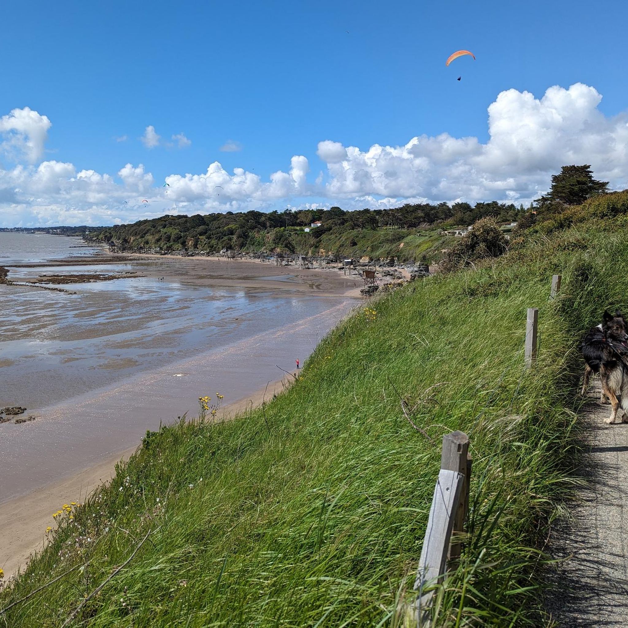
Magnificent sandy beach, bordered by cliffs. Accessible via a gently sloping gravel path. For swimming or taking photos, it's best to do so at high tide, as the sea is far, far away at low tide.
0
0


When there is a market here on Fridays - it will certainly be busy
0
0
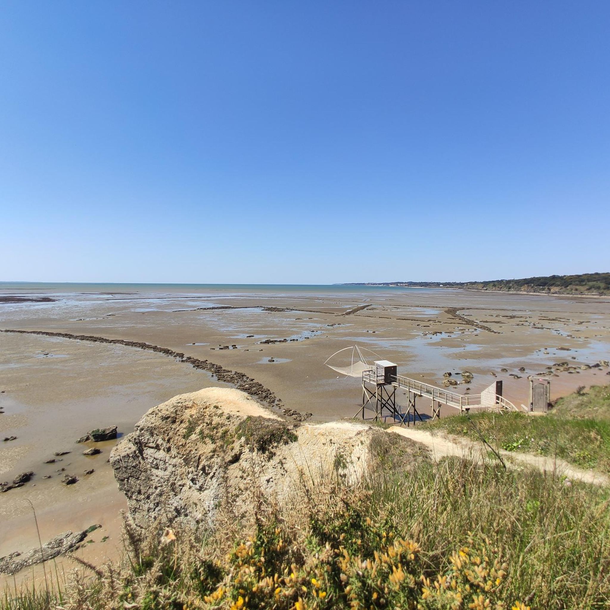
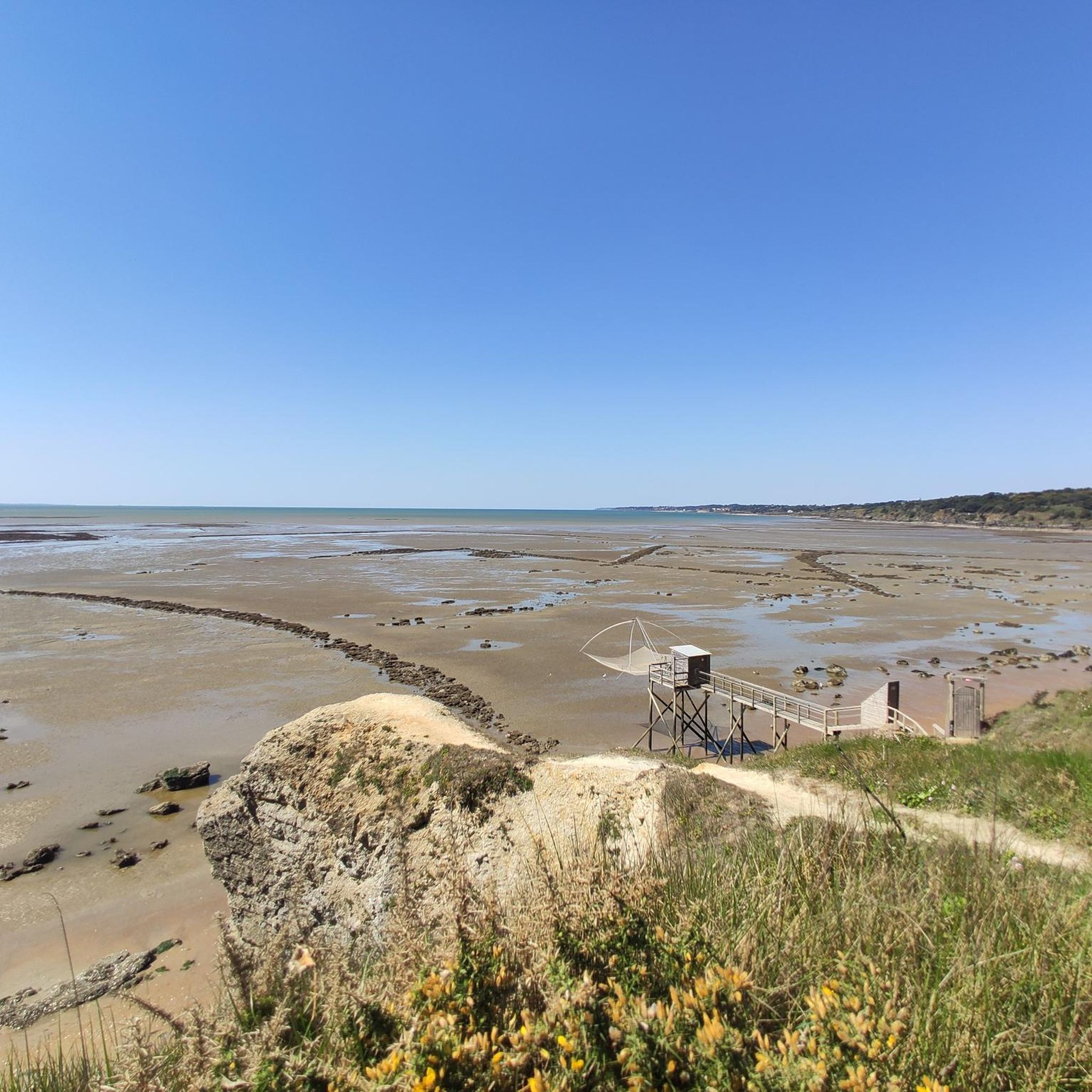
Many fishing huts - at low tide or high tide
0
0
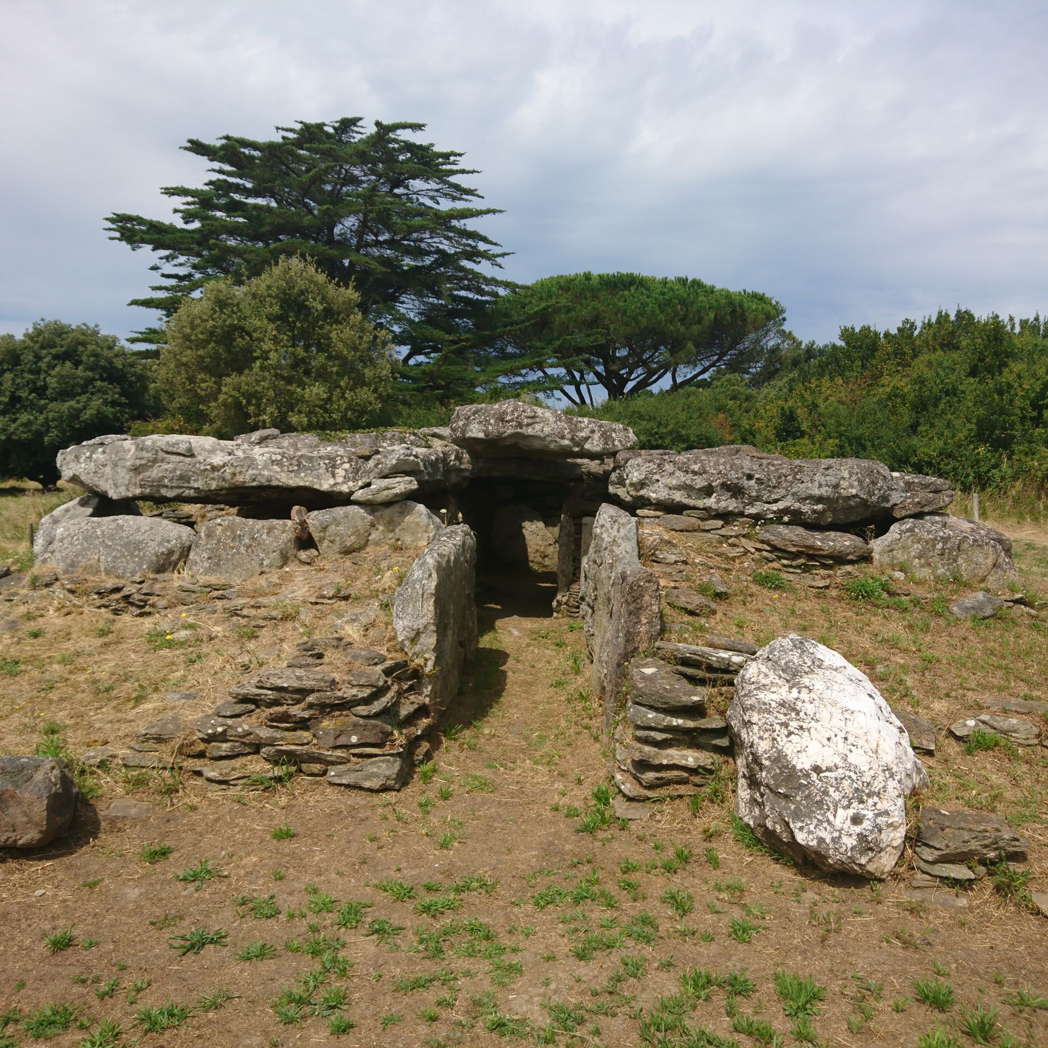
A small information board provides information about these dolmens
0
0

The Prédaire dolmen located south-east of Pornic, towards La Bernerie via the coastal path, rests on rocky ground at a place called "le Prédaire". This heavily damaged megalithic site belongs to the transept dolmens referenced on either side of the Loire estuary. Constitution of the Prédaire dolmen This monument, also spelled dolmen du Pré d'Air, is made up of scattered sandstone blocks and slabs in place quite clearly delimiting its different parts. Towards the West, the main terminal chamber was partly covered by an imposing block which, for security reasons, was deposited nearby in 2003. We can still see on the ground the location of the corridor and the two other bedrooms. Baron Olivier de Wismes, a scholar from Nantes, carried out archaeological excavations on the site in 1878. In the drawings he made on this occasion, the baron accurately represents this “basin stone” characteristic of this site which earned him also the name “Dolmen of the Dug Stone”. The funerary furniture discovered by him is kept at the Dobrée museum in Nantes. It is made up of: an oval pendant in fibrolith (small jewel), a round pendant (small jewel), two daggers (knives) in flint from Grand Pressigny (large production center in the Final Neolithic), a small ax and an ax fragment, pottery fragments, and flint flakes. This dolmen is listed in the supplementary inventory of Historic Monuments by decree of March 15, 1983. https://www.pornic.com/le-dolmen-du-predaire.html
0
0

The church was not opened for services until 1862. The gallery dates from 1922. The large organ from 1860 was bought by the municipality of La Bernerie-en-Retz in 1922 and rebuilt in 1939.
2
0

The market takes place under the hall: All year round: Friday from 8:00 a.m. to 1:00 p.m., during summer time from June 15th to September 15th, Tuesday from 8:00 a.m. to 1:00 p.m., Craft markets, from 6 p.m., under Les Halles; Every Thursday (except July 14th)
2
0
Frequently Asked Questions
How many hiking trails are there in La Bernerie-En-Retz?
There are over 35 hiking routes available around La Bernerie-En-Retz, catering to various skill levels. This includes 23 easy trails, 10 moderate, and 2 more challenging options.
What is the best time of year to go hiking in La Bernerie-En-Retz?
The coastal climate of La Bernerie-En-Retz makes hiking enjoyable for much of the year. Spring and autumn offer pleasant temperatures and fewer crowds, ideal for exploring the coastal paths. Summer is popular for beach activities, but early mornings or late afternoons can still be great for walks. Even in winter, the mild climate allows for refreshing coastal strolls, though some paths might be windier.
Are there any easy, family-friendly hikes in La Bernerie-En-Retz?
Yes, La Bernerie-En-Retz offers many easy trails suitable for families. A good option is the Port du Collet – Pré Vincent Beach loop from La Bernerie-en-Retz, which is an easy 3.3-mile (5.3 km) route with minimal elevation change, perfect for a relaxed outing with children.
Can I bring my dog on the hiking trails in La Bernerie-En-Retz?
Many coastal paths and trails in La Bernerie-En-Retz are dog-friendly, especially outside of peak season. However, it's always best to keep your dog on a leash, particularly near nature reserves, agricultural areas, or crowded beaches. Check local signage for specific restrictions, especially during nesting seasons or on certain beach sections.
Are there any circular walks available in the area?
Yes, many of the routes around La Bernerie-En-Retz are designed as circular walks, allowing you to start and end at the same point. For example, the Fountain Cave – Crève-Coeur Beach loop from La Bernerie-en-Retz is a popular 5.5-mile (8.8 km) circular trail that explores coastal scenery and beaches.
What kind of scenery can I expect on the hikes around La Bernerie-En-Retz?
Hiking around La Bernerie-En-Retz is characterized by diverse coastal landscapes. You'll find sandy beaches, rugged cliffs, traditional fishing structures known as 'carrelets', and views of the Atlantic Ocean. Inland, some paths may lead through agricultural fields or small wooded areas, offering a mix of open vistas and sheltered sections.
Are there any interesting landmarks or attractions to see along the trails?
Yes, the region offers several points of interest. You might encounter historical sites like the Pornic Castle or ancient structures like the Prédaire Dolmen. The working fishing port of Port du Collet is also a notable highlight. Additionally, there are several beautiful ponds and lakes nearby, such as Val Saint-Martin Pond and Gatineaux and Gros Caillou Ponds.
Are there any longer or more challenging hikes in the area?
While many trails are easy to moderate, there are options for longer walks. The La Boutinardiere – Carrelets of the Jade Coast loop from La Bernerie-en-Retz is a moderate 8.5-mile (13.8 km) path that offers a good distance and features views of the Jade Coast. For a slightly different moderate challenge, consider the Crève-Coeur Beach – La Boutinardiere loop from La Bernerie-en-Retz, covering 5.9 miles (9.5 km).
What do other hikers enjoy most about hiking in La Bernerie-En-Retz?
The area is highly rated by the komoot community, with an average score of 4.5 stars. Reviewers often praise the stunning coastal views, the accessibility of the paths, and the variety of landscapes, from sandy beaches to charming fishing villages. The well-maintained trails and the opportunity to discover hidden coves are frequently highlighted.
Is it possible to hike along the famous Sentier des Douaniers (Customs Officers' Path) near La Bernerie-En-Retz?
Yes, sections of the historic Sentier des Douaniers, also known as the GR34, run along the coast near La Bernerie-En-Retz. These coastal paths offer breathtaking views of the Atlantic and allow you to explore the rugged coastline and beautiful beaches that define the region.
Are there hiking trails accessible by public transport?
La Bernerie-En-Retz is generally well-connected by local bus services, especially during the summer months, which can help access various starting points for hikes. However, for more remote trailheads, having a car might offer greater flexibility. Always check local bus schedules in advance, as services can be less frequent outside of peak season.
Where can I find parking for hiking trails in La Bernerie-En-Retz?
Parking is generally available at key access points along the coast and near popular beaches in La Bernerie-En-Retz. Many trailheads, especially those starting from the town center or near specific attractions like Port du Collet, have designated parking areas. During peak season, these spots can fill up quickly, so arriving early is advisable.
Most popular routes around La Bernerie-En-Retz
Most popular attractions around La Bernerie-En-Retz

Get inspired with the komoot mobile app


Explore more
Browse the best Hikes in other regions.
