The best walks and hikes around Oye-Et-Pallet
4.5
(812)
6,075
hikers
14
hikes
Hiking around Oye-Et-Pallet offers diverse trails through a landscape shaped by glacial origins in the Haut-Doubs region of France. The area features significant natural landmarks such as Lac de Remoray and Lac de Saint-Point, both glacial lakes surrounded by protected ecosystems. Hikers can explore wide glacial valleys, dense forests, and open pastures, encountering unique geological features and rich biodiversity. This varied terrain provides numerous opportunities for outdoor activities.
Best hiking trails around Oye-Et-Pallet
- The most popular hiking route is Tour…
Last updated: July 6, 2026
4.7
(47)
385
hikers
22.2km
05:55
250m
250m
Hard hike. Very good fitness required. Easily-accessible paths. Suitable for all skill levels.
4.7
(3)
35
hikers
6.97km
01:54
110m
110m
Easy hike. Great for any fitness level. Easily-accessible paths. Suitable for all skill levels.

Sign up for free
4.7
(3)
23
hikers
8.87km
02:27
150m
150m
Moderate hike. Good fitness required. Easily-accessible paths. Suitable for all skill levels.
5.0
(2)
23
hikers
14.2km
03:49
170m
170m
Moderate hike. Good fitness required. Easily-accessible paths. Suitable for all skill levels.
10
hikers
10.6km
02:55
180m
180m
Moderate hike. Good fitness required. Easily-accessible paths. Suitable for all skill levels.
Get access to more routes and recommendations from other explorers.
Sign up for free
Already have an account?
Our route recommendations are based on thousands of hikes, rides, and runs completed by other people on komoot.
Start today with a free account
Your next adventure awaits.
Login or Signup

Tips from the Community

The "tour du lac" trail is authorized for bicycles but /!\ priority is given to pedestrians.
1
0


Unmissable site of Lac Saint Point with its houses on stilts
0
1

See the site: https://www.destination-haut-doubs.com/le-village-de-pecheurs-dans-le-haut-doubs.html
0
0

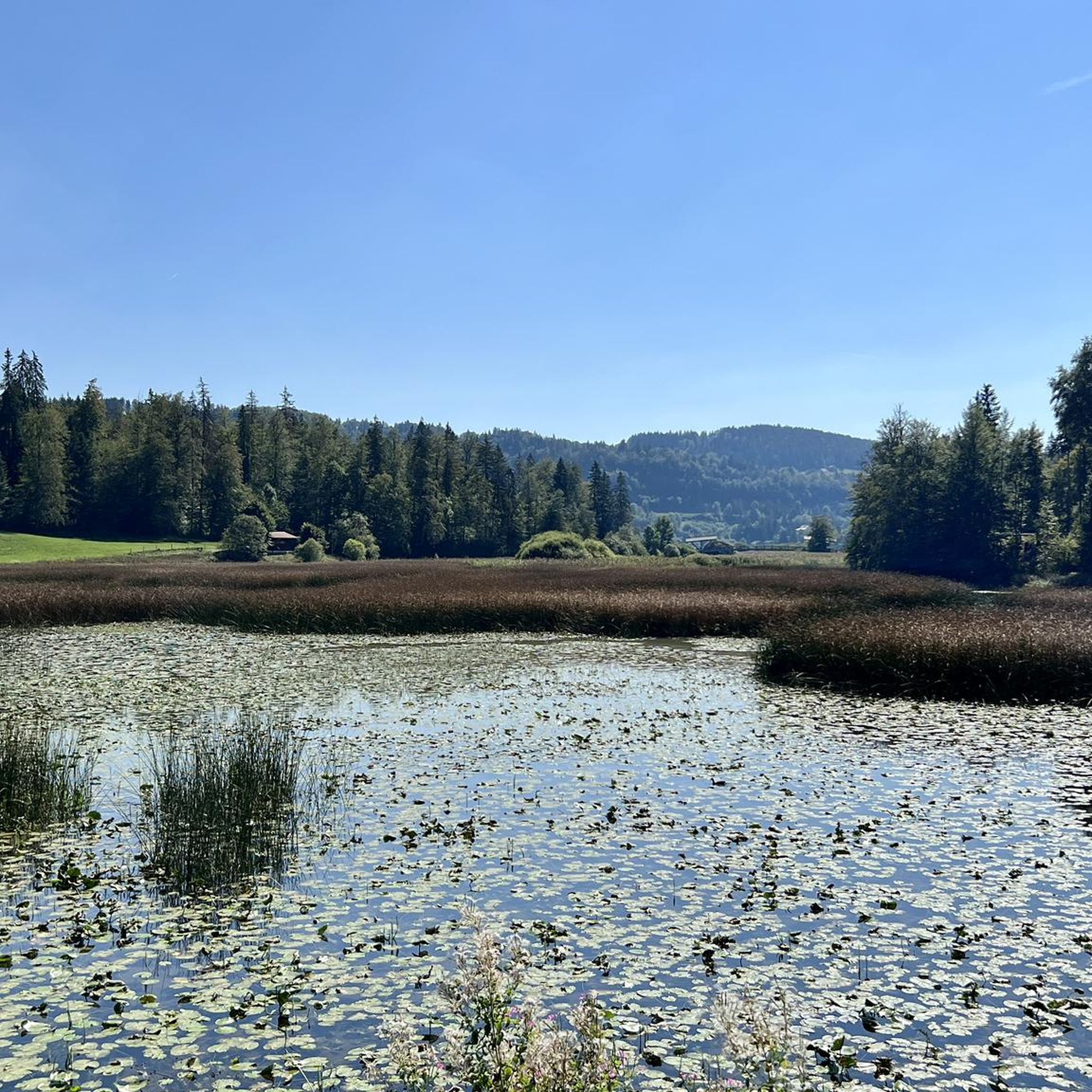
Very nice view of the Doubs marsh between the Lac de Remoray and the Lac de Saint-Point. In the background you can see the Grand Taureau mountain
5
0
Port Titi does not owe its name to the colourful boats on the blue water, but to Maurice Maire Sébille, also called "Titi", a pike fisherman who built the first fishing hut here in 1902.
7
0

The trail runs all the way around Lake Saint Point, with fir trees all around, it is possible to do only sections With, among other things, the small houses of Port Titi right on the edge Swans, moorhens, ducks...... Gorgeous
0
0

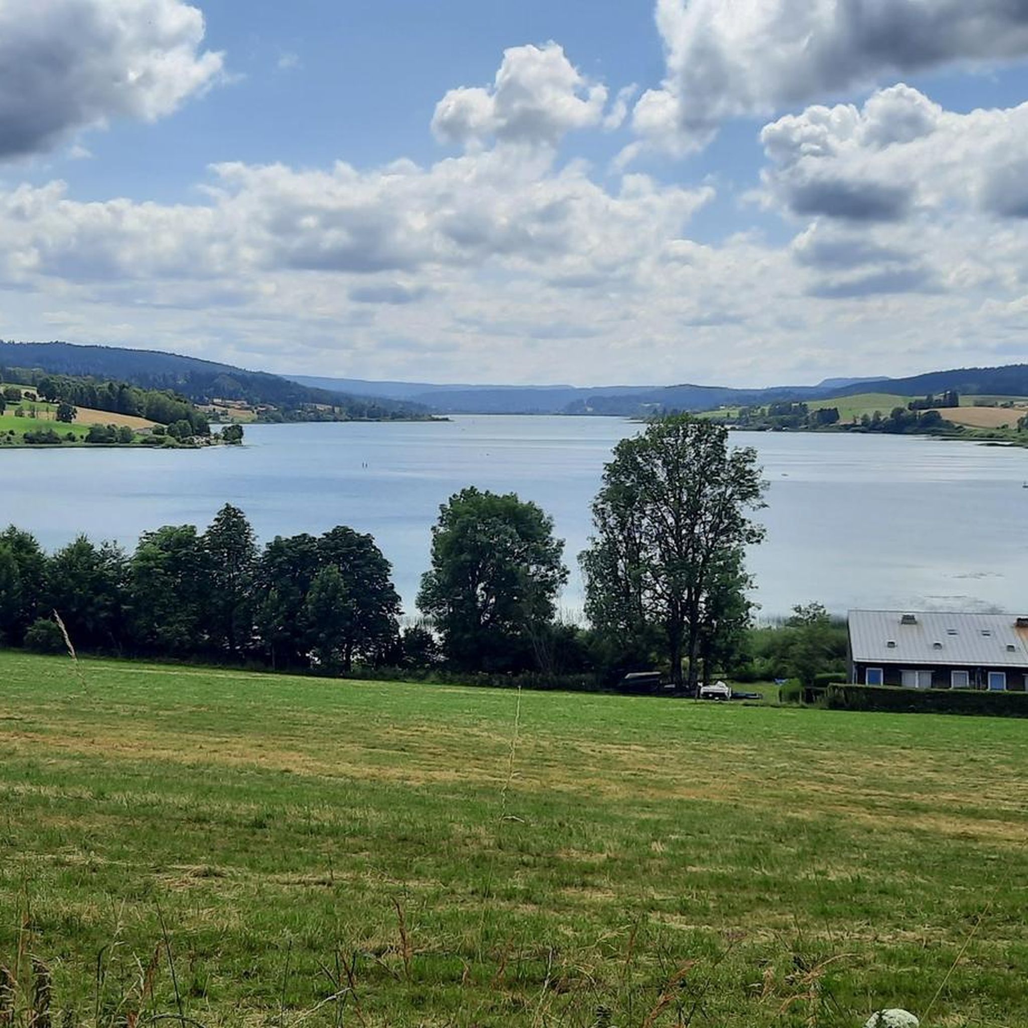
Third largest natural lake in France with its 398 hectares. Whatever the season, we never tire of observing it from the road.
0
0
Frequently Asked Questions
How many hiking trails are there around Oye-Et-Pallet?
There are over 10 hiking trails available around Oye-Et-Pallet, offering a range of options from easy strolls to more challenging long-distance routes. You'll find a diverse network of paths through glacial valleys, dense forests, and picturesque lakes.
What kind of natural features can I explore on hikes in Oye-Et-Pallet?
The region is rich in natural features shaped by its glacial origins. You can explore the unique ecosystems around Lake Remoray, which is part of a National Nature Reserve, or visit the captivating Source Bleue, a karst spring known for its exceptionally pure blue water and a small waterfall downstream. Panoramic views are also available from spots like the Belvédère des 2 Lacs.
Are there any family-friendly hiking options in Oye-Et-Pallet?
Yes, there are several family-friendly hiking options. Some circuits around Lac de Remoray are suitable for those with strollers, offering easy access to diverse environments. The region's varied terrain includes gentle forest paths and open pastures, making it enjoyable for all ages.
Can I bring my dog on the hiking trails in Oye-Et-Pallet?
While many trails in the Haut-Doubs region are dog-friendly, it's important to be mindful of protected areas. The Lac de Remoray is a National Nature Reserve with restricted public access to protect its fragile ecosystems and wildlife. Always keep dogs on a leash and check specific trail regulations, especially near nature reserves, to ensure responsible hiking.
What is the best time of year to go hiking in Oye-Et-Pallet?
The warmer months, from spring through autumn, are generally the best time for hiking in Oye-Et-Pallet. During this period, the weather is pleasant for exploring the diverse landscapes, and you can also enjoy water activities at the supervised beaches of Lac de Remoray and Plage de Oye et Pallet.
Are there any circular walks available around Oye-Et-Pallet?
Yes, the area offers several circular walks. For instance, the Tour of Lake Saint Point – Lake Malpas loop from Oye-et-Pallet is a moderate 10.2-mile (16.4 km) path providing varied scenery. Another option is the easier Tour of Lake Saint Point loop from Montperreux, which is about 4.5 miles (7.2 km).
What kind of wildlife might I encounter while hiking?
The region, particularly around the Lac de Remoray National Nature Reserve, is a haven for wildlife. You might spot over 200 species of birds, numerous insects, and mammals such as foxes and badgers. The elusive lynx also inhabits the area, though it is rarely seen. Remember to observe from a distance and respect their natural habitat.
Are there any easy hiking trails suitable for beginners?
Yes, there are several easy trails. The View of Lac de Saint-Point – Lake Saint-Point loop from Montperreux is an easy 4.3-mile (7.0 km) trail offering scenic views. Another accessible option is the Tour of Lake Saint Point loop from Montperreux, which is also rated easy.
What do other hikers enjoy most about the trails in Oye-Et-Pallet?
The trails in Oye-Et-Pallet are highly rated by the komoot community, with an average score of 4.5 stars from over 700 reviews. Hikers often praise the diverse landscapes, including the picturesque lakes and varied terrain, as well as the well-maintained paths that offer opportunities for both challenging and leisurely walks.
Are there any waterfalls to see on hikes near Oye-Et-Pallet?
Yes, the region offers opportunities to see waterfalls. Downstream from the Source Bleue, you can find a small waterfall. The wider Doubs region, which Oye-Et-Pallet is part of, is also known for the spectacular Saut du Doubs waterfall, featuring impressive canyon-like landscapes.
Is public transport available to reach hiking trailheads?
While specific public transport routes directly to all trailheads might be limited, Oye-Et-Pallet is situated within the Haut-Doubs region. For detailed information on local bus services or other transport options to reach specific starting points, it's advisable to check with local tourist information centers or regional transport providers.
Where can I find parking for hiking trails in Oye-Et-Pallet?
Parking is generally available near popular trailheads and attractions. For instance, if you plan to hike around Lac de Saint-Point or Lake Remoray, you will typically find designated parking areas. It's always a good idea to check maps or local signage for specific parking locations before your hike.
Most popular routes around Oye-Et-Pallet
Most popular attractions around Oye-Et-Pallet

Get inspired with the komoot mobile app


Explore more
Browse the best Hikes in other regions.
