The best cycling routes around Saint-Mars-D'Outillé
4.5
(79)
1,554
riders
256
rides
Touring cycling around Saint-Mars-D'Outillé offers routes through the Sarthe department, characterized by varied landscapes including the edges of the Bercé Forest, tranquil riversides, and open plains. The region's topography features altitudes ranging from 74m to 168m, providing a generally accessible terrain for cyclists. Saint-Mars-D'Outillé is strategically located near La Vélobuissonnière (V44), a 250 km cycling route that combines low-traffic country roads and dedicated cycle paths. This connectivity allows for extensive touring experiences across the region.
Best touring cycling routes around…
Last updated: May 23, 2026
11
riders
42.4km
03:36
410m
410m
Hard bike ride. Good fitness required. You may need to push your bike for some segments of this route.
7
riders
34.3km
02:59
210m
210m
Hard bike ride. Good fitness required. You may need to push your bike for some segments of this route.

Sign up for free
6
riders
42.1km
03:37
290m
290m
Hard bike ride. Good fitness required. You may need to push your bike for some segments of this route.
11
riders
47.8km
03:50
300m
300m
Moderate bike ride. Good fitness required. Mostly paved surfaces. Suitable for all skill levels.
5.0
(1)
3
riders
8.33km
00:36
70m
70m
Easy bike ride. Great for any fitness level. Mostly paved surfaces. Suitable for all skill levels.
Get access to more routes and recommendations from other explorers.
Sign up for free
Already have an account?
Our route recommendations are based on thousands of hikes, rides, and runs completed by other people on komoot.
Start today with a free account
Your next adventure awaits.
Login or Signup
Popular around Saint-Mars-D'Outillé


Other adventures around Saint-Mars-D'Outillé

Tips from the Community

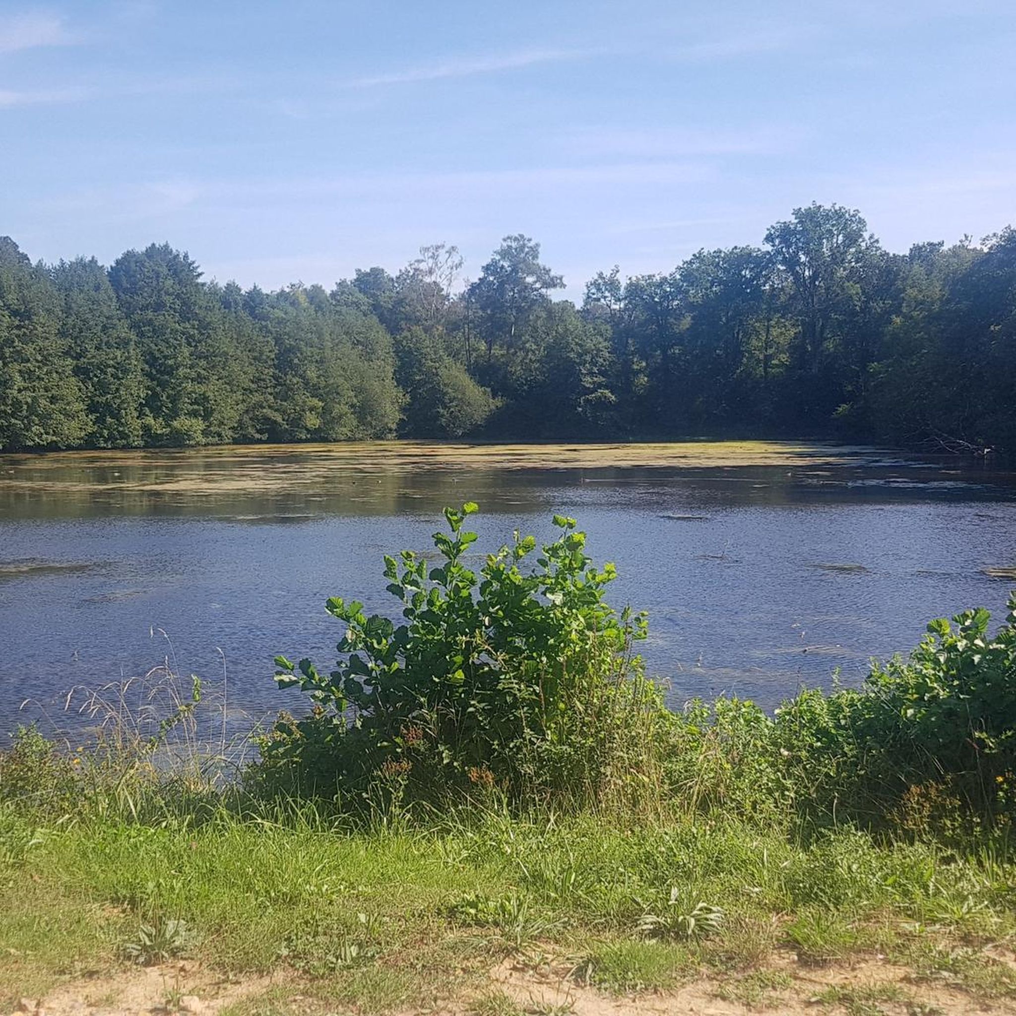
The Loudon ponds are located in the town of Parigné l'Evêque, in the heart of a forest. They are surrounded by peat bogs, wet and dry heaths, lawns and vast forests. They are the starting point for many hikes and it is not uncommon to see large mammals there, notably wild boars. The site is classified in the national inventory of Natural Areas of Ecological Fauna and Flora Interest.
1
0

This menhir, as its name suggests, was used by shepherds to protect their sheep. It was damaged in a tractor accident in 2008, which caused the stone to deteriorate. So take the time to visit this menhir - it may not be there anytime soon!
2
0
Here you will find calm waters and picnic benches among the trees of the forest. A great place to start, end or take a break from your hike.
2
0
This menhir, as its name suggests, was used by shepherds to protect their sheep. It was damaged in a tractor accident in 2008, which caused the stone to deteriorate. So take the time to visit this menhir - it may not be there anytime soon!
2
0
The lakes of Loudon are a privileged place to visit with a diverse habitat of bogs, wet and dry moors and forests. If you are lucky, you may even spot wild boars.
3
0


Very beautiful place, the rocked forest is filled with hiking trails and lives but be careful some paths are quite steep and narrow
0
0

Thank you. For this very nice circuit.! He makes it happen!
0
0
Frequently Asked Questions
How many touring cycling routes are available around Saint-Mars-d'Outillé?
There are over 250 touring cycling routes around Saint-Mars-d'Outillé. This includes a wide range of options, with 83 easy routes, 116 moderate routes, and 55 difficult routes, catering to various skill levels and preferences.
What kind of terrain can I expect on touring cycling routes in Saint-Mars-d'Outillé?
The terrain around Saint-Mars-d'Outillé is quite varied, offering cyclists a mix of landscapes. You can expect to ride along the edges of the Bercé Forest, tranquil riversides, and open plains. The region's topography is generally accessible, with altitudes ranging from 74m to 168m, making for a diverse but manageable cycling experience. Many routes utilize small, low-traffic country roads and some dedicated cycle paths.
Are there any easy touring cycling routes suitable for beginners or families?
Yes, Saint-Mars-d'Outillé offers several easy touring cycling routes perfect for beginners or families. One such option is the Bike loop from Saint-Mars-d'Outillé, an 8.3 km (5.2 miles) trail that typically takes about 35 minutes to complete. Another easy route is the Bike loop from Brette-les-Pins, which is 14.1 km (8.8 miles) long. These routes are generally on local roads and offer a gentle introduction to touring cycling in the area.
What are some notable landmarks or attractions I can see along the cycling routes?
While cycling around Saint-Mars-d'Outillé, you can encounter several interesting landmarks and natural features. The region borders the scenic Bercé Forest, and routes often pass by tranquil riversides. Specific points of interest include the Loudon Ponds, the Château du Fort des Salles, and the Gué de l'Aulne Stele. The nearby city of Le Mans, accessible via cycling routes, also offers its historic Plantagenet City and the famous 24 Hours circuit.
Is Saint-Mars-d'Outillé connected to any major long-distance cycling routes?
Yes, Saint-Mars-d'Outillé is strategically located near La Vélobuissonnière (V44), a significant 250 km cycling route. This route connects Alençon to Saumur via Le Mans and the Vallée de la Sarthe, offering extensive touring opportunities. Saint-Mars-d'Outillé is approximately 20 kilometers from Le Mans, a key point on the Vélobuissonnière, making it easy to join this network for longer journeys.
Are there any circular touring cycling routes available?
Yes, many touring cycling routes around Saint-Mars-d'Outillé are designed as loops, allowing you to start and end in the same location. For example, the popular L'Épau Abbey – Prairie House loop from Saint-Mars-d'Outillé is a 63.7 km (39.6 miles) route. Another option is the View of Parigné-l'Évêque loop from Brette-les-Pins, a 33.3 km (20.7 miles) path offering scenic views.
What is the best time of year for touring cycling in this region?
The Pays de la Loire region, where Saint-Mars-d'Outillé is located, generally offers pleasant cycling conditions from spring through early autumn (April to October). During these months, the weather is typically mild, and the landscapes are vibrant. Summer can be warm, but the varied terrain with forest edges provides some shade. It's always advisable to check local weather forecasts before your ride.
What do other touring cyclists enjoy most about cycling in Saint-Mars-d'Outillé?
The area is highly rated by the komoot community, with an average score of 4.5 stars from over 80 reviews. Reviewers often praise the diverse scenery, which includes quiet woodlands, tranquil riversides, and open plains. Cyclists appreciate the mix of low-traffic country roads and dedicated paths, making for a pleasant and varied touring experience.
Are there options for more challenging or advanced touring cycling routes?
Yes, for those seeking a greater challenge, there are difficult touring cycling routes available. One such route is The Turning Stones loop from Saint-Mars-d'Outillé, a 34.2 km (21.3 miles) trail with more significant elevation changes, offering a more demanding ride for experienced cyclists.
Are there any facilities or services for cyclists, such as bike-friendly accommodations?
The broader region, particularly the Vallée de la Sarthe, features 'Accueil Vélo' (Cyclists Welcome) labeled establishments. These places are equipped to provide quality services for touring cyclists, including secure bike storage, repair kits, and often adapted accommodation. It's recommended to look for this label when planning your stops.
Can I reach the cycling routes using public transport?
Saint-Mars-d'Outillé is located approximately 20 kilometers from Le Mans, a larger city with public transport connections. While direct public transport to the specific trailheads within Saint-Mars-d'Outillé might be limited, you can often use regional buses or trains to get to nearby towns like Le Mans and then cycle to your starting point. It's best to check local public transport schedules and bike carriage policies in advance.
Are there any cafes or places to stop for refreshments along the routes?
While specific cafes directly on every route might vary, the cycling network around Saint-Mars-d'Outillé often passes through charming villages. These villages, especially those along the Vélobuissonnière, typically offer opportunities for cultural stops and places to find refreshments, local produce, or a meal. Planning your route with potential village stops in mind is a good idea.
Most popular routes around Saint-Mars-D'Outillé
Most popular attractions around Saint-Mars-D'Outillé

Get inspired with the komoot mobile app


Explore more
Browse the best Cycling routes in other regions.
