The best road cycling routes around Touillon-Et-Loutelet
4.2
(44)
2,096
riders
118
rides
Road cycling routes around Touillon-Et-Loutelet are set within the Doubs department of France's Bourgogne-Franche-Comté region, characterized by mountainous terrain and diverse landscapes. The area features low-traffic country roads that wind through pastures and woods, offering varied elevation gains. Notable natural features include glacial lakes such as Lac de Saint-Point and Lac de Remoray, alongside extensive forests and gorges. This region provides a setting for road cyclists seeking routes with both challenging climbs and scenic views of the Haut-Doubs.
Best road cycling routes around Touillon-Et-Loutelet
- The most popular road cycling route is La vallée de Joux — loop from Métabief, a 70.2 miles (113.0 km) trail that takes 5 hours 21 minutes to complete. This difficult route features significant climbs and panoramic views of the Jura Mountains.
- Another top favourite among local road cyclists is View of Lac de Saint-Point – View of Lac de St-Point loop from Coni'fer, a moderate 27.5 miles (44.2 km) path. This route offers views of Lac de Saint-Point, known for its iridescent colors.
- Local road cyclists also love the View of Lac de Remoray – Mouthe loop from Coni'fer, a 40.5 miles (65.2 km) trail leading through the area around Lac de Remoray, often completed in about 3 hours.
- Road cycling around Touillon-Et-Loutelet is defined by glacial lakes, extensive forests, and mountainous terrain, including the Mont d'Or. The network offers options for different ability levels, from moderate rides to more demanding excursions.
- The routes in Touillon-Et-Loutelet are highly rated by the komoot community with an average score of 4.2 stars from over 70 reviews. More than 2,900 road cyclists have used komoot to explore Touillon-Et-Loutelet's varied terrain.
Last updated: June 28, 2026
4.7
(3)
107
riders
113km
05:21
1,390m
1,390m
Hard road ride. Very good fitness required. Mostly well-paved surfaces and easy to ride.
4.8
(12)
200
riders
59.4km
02:45
640m
640m
Moderate road ride. Good fitness required. Mostly well-paved surfaces and easy to ride.

Sign up for free
4.3
(3)
67
riders
65.7km
02:54
630m
630m
Moderate road ride. Good fitness required. Mostly well-paved surfaces and easy to ride.
4.0
(2)
59
riders
113km
05:03
1,150m
1,150m
Hard road ride. Very good fitness required. Mostly well-paved surfaces and easy to ride.
56
riders
59.9km
02:38
560m
560m
Moderate road ride. Good fitness required. Mostly well-paved surfaces and easy to ride.
Get access to more routes and recommendations from other explorers.
Sign up for free
Already have an account?
Our route recommendations are based on thousands of hikes, rides, and runs completed by other people on komoot.
Start today with a free account
Your next adventure awaits.
Login or Signup
Tips from the Community


Pass without any difficulty from Mouthe: approximately 6.5 km at 3-4%.
0
0
Beautiful section of road along a wood.
0
0

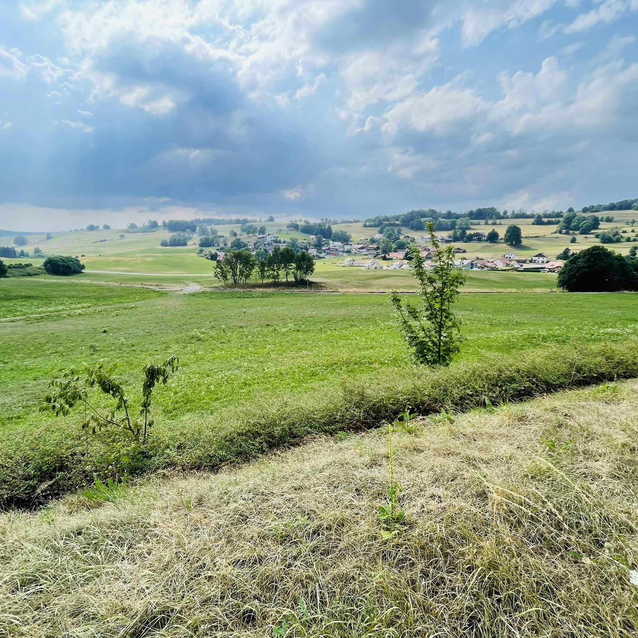
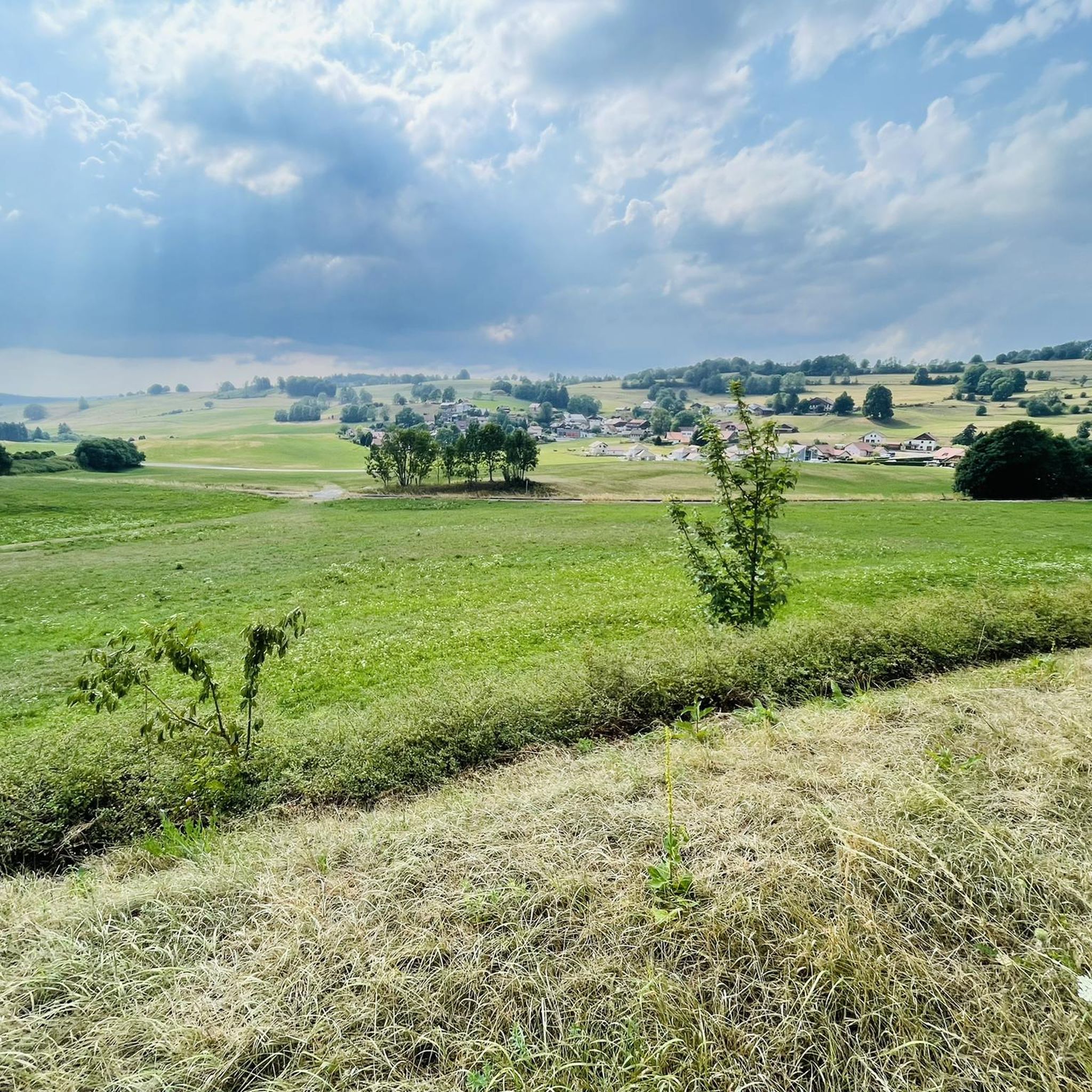
The Jura in all its splendor @
0
0

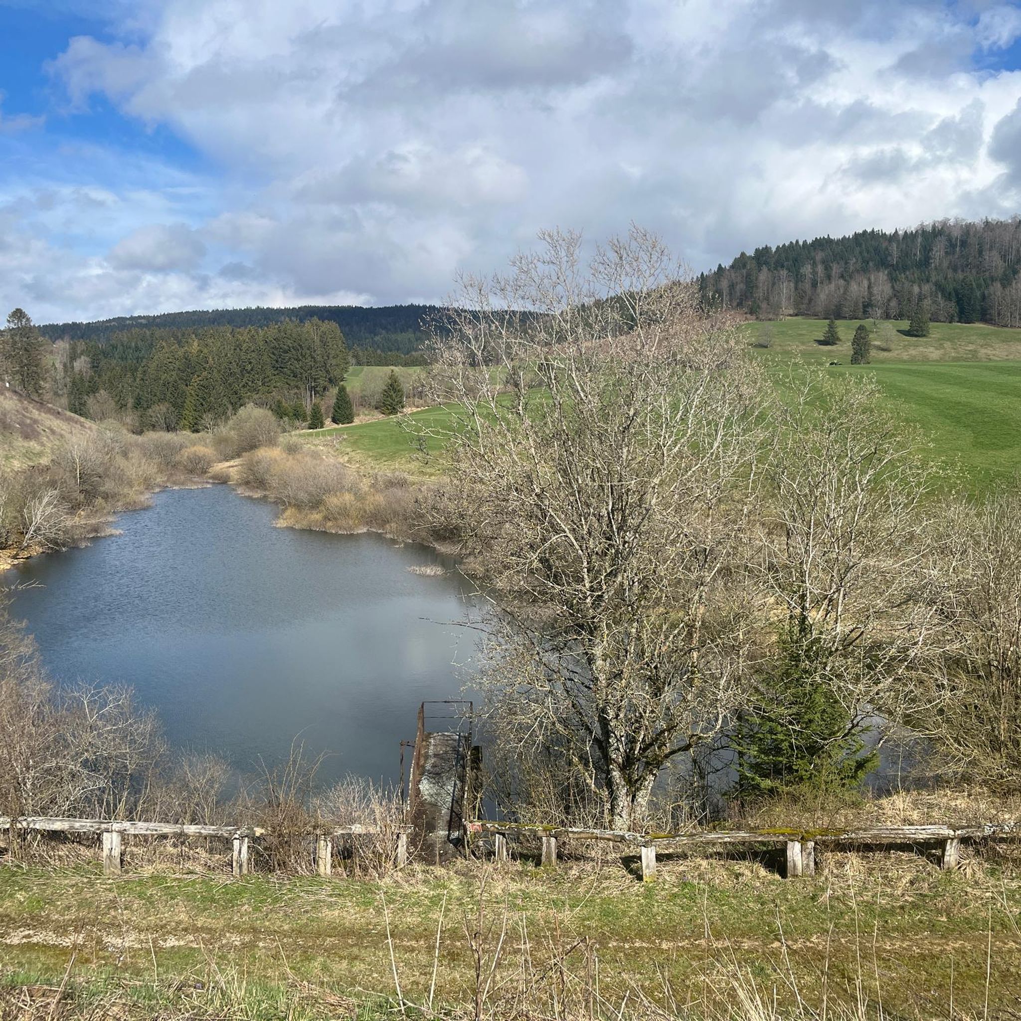
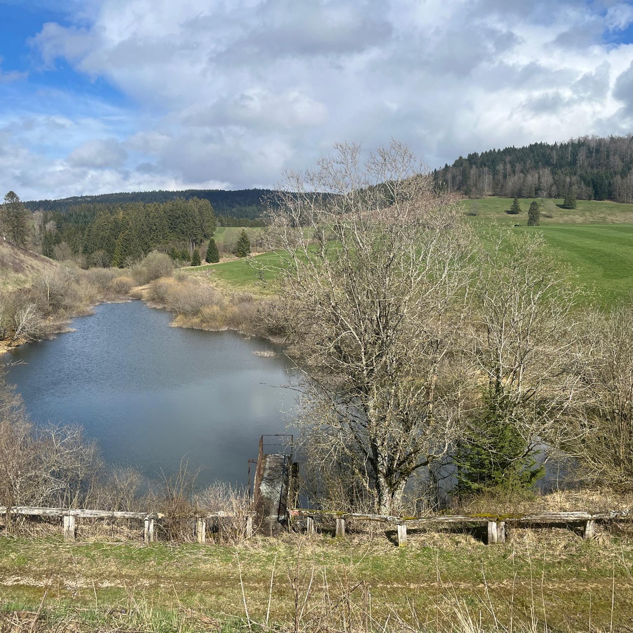
Very nice view of the Doubs marsh between the Lac de Remoray and the Lac de Saint-Point. In the background you can see the Grand Taureau mountain
5
0

When you are slowly losing your strength, such a path is wonderful. And when you still have strength, even more so
0
0
It is great to drive here
0
0
Highly recommended, as there is no car traffic
0
0
Frequently Asked Questions
How many road cycling routes are available around Touillon-Et-Loutelet?
There are over 110 road cycling routes in the Touillon-Et-Loutelet area, offering a wide range of options for different skill levels and preferences. You'll find everything from easy rides to very challenging excursions.
What types of terrain can I expect on road cycling routes in this region?
The region around Touillon-Et-Loutelet is characterized by mountainous terrain, offering diverse landscapes. Cyclists can expect low-traffic country roads winding through pastures and woods, with varied elevation gains. You'll encounter challenging climbs and scenic views of the Haut-Doubs, often with stunning vistas of glacial lakes and forests.
Are there any easy road cycling routes suitable for beginners or families?
Yes, the area offers several easier routes. For instance, while not explicitly labeled 'easy' in the data, routes around the lakes tend to have more moderate elevation changes. There are 15 routes classified as easy in the region, providing gentler options for those new to road cycling or looking for a more relaxed ride.
Where can I find challenging road cycling routes with significant climbs?
For those seeking a challenge, the mountainous terrain of the Doubs department provides ample opportunity. Routes like La vallée de Joux — loop from Métabief feature significant climbs and panoramic views of the Jura Mountains. There are 50 routes classified as difficult in the region, ensuring plenty of demanding options.
What are some scenic viewpoints I can reach by road bike?
Many routes offer superb panoramic views. The Mont d'Or, the highest point in the Doubs department, provides breathtaking vistas of the Suchet massif, the Dent de Vaulion, and on clear days, over 300 Alpine peaks, including Mont Blanc. Routes around Lac de Saint-Point also offer beautiful scenery, such as View of Lac de Saint-Point – View of Lac de St-Point loop from Coni'fer.
Are there any loop road cycling routes in the Touillon-Et-Loutelet area?
Yes, many of the road cycling routes in the region are designed as loops, allowing you to start and end at the same point. Examples include View of Lac de Remoray – Mouthe loop from Coni'fer and Chemin du Train near Doubs – Bridge over the Doubs loop from Coni'fer, which offer circular journeys through the scenic landscape.
What natural attractions can I see along the road cycling routes?
The region is rich in natural beauty. You can cycle past several beautiful glacial lakes, including Lac de Saint-Point and Lac de Remoray. The area also features dramatic gorges like the Défilé d'Entre-Roches and Gorges de Remonot, and extensive wooded areas such as the Forêt de la Joux. Keep an eye out for the intermittent spring of Fontaine Ronde, a local natural curiosity.
Are there any historical landmarks or castles accessible by road bike?
Absolutely. The imposing Joux Castle, a clifftop fortress with a thousand-year history, is a significant historical attraction located just 9 km from Touillon-et-Loutelet. You can find routes that pass by or offer views of this impressive structure, such as Mouthe – View of Lac de Remoray loop from Coni'fer which is in the vicinity.
What do other road cyclists enjoy most about cycling in Touillon-Et-Loutelet?
The area is highly rated by the komoot community, with an average score of 4.2 stars from over 70 reviews. Reviewers often praise the diverse landscapes, the challenging climbs, and the stunning views of the Jura Mountains and glacial lakes. The low-traffic country roads winding through pastures and woods are also frequently highlighted as a positive aspect of the cycling experience.
Is the Grande Traversée du Jura (GTJ) by bike accessible from this area?
Yes, Touillon-Et-Loutelet is situated within the vicinity of the Grande Traversée du Jura (GTJ) by bike, a renowned cycling route traversing the Jura Mountains. This route, approximately 370 km long, uses minor roads and integrates with the EuroVelo 6, offering extensive cycling opportunities for various proficiencies. You can find more information about the GTJ on France Vélo Tourisme.
Are there any routes that pass by impressive man-made structures?
Yes, you can find routes that offer views of impressive engineering. The Viaduc ferroviaire de Day, an impressive railroad viaduct with a pedestrian walkway, offers wonderful views of the reservoir and is located within the broader region, providing an interesting point of interest for cyclists.
Most popular routes around Touillon-Et-Loutelet
Most popular attractions around Touillon-Et-Loutelet

Get inspired with the komoot mobile app


Explore more
Browse the best Road cycling routes in other regions.
