The best road cycling routes around Lagarde-Sur-Le-Né
4.8
(15)
338
riders
182
rides
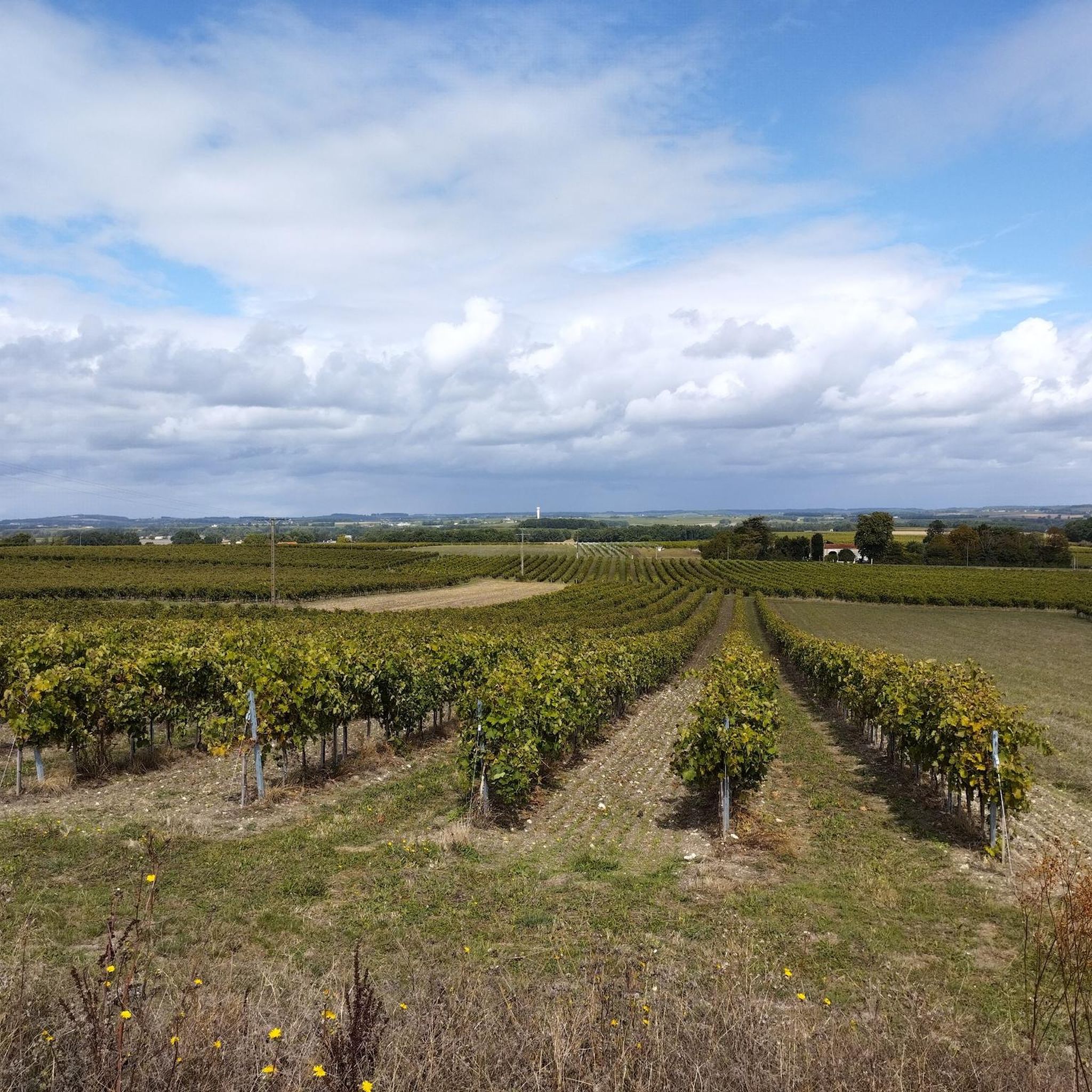
Road cycling around Lagarde-Sur-Le-Né, a commune in the Charente department of Nouvelle-Aquitaine, France, offers a rural setting for outdoor activities. The area is characterized by quiet country roads, rolling hills, and river valleys. Cyclists traverse landscapes of vineyards and sunflower fields, providing varied terrain for road cycling routes.
Best road cycling routes around Lagarde-Sur-Le-Né
- The most popular road cycling route is Montchaude Church – Château de Montchaude loop from Barbezieux-Saint-Hilaire, a 38.0 miles (61.1 km) trail that takes 2…
Last updated: June 30, 2026
5.0
(2)
7
riders
54.9km
02:22
360m
360m
Moderate road ride. Good fitness required. Mostly well-paved surfaces and easy to ride.
6
riders
51.2km
02:12
390m
390m
Moderate road ride. Good fitness required. Mostly well-paved surfaces and easy to ride.

Sign up for free
4
riders
42.9km
01:52
300m
300m
Moderate road ride. Good fitness required. Mostly well-paved surfaces and easy to ride.
4
riders
37.9km
01:41
300m
300m
Easy road ride. Great for any fitness level. Mostly well-paved surfaces and easy to ride.
3
riders
49.7km
02:16
460m
460m
Moderate road ride. Good fitness required. Mostly well-paved surfaces and easy to ride.
Get access to more routes and recommendations from other explorers.
Sign up for free
Already have an account?
Our route recommendations are based on thousands of hikes, rides, and runs completed by other people on komoot.
Start today with a free account
Your next adventure awaits.
Login or Signup



Tips from the Community

Consider deviating from the cycle path for a few minutes. Church your real the detour
1
0

Very pretty village, worth visiting!
0
0
Superb Saint-Pierre church in Lagarde sur le Né, surrounded by fields. Built in the 12th century in the pure Romanesque style. The church is often open. Ideal for a cool ravito and a prayer break 🙏
0
0

5 km north of Barbezieux, we find this beautiful 13th century church in the small hamlet of Saint-Médard. From here, you can take the greenway to Clérac.
1
0

The church is in the form of a rectangle thirty meters long and ten meters wide, flanked by 4 buttresses, one of which is located on the north wing and the 3 others on the south wing, a bell tower and a small extension on the south west part housing a chapel dedicated to the Virgin Massive building, reinforced by buttresses, low and poorly lit, it has a facade with a Romanesque portal surmounted by a large rose window. This gate is made up of 2 straight legs, and a projecting coving made up of 3 semicircular rollers with a keystone. The oculus rose is surrounded by a frieze with a sawtooth motif. The porch opens onto a single nave 22 m long by 9 wide without side aisles. It is made up of 4 bays with semi-circular vaults. The south wall is pierced under the 1st bay with a large semi-circular arch giving access to the chapel. The north wall has a pulpit which bears a monogram which would be that of Louis XIV. The choir of the church, raised from the nave by 3 steps, consists of a flat chevet and a span of semi-circular vaults. The bedside wall is pierced at each end with a rectangular door allowing access to the sacristy. The old sacristy has just been refurbished and has a very modern look with paneling on the floor and ceiling. The chapel of the Virgin is located on the southern extension of the church. It measures 13.50 m long by 7 wide, and consists of a small single nave 10 m long by 7 wide and a choir with a flat apse. The floor of this chapel is 1.25 m lower than the floor of the church corresponding to the initial floor of the old abbey. Access to the bell tower is through a door located on the east wall of the nave of the chapel. It consists of 4 floors and a vaulted ground floor. The facing is made up of medium-sized cut stone for the ground floor and the 1st floor and rubble stone coated with brown lime for the 2nd and 3rd floors.
0
0

The ruins of Bouteville Castle were built around the year 1000 on the site of a Roman villa.
3
0

Good quiet spot along the bike path on a picnic area, toilets 100m away
0
0
Baignes Abbey became a parish church after the revolution. It was part of the diocese of Saintes until the middle of the 19th century. The foundation of the Abbey would seem to date back to the 11th century. It was ransacked during the 100 Years War and then destroyed by the Protestants. The current building is totally different from the Old Abbey due to the destruction/modifications that have taken place.
2
0
Frequently Asked Questions
How many road cycling routes are available around Lagarde-Sur-Le-Né?
There are over 190 road cycling routes around Lagarde-Sur-Le-Né listed on komoot. These routes cater to various skill levels, including easy, moderate, and challenging options, allowing cyclists to explore the diverse landscapes of the Charente department.
What kind of terrain can I expect when road cycling around Lagarde-Sur-Le-Né?
The region around Lagarde-Sur-Le-Né offers a quintessential Charentais landscape. You can expect to traverse rolling hills, vast vineyards (especially in the nearby Cognac region), and fields of vibrant sunflowers. The routes often follow quiet country roads and greenways, providing a peaceful experience through river valleys and past local hamlets. While generally rolling, there are also more challenging ascents like the 'Col de la Bergère' near Bouteville, offering panoramic views.
Are there family-friendly road cycling routes in the area?
Yes, the area offers a variety of routes, including family-friendly options. These are typically shorter, under 10 km, and utilize quiet country roads or dedicated greenways, providing a safe and enjoyable experience for all ages. The rural nature of the surroundings ensures a peaceful ride away from heavy traffic.
What landmarks or points of interest can I see along road cycling routes?
Road cycling routes around Lagarde-Sur-Le-Né often pass by charming historical and natural sites. You might encounter the peaceful Saint-Pierre Church of Bonneuil, the Dolmen of Saint-Fort, or the Saint-Bonnet Church of Saint-Bonnet. Additionally, routes may offer views of historical châteaux like Château de Bouteville and pass through picturesque villages.
Are there challenging road cycling routes for experienced riders?
Absolutely. While many routes are moderate, there are 15 difficult routes available for experienced cyclists seeking a challenge. The rolling hills of the South Charente, including ascents like the 'Col de la Bergère' near Bouteville, provide varied terrain and rewarding climbs with exceptional panoramic views of the Charente valley.
What are the typical distances for road cycling routes in this region?
The road cycling routes around Lagarde-Sur-Le-Né vary significantly in length. You can find shorter routes, such as the Roadbike loop from Barbezieux-Saint-Hilaire at 33.6 km, or longer exploration routes ranging from 40 to over 70 km, like the Voie verte de 21,5 kilomètres – La voie verte loop from Barbezieux-Saint-Hilaire which is 70.7 km.
What do other road cyclists enjoy the most about road cycling in Lagarde-Sur-Le-Né?
The road cycling experience around Lagarde-Sur-Le-Né is highly rated by the komoot community, with an average score of 4.8 stars from over 10 reviews. Cyclists frequently praise the tranquil rural setting, the extensive network of quiet country roads, and the beautiful scenery characterized by vineyards, sunflower fields, and river valleys. The diverse routes, from easy family rides to more challenging exploration routes, are also a highlight.
When is the best time of year for road cycling in Lagarde-Sur-Le-Né?
The Charente region, including Lagarde-Sur-Le-Né, is generally pleasant for cycling from spring through autumn. Spring offers lush green landscapes and blooming wildflowers, while summer brings vibrant sunflower fields and warm weather. Autumn provides cooler temperatures and beautiful fall foliage. The quiet roads and rural setting make it enjoyable across these seasons, though summer can be quite warm.
Are there any specific cycling routes that are part of larger national or European networks?
Yes, the Charente region is well-integrated into larger cycling networks. You can find sections of major routes like La Scandibérique (EuroVelo 3), which offers paths through picturesque countryside and vineyards. Another notable route is The Flow Vélo®, which winds through the Charente valley and past Cognac vineyards, connecting Périgord to the Atlantic Ocean.
Where can I find more information about cycling in the South Charente region?
For additional details and resources on cycling opportunities within the broader South Charente region, you can visit the local tourism website: sudcharentetourisme.fr. This can provide further context on routes and attractions in the area.
Are there options for circular road cycling routes around Lagarde-Sur-Le-Né?
Yes, many of the road cycling routes in the area are designed as loops, allowing you to start and end your ride in the same location. Examples include the Montchaude Church – Château de Montchaude loop from Barbezieux-Saint-Hilaire and the Château de Barbezieux – La voie verte loop from Barbezieux-Saint-Hilaire, providing convenient options for exploring the region.
What are the elevation gains like on road cycling routes in this area?
The elevation gains vary depending on the route's difficulty and length. For instance, an easy route like the Roadbike loop from Barbezieux-Saint-Hilaire has an elevation gain of around 228 meters over 33.6 km. More challenging routes, such as the Montchaude Church – Château de Montchaude loop from Barbezieux-Saint-Hilaire, can feature over 600 meters of ascent across 61.1 km, reflecting the rolling countryside.
Most popular attractions around Lagarde-Sur-Le-Né

Get inspired with the komoot mobile app


Explore more
Browse the best Road cycling routes in other regions.
