The best road cycling routes around Morville-Sur-Seille
4.4
(121)
2,623
riders
121
rides
Road cycling routes around Morville-Sur-Seille traverse a varied landscape within France's Grand-Est region, characterized by its proximity to the Moselle River and the Lorraine Regional Natural Park. The terrain includes flat river paths, gentle elevation changes, and wooded hills, with local elevations ranging from 177 to 236 meters. This area offers a mix of routes suitable for different skill levels, from leisurely rides along waterways to more challenging ascents through forests and vineyards.
Best road cycling routes in Morville-Sur-Seille
- The…
Last updated: October 13, 2026
5.0
(1)
18
riders
30.8km
01:21
260m
260m
Easy road ride. Great for any fitness level. Mostly well-paved surfaces and easy to ride.
5.0
(1)
10
riders
199km
08:06
790m
790m
Hard road ride. Very good fitness required. Some segments of this route may be unpaved and difficult to ride.

8
riders
42.0km
02:01
370m
370m
Moderate road ride. Good fitness required. Mostly well-paved surfaces and easy to ride.
5
riders
36.3km
01:40
370m
360m
Moderate road ride. Good fitness required. Mostly well-paved surfaces and easy to ride.
4.0
(2)
10
riders
42.9km
02:00
450m
450m
Moderate road ride. Good fitness required. Some segments of this route may be unpaved and difficult to ride.
Get access to more routes and recommendations from other explorers.
Already have an account?
Our route recommendations are based on thousands of hikes, rides, and runs completed by other people on komoot.
Start today with a free account
Your next adventure awaits.
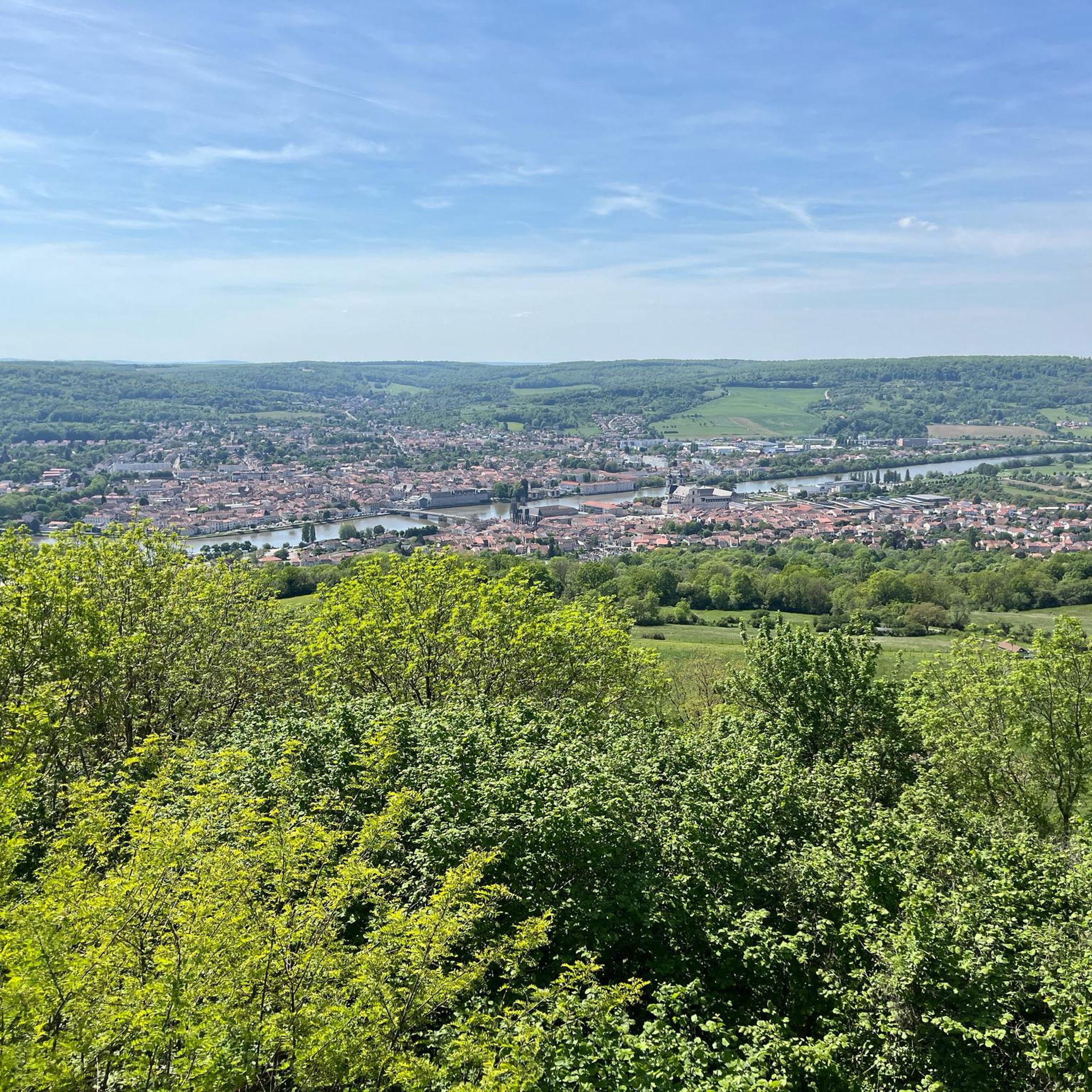

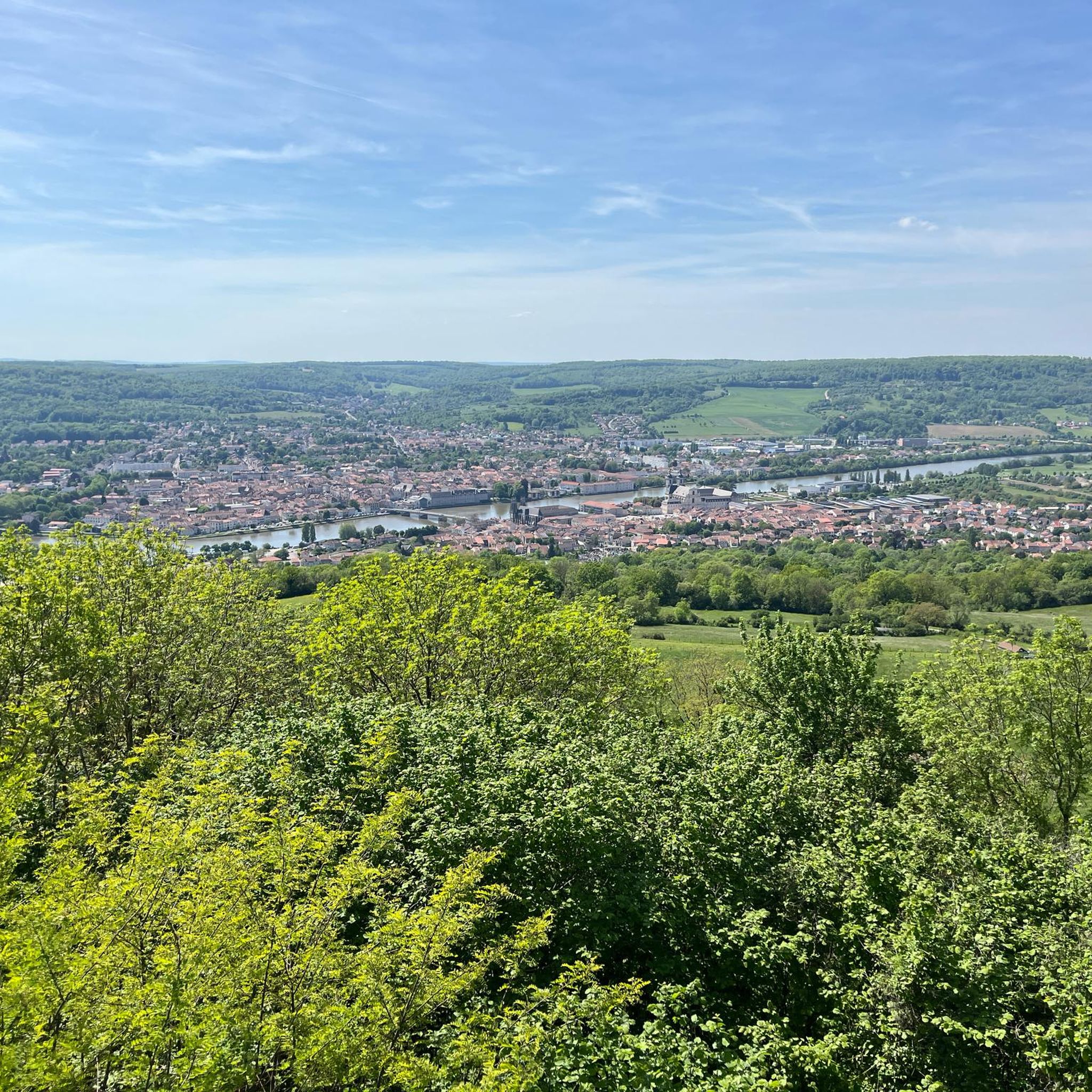
Tips from the Community

very impressive Roman architecture
0
0

further along the path along the river
0
0
beautiful aqueduct from Roman times
0
0
beautiful cycle path along the Moselle
0
0

Wild and unspoiled, the banks of the Moselle offer very beautiful picnic spots, or even for bivouacking! For cycling, they are exceptional.
0
0

The nature is exceptional, it is dotted with ponds with their small chalets
0
0
Frequently Asked Questions
How many road cycling routes are available around Morville-Sur-Seille?
There are over 130 road cycling routes around Morville-Sur-Seille, offering a wide variety of options for different skill levels and preferences. These routes traverse diverse landscapes, from flat river paths to more challenging ascents through wooded hills.
What kind of terrain can I expect on road cycling routes near Morville-Sur-Seille?
The region around Morville-Sur-Seille offers a varied terrain. You'll find mostly flat river paths along the Moselle, gentle elevation changes through vineyards, and some routes with more significant climbs in the wooded hills of the Lorraine Regional Natural Park. The local elevation ranges from 177 to 236 meters, indicating a mix of flat and undulating sections.
Are there any easy road cycling routes suitable for beginners or families?
Yes, the area offers several easy road cycling routes. The Moselle Cycle Path and the Boucle de la Moselle are known for their minimal elevation gain, making them ideal for leisure cyclists and families. A good example of an easy route is the Gélot Bridge – Pont-à-Mousson Town Centre loop from Éply, which is 19.4 miles (31.2 km) long.
What are some challenging road cycling routes in the Morville-Sur-Seille area?
For more experienced cyclists seeking a challenge, routes with greater distances and elevation gains are available. The Along the Moselle – Canal Path (La Voie Bleue) loop from Lorraine TGV is a difficult 150.3 miles (241.9 km) path with over 1000 meters of elevation gain, exploring extensive riverine landscapes.
What are the best seasons for road cycling around Morville-Sur-Seille?
The region is generally pleasant for road cycling from spring through autumn. Spring offers blooming landscapes, while summer provides warm weather for longer rides. Autumn brings beautiful foliage, especially in the wooded areas. While specific winter conditions are not detailed, the region can experience colder temperatures and potential snow, making spring to autumn the most favorable times.
What interesting landmarks or attractions can I see along the road cycling routes?
Many routes pass by or near significant cultural and natural attractions. You can explore the Pont-à-Mousson Town Centre, visit the historic Premonstratensian Abbey, or see St. Martin's Church. The Moselle Valley itself offers scenic views of vineyards and river loops, and the Lorraine Regional Natural Park provides beautiful natural landscapes.
Are there specific cycle paths or networks in the region?
Yes, the area is well-served by several prominent cycling networks. These include the extensive Moselle Cycle Path (Chemin de la Moselle / Velo Tour Moselle), the 85 km Boucle de la Moselle, and sections of the EuroVelo 5 (Via Romea). These networks offer well-signposted routes along canals, rivers, and through vineyards.
What do other road cyclists enjoy most about road cycling in Morville-Sur-Seille?
The area is highly rated by the komoot community, with an average score of 4.3 stars from over 110 reviews. Reviewers often praise the varied terrain, from the scenic river paths to the challenging climbs, and the opportunity to explore both natural beauty and historical sites. The well-developed cycling networks are also frequently highlighted.
Are there any loop routes available for road cycling?
Yes, many road cycling routes in the area are designed as loops, allowing you to start and end at the same point. For example, the Along the Moselle – Moselle Riverside Path loop from Lorraine TGV is a popular 74.6 miles (120.1 km) loop that follows the Moselle River.
Where can I find parking for road cycling routes around Morville-Sur-Seille?
While specific parking locations for each route are not detailed here, many routes, especially those starting from larger towns or transport hubs like Lorraine TGV, typically offer parking facilities. For routes originating in smaller villages like Éply or Port-sur-Seille, local parking options are usually available near the starting points.
Can I reach the road cycling routes by public transport?
Yes, some routes are accessible via public transport. For instance, routes like Along the Moselle – Moselle Riverside Path loop from Lorraine TGV and Along the Moselle – Canal Path (La Voie Bleue) loop from Lorraine TGV start from Lorraine TGV, a major transport hub, making them convenient for cyclists arriving by train.
Are there any routes that explore the Lorraine Regional Natural Park?
Yes, Morville-sur-Seille is within reach of the Lorraine Regional Natural Park, which features a network of well-developed cycle paths. Routes in this area will take you through deciduous forests, past rivers and ponds, and over wooded hills, offering a diverse natural experience. You can find more information about the park at tourisme-bassindepontamousson.fr.
Most popular routes around Morville-Sur-Seille
Most popular attractions around Morville-Sur-Seille

Get inspired with the komoot mobile app


Explore more
Browse the best Road cycling routes in other regions.
