The best cycling routes around Hauteville
4.8
(112)
2,526
riders
72
rides
Touring cycling routes around Hauteville traverse a landscape characterized by rolling hills, significant elevation changes, and views of local lakes and historic sites. The region features several cols, indicating a varied and often challenging terrain for cyclists. Routes frequently pass through areas with notable natural features and offer panoramic vistas.
Best touring cycling routes around Hauteville
- The most popular touring cycling route is Lake Carouge – Col du Frêne (950 m) loop from Hauteville, a 20.5 miles (33.0 km)…
Last updated: July 1, 2026
5.0
(1)
38
riders
33.0km
02:34
890m
890m
Hard bike ride. Very good fitness required. Mostly paved surfaces. Suitable for all skill levels.
38
riders
31.1km
02:14
600m
600m
Hard bike ride. Very good fitness required. Mostly paved surfaces. Suitable for all skill levels.

Sign up for free
30
riders
44.1km
03:27
1,140m
1,140m
Hard bike ride. Very good fitness required. Mostly paved surfaces. Suitable for all skill levels.
11
riders
30.3km
01:51
220m
220m
Moderate bike ride. Good fitness required. Mostly paved surfaces. Suitable for all skill levels.
12
riders
27.5km
02:01
470m
470m
Hard bike ride. Very good fitness required. Mostly paved surfaces. Suitable for all skill levels.
Get access to more routes and recommendations from other explorers.
Sign up for free
Already have an account?
Our route recommendations are based on thousands of hikes, rides, and runs completed by other people on komoot.
Start today with a free account
Your next adventure awaits.
Login or Signup



Tips from the Community

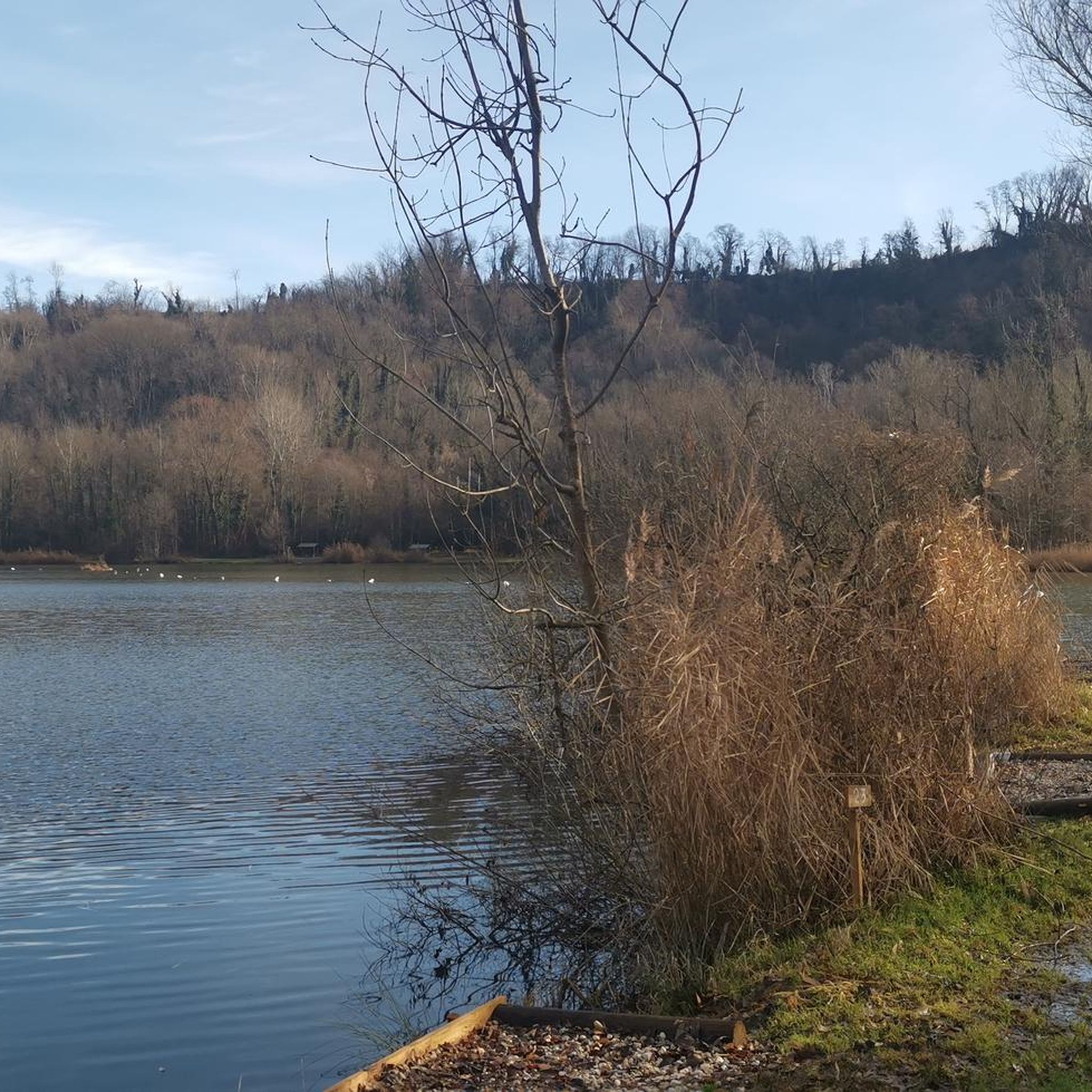
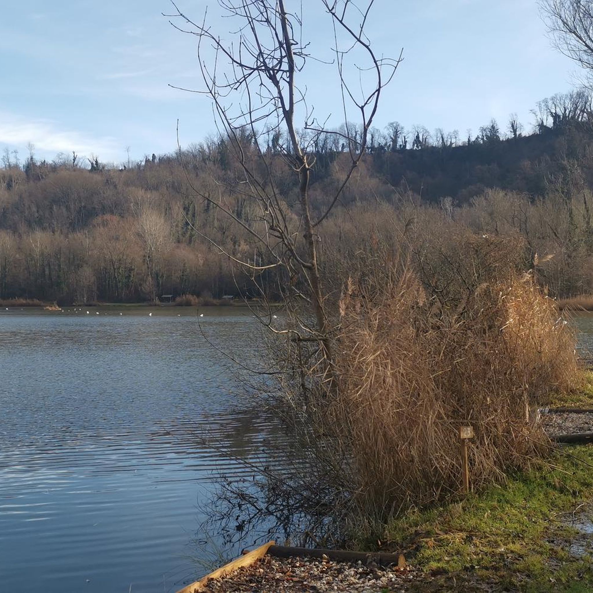
The place is clean and pleasant. There's room for everyone: fishermen, walkers, swimmers, cyclists...
0
0
The place is nice and clean. Ideal for fishing and plenty of room for swimming. A greenway runs alongside the pond...
0
0

Quiet little road to begin the ascent of the Col du Frêne. Very beautiful view.
0
0


Beautiful pass. The climb is a bit gentler from the north. The descent to the south offers beautiful views of the Isère Valley.
0
0
Beautiful quiet street with a view of the Chateau
0
0

Nice opportunity to take a refreshment after the climb - before the descent - unless you want to continue on to the pass
1
0

Col du Frêne from Saint Pierre d'Albigny is a climb in the Annecy region. It is 7.7 kilometres long and has a vertical ascent of 554 metres with an average gradient of 7.2%, implying a difficulty level of 483. The summit of the climb is located at 960 metres
0
0
Frequently Asked Questions
How many touring cycling routes are available around Hauteville?
There are over 75 touring cycling routes around Hauteville. The region offers a diverse range of options, from easier paths to more challenging rides with significant elevation changes.
Are there any easy touring cycling routes in Hauteville for beginners?
Yes, Hauteville offers 12 easy touring cycling routes suitable for beginners. These routes generally feature less elevation gain and shorter distances, allowing for a more relaxed experience. While specific examples are not provided here, you can find them on komoot.
What kind of terrain can I expect on touring cycling routes in Hauteville?
The terrain around Hauteville is characterized by rolling hills and significant elevation changes, often including ascents to various 'cols' or mountain passes. You can expect a mix of challenging climbs and scenic descents, with routes frequently offering views of local lakes and historic sites.
What are some scenic viewpoints or natural attractions along the cycling routes?
Many routes offer panoramic vistas. You can find stunning views from various peaks and passes. Notable highlights include Watch Rock, La Galoppaz Peak, and the challenging Col du Frêne (950 m). Routes also pass by historic châteaux and offer views of Lake Carouge.
Are there any circular touring cycling routes in the Hauteville area?
Yes, many touring cycling routes in Hauteville are designed as loops, allowing you to start and end at the same point. An example is the challenging Descent of the Frasses – View of Mont Blanc loop from Châteauneuf, which covers 17.1 miles (27.5 km) with 473 m of elevation gain.
What is the best season for touring cycling in Hauteville?
Given the region's significant elevation changes and mountain passes, the best season for touring cycling in Hauteville is typically from late spring through early autumn (May to October). During these months, the weather is generally more stable, and the higher passes are clear of snow, offering optimal conditions for exploring the varied terrain.
What do other touring cyclists enjoy most about cycling in Hauteville?
The area is highly rated by the komoot community, with an average score of 4.8 stars from over 140 reviews. Touring cyclists often praise the challenging climbs to cols, the scenic lake views, and the routes that pass by historical châteaux, highlighting the region's diverse and rewarding cycling experience.
Are there any touring cycling routes suitable for families with children?
While many routes in Hauteville feature significant elevation changes and are rated as difficult, there are 12 easy routes that might be more suitable for families or those seeking a less strenuous ride. It's advisable to check the specific route details for distance and elevation to ensure it matches your family's ability.
Can I find touring cycling routes that pass by cafes or places to stop for refreshments?
Many touring cycling routes in Hauteville pass through or near villages and towns where you can typically find cafes, bakeries, or small shops for refreshments. While specific cafes aren't listed for each route, planning your stops in advance using a map or komoot's highlight feature can help you locate suitable places.
What are the typical distances and elevation gains for touring cycling routes in Hauteville?
Touring cycling routes in Hauteville vary significantly. Distances can range from shorter easy routes to longer, more challenging ones like the Col de Cochette – Col de Cochette (587 m) loop from Betton-Bettonet, which is 14.3 miles (22.9 km) with 470 m of elevation gain. Difficult routes can feature over 1000 m of ascent, such as the Col du Frêne (950 m) – Col du Frêne (950 m) loop from Coise-Saint-Jean-Pied-Gauthier, covering 28.0 miles (45.1 km) with 1154 m of elevation.
Is public transport available to access touring cycling routes in Hauteville?
Public transport options in the Hauteville region may be limited, especially for reaching specific trailheads in more remote areas. It's recommended to research local bus services or train connections to nearby towns and then plan your cycling route accordingly. Many cyclists prefer to drive to a starting point with parking.
Are touring cycling routes in Hauteville dog-friendly?
While many outdoor areas in Hauteville are generally welcoming to dogs, specific regulations for touring cycling routes can vary. It's always best to check local signage or official tourism information for any restrictions regarding dogs on cycling paths, especially in nature reserves or protected areas. Always keep your dog on a leash and ensure they are comfortable with the distance and terrain.
Most popular routes around Hauteville
Most popular attractions around Hauteville

Get inspired with the komoot mobile app


Explore more
Browse the best Cycling routes in other regions.
