The best running trails around Banvillars
4.4
(223)
9,421
runners
439
runs
Jogging routes around Banvillars offer diverse running experiences across varied terrain, characterized by lush forests, picturesque valleys, and rolling ridges. The region features a mix of woodlands, open fields, and gentle elevations, providing suitable conditions for different fitness levels. An extensive network of trails, including those near the Parc Naturel Régional des Ballons des Vosges, ensures options for both short, easy runs and longer, more demanding sessions. Runners can also utilize towpaths along the Canal du Rhône au Rhin for…
Last updated: October 8, 2026
10
runners
Moderate run. Good fitness required. Mostly accessible paths. Some sure footedness required.
25
runners
28.2km
02:59
100m
100m
Hard run. Very good fitness required. Mostly paved surfaces. Suitable for all skill levels.

7
runners
11.8km
01:18
170m
170m
Moderate run. Good fitness required. Mostly paved surfaces. Suitable for all skill levels.
6
runners
9.26km
01:00
90m
90m
Moderate run. Good fitness required. Mostly paved surfaces. Suitable for all skill levels.
5
runners
8.29km
00:55
70m
70m
Moderate run. Good fitness required. Mostly paved surfaces. Suitable for all skill levels.
Get access to more routes and recommendations from other explorers.
Already have an account?
Our route recommendations are based on thousands of hikes, rides, and runs completed by other people on komoot.
Start today with a free account
Your next adventure awaits.


Tips from the Community

A beautiful green paradise between the highway and the city. The birdsong even drowns out the highway noise.
0
0

A beautiful strip of nature with waters and wet meadows, between the motorway and the city, for relaxation and enjoyment of nature.
3
0

This reserve, classified since 2008, helps protect the main bed of the Savoureuse, a river which crosses Montbéliard and Belfort. It helps preserve wetlands and the many species that live there, ranging from birds to amphibians. So, you may see gray woodpeckers, black kites or even kingfishers.
0
0

This reserve is a wetland that protects many species of fauna and flora. Enjoy this race around the Pâquis pond and the nature reserve.
2
0
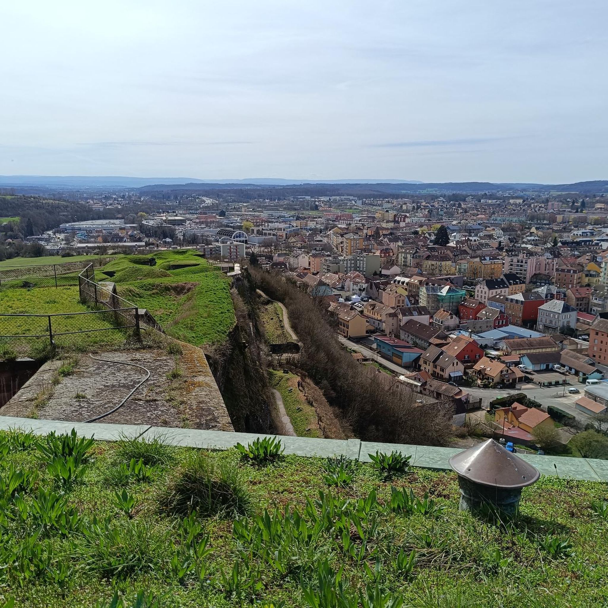
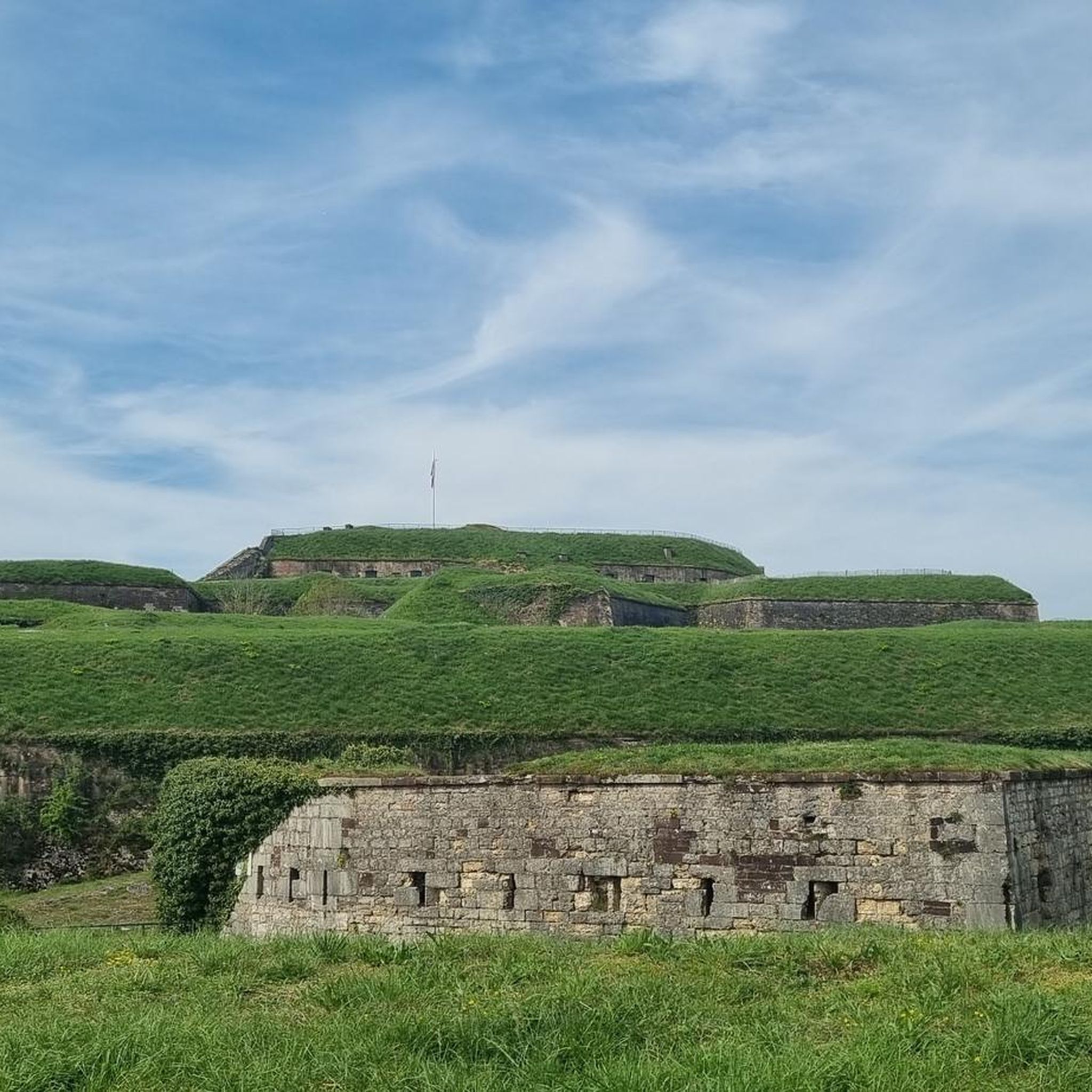
The construction of the Mont-Vaudois fort took 3 years between 1874 and 1877. In 1885, the invention of the torpedo shell, I suppose, bombarded the fort from above and led to the construction of an underground bunker as a defense. In 1944, faced with the advance of the Allies, a German unit occupied the fort and was driven out without success, despite a barrage of 3,000 shells. The Germans withdrew on their own. A testimony of this bunker built in 1885.
2
0
The construction of the Mont-Vaudois fort took 3 years between 1874 and 1877. In 1885, the invention of the torpedo shell, I suppose, bombarded the fort from above and led to the construction of an underground bunker as a defense. In 1944, faced with the advance of the Allies, a German unit occupied the fort and was driven out without success, despite a barrage of 3,000 shells. The Germans withdrew on their own. A testimony of this bunker built in 1885.
2
1
This reserve, classified since 2008, protects the major bed of the Savoureuse, a river that crosses Montbéliard and Belfort. It preserves wetlands and the many species that live there, ranging from birds to amphibians. Thus, you may see gray woodpeckers, black kites or even kingfishers.
3
0

The Territory of Belfort was born in 1871 from the Treaty of Frankfurt which put an end to the war of 1870-1871. It is then called "subsisting district of Haut-Rhin". Alsace and Lorraine had the particularity of being two bilingual regions and their dismantling was organized according to linguistic criteria. The German Empire thus gained by this treaty the greater part of Alsace and a quarter of Lorraine. The extreme south-west of the Haut-Rhin, around Belfort, was left to France and thus separated from the rest of Alsace. The main reason is that the population around Belfort was predominantly French-speaking (while the rest of Alsace was predominantly German-speaking, with the main Alsatian dialect being part of the Germanic languages). However, this was not an absolute criterion because there were French-speakers and German-speakers both in Belfort and in the rest of Alsace, only their proportion differed.
2
0
Frequently Asked Questions
How many running routes are available around Banvillars?
There are over 450 running routes around Banvillars, offering a wide variety of options for different preferences and fitness levels. The komoot community has explored these trails extensively, providing valuable insights.
Are there easy running routes suitable for beginners in Banvillars?
Yes, Banvillars offers a good selection of easy running routes perfect for beginners or those looking for a relaxed jog. There are 33 routes specifically categorized as easy, often featuring gentle terrain through woodlands and open fields.
Can I bring my dog on the running trails in Banvillars?
Many of the natural trails around Banvillars are suitable for running with dogs, especially those that wind through forests and open country paths. It's always a good idea to keep your dog on a leash and be mindful of local regulations and other trail users.
What are the typical lengths of running trails near Banvillars?
The running trails around Banvillars vary significantly in length. You can find options for short, quick runs as well as longer, more demanding sessions. The diverse network ensures there's a route to match your desired distance.
Are there family-friendly running routes in Banvillars?
Yes, Banvillars has several running routes that are suitable for families. These often feature well-maintained paths and less challenging terrain, making them enjoyable for all ages. Look for routes that traverse green spaces and offer easy access.
When is the best time of year to go running in Banvillars?
The region around Banvillars is generally pleasant for running throughout much of the year. Spring and autumn offer mild temperatures and beautiful scenery, while summer mornings and evenings are ideal. Even winter can be suitable, especially on well-maintained paths, though conditions may vary.
Where can I find scenic running routes with good viewpoints in Banvillars?
For scenic runs with rewarding views, consider routes that pass by natural attractions. For example, some trails offer glimpses of the Viewpoint overlooking Lake Malsaucy or wind through areas near the Savoureuse Valley Nature Reserve, providing picturesque backdrops for your run.
Are there any interesting landmarks or attractions along the running routes?
Yes, several running routes in the Banvillars area pass by interesting landmarks. You might encounter sections of the Montbéliard–Haute-Saône Canal, or even historical sites like the Citadel of Belfort on longer excursions. The region also features various lakes and ponds like Étang du Malsaucy.
What do other runners enjoy most about jogging in Banvillars?
The running routes in Banvillars are highly rated by the komoot community, with an average score of 4.5 stars from over 200 reviews. Runners often praise the diverse terrain, which includes a mix of forest trails, open country paths, and gentle hills, as well as the natural beauty and varied surfaces.
Are there circular running routes available in Banvillars?
Yes, many of the running routes around Banvillars are designed as circular paths, allowing you to start and finish at the same point. This makes planning your run more convenient, especially if you're driving to the trailhead.
Are there running routes in Banvillars with convenient parking?
While specific parking details vary by route, many trailheads and popular starting points for running routes in Banvillars are accessible by car and offer parking facilities. It's advisable to check the route details on komoot for specific parking information before you go.
What kind of terrain can I expect on the running trails in Banvillars?
The running trails in Banvillars feature a diverse range of terrain. You can expect a mix of woodlands, open fields, and gentle elevations. The paths often include forest trails, open country paths, and some gentle hills, providing varied surfaces for your run.
Most popular routes around Banvillars
Most popular attractions around Banvillars

Get inspired with the komoot mobile app


Explore more
Browse the best Running Trails & Routes in other regions.
