The best walks and hikes around Lussas
4.4
(493)
2,114
hikers
26
hikes
Hiking around Lussas offers diverse natural landscapes, characterized by limestone plateaus, deep valleys, and the impressive Louyre Canyon. The region is situated at the foot of the Coiron Massif, contributing to its varied and elevated topography. Hikers can explore a mix of terrain, from relatively flat plateaus to more rugged canyon paths. This area provides a range of trails suitable for different experience levels.
Best hiking trails around Lussas
- The most popular hiking route is The Canyon de la Louyre…
Last updated: September 1, 2026
4.5
(61)
201
hikers
12.5km
03:37
300m
300m
Moderate hike. Good fitness required. Easily-accessible paths. Suitable for all skill levels.
4.5
(32)
93
hikers
Easy hike. Great for any fitness level. Easily-accessible paths. Suitable for all skill levels.

Sign up for free
4.2
(17)
75
hikers
Moderate hike. Good fitness required. Easily-accessible paths. Suitable for all skill levels.
4.2
(18)
75
hikers
Moderate hike. Good fitness required. Easily-accessible paths. Suitable for all skill levels.
4.5
(13)
65
hikers
5.39km
01:28
70m
70m
Easy hike. Great for any fitness level. Easily-accessible paths. Suitable for all skill levels.
Get access to more routes and recommendations from other explorers.
Sign up for free
Already have an account?
Our route recommendations are based on thousands of hikes, rides, and runs completed by other people on komoot.
Start today with a free account
Your next adventure awaits.
Login or Signup

Tips from the Community

The path was lost for me when I was about to cross back, found again thanks to a cairn (thanks) then lost again a little further up. The GPS is struggling. Quite a few brambles to get out of the canyon on the Lussas side.
0
0

sometimes difficult to follow the route but very pleasant to walk in the (dry) river bed
0
0

No difficulty or difference in altitude, very nice!
1
0

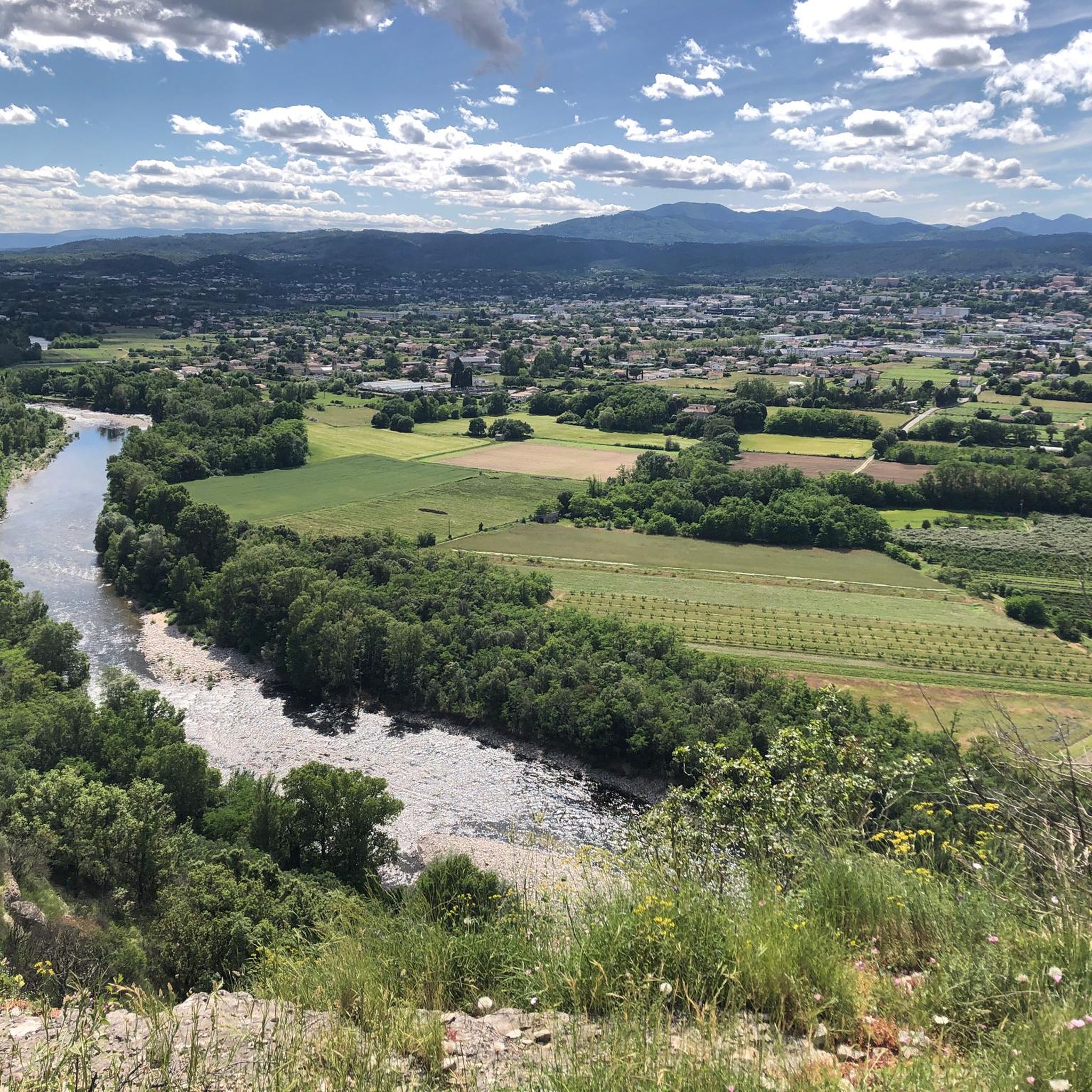
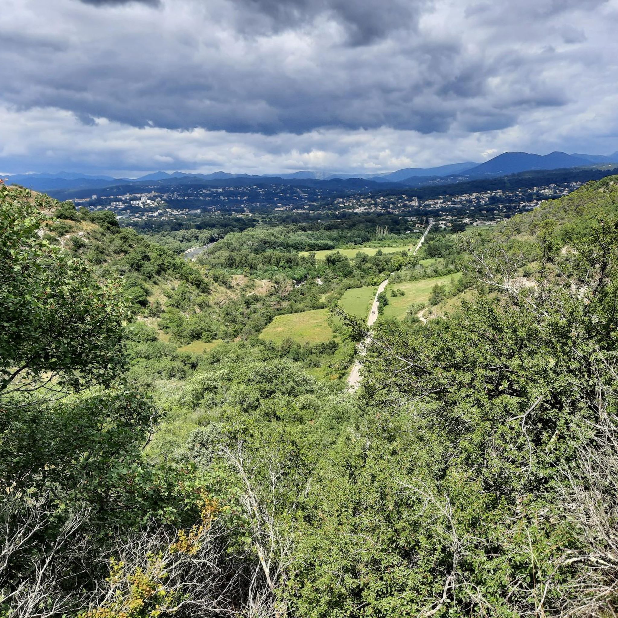
Nice hike taking the path that runs along the canyon above. Nice view
1
1
Warning ⚠️: lost path going down into the gorges after Sevenier. GPS in the cabbages, path eaten by vegetation, landslide,.... ??? We had to turn back
3
1

You are not in the canyon as suggested by the fist foto. You have a panoramic view on the canyon from above
3
2

Sources: https://www.pop.culture.gouv.fr/notice/merimee/PA00116726 "Gallic oppidum of the barred spur type, dominating the Ardèche. On the accessible side, it is defended by a monumental wall presenting three stages of construction. The first is represented by a rectilinear dry stone wall, pierced by a cart door which delimits a four-hectare oppidum, dated 130 AC Then, the enlargement of the oppidum results in a massive work punctuated by square towers involved in the work. An external clavicula, usually found in Roman camps and serving as the forward defense of the gate, and the use of mortar to bind the core are seen in this second phase dating back to around 80 AC. Finally, a third phase, around 50 AC, doubles this construction of overhanging towers, alternately round and square. This last state uses mortar more widely for facings and towers. At the rear of these fortifications is perceptible a habitat composed of houses of different sizes interspersed by a network of roads. This site is undoubtedly the former administrative center of the city of the Helvians, before the creation of Alba Helviorum."
1
1

This canyon is quite spectacular in its presentation. Its layers of rock are visible to all, revealed by the water of the Louyre stream for thousands of years.
3
3
Frequently Asked Questions
How many hiking trails are available around Lussas?
Lussas offers a good variety of hiking opportunities, with over 25 recognized routes. These trails cater to different fitness levels, ranging from easy walks to more challenging moderate hikes, allowing you to explore the diverse landscapes of the Ardèche.
What are the main natural features I'll encounter on hikes in Lussas?
The region around Lussas is characterized by its striking natural scenery. You'll find impressive limestone plateaus, such as the "Plateau des Gras," and deep valleys. A prominent feature is the wild and exotic Louyre Canyon, which offers dramatic views and paths along its ravine. The area is also at the foot of the Coiron Massif, contributing to its varied topography.
Are there any easy hiking trails suitable for beginners or casual walkers?
Yes, Lussas has several easy hiking options. There are 11 routes classified as easy, perfect for a relaxed stroll. For example, the View of the Louyre Canyon loop from Aire de stationnement is a gentle 5.8 km path with minimal elevation gain, offering pleasant views without much effort.
Can I find circular hiking routes in Lussas?
Many of the trails around Lussas are designed as circular routes, allowing you to start and end at the same point. This is ideal for convenience, especially if you're driving. The popular View of the Louyre Canyon loop from Lussas is a great example, providing a scenic loop starting directly from the village.
What historical sites or landmarks can I see while hiking in the area?
Lussas and its surroundings are rich in history, with several sites integrated into the natural landscape. You can discover Roman relics, including traces of the Antonin route. A significant historical and natural site is the Jastres Oppidum, a Gallic oppidum with monumental walls that dominates the Ardèche region. Additionally, the prehistoric Dolmen of the Four Stones in Mias is another interesting point of interest.
What do other hikers say about the trails in Lussas?
The hiking trails in Lussas are highly regarded by the komoot community, holding an average rating of 4.4 stars from over 400 reviews. Hikers frequently praise the diverse scenery, the well-maintained paths, and the opportunity to explore both the dramatic Louyre Canyon and the peaceful limestone plateaus.
Are there any challenging hikes for experienced trekkers?
While most trails are easy to moderate, there are a couple of more challenging routes for those seeking a greater adventure. These routes often feature more significant elevation changes and rugged terrain, providing a good workout amidst the beautiful Ardèche landscape.
Is Lussas a good destination for family-friendly hikes?
Yes, Lussas is well-suited for family outings. The region's varied terrain includes many easy and moderate trails with relatively little elevation gain, particularly on the limestone plateaus. These paths are perfect for families with children, offering accessible ways to enjoy nature and explore the local environment together.
What is the best time of year to go hiking in Lussas?
The Ardèche region, including Lussas, generally offers pleasant hiking conditions from spring through autumn. Spring brings blooming wildflowers and mild temperatures, while autumn provides comfortable weather and beautiful fall foliage. Summers can be warm, so early morning or late afternoon hikes are often preferred during this season.
Are there any trails that offer panoramic views?
Absolutely. Many trails, especially those on the heights overlooking the Louyre Canyon or the Coiron Massif, provide expansive, unobstructed views. For instance, the View of Séveniers – View of the Louyre Canyon loop from Aire de stationnement offers superb vistas over the canyon and the surrounding landscape, including glimpses of Aubenas.
What kind of wildlife might I spot while hiking in Lussas?
The diverse natural habitats around Lussas, from canyons to plateaus, support a variety of wildlife. Hikers might spot various bird species, small mammals, and a rich array of insects and reptiles. The area's natural beauty provides excellent opportunities for nature observation, especially in quieter sections of the trails.
Are there any specific attractions or points of interest near the hiking routes?
Beyond the natural beauty, you can find several interesting points near the trails. For example, the Viaduct Over the Auzon is a notable bridge, and the charming settlement of Vogüé, with its castle, is also within reach. These attractions can complement your hiking experience with cultural and architectural interest.
Most popular attractions around Lussas

Get inspired with the komoot mobile app


Explore more
Browse the best Hikes in other regions.
