The best road cycling routes around Mörchingen
4.5
(4)
135
riders
44
rides
Road cycling around Mörchingen, also known as Morhange, offers diverse landscapes with mostly paved surfaces suitable for various fitness levels. The region features a varied topography, including hilly areas intersected by rivers like the Nied Allemande, providing engaging challenges and picturesque backdrops. Notable natural features include the Grand Pond of Mittersheim, a significant 220-hectare body of water, and surrounding forests. These elements combine to create a compelling destination for road cyclists.
Best road cycling routes around Mörchingen
- The most popular…
Last updated: August 19, 2026
9
riders
72.0km
03:02
500m
500m
Moderate road ride. Good fitness required. Mostly well-paved surfaces and easy to ride.
8
riders
38.0km
01:40
310m
310m
Moderate road ride. Good fitness required. Mostly well-paved surfaces and easy to ride.

Sign up for free
3
riders
55.8km
02:29
550m
550m
Moderate road ride. Good fitness required. Mostly well-paved surfaces and easy to ride.
5.0
(1)
4
riders
Moderate road ride. Good fitness required. Mostly well-paved surfaces and easy to ride.
5
riders
Moderate road ride. Good fitness required. Mostly well-paved surfaces and easy to ride.
Get access to more routes and recommendations from other explorers.
Sign up for free
Already have an account?
Our route recommendations are based on thousands of hikes, rides, and runs completed by other people on komoot.
Start today with a free account
Your next adventure awaits.
Login or Signup


Tips from the Community

In good weather, you can enjoy a wonderful view of the Seille valley here. 👍
0
0
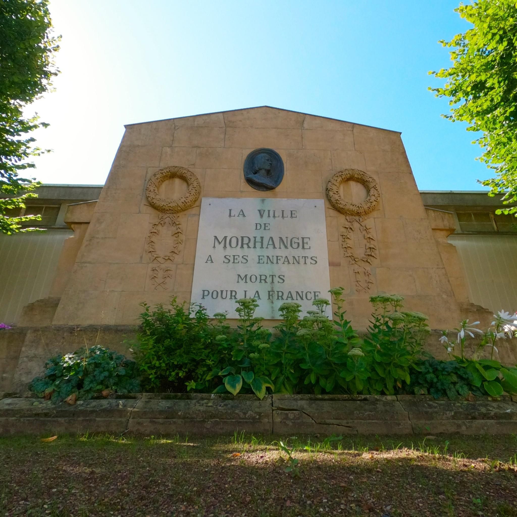
Monument to the fallen of the two world wars 🕊
0
0
Memorial to the fallen of the two World Wars 🕊
0
0
Monument to the fallen of the 134th American Infantry Regiment in World War II 🕊
0
0
Monument to the fallen of both world wars 🕊
0
0

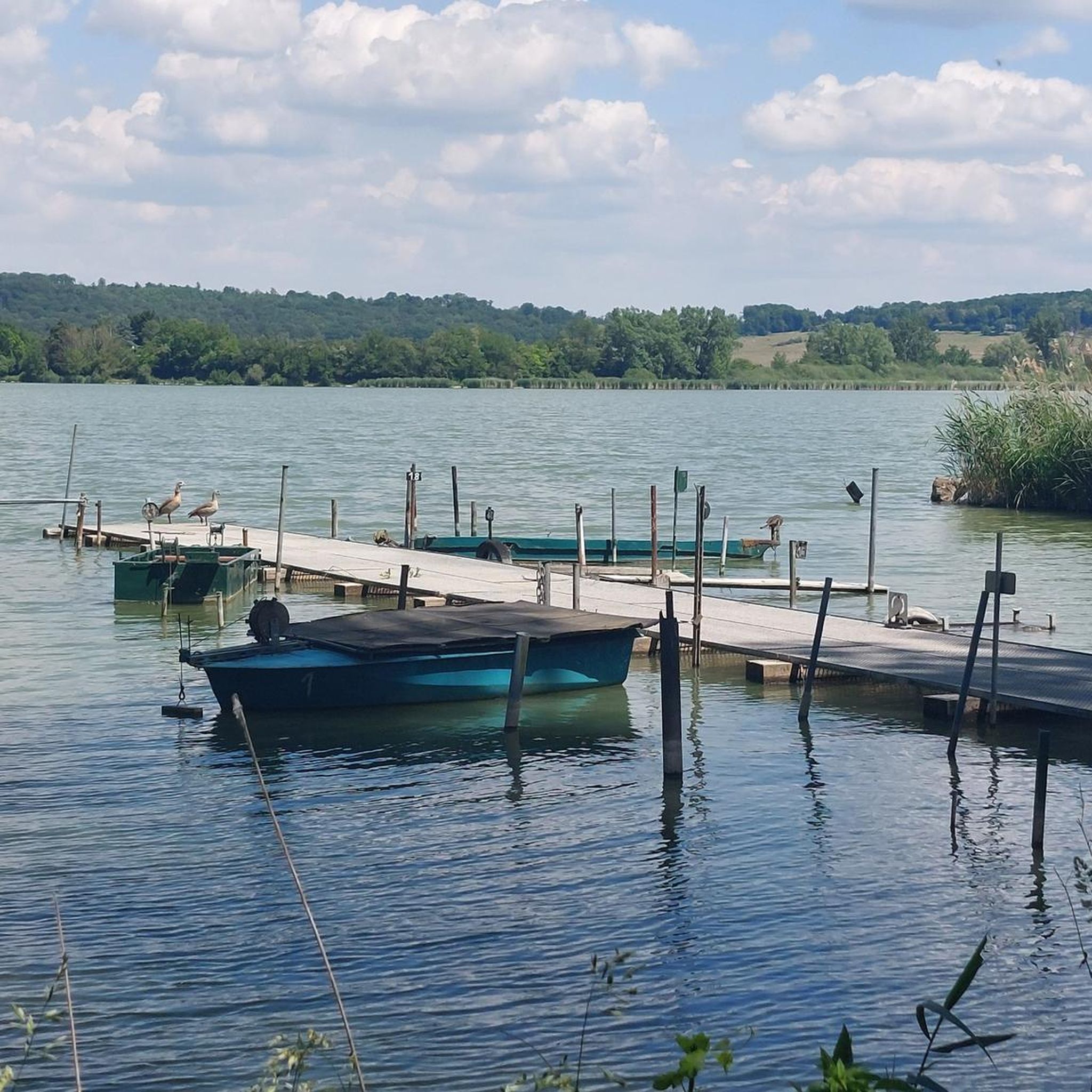
The Hoste Bas pond borders the Hoste Haut pond. It was part of the Maginot Line defense system. Today, they are home to numerous species of fish, much to the delight of anglers.
0
1

Historic site with well-preserved bunkers and tracked vehicle🐯🚴
0
0
Memorial to the fallen of the two world wars 🕊️
0
0
Frequently Asked Questions
How many road cycling routes are available around Mörchingen?
There are over 50 road cycling routes around Mörchingen (Morhange) documented on komoot, offering diverse options for cyclists. These include 9 easy routes, 34 moderate routes, and 8 challenging routes, catering to various fitness levels.
What kind of terrain can I expect on road cycling routes in Mörchingen?
Road cycling routes in Mörchingen feature a varied topography, including hilly landscapes intersected by rivers like the Nied Allemande. You'll find mostly paved surfaces, making them suitable for road bikes. The region offers engaging challenges and picturesque backdrops, with routes leading through forests and past natural features.
Are there any scenic natural features to see while road cycling in Mörchingen?
Yes, a significant natural highlight is the Grand Pond of Mittersheim (Etang de Mittersheim), a 220-hectare body of water traversed by the Saar Coal Canal. Many routes offer scenic views around this pond. You might also encounter areas known for storks, which are part of the region's diverse ecosystems.
Are there any loop routes for road cycling in Mörchingen?
Many road cycling routes in Mörchingen are designed as loops. For example, the Étang de Welschhof – Lower Hoste Pond loop from Morhange is a popular option, offering scenic views around the ponds. Another is the Montdidier – Denkmal für die Gefallenen 🕊️ loop from Morhange, which leads through varied terrain with historical points of interest.
What do other road cyclists enjoy most about cycling in Mörchingen?
The road cycling routes in Mörchingen are highly rated by the komoot community, with an average score of 4.7 stars. Cyclists often praise the varied terrain, which includes both challenging hilly sections and idyllic lowlands, as well as the scenic beauty of natural features like the Grand Pond of Mittersheim.
Are there any historical landmarks along the road cycling routes?
Yes, some routes pass by historical landmarks. For instance, the War Memorial and Clock Tower – Book Cabin of Suisse loop from Morhange is a moderate path that passes historical landmarks, offering a blend of natural beauty and cultural interest.
What is the best time of year for road cycling in Mörchingen?
The region's diverse landscapes and natural features are enjoyable throughout the warmer months. Spring and autumn generally offer pleasant temperatures and beautiful scenery, while summer provides longer daylight hours. Always check local weather conditions before heading out.
Are there family-friendly road cycling routes in Mörchingen?
While specific 'family-friendly' designations for road cycling can vary, Mörchingen offers 9 easy routes that are generally shorter and have less elevation gain, making them more accessible for families or those seeking a relaxed ride. These routes often follow paved surfaces suitable for a comfortable family outing.
Where can I find information about parking for road cycling routes in Mörchingen?
While specific parking details for each trailhead are not provided here, many routes start and end in or near Morhange, where public parking options are typically available. For detailed information on parking at specific starting points, it's recommended to check the individual route descriptions on komoot or local municipal websites.
Can I access road cycling routes in Mörchingen using public transport?
Mörchingen (Morhange) is a town in the Moselle department of France. While local public transport options exist, their suitability for accessing specific road cycling trailheads with a bike may vary. It's advisable to research local bus or train services to Morhange and their bike carriage policies if you plan to use public transport.
Are there any permits required for road cycling in Mörchingen?
Generally, no specific permits are required for road cycling on public roads and designated cycling paths in the Mörchingen region. However, always respect local regulations, private property, and any signage indicating restricted areas.
What is the typical duration for road cycling routes in Mörchingen?
Route durations vary significantly based on distance and elevation. For example, the Étang de Welschhof – Lower Hoste Pond loop from Morhange is approximately 46.3 miles (74.5 km) and takes about 3 hours 9 minutes, while the Denkmal für die Gefallenen 🕊️ loop from Morhange is 45.5 miles (73.2 km) and typically takes around 2 hours 6 minutes.

Get inspired with the komoot mobile app


Explore more
Browse the best Road cycling routes in other regions.
