The best walks and hikes around Belmont-Bretenoux
4.6
(615)
3,140
hikers
146
hikes
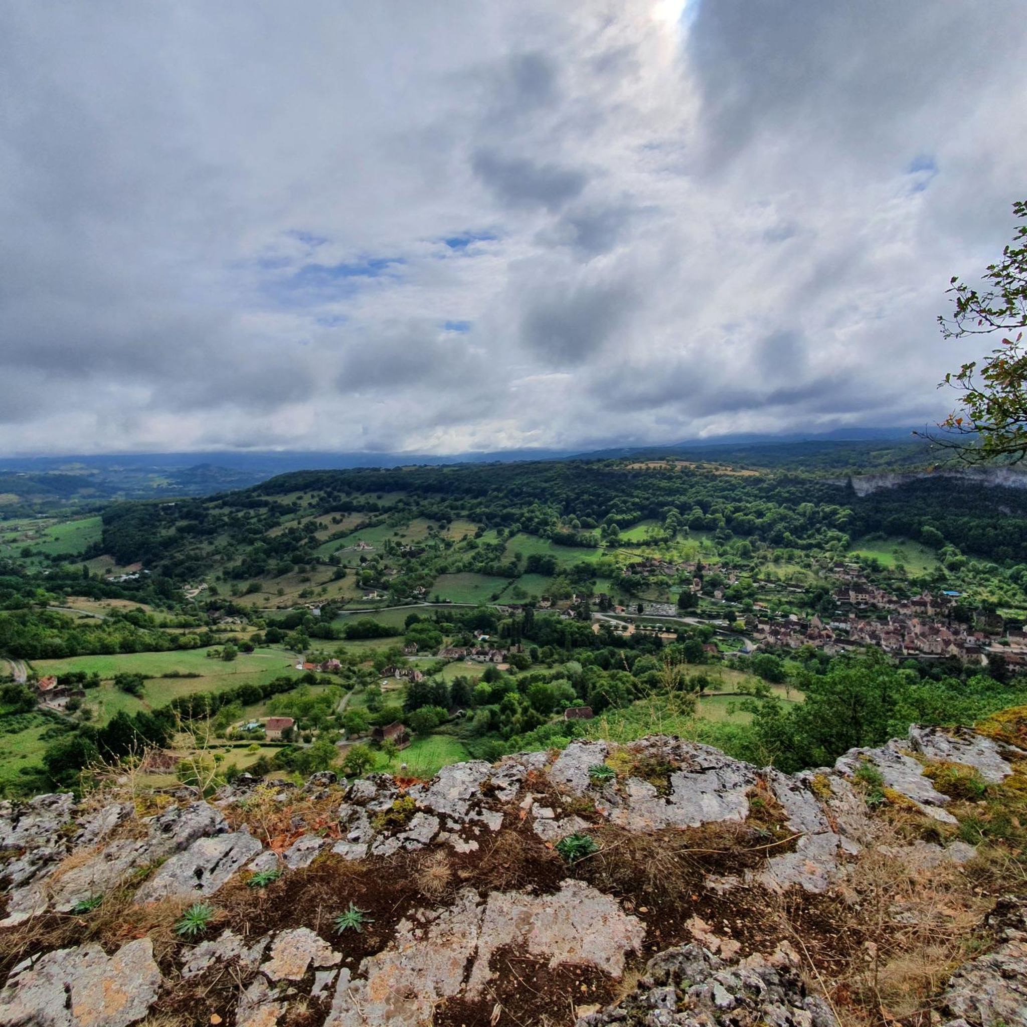
Hiking around Belmont-Bretenoux, located in France's Occitanie region, offers diverse terrain within a hilly topography. The area is characterized by the valleys of the Dordogne, Cère, and Bave rivers, contributing to a lush landscape that includes significant forest areas. Elevations such as Pech d'Embrieu and Pech de Rimont (340 meters), with the highest point at Esclat (403 meters), provide various viewpoints. This region forms part of the "Limargues," the sedimentary border of the Massif Central.
Best hiking trails in Belmont-Bretenoux
…Last updated: June 29, 2026
4.6
(10)
17
hikers
10.5km
03:00
240m
240m
Moderate hike. Good fitness required. Easily-accessible paths. Suitable for all skill levels.
4.6
(8)
51
hikers
9.26km
02:39
220m
220m
Moderate hike. Good fitness required. Easily-accessible paths. Suitable for all skill levels.

Sign up for free
4.0
(4)
16
hikers
6.52km
01:58
220m
220m
Easy hike. Great for any fitness level. Easily-accessible paths. Suitable for all skill levels.
8
hikers
5.27km
01:26
70m
70m
Easy hike. Great for any fitness level. Easily-accessible paths. Suitable for all skill levels.
4.5
(6)
16
hikers
10.4km
03:02
290m
290m
Moderate hike. Good fitness required. Easily-accessible paths. Suitable for all skill levels.
Get access to more routes and recommendations from other explorers.
Sign up for free
Already have an account?
Our route recommendations are based on thousands of hikes, rides, and runs completed by other people on komoot.
Start today with a free account
Your next adventure awaits.
Login or Signup



Tips from the Community

By the artist Marc Petitt - "The Guardians of the Angel" A bronze figure by the artist also stands in Cahors' "The Lazaret Angel" next to the cathedral.
1
0
Be sure to stop by and try it if you're in the old town.
1
0

Small, bustling town. Lively center, beautiful view of the castle.
1
0

Must see: The art collection in the castle also includes seven large-format tapestries from the 17th century with scenes from country life.
0
0

Passing by, do not forget to appreciate this beautiful little mill.
3
0
This beautiful little castle has a secret. In March 1943, the Mona Lisa was kept there until it was transferred to the Louvre in June 1945.
3
0

Saint-Céré is a commune in the Lot department of France. The municipality had 3,414 inhabitants on January 1, 2019. The place is part of the arrondissement of Figeac. Saint-Céré is located in the south of the Dordogne valley on the Bave, a river that has been canalized since the 17th century
2
0
Every Sunday regional weekly market on the Place de la République, it couldn't be fresher!
3
0
Frequently Asked Questions
How many hiking trails are available in Belmont-Bretenoux?
Belmont-Bretenoux offers a wide selection of hiking opportunities, with over 120 routes available. These trails cater to various fitness levels, including more than 50 easy routes, nearly 70 moderate options, and a few challenging paths for experienced hikers.
What kind of natural features can I expect to see while hiking in Belmont-Bretenoux?
The region is characterized by its hilly topography and lush river valleys, including the Dordogne, Cère, and Bave. You'll find extensive forests covering 107 hectares within the commune. Notable natural features include the impressive Autoire Waterfall and the dramatic Gorges d'Autoire. For those interested in geological wonders, the famous Gouffre de Padirac cave system is also nearby.
Are there any historical sites or castles visible from the hiking trails?
Yes, the area is rich in history. Many trails offer views of impressive châteaux, such as the Château de Saint-Laurent-Les-Tours and the majestic Montal Castle. You can also explore the ruins of the Château des Anglais near Autoire, or enjoy a view of the Castelnau-de-Bretenoux castle from various vantage points.
What do other hikers enjoy most about hiking in Belmont-Bretenoux?
The hiking experience in Belmont-Bretenoux is highly regarded by the komoot community, with an average rating of 4.6 stars from over 600 reviews. Hikers frequently praise the varied terrain, the well-marked paths, and the beautiful blend of natural landscapes and historical sites.
Are there any easy, family-friendly hiking options in the area?
Yes, Belmont-Bretenoux offers over 50 easy routes suitable for families. A good option is the Hiking loop from Saint-Céré, which is 4.0 miles (6.5 km) long and typically takes under two hours to complete, leading through pleasant local landscapes.
Can I find circular hiking routes in Belmont-Bretenoux?
Many of the trails in Belmont-Bretenoux are designed as circular routes, allowing you to start and end at the same point. For example, the Le moulin Haut and château de Montal — loop from Saint-Céré is a popular moderate option that takes you past historic sites.
Are there any trails that pass by lakes or other water bodies?
The region is defined by its river valleys, and you can find trails that lead to or near water bodies. The Lac des Gours is a notable lake in the area, offering a tranquil spot that can be incorporated into a hike.
What are the highest points or best viewpoints for panoramic views?
Prominent elevations like the Pech d'Embrieu and the Pech de Rimont (340 meters), with the highest point at Esclat (403 meters), offer excellent panoramic views. From various vantage points, you can admire the conical hills of Saint-Laurent-Les-Tours and, on clear days, even the distant Château de Turenne. The View of the Castelnau-de-Bretenoux castle is another recommended viewpoint.
Are there any trails that explore the local vineyards?
Yes, you can experience the local viticulture on trails such as The vineyards of Glanes loop from Glanes. This moderate route is about 6.4 miles (10.4 km) long and offers a different perspective of the region's agricultural landscape.
What is the terrain like for hiking in Belmont-Bretenoux?
The terrain in Belmont-Bretenoux is primarily hilly, described as 'chahutée,' offering diverse landscapes. You'll encounter paths through woods, meadows, and river valleys. The trails are generally well-maintained and often marked in red, providing a mix of ascents and descents characteristic of the Limargues region, which borders the Massif Central.
Are there any charming villages to explore near the hiking routes?
Absolutely. The region is home to several picturesque villages. Autoire is popular for its atmosphere and proximity to the waterfall. Loubressac offers beautiful views over the Dordogne valley, and Carennac boasts a historic center with an 11th-century church and cloister. Loubressac Village is a particularly charming settlement to visit.
Most popular routes around Belmont-Bretenoux
Most popular attractions around Belmont-Bretenoux

Get inspired with the komoot mobile app


Explore more
Browse the best Hikes in other regions.
