Top 6 Mountain Passes around Chamoux-Sur-Gelon
Mountain passes around Chamoux-Sur-Gelon, located in the Savoie department of France, provide access to the Bauges and Belledonne massifs. The region is characterized by its mountainous terrain, offering routes for cycling, hiking, and scenic drives. These passes feature varied gradients and provide views of the surrounding valleys and peaks. The area's natural landscape includes forested sections and open pastures.
Best mountain passes around Chamoux-Sur-Gelon
- The most popular mountain passes is Marocaz Pass, a mountain pass that is considered one…
Last updated: May 14, 2026
Marocaz Pass
Highlight (Segment) • Mountain Pass
Tip by

Col du Frêne (950 m)
Highlight • Mountain Pass
Translated by Google •
Tip by

Sign up now to discover places like this
Get recommendations on the best single tracks, peaks, & plenty of other exciting outdoor places.
Sign up for free
Col du Grand Cucheron
Highlight (Segment) • Mountain Pass
Translated by Google •
Tip by

Col de Champlaurent
Highlight • Mountain Pass
Translated by Google •
Tip by

Col de Cochette (587 m)
Highlight • Mountain Pass
From Villard-d'Héry, …
Translated by Google •
Tip by
Sign up for free to discover even more mountain passes around Chamoux-Sur-Gelon.
Sign up for free
Already have an account?
Start today with a free account
Your next adventure awaits.
Login or Signup

Tips from the Community

just magnificent, keep it secret or almost....
0
0

Quiet little road to begin the ascent of the Col du Frêne. Very beautiful view.
0
0

Beautiful pass. The climb is a bit gentler from the north. The descent to the south offers beautiful views of the Isère Valley.
0
0

magnificent view of the snow-capped mountains at the end of May
1
0

Col du Frêne from Saint Pierre d'Albigny is a climb in the Annecy region. It is 7.7 kilometres long and has a vertical ascent of 554 metres with an average gradient of 7.2%, implying a difficulty level of 483. The summit of the climb is located at 960 metres
0
0

Very nice pass; % real on the terminals. Hard but really quiet, because very few vehicles. Not very long either.
1
0

The climb is very pretty and pleasant until the Col
1
0
Large parts of the tour have very little traffic, so you can enjoy the beautiful nature even more.
1
0
Frequently Asked Questions
What kind of views can I expect from the mountain passes near Chamoux-sur-Gelon?
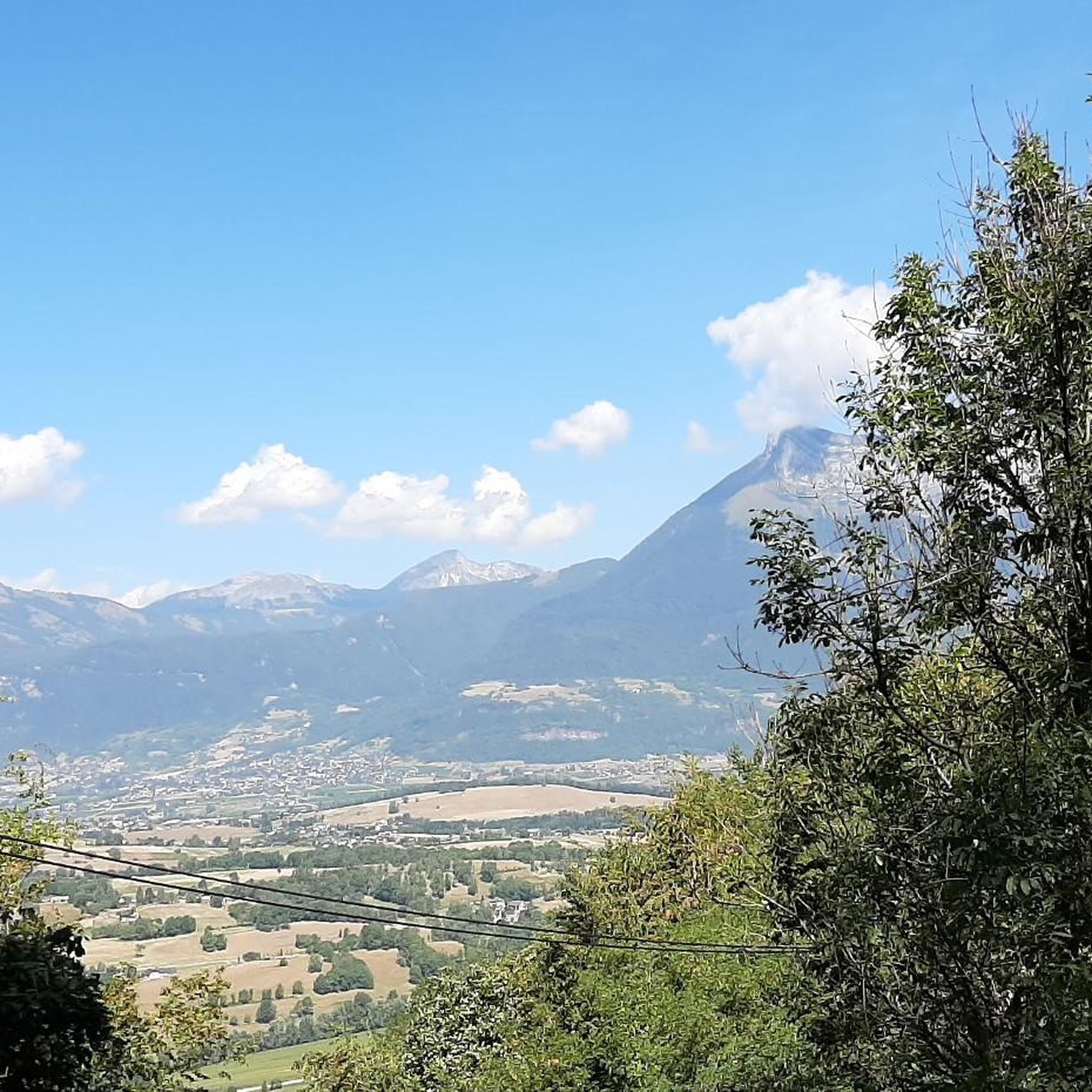
The mountain passes offer diverse and stunning views. From Col du Frêne (950 m), you can enjoy vistas of the Combe de Savoie, the impressive Dent d’Arclusaz, and even a glimpse of Mont Blanc on clear days. Marocaz Pass is celebrated for its panoramic views of surrounding mountain ranges and valleys. From Col du Grand Cucheron, you'll see the Bauges massif, including the Dent d'Arclusaz. Even the lower Col de Cochette (587 m) can offer exceptional views of Saint-Jorioz, Sevrier, and Annecy on certain routes.
How challenging are the mountain passes around Chamoux-sur-Gelon for cyclists?
The passes offer a range of challenges. Col du Grand Cucheron is a well-known climb, featured in the Tour de France, with an average slope of 6.94% and maximum gradients up to 13.1%. Col de Champlaurent is considered particularly tough from the northern side, with an average gradient around 8%. Marocaz Pass, while shorter, features percentages sometimes exceeding 10%. Col du Frêne (950 m) offers varying slopes, from gentle sections to steeper ramps.
What outdoor activities are popular around the mountain passes near Chamoux-sur-Gelon?
The region is excellent for road cycling, mountain biking, and hiking. Many passes, like Col du Grand Cucheron and Col de Champlaurent, are popular cycling routes. For hiking, you can find various trails, from moderate to challenging. For more specific routes, explore our guides on Hiking around Chamoux-Sur-Gelon, Gravel biking around Chamoux-Sur-Gelon, and MTB Trails around Chamoux-Sur-Gelon.
When is the best time to visit the mountain passes near Chamoux-sur-Gelon?
The summer months are generally ideal for visiting the mountain passes. Many routes, such as the climb to Col du Grand Cucheron, offer shade during this time, providing welcome coolness. The pleasant roads and often shaded sections of passes like Col du Frêne (950 m) also make them enjoyable during warmer weather.
Are there family-friendly options among the mountain passes or nearby trails?
While some passes present significant challenges, there are options for varying skill levels. For instance, some routes through Col de Cochette (587 m) are more moderate and family-friendly, though others are recommended for experienced hikers. For easy hiking, consider routes like the Col de Champlaurent loop from Champlaurent (5.5 km) or the Lake Carouge loop from Châteauneuf (2.3 km).
Is parking available at the mountain passes?
Yes, parking is available at some of the passes. For example, there is parking available at the summit of Col du Frêne (950 m), making it convenient for those looking to hike or jog from there. Col du Grand Cucheron also features a small picnic area at the top, which implies parking access.
What makes Col du Grand Cucheron a notable mountain pass?
Col du Grand Cucheron is located at the northern end of the Belledonne massif and is a well-known climb among cyclists. It has been featured three times in the Tour de France, most recently in 2012, classified as a Category 2 climb. The ascent from La Corbière is 11.6 kilometers long with an average slope of 6.94% and offers good shade during summer months. You can find more historical context on Wikipedia.
What are some unique features of Col de Champlaurent?
Col de Champlaurent is often tackled in conjunction with Col du Grand Cucheron for a challenging cycling route. The ascent from Chamoux-sur-Gelon is known for its tough, regular gradient (around 8%), allowing cyclists to find a good rhythm. Upon reaching the pastures at the top, visitors are rewarded with uncrowded surroundings and beautiful views of the Maurienne massifs. A fresh drinking water point is also available during the climb.
What is special about Marocaz Pass?
Marocaz Pass is celebrated as one of the most beautiful climbs in the region, offering stunning views of the surrounding mountain ranges and valley. While relatively short, it features challenging percentages sometimes exceeding 10%. The climb is exposed to the south, providing ample sunshine, and offers a beautiful descent towards Chamoux-sur-Gelon. Hikers and cyclists can extend their journey to Lac de la Thuile for further exploration.
Are there any specific tips for cycling Col du Frêne?
Col du Frêne (950 m) is known for its pleasant road, often partially shaded by large trees, which provides welcome coolness during climbs. Cyclists appreciate the regular turns and the opportunity to enjoy the landscape. The ascent from Saint-Pierre d'Albigny is approximately 7.7 km long with an average gradient of 7.2%. It serves as a gateway to the Bauges massif.
What do visitors enjoy most about the mountain passes around Chamoux-sur-Gelon?
Visitors highly appreciate the scenic beauty, the physical challenge offered by the climbs, and the opportunities for various outdoor activities like road cycling, mountain biking, and hiking. The region's natural landscape, including forested sections and open pastures, combined with panoramic vistas, provides memorable experiences. The komoot community has contributed 48 photos and given 102 upvotes to the highlights in this area, reflecting its popularity.
Are there any water sources available on the mountain passes?
Yes, for example, during the climb to Col de Champlaurent, there is a fresh drinking water point available, which can be very useful for cyclists and hikers.
Most popular routes around Chamoux-Sur-Gelon
Most popular attractions around Chamoux-Sur-Gelon

Get inspired with the komoot mobile app


Explore more
See even more epic mountain passes by checking out these guides around Chamoux-Sur-Gelon:
