The best walks and hikes around Saint-Michel
4.1
(15)
94
hikers
28
hikes
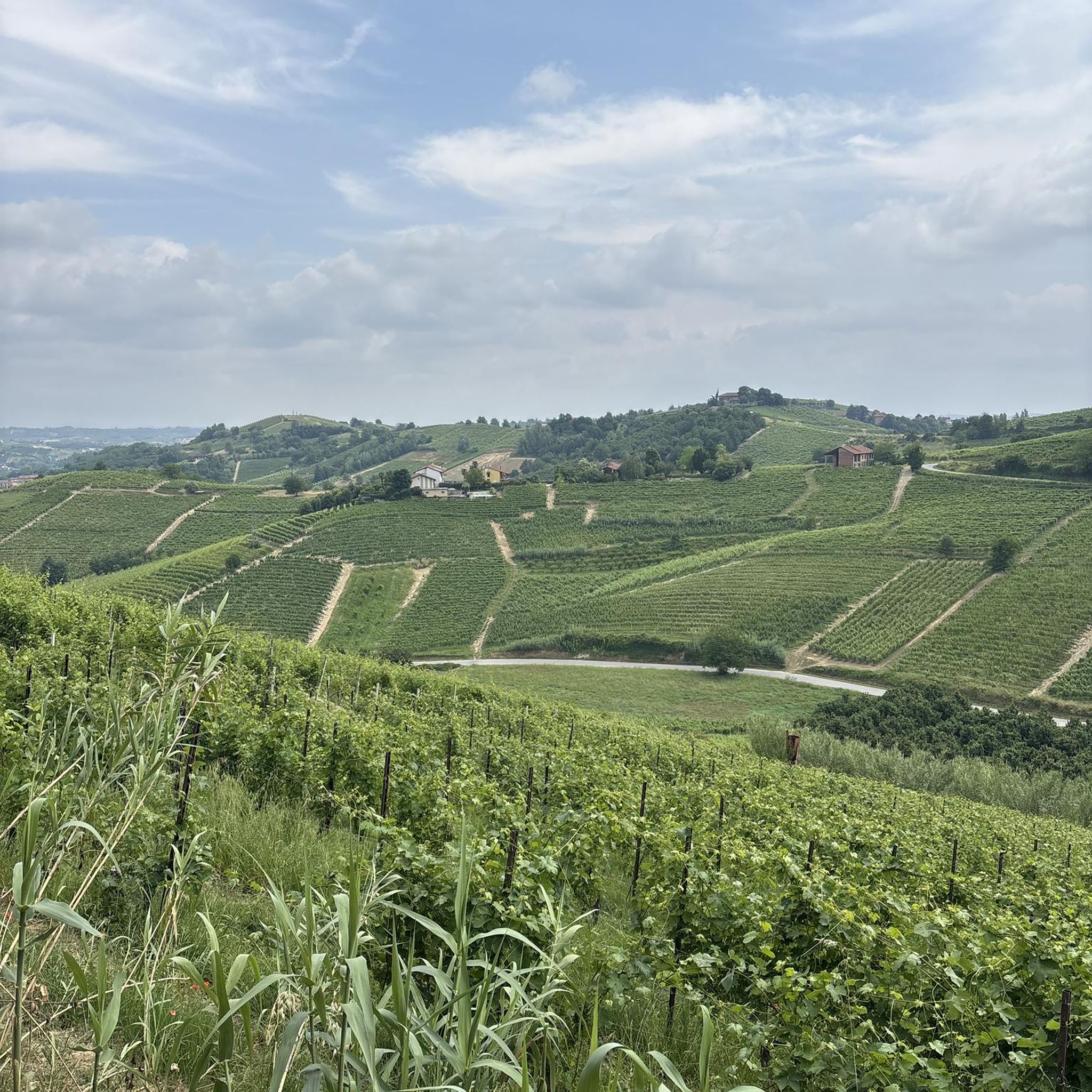
Hiking around Saint-Michel offers trails through a landscape characterized by rolling hills, agricultural fields, and small river valleys. The region features a mix of open countryside and wooded sections, providing varied scenery for outdoor activities. Elevation changes are generally moderate, making the area accessible for a range of hiking abilities.
Best hiking trails around Saint-Michel
- The most popular hiking route is Motte castrale de Moncassin — loop from Moncassin, a 6.8 miles (11.0 km) trail that takes 2 hours…
Last updated: July 2, 2026
4
hikers
11.0km
02:57
140m
130m
Moderate hike. Good fitness required. Mostly accessible paths. Sure-footedness required.
3
hikers
15.0km
04:07
250m
250m
This moderate 9.3-mile loop from Laguian-Mazous explores L'étang de Mazous and features two unique Eiffel bridges.

Sign up for free
16
hikers
10.3km
02:54
200m
200m
Moderate hike. Good fitness required. Easily-accessible paths. Suitable for all skill levels.
6
hikers
8.43km
02:20
150m
150m
Moderate hike. Good fitness required. Easily-accessible paths. Suitable for all skill levels.
4.0
(1)
4
hikers
9.57km
02:39
170m
170m
Moderate hike. Good fitness required. Easily-accessible paths. Suitable for all skill levels.
Get access to more routes and recommendations from other explorers.
Sign up for free
Already have an account?
Our route recommendations are based on thousands of hikes, rides, and runs completed by other people on komoot.
Start today with a free account
Your next adventure awaits.
Login or Signup



Tips from the Community


Bastide in the heart of the Gers, holder of the international Cittaslow label dedicated to the quality of life. Beautiful 15th century cathedral and interesting earthenware museum. It is also the place to enjoy a crisp! At the exit of the city, there is a very beautiful lake with the shaded surroundings of the Baïse.
1
0

A breathtaking view awaits you from this orientation table. A nice place to visit with picnic tables. For my part, I am intrigued to know if the view is still possible? The trees may have grown too much. Can you know?
3
0
A small castle with lots of details and intrigue. It is of course a private property, but you only have to see it from the road to realize that.
4
0
The best thing to do after visiting the top of this motte is to see it from here in relief. It is strangely a perfect cone or rounded shape. It is very impressive.
4
0
This rather unusual topographic feature must have been the seat of a kind of defensive building. Today, only two crosses remain and the stunning views that can be found at the top.
4
0


On this old railway line (disappeared), are still visible 2 bridges (second) of Gustave Eiffel (impassable certainly). A must see.
1
0
Frequently Asked Questions
How many hiking trails are available in Saint-Michel?
The Saint-Michel region offers a selection of over 25 hiking trails. These routes traverse a landscape of gentle hills, agricultural fields, and scattered woodlands, providing varied scenery for outdoor activities.
What types of trails can I expect in Saint-Michel?
You'll find a good mix of trails in Saint-Michel, primarily catering to easy and moderate abilities. There are 7 easy routes and 19 moderate routes, making the area accessible for a range of hiking experiences. There are no difficult trails listed in this guide.
Are there any circular walks in Saint-Michel?
Yes, many of the trails in Saint-Michel are designed as circular routes, allowing you to start and end in the same location. Examples include the Motte castrale de Moncassin — loop from Moncassin and the Mirande loop from Mirande.
What can I see along the hiking trails in Saint-Michel?
The trails in Saint-Michel offer glimpses of the local rural charm. You might encounter historical sites like the Bernet Castle, or visit settlements such as Mirande. There's also an Orientation table providing scenic views, and the Église Sainte-Marie de Mirande.
What do other hikers enjoy most about hiking in Saint-Michel?
The hiking routes in Saint-Michel are highly rated by the komoot community, with an average score of 4.1 stars from over 15 reviews. Hikers often appreciate the varied rural landscapes, gentle hills, and the accessibility of the moderate trails.
Are there any trails featuring water elements like ponds or rivers?
Yes, some routes incorporate local water features. For example, the Mazous Pond and Eiffel Bridges Loop specifically highlights a pond and bridges, offering a different scenic element to your hike.
What is the typical duration for a hike in Saint-Michel?
Most moderate hikes in Saint-Michel range from approximately 2.5 to 4 hours. For instance, the Motte castrale de Moncassin — loop from Moncassin takes about 2 hours 57 minutes, while the longer Mazous Pond and Eiffel Bridges Loop is around 4 hours 7 minutes.
What kind of terrain should I expect on the trails?
The terrain around Saint-Michel is characterized by gentle hills, agricultural fields, and scattered woodlands. Elevation changes are generally moderate, making the paths suitable for a comfortable hiking experience without extreme climbs.
Are there any historical sites to explore while hiking?
Yes, the region has historical points of interest. You can find sites like the Bernet Castle and the Église Sainte-Marie de Mirande, which add a cultural dimension to your outdoor exploration.
How many people have explored these trails using komoot?
Over 89 hikers have used komoot to explore the varied terrain of Saint-Michel, contributing to the community's ratings and insights on the routes.
Are there any trails that pass through or near towns/villages?
Yes, some routes are designed to pass through or near local settlements. For example, the Mirande loop from Mirande starts and ends in the town of Mirande, allowing for easy access to amenities.
Most popular attractions around Saint-Michel

Get inspired with the komoot mobile app


Explore more
Browse the best Hikes in other regions.
