The best walks and hikes around Saint-Léry
4.5
(768)
4,294
hikers
37
hikes
Hiking around Saint-Léry offers a diverse landscape characterized by natural features such as the Barenton Fountain, various ponds, and notable rock formations like Rocher des Braves. The region's trails often lead through areas with historical elements, including the Château de Comper. Elevation changes are generally moderate, providing accessible paths through woodlands and open areas.
Best hiking trails around Saint-Léry
- The most popular hiking route is Barenton Fountain – Rocher des Braves loop from Concoret, a 7.7 miles (12.4 km)…
Last updated: August 27, 2026
4.6
(40)
172
hikers
12.4km
03:22
170m
170m
Moderate hike. Good fitness required. Easily-accessible paths. Suitable for all skill levels.
4.6
(38)
160
hikers
10.1km
02:42
120m
120m
Moderate hike. Good fitness required. Easily-accessible paths. Suitable for all skill levels.

Sign up for free
4.6
(36)
277
hikers
2.42km
00:41
50m
50m
Easy hike. Great for any fitness level. Easily-accessible paths. Suitable for all skill levels.
4.3
(12)
26
hikers
20.2km
05:37
350m
340m
Hard hike. Very good fitness required. Mostly accessible paths. Sure-footedness required.
4.7
(9)
47
hikers
11.5km
03:00
80m
80m
Moderate hike. Good fitness required. Easily-accessible paths. Suitable for all skill levels.
Get access to more routes and recommendations from other explorers.
Sign up for free
Already have an account?
Our route recommendations are based on thousands of hikes, rides, and runs completed by other people on komoot.
Start today with a free account
Your next adventure awaits.
Login or Signup

Tips from the Community

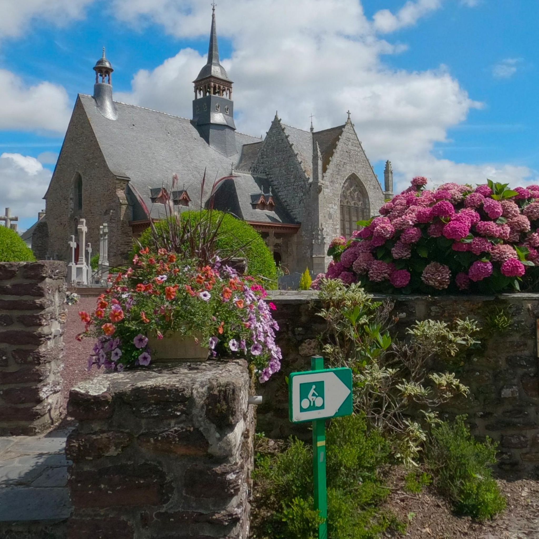
The church is the setting for the novel Bretonische Geheimnisse – Kommissar Dupins siebter Fall by Jean-Luc Bannalec. Information about the church can be found on Wikipedia: https://de.wikipedia.org/wiki/Ste-Onenne_(Tr%C3%A9horenteuc)
0
0
Chateau Comper is the only castle that is historically linked to the forest of Paimpont (and thus to the Arthurian legend) and still exists today. Several legends attest that it is the birthplace and home of the fairy Viviane. More info at: https://fr.wikipedia.org/wiki/Ch%C3%A2teau_de_Comper
0
0

The place called "Point-Clos" is located north of the Brocéliande massif, in the Gaël-Paimpont state forest. It extends over part of the communes of Gaël (Ille-et-Vilaine), Concoret (Morbihan) and Muël (Ille-et-Vilaine). It is bordered by the D773 departmental road linking Paimpont to Gaël. It houses the remains of a former aviation camp created in 1922. It was occupied by the Luftwaffe from 1940 to 1944. The Allied Air Force used it from the beginning of August to the end of September 1944. It officially lost its status as an airfield in 1955.
1
0

Outside of peak hours, it is very peaceful.
1
0
In the morning with the birds singing...it's magical
0
0

enriching visit and you will be able to sit on the seat of Merlin the magician
2
0
This hike was great even though it was a lot of climbing.
0
0
Frequently Asked Questions
How many hiking trails are available in Saint-Léry?
There are over 35 hiking trails around Saint-Léry, offering a variety of experiences. These include 17 easy routes, 16 moderate paths, and 4 more challenging options, catering to different fitness levels.
Are there any easy, family-friendly hikes in Saint-Léry?
Yes, Saint-Léry offers several easy routes suitable for families. An excellent option is the Tipi! – Barenton Fountain loop from Fontaine de Barenton, which is a 2.4 km (1.5 miles) trail that can be completed in about 40 minutes, leading through varied terrain.
What kind of natural landmarks can I expect to see on the trails?
The trails in Saint-Léry are known for their natural features, including the mystical Barenton Fountain, various ponds, and notable rock formations like Rocher des Braves. You can also discover highlights such as the Fairies' Mirror Pond and the ancient Guillotin Oak.
Are there any circular walks available in Saint-Léry?
Many of the routes in Saint-Léry are circular, allowing you to start and end at the same point. For example, the popular Barenton Fountain – Rocher des Braves loop from Concoret is a 12.4 km (7.7 miles) moderate trail that showcases prominent natural landmarks in a loop.
What do other hikers say about the trails in Saint-Léry?
The hiking routes in Saint-Léry are highly rated by the komoot community, with an average score of 4.5 stars from over 600 reviews. Hikers often praise the diverse landscapes, the mix of open and wooded areas, and the well-maintained paths that lead to unique natural and historical sites.
Are there any challenging hikes for experienced trekkers?
Yes, for those seeking a more demanding experience, Saint-Léry offers some challenging routes. One such option is the Fairies' Mirror Pond – Golden Tree loop from Fontaine de Barenton, a difficult 20.3 km (12.6 miles) trail that provides a substantial trek through the region's varied terrain.
Can I find trails that pass by historical sites?
Absolutely. Many trails in Saint-Léry incorporate historical elements. For instance, the Château de Comper – Comper Ponds loop from Concoret takes you past the historic Château de Comper, offering a blend of nature and heritage.
Are there any trails with good viewpoints?
While specific designated viewpoints are not highlighted, the region's varied terrain and rock formations, such as the Rocher des Braves, often provide elevated perspectives. Trails like the Guillotin Oak – Rocher des Braves loop from Fontaine de Barenton offer a mix of woodland scenery and views of these prominent natural features.
What is the best time of year to go hiking in Saint-Léry?
The region's moderate elevation changes and diverse landscapes make it enjoyable for hiking throughout much of the year. Spring and autumn offer pleasant temperatures and beautiful foliage, while summer provides longer daylight hours. Winter hikes are also possible, though conditions may vary.
Are there any hidden gems or less-traveled paths in the area?
With over 35 routes, Saint-Léry offers many opportunities to discover quieter paths beyond the most popular ones. Exploring some of the lesser-known easy or moderate trails can lead you to serene spots and unique natural features away from the main routes.
Are there hiking trails with parking available?
Most trailheads in and around Saint-Léry, especially those starting from villages like Concoret or near popular sites like Fontaine de Barenton, typically have designated parking areas or roadside parking options. It's always advisable to check specific route details for parking information.
What kind of elevation changes should I expect on Saint-Léry trails?
Elevation changes in Saint-Léry are generally moderate, making many paths accessible. While some routes, like the difficult Fairies' Mirror Pond – Golden Tree loop, have more significant ascents, most trails feature gentle undulations through woodlands and open areas.
Most popular routes around Saint-Léry
Most popular attractions around Saint-Léry

Get inspired with the komoot mobile app


Explore more
Browse the best Hikes in other regions.
