The best walks and hikes around Lamagistère
4.4
(102)
658
hikers
45
hikes
Hiking around Lamagistère offers routes primarily along waterways and through agricultural landscapes. The region is characterized by its network of canals, including the Garonne Lateral Canal and Canal des Deux Mers, providing mostly flat terrain. Elevation changes are generally minimal, making many routes accessible for various fitness levels. The area's trails often follow riverbanks and canal towpaths, passing through rural settings.
Best hiking trails around Lamagistère
- The most popular hiking route is Canal Bridge over the Barguelonne – Canal des…
Last updated: May 12, 2026
3.0
(1)
10
hikers
7.48km
01:53
10m
10m
Easy hike. Great for any fitness level. Easily-accessible paths. Suitable for all skill levels.
5.0
(1)
3
hikers
21.8km
06:00
360m
360m
Hard hike. Very good fitness required. Easily-accessible paths. Suitable for all skill levels.

Sign up for free
5.0
(2)
6
hikers
10.7km
02:42
20m
20m
Moderate hike. Good fitness required. Easily-accessible paths. Suitable for all skill levels.
5
hikers
5.19km
01:19
10m
10m
Easy hike. Great for any fitness level. Easily-accessible paths. Suitable for all skill levels.
3
hikers
10.2km
02:43
110m
110m
Moderate hike. Good fitness required. Easily-accessible paths. Suitable for all skill levels.
Get access to more routes and recommendations from other explorers.
Sign up for free
Already have an account?
Our route recommendations are based on thousands of hikes, rides, and runs completed by other people on komoot.
Start today with a free account
Your next adventure awaits.
Login or Signup

Tips from the Community

I found an open-air stage there, but no infrastructure in the sense of a rest stop for hikers and cyclists.
0
0

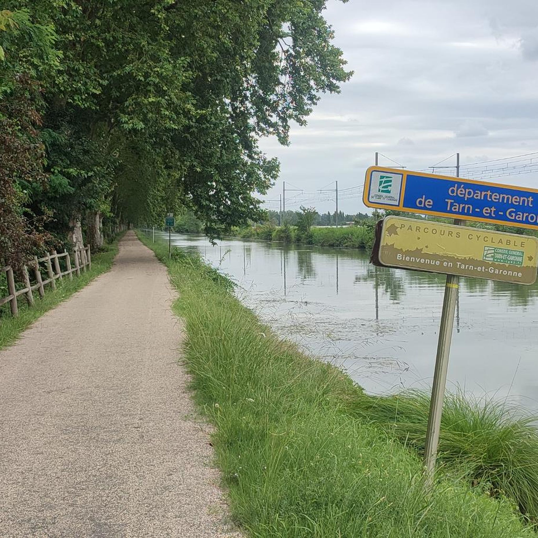
Totally level cycle path, without any difference in height, all along the canal among rows of plane trees and oaks.
3
0

Nice building, but unfortunately I couldn't see any benefit for cyclists.
2
0
The first thing I noticed positively, from here the bike path along the canal is much better from the surface.
4
0

View of the small port of Valence d'Agen, on the other side of the canal, on the V80 towards Agen or Moissac. The bastide is worth the little detour!
2
0
Bastide which spreads out along the canal built in the 13th century and which has very large Halles, 3 washhouses and a very pretty port on the Canal du Midi. The v80, which connects Agen or Moissac, passes just below the village.
1
0

Since 2011, this former slaughterhouse has been converted into a stopover dedicated to hikers and bikers. You will find a water point, toilets, picnic tables, a kitchen area and a rest room. In short, it is a welcoming place to take a break and regain strength.
0
0

A must on the route, witness to the local culture and the history of this territory.
0
0
Frequently Asked Questions
Are there easy hiking trails suitable for beginners around Lamagistère?
Yes, Lamagistère offers a good selection of easy trails, primarily along the canals and through flat agricultural areas. There are 12 easy routes available, many of which follow the Garonne Lateral Canal and Canal des Deux Mers. An example is the Canal Bridge over the Barguelonne – Canal des Deux Mers loop from Golfech, which is 4.8 miles (7.7 km) long with minimal elevation gain.
Are the hiking trails around Lamagistère suitable for families with children?
Many of the trails around Lamagistère are well-suited for families, especially those following the canal towpaths. The terrain is generally flat with minimal elevation changes, making it accessible for various ages and fitness levels. Look for the 'easy' rated routes for the most family-friendly options.
Can I bring my dog on the hiking trails near Lamagistère?
Most hiking trails in the Lamagistère area, particularly those along the canal towpaths and through rural landscapes, are dog-friendly. It's always recommended to keep your dog on a leash, especially when passing through agricultural areas or near livestock, and to carry water for them.
Are there many circular hiking routes in the Lamagistère area?
Yes, the region offers numerous circular hiking routes, often utilizing the extensive network of canal towpaths and country lanes. These loops provide varied scenery without requiring a return trip on the same path. An example is the Canal Bridge over the Barguelonne loop from Golfech.
Are there any challenging hiking routes for experienced hikers?
While much of the terrain is flat, there are a few longer and more challenging routes available. For instance, the Garonne Lateral Canal loop from Lamagistère is a difficult 13.5 miles (21.8 km) path that offers a longer challenge through the local landscape. Overall, there are 2 difficult routes among the 47 available.
Where can I find parking for hiking trails near Lamagistère?
Parking for hiking trails in Lamagistère is typically available in the villages themselves, near canal access points, or at designated parking areas close to popular trailheads. Check the starting points of specific routes on komoot for detailed parking information.
Is it possible to access hiking trails around Lamagistère using public transport?
Public transport options directly to trailheads in rural areas like Lamagistère can be limited. However, some routes may be accessible from train stations or bus stops in larger nearby towns such as Valence d'Agen or Golfech, which have connections to regional transport networks. Planning your route in advance and checking local transport schedules is advisable.
What is the best time of year to go hiking in Lamagistère?
The best time for hiking around Lamagistère is generally during spring (April-May) and autumn (September-October). During these seasons, the weather is mild and pleasant, and the natural scenery is vibrant. Summer can be hot, especially in July and August, while winter can be damp but generally mild enough for walking.
What interesting sights or landmarks can I see while hiking near Lamagistère?
The area around Lamagistère offers several interesting sights. You might encounter historical structures like the Auvillar Circular Market Hall or the Saint-Antoine Chapel. The picturesque village of Auvillar itself is a highlight, and you might cross the impressive Suspension bridge over the Garonne.
Are there places to stop for food or drinks along the hiking routes?
Yes, many routes pass through or near villages where you can find local restaurants, cafés, or bakeries. Canal-side establishments are also common. For example, the Poule à Vélo Inn is a notable stop in the area, offering refreshments.
What do other hikers enjoy the most about hiking in Lamagistère?
The area is highly rated by the komoot community, with an average score of 4.4 stars from over 90 reviews. Hikers often praise the peaceful canal-side paths, the flat and accessible terrain, and the opportunity to experience the tranquil agricultural landscapes of the region.
How many hiking trails are available around Lamagistère?
There are 47 hiking trails available around Lamagistère, offering a diverse range of options from easy strolls to more challenging long-distance routes. This includes 12 easy, 33 moderate, and 2 difficult trails.
Most popular attractions around Lamagistère

Get inspired with the komoot mobile app


Explore more
Browse the best Hikes in other regions.
