The best walks and hikes around Saint-Antonin-Noble-Val
4.5
(387)
2,277
hikers
97
hikes
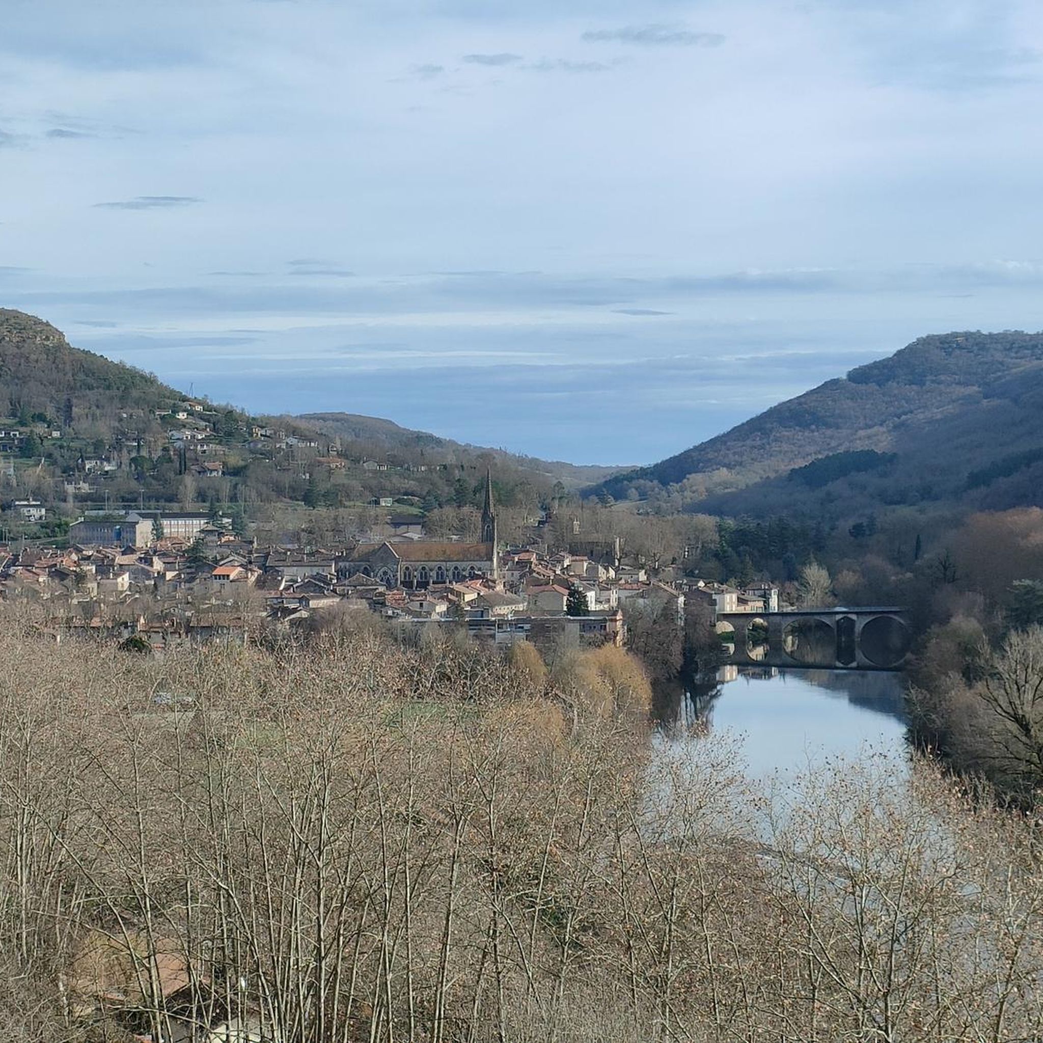
Hiking around Saint-Antonin-Noble-Val offers access to dramatic landscapes at the confluence of the Aveyron and Bonnette rivers. The region is characterized by the deep Gorges de l'Aveyron, impressive limestone plateaus, and extensive oak woods. Hikers can explore trails that feature majestic cliffs like Roc d'Anglars and Roc Deymié, providing varied terrain for outdoor activities. The area's natural environment includes riverbanks and natural amphitheatres such as the Cirque de Bône.
Best hiking trails around Saint-Antonin-Noble-Val
- The most popular hiking route is Le cirque de Bône — loop from Saint-Antonin-Noble-Val, a 5.6 miles (9.0 km) moderate trail that takes 2 hours 37 minutes to complete. This route offers panoramic views of the impressive Cirque de Bône.
- Another top favourite among local hikers is Sainte-Sabine and Roc d'Anglars Loop, a moderate 8.0 miles (12.9 km) path. This trail provides diverse landscapes and views of the Roc d'Anglars cliffs.
- Local hikers also love the Cirque de Bône Loop, a 2.7 miles (4.3 km) trail leading through the natural amphitheatre of Cirque de Bône, often completed in about 1 hour 16 minutes.
- Hiking around Saint-Antonin-Noble-Val is defined by the Gorges de l'Aveyron, limestone plateaus, and scenic oak woods. The extensive network of trails offers options for easy strolls, moderate hikes, and more challenging treks.
- The routes in Saint-Antonin-Noble-Val are highly rated by the komoot community with an average score of 4.5 stars from over 340 reviews. More than 2000 hikers have used komoot to explore Saint-Antonin-Noble-Val's varied terrain.
Last updated: August 30, 2026
4.6
(43)
264
hikers
9.03km
02:38
230m
230m
Moderate hike. Good fitness required. Easily-accessible paths. Suitable for all skill levels.
4.2
(41)
131
hikers
4.35km
01:17
110m
110m
Easy hike. Great for any fitness level. Easily-accessible paths. Suitable for all skill levels.

Sign up for free
4.1
(9)
31
hikers
12.9km
03:45
310m
310m
Moderate hike. Good fitness required. Easily-accessible paths. Suitable for all skill levels.
4.6
(49)
314
hikers
10.9km
03:06
250m
250m
Moderate hike. Good fitness required. Easily-accessible paths. Suitable for all skill levels.
4.7
(15)
111
hikers
Moderate hike. Good fitness required. Easily-accessible paths. Suitable for all skill levels.
Get access to more routes and recommendations from other explorers.
Sign up for free
Already have an account?
Our route recommendations are based on thousands of hikes, rides, and runs completed by other people on komoot.
Start today with a free account
Your next adventure awaits.
Login or Signup


Tips from the Community

If the caves are indeed there. White Lady Cave Trassadou Cave Tannery Cave and Capuchin Cave, which is the Bat Cave but is not accessible year-round so as not to disturb the creatures.
0
0

Magnificent via ferrata with a very beautiful view of St Antonin Noble Val.
0
0

Although it is a quick climb, the path is shady, making the midday heat of summer easy to bear.
0
0
On the left bank of the river, the only way to cross the weir. Portaging boats is not possible. During peak season, there are sometimes traffic jams here.
0
0

The cave was closed by walls, impossible to enter.
0
0

I agree with Gilles. No caves... Very dangerous path, this hike is rather accessible for people in very good physical condition and with crampons... Very disappointed with this hike
1
0

After an enriching hike along the picturesque trails of Saint-Antonin-Noble-Val, take a well-deserved break in this charming square. Nestled beneath the historic market halls, this charming spot offers a comfortable atmosphere to relax and enjoy a drink or light snack. The outdoor seating provides a perfect vantage point to admire the square’s medieval architecture, allowing you to unwind while soaking up the local atmosphere. It’s an ideal stop to recharge your batteries before continuing on your journey.
1
0

The cave is either not accessible anymore or on the wrong place on the map. The path is overgrown and we couldn't find the entrance.
0
0
Frequently Asked Questions
How many hiking trails are available around Saint-Antonin-Noble-Val?
There are over 100 marked hiking trails in the Saint-Antonin-Noble-Val area, offering a wide range of options from easy strolls to more challenging treks. The region is known for its diverse landscapes, including the Gorges de l'Aveyron, limestone plateaus, and oak woods.
What types of landscapes can I expect to see while hiking here?
Hikers in Saint-Antonin-Noble-Val will encounter dramatic landscapes, including the stunning Gorges de l'Aveyron, impressive natural amphitheatres like the Cirque de Bône, and majestic cliffs such as Roc d'Anglars. Trails often follow the picturesque Aveyron and Bonnette rivers, and traverse scenic limestone plateaus and oak woods.
Are there any family-friendly hiking options in Saint-Antonin-Noble-Val?
Yes, the area offers several easy routes suitable for families. For example, the Cirque de Bône Loop is an easy 2.7-mile (4.3 km) trail that can be completed in about 1 hour 16 minutes, providing a great experience for all ages through a natural amphitheatre.
Can I bring my dog on the hiking trails?
Many trails in the Saint-Antonin-Noble-Val region are dog-friendly, but it's always recommended to keep your dog on a leash, especially in nature reserves or areas with livestock. Be sure to check specific trail regulations before you go.
Are there any circular walks available?
Yes, Saint-Antonin-Noble-Val is well-suited for circular walks. A popular moderate option is the Le cirque de Bône — loop from Saint-Antonin-Noble-Val, which is 5.6 miles (9.0 km) and offers panoramic views of the impressive Cirque de Bône.
What do other hikers say about the trails in Saint-Antonin-Noble-Val?
The routes in Saint-Antonin-Noble-Val are highly rated by the komoot community, with an average score of 4.5 stars from over 340 reviews. Hikers often praise the stunning views of the Gorges de l'Aveyron and the well-maintained paths through diverse natural settings.
Are there any waterfalls or caves to explore along the trails?
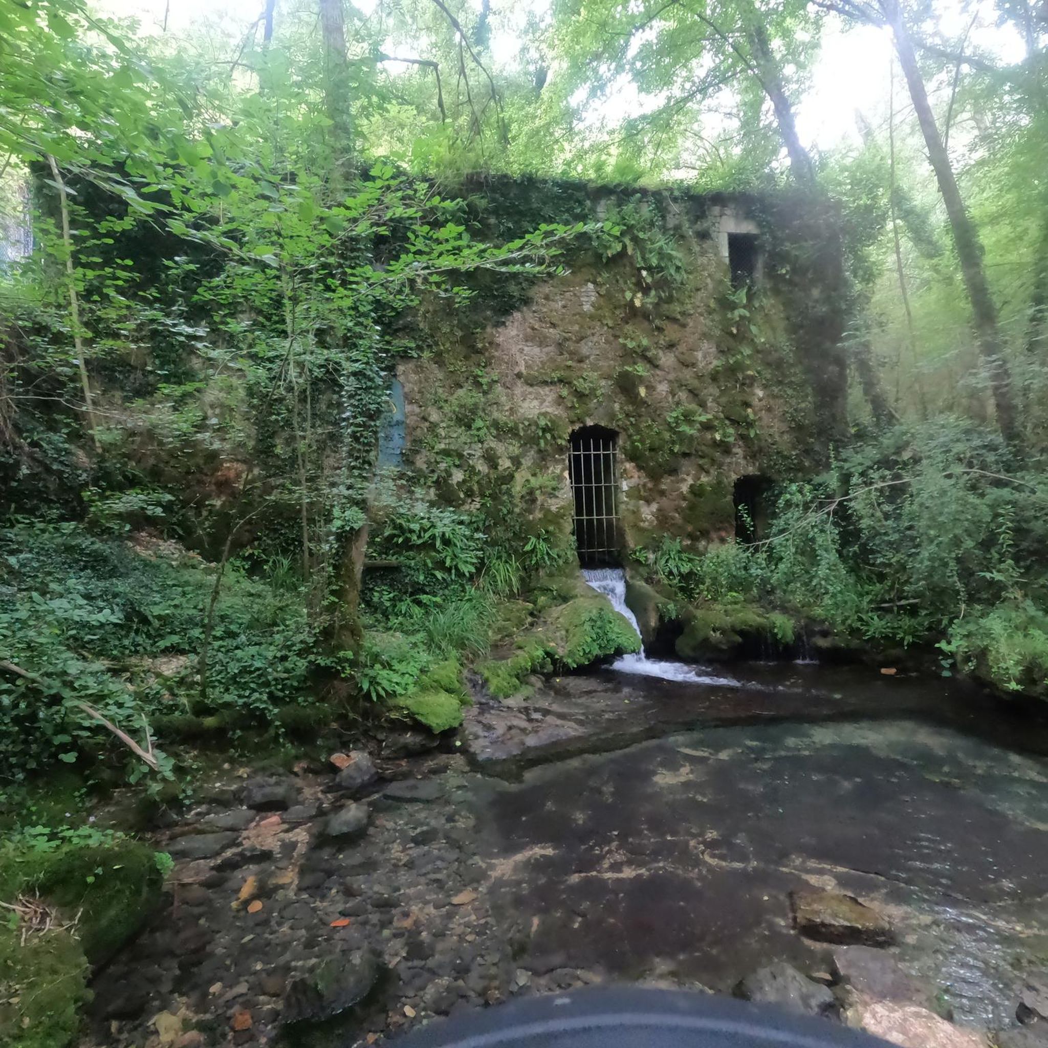
Yes, the region is home to intriguing natural features. You can find the Cascade Pétrifiante, a petrifying waterfall, and several caves like the Mayrière Supérieure Cave. The wider area also features the Grotte du Trassadou and the Bosc caves, offering opportunities for exploration.
What historical sites or landmarks can I visit near the hiking routes?
Beyond the natural beauty, the area is rich in history. You can explore the medieval town of Saint-Antonin-Noble-Val itself, with its ancient architecture. Nearby, you can visit the impressive Bruniquel Castle or the ruins of Château de Penne, which offer a glimpse into the region's past.
What is the best time of year to go hiking in Saint-Antonin-Noble-Val?
Spring and autumn are generally considered the best seasons for hiking in Saint-Antonin-Noble-Val, offering pleasant temperatures and vibrant natural colors. Summer can be warm, especially in the gorges, so early morning or late afternoon hikes are recommended. Winter hiking is also possible, with fewer crowds and a different kind of serene beauty.
Are there any longer or more challenging trails for experienced hikers?
Yes, for those seeking a greater challenge, there are more difficult routes available. The region is also traversed by the long-distance GR 46 trail, which attracts serious hikers. The dramatic cliffs and varied terrain provide ample opportunities for strenuous treks and panoramic views.
Is there public transport available to reach the hiking trailheads?
While Saint-Antonin-Noble-Val is accessible, public transport options directly to specific trailheads can be limited. It is often recommended to have a car for flexibility, especially when accessing routes further afield from the town center. However, many trails, including popular loops, start directly from the town.
Where can I find parking when hiking in Saint-Antonin-Noble-Val?
Parking is generally available within Saint-Antonin-Noble-Val itself, particularly near the town center, which serves as a starting point for many popular trails. Specific trailheads outside the town may have smaller designated parking areas. It's advisable to arrive early during peak season to secure a spot.
Most popular routes around Saint-Antonin-Noble-Val
Most popular attractions around Saint-Antonin-Noble-Val

Get inspired with the komoot mobile app


Explore more
Browse the best Hikes in other regions.
