The best road cycling routes around Lapte
4.3
(105)
3,221
riders
17
rides
Road cycling routes around Lapte traverse the Velay region of the French Central Massif, offering varied terrain shaped by ancient volcanoes. The area features elevations ranging from 600 to 914 meters, providing both challenging climbs and scenic descents. Cyclists can explore routes through beautiful woodland scenery, along the tranquil Lac de Lavalette, and beside the Lignon du Velay and Dunières rivers. The region is characterized by undulating landscapes and quiet country lanes, ideal for backroad cycling.
Best road cycling routes…
Last updated: July 1, 2026
69
riders
27.0km
01:58
460m
460m
Moderate road ride. Good fitness required. Some segments of this route may be unpaved and difficult to ride.
44
riders
24.2km
01:19
450m
450m
Moderate road ride. Good fitness required. Mostly well-paved surfaces and easy to ride.

Sign up for free
4.0
(2)
24
riders
43.2km
02:12
690m
700m
Moderate road ride. Good fitness required. Mostly well-paved surfaces and easy to ride.
5.0
(1)
38
riders
63.6km
02:56
770m
770m
Moderate road ride. Good fitness required. Mostly well-paved surfaces and easy to ride.
14
riders
166km
08:46
2,300m
2,300m
Hard road ride. Very good fitness required. Some segments of this route may be unpaved and difficult to ride.
Get access to more routes and recommendations from other explorers.
Sign up for free
Already have an account?
Our route recommendations are based on thousands of hikes, rides, and runs completed by other people on komoot.
Start today with a free account
Your next adventure awaits.
Login or Signup



Tips from the Community

very good route for the tour of the lake or even for training for a first triathlon 🚴♂️
0
0

Very beautiful section from Montfaucon-en-Velay, towards Tence and Yssingeaux, with a view of all the Yssingelais peaks, and in the background, the Mézenc.
2
0
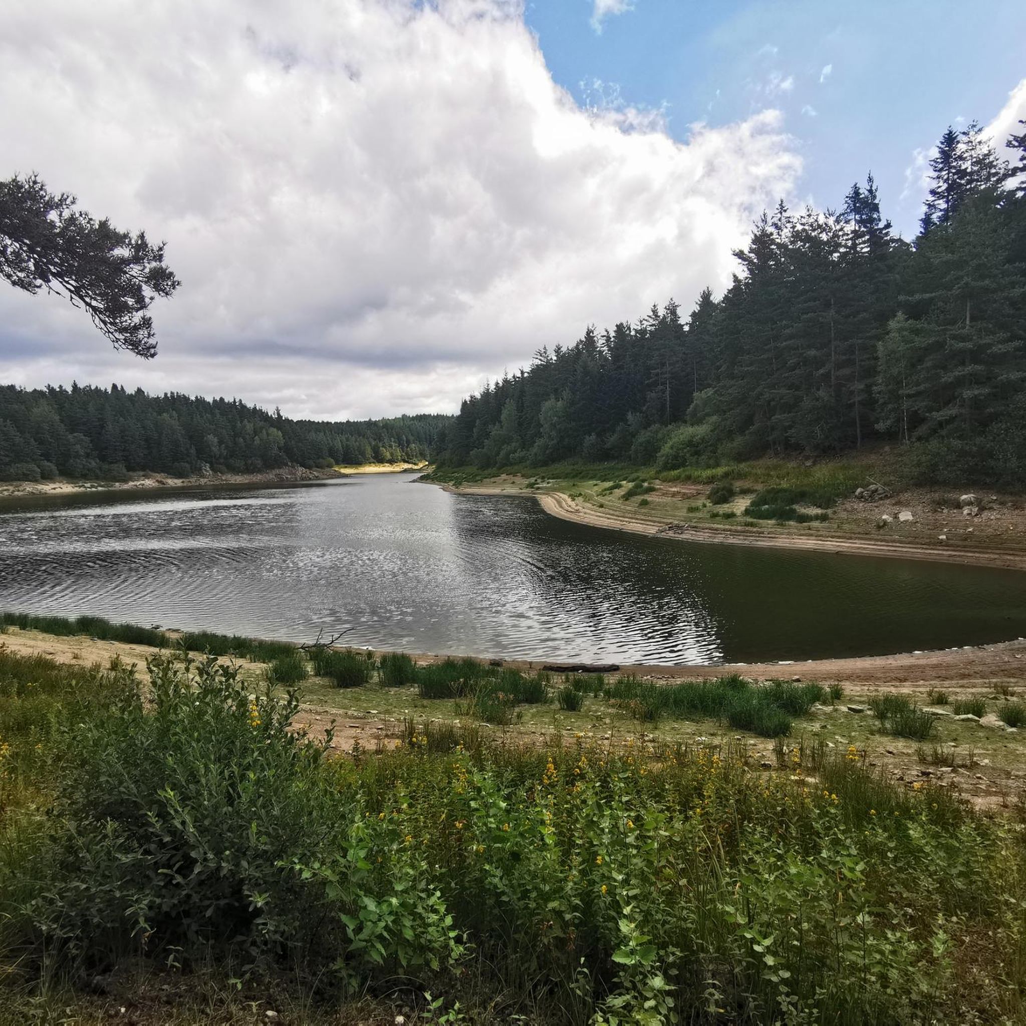
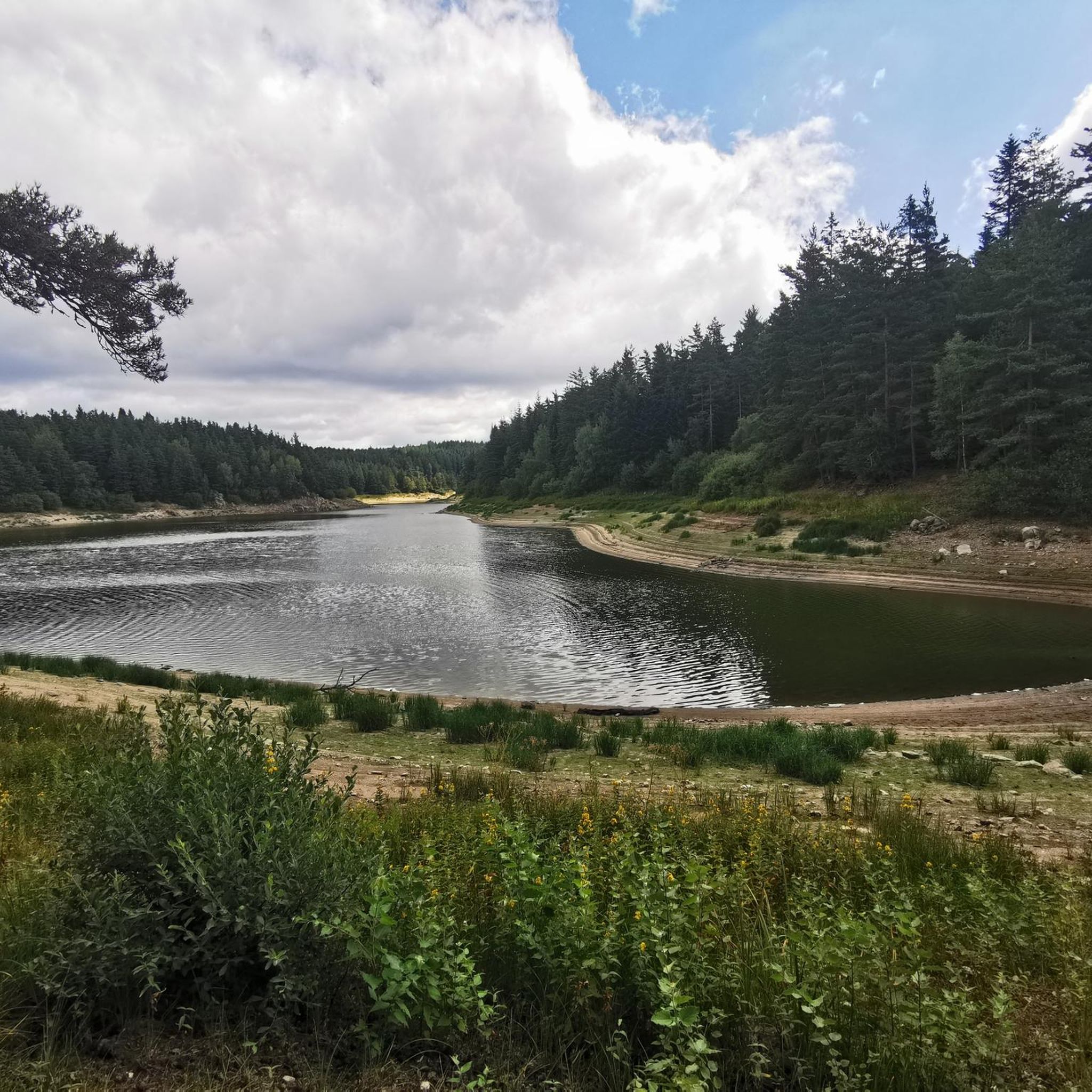
Beautiful reservoir, the level is low currently because repairs are underway until 2026, but otherwise, it's a little Canada!
0
0

superb greenway the riverway
0
0

The Lavalette dam is 507 meters long and 60 meters high. This hydraulic dam was built in 1949 upstream of the Lignon river and retains the waters of Lake Lavalette, known for its water sports center.
0
0
Lake Lavalette is fed by the waters of the Lignon and covers 220 hectares at an altitude of 820 meters. The nautical leisure center offers plenty of activities such as catamaran rides, dinghy rides, windsurfing, and also equipment rental: kayaks, pedal boats, stand-up paddleboards, etc.
0
0
Le Riotord is a town full of assets located in the far east of Haute-Loire. It is at the crossroads of many well-marked and maintained hiking trails such as the GR 7 and the path to Saint-Jacques-de-Compostelle but also cycling routes such as the Via Fluvia and the Grande Traversée à VTT de la Haute-Loire. The town has a beautiful 11th century church or a pond ideal for a little nap by the water.
0
0

The Lavoûte-sur-Loire bridge offers magnificent views of the river and the surrounding green hills. You're driving on a secondary road, so it's not the best place to stop, but you can still enjoy it!
0
0
Frequently Asked Questions
What kind of terrain can I expect when road cycling around Lapte?
Road cycling around Lapte offers a diverse and undulating terrain, characteristic of the Velay region in the French Central Massif. You'll encounter rolling hills and landscapes shaped by ancient volcanoes, with elevations ranging from 600 to 914 meters. This provides a mix of challenging climbs and scenic descents, often on quiet country lanes through beautiful woodland scenery and along river valleys like the Lignon du Velay and Dunières.
Are there road cycling routes suitable for different skill levels in Lapte?
Yes, the Lapte area caters to various skill levels. The komoot community has mapped approximately 19 road cycling routes, including options for easy, moderate, and difficult abilities. For example, you can find 3 easy routes, 10 moderate routes, and 6 difficult routes, ensuring there's something for everyone.
What natural features or landmarks can I see while road cycling in Lapte?
The region is rich in natural beauty and interesting landmarks. Many routes will take you past the expansive Lac de Lavalette, a hub for outdoor recreation. You might also encounter the scenic Himalayan footbridge at Gorges du Lignon, offering dramatic views. The area's volcanic landscapes and lush woodlands provide a picturesque backdrop for your rides. Additionally, the Via Fluvia greenway, accessible from nearby Grazac, offers a dedicated, traffic-free cycling experience through the scenery.
Are there any circular road cycling routes around Lapte?
Yes, many of the road cycling routes around Lapte are designed as loops, allowing you to start and finish in the same location. A popular choice is the Lakeside Beach loop from Barrage de Lavalette, which offers scenic views around Lac de Lavalette. Another option is the Lake Lavalette – Lavalette Dam loop from Parking handicapés, circling the expansive lake.
What are the typical distances and elevations for road cycling routes in Lapte?
The road cycling routes in Lapte vary significantly in distance and elevation gain. You can find shorter loops, like the Lakeside Beach loop from Barrage de Lavalette at 26.9 km with 461 meters of elevation gain. For more challenging rides, consider routes such as the Vaubarlet Climb – Human Rights Bridge loop from Lapte, which covers 66.1 km with over 1000 meters of ascent.
What do other road cyclists enjoy most about road cycling in Lapte?
The road cycling routes in Lapte are highly rated by the komoot community, with an average score of 4.1 stars from over 5 reviews. Cyclists often praise the varied terrain, the tranquil settings of Lac de Lavalette, and the quiet country lanes that wind through the impressive volcanic landscapes and beautiful woodland scenery. The network offers a good mix of physical challenges and rewarding views.
Is it possible to combine road cycling with other activities in Lapte?
Absolutely! Lapte and its surroundings offer various outdoor activities. Lac de Lavalette is a hub for water sports, swimming, and fishing. The Himalayan footbridge at Gorges du Lignon is a great spot for a scenic walk. The broader Haute-Loire region is also dotted with charming villages and historical sites, providing cultural points of interest to explore during your cycling trip.
What is the best time of year for road cycling in Lapte?
The region's 'beautiful woodland scenery' and 'refreshing backdrop' suggest that spring, summer, and early autumn are ideal for road cycling in Lapte. During these seasons, the weather is generally pleasant, allowing you to fully enjoy the tranquil settings and diverse landscapes without extreme heat or cold. Always check local weather forecasts before heading out.
Are there any specific routes that incorporate the Via Fluvia greenway?
Yes, some road cycling routes around Lapte integrate sections of the Via Fluvia greenway. For instance, the Vaubarlet Climb – Via Fluvia loop from Lapte is a 42.8 km trail that leads through the Vaubarlet Climb and along this dedicated, traffic-free path, offering a unique cycling experience.
Where can I find amenities or places to rest along the routes?
While specific cafes or pubs directly on every route are not detailed, the 'Aire Respirando' at Lake Lavalette provides amenities and a variety of activities, making it a convenient stop for cyclists. As Lapte is a commune, you can expect to find local services within the village itself. The broader Haute-Loire region also features charming villages where you can find refreshments and accommodation.
Are there any challenging climbs for experienced road cyclists?
Yes, the varied elevation around Lapte, with its rolling hills and volcanic landscapes, offers several challenging climbs. Routes like the Vaubarlet Climb – Human Rights Bridge loop from Lapte, classified as 'difficult', feature significant elevation gains, providing a good test for experienced road cyclists looking for a physical challenge.
Most popular attractions around Lapte

Get inspired with the komoot mobile app


Explore more
Browse the best Road cycling routes in other regions.
