The best road cycling routes around Fontcouverte
4.3
(74)
2,346
riders
404
rides
Road cycling routes around Fontcouverte traverse a landscape characterized by the Charente River valley and surrounding agricultural lands. The region features gentle rolling hills, providing varied terrain suitable for road cyclists. Historical sites and small villages are often encountered along the routes, adding to the scenic appeal.
Best road cycling routes around Fontcouverte
- The most popular road cycling route is Cathedral of Saintes – View of the Charente River loop from Saintes, a 39.3 miles (63.2 km) trail that takes 2 hours 38 minutes to complete. This route offers views of the Charente River and passes by historical landmarks.
- Another top favourite among local road cyclists is Crazannes Castle – Saint-Savinien-sur-Charente loop from Saintes, a moderate 38.2 miles (61.5 km) path. This route winds through the countryside, featuring Crazannes Castle and the town of Saint-Savinien-sur-Charente.
- Local road cyclists also love the Abbaye aux Dames de Saintes – Fenioux loop from Saintes, a 39.0 miles (62.8 km) trail leading through rural landscapes and past the Abbaye aux Dames, often completed in about 2 hours 47 minutes.
- Road cycling around Fontcouverte is defined by river valleys, historical sites, and gently rolling hills. The network offers options for easy, moderate, and challenging routes, catering to various skill levels.
- The routes in Fontcouverte are highly rated by the komoot community with an average score of 4.4 stars from more than 60 reviews. More than 2,300 road cyclists have used komoot to explore Fontcouverte's varied terrain.
Last updated: August 25, 2026
4.3
(3)
114
riders
Moderate road ride. Good fitness required. Mostly well-paved surfaces and easy to ride.
3.0
(1)
41
riders
90.9km
03:54
440m
440m
Moderate road ride. Good fitness required. Some segments of this route may be unpaved and difficult to ride.

Sign up for free
5.0
(1)
28
riders
61.5km
02:45
410m
410m
Moderate road ride. Good fitness required. Some segments of this route may be unpaved and difficult to ride.
4.0
(1)
23
riders
63.2km
02:48
460m
460m
Moderate road ride. Good fitness required. Mostly well-paved surfaces and easy to ride.
5.0
(1)
22
riders
81.3km
03:33
500m
500m
Moderate road ride. Good fitness required. Some segments of this route may be unpaved and difficult to ride.
Get access to more routes and recommendations from other explorers.
Sign up for free
Already have an account?
Our route recommendations are based on thousands of hikes, rides, and runs completed by other people on komoot.
Start today with a free account
Your next adventure awaits.
Login or Signup


Tips from the Community

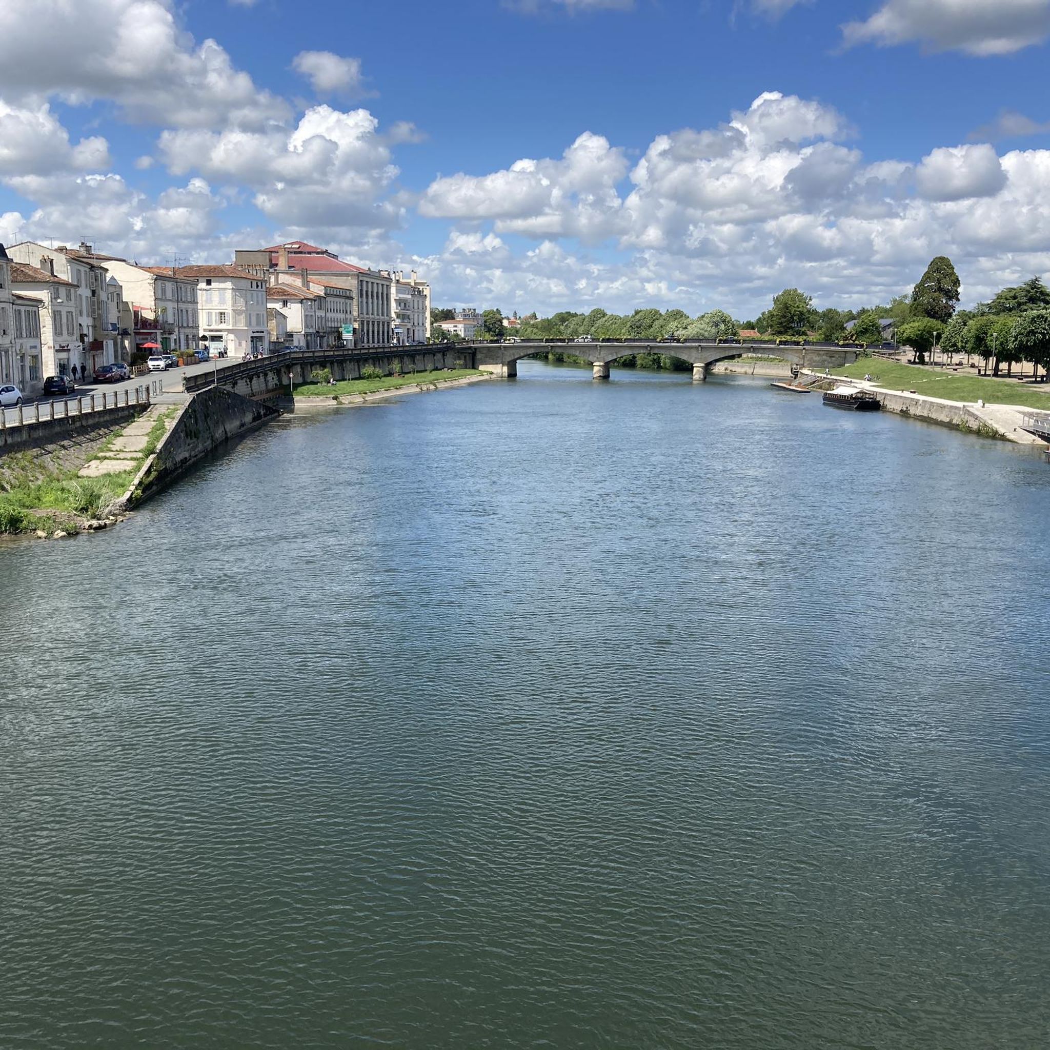
🏛️ Construction: 18-19 AD The arch was built around 18-19 AD, during the reign of Emperor Tiberius. It stood at the entrance to the Roman bridge crossing the Charente, at the outlet of the Via Agrippa, which connected Lyon to Saintes. It is therefore not truly a "triumphal arch": it was both a road monument and a monumental gate marking the entrance to Mediolanum Santonum, the capital of Roman Aquitaine. 👤 Who had it built? The arch was financed by Caius Julius Rufus, a Romanized notable from Saintonge. He dedicated it to Tiberius as well as his nephew Germanicus. The inscriptions engraved on the entablature still allow us today to know the figures to whom it was dedicated. The name "Arch of Germanicus" therefore comes from this dedication, and not from the fact that Germanicus personally had the arch built or crossed it. 🏗️ A rather exceptional monument The arch has two bays, likely allowing for the differentiation of traffic flows. It measures approximately 15 m high by 16 m wide. Its Corinthian and composite capitals bear witness to particularly meticulous Roman architecture. It constituted a true demonstration of the power and Romanization of Saintes. ⚠️ The moment the arch almost disappeared This is probably the most interesting episode in its history. For centuries, the arch was always located at the level of the Roman bridge and then the medieval bridge, on the right bank of the Charente. In the 19th century, the old bridge had become dilapidated. When it was decided to demolish it, around 1843, the arch was also threatened with destruction. It was then that Prosper Mérimée, Inspector General of Historical Monuments, intervened. He advocated for its preservation and arranged for its dismantling, relocation, and reassembly on the new bank. Another figure is also associated with this preservation: Victor Hugo, who stayed in Saintes in September 1843 and intervened in favor of the monument's conservation with Mérimée. 📍 Why is the arch no longer exactly in its ancient location? The arch we see today, on Place Bassompierre, is therefore no longer in its original location. It was moved a few dozen meters during the transformation of the quays and the disappearance of the old bridge. It was dismantled stone by stone and then reassembled in order to preserve it. It is now located in the immediate vicinity of the ancient Roman bridge crossing. 🏛️ Protection The Arch of Germanicus was finally classified as a historical monument in July 1905. An interesting detail The Crazannes quarries, located near Saintes, supplied a limestone widely used in the region's ancient constructions. Crazannes stone was notably used for monuments such as the Arch of Germanicus. In summary: 18-19 → construction of the arch at the entrance to the Roman bridge ↓ Antiquity → Middle Ages → the arch remains associated with the crossing of the Charente ↓ 1843 → demolition of the old bridge and threat to the arch ↓ 1843-1844 → Mérimée's intervention and relocation of the arch ↓ 1905 → classified as a Historical Monument
0
0

Exceptional view, the most beautiful village in France.
0
0

Courcoury is a natural island surrounded by the Charente and Seugne rivers, giving it a unique landscape setting between marshes and waterways, conducive to biodiversity and outdoor activities. It is also the only village in Charente-Maritime to have been awarded 4 stars by the "Villes et villages étoilés" label, recognizing its efforts to reduce light pollution through intelligent and environmentally friendly public lighting.
1
0

A beautiful church with beautiful houses hidden in an ancient but romantic village, it's worth a stop. The Saint-Étienne church in Brives-sur-Charente is recent. It was consecrated in 1868 and reflects the 14th-century Gothic style. It replaced an older church, of which only a baptismal font, listed as a historic object in 1922, and a capital remain. This font, square and made of a single block of siliceous limestone, is a rare specimen of 12th-century sculpture and symbolism. Certain characteristic features, such as the draperies, allow it to be dated to the 1150s. On three sides, we discover the Annunciation made to Mary, then on the main face of the font, Christ officiating in heaven, and finally Christ descending into hell, savior of souls.
0
0

It is an absolutely beautiful village.
0
0

Small town with a special charm along the Charente.
0
0

The Abbaye-aux-Dames is built around the church of Sainte-Marie, built in the twelfth century. Famous for its facade and its characteristic "pinecone" bell tower, it is one of the emblematic monuments of Saintonge's Romanesque art. After several wars and fires, the place was restored in the 1970s and 1980s and is now a hotel. When you walk through the long corridors you feel like you have been transported back to the time when the abbey was still alive.
4
0

Frequently Asked Questions
How many road cycling routes are available around Fontcouverte?
There are over 400 road cycling routes in the Fontcouverte area, offering a wide range of options for cyclists of all abilities.
Are there easy road cycling routes suitable for beginners in Fontcouverte?
Yes, Fontcouverte offers over 100 easy road cycling routes. A great option for beginners is the Saint Saturnin of Séchaud – Abbaye aux Dames de Saintes loop from Saintes, which is 40.6 km long with manageable elevation changes.
What are some challenging road cycling routes in the Fontcouverte region?
While the region is known for its gentle rolling hills, there are 9 routes classified as difficult for those seeking a greater challenge. These routes typically feature more significant elevation gains and longer distances.
Are there any long-distance road cycling routes around Fontcouverte?
Many routes around Fontcouverte offer substantial distances. For example, the Abbaye aux Dames de Saintes – Estuary front loop from Saintes covers approximately 80.5 km, providing a longer ride through varied landscapes.
What kind of scenery can I expect on road cycling routes near Fontcouverte?
Road cycling routes around Fontcouverte are characterized by the picturesque Charente River valley, expansive agricultural lands, and charming small villages. You'll often encounter historical sites and gentle rolling hills, providing a diverse and scenic backdrop for your ride.
Are there circular road cycling routes available?
Yes, many of the road cycling routes in the Fontcouverte area are designed as loops, allowing you to start and finish at the same point. Examples include the Cathedral of Saintes – View of the Charente River loop from Saintes and the Crazannes Castle – Saint-Savinien-sur-Charente loop from Saintes.
What historical landmarks or attractions can I see along the road cycling routes?
The region is rich in history. You can cycle past significant sites such as the Abbaye aux Dames de Saintes, the Saint-Pierre Cathedral (Saintes), and Crazannes Castle. The Abbaye aux Dames de Saintes – Fenioux loop from Saintes is a great route to experience some of these historical highlights.
What do other road cyclists enjoy most about road cycling in Fontcouverte?
The Fontcouverte area is highly rated by the komoot community, with an average score of 4.4 stars from over 60 reviews. Cyclists often praise the varied terrain, the scenic views of the Charente River, and the opportunity to explore historical landmarks and quiet rural landscapes.
Are there routes that pass through towns or villages where I can find food stops?
Many routes in the Fontcouverte area connect charming villages and towns, such as Saint-Savinien-sur-Charente. These locations often provide opportunities for refreshments, local cuisine, and rest stops during your ride.
When is the best time of year for road biking in Fontcouverte?
The spring and autumn months generally offer the most pleasant conditions for road cycling in Fontcouverte, with mild temperatures and less crowded routes. Summer can also be enjoyable, though it's advisable to start earlier in the day to avoid the midday heat.
Where are common starting points for road cycling routes in the Fontcouverte area?
Many popular road cycling routes in the region, including those mentioned in this guide, frequently start from the larger town of Saintes, which offers good access and amenities. However, you can join routes from various points within the Fontcouverte area depending on your preference.
Most popular routes around Fontcouverte
Most popular attractions around Fontcouverte

Get inspired with the komoot mobile app


Explore more
Browse the best Road cycling routes in other regions.
