The best road cycling routes around Saint-Jean-Sur-Veyle
4.5
(166)
4,452
riders
476
rides
Road cycling routes around Saint-Jean-Sur-Veyle offer a varied landscape within the Ain department of eastern France. The commune features gentle elevations, typically ranging between 176 and 213 meters above sea level, providing a mix of terrain for cyclists. The Veyle River flows through the southern part of the commune, offering scenic routes, while the broader Ain region is recognized for its extensive cycling opportunities. This area combines river valleys with slightly undulating terrain, making it suitable for diverse road cycling…
Last updated: July 5, 2026
5.0
(2)
36
riders
44.5km
02:05
470m
470m
Moderate road ride. Good fitness required. Mostly well-paved surfaces and easy to ride.
5.0
(1)
25
riders
67.7km
02:55
330m
330m
Moderate road ride. Good fitness required. Mostly well-paved surfaces and easy to ride.

Sign up for free
4.6
(8)
21
riders
54.3km
02:22
200m
200m
Moderate road ride. Good fitness required. Some segments of this route may be unpaved and difficult to ride.
5.0
(1)
24
riders
44.9km
02:03
400m
400m
Moderate road ride. Good fitness required. Mostly well-paved surfaces and easy to ride.
5.0
(1)
13
riders
34.5km
01:28
160m
160m
Easy road ride. Great for any fitness level. Mostly well-paved surfaces and easy to ride.
Get access to more routes and recommendations from other explorers.
Sign up for free
Already have an account?
Our route recommendations are based on thousands of hikes, rides, and runs completed by other people on komoot.
Start today with a free account
Your next adventure awaits.
Login or Signup


Tips from the Community

The Rock of Solutré is a world-famous, 493-meter-high limestone rock in the south of the Burgundy region. It is located amidst the picturesque vineyards of the municipality of Solutré-Pouilly. The region is officially designated as a Grand Site de France. The hike to the summit is easy to moderate and very doable for families. It takes about 1 hour for the entire loop (approx. 4 kilometers round trip). The elevation gain is around 100 to 140 meters from the official parking lot on well-maintained paths with information panels, although there are many steps.
1
0
Among anglers, the Saône near Mâcon enjoys a legendary reputation. The river is known for its gigantic European catfish (Waller). In this area, capital fish regularly get caught, which are well over 2 meters long and weigh over 100 kilograms.
0
0
The Maison de Bois (Wooden House) is located at Place aux Herbes in the center of Mâcon. It is the oldest and most famous residential building in the city. It was built between 1490 and 1510. The ground floor is made of masonry, while the three floors above are built entirely of wood. The wooden structure is famous for its countless, partly grotesque and suggestive carvings. Mythical creatures, monkey masks, and naked and winged figures can be seen. Today, a popular bar-restaurant is located on the ground floor.
1
0
The Berges de la Saône (the riverbank promenade of the Saône River) is a modernized riverbank section in the Burgundy region of France, near the road du Pont Vert. This paved riverside path is a popular section of the well-known La Voie Bleue cycle route (Moselle-Saône cycle route) and serves as a recreational and event area for both pedestrians and cyclists.
1
0
The Saint-Laurent Bridge (Pont Saint-Laurent) is a historic stone bridge that spans the Saône River. It connects the town of Mâcon in the Saône-et-Loire department with the municipality of Saint-Laurent-sur-Saône in the Ain department. Initial wooden structures were already built by the Romans. The current stone bridge dates back to the 11th century in its core and is considered the oldest bridge over the Saône. The structure consists of twelve stone arches. On one of the pillars, there is a statue of Saint Nicholas, the patron saint of boatmen. It is one of the few historic structures in the region that survived the demolitions of World War II unscathed.
1
0
The Voie Verte (Green Way) is a former, paved railway line. At the starting point in Charnay-lès-Mâcon is the Vélo-Gare du Mâconnais - a former train station, which today serves as a tourist office and bicycle rental.
1
0

On a road cycling tour, Komoot sends road cyclists this way, Komoot thinks it's a good route for road cycling. I disagree.
0
0

Frequently Asked Questions
How many road cycling routes are available around Saint-Jean-sur-Veyle?
The Saint-Jean-sur-Veyle area offers a wide selection of road cycling routes, with over 480 tours available on komoot. These routes cater to various skill levels, including 102 easy, 273 moderate, and 105 difficult options.
What is the typical terrain and elevation like for road cycling in Saint-Jean-sur-Veyle?
The region around Saint-Jean-sur-Veyle features a varied landscape, with gentle elevations typically ranging between 176 and 213 meters above sea level. You'll find a mix of flat routes along riverbanks, such as those near the Veyle River, and slightly more undulating terrain. For example, the View of Roche Solutré – View of La Roche de Solutré loop from Saint-Jean-sur-Veyle includes an elevation gain of approximately 407 meters over its 45.6 km.
What natural features or landmarks can I see while road cycling near Saint-Jean-sur-Veyle?
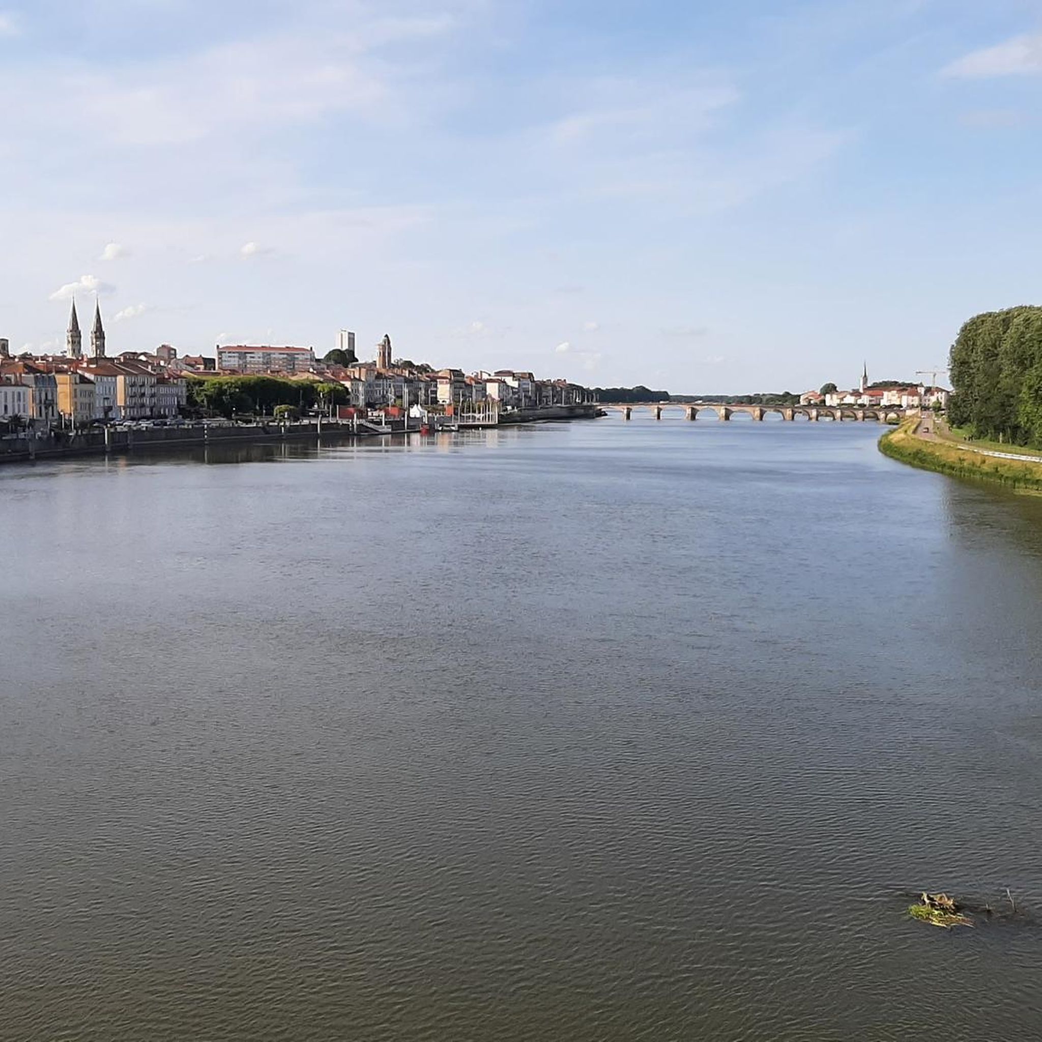
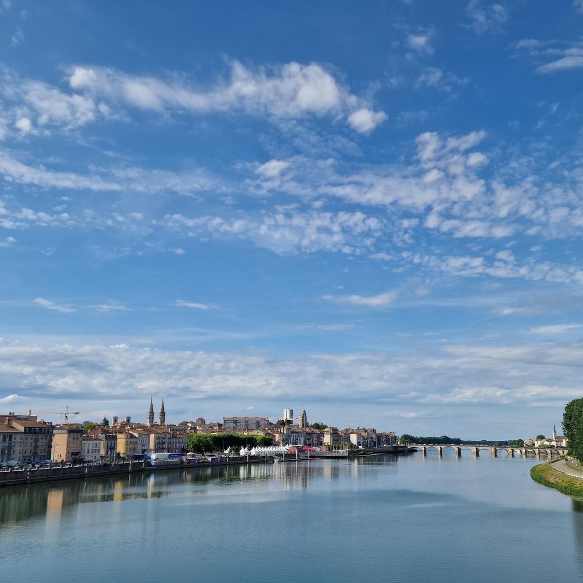
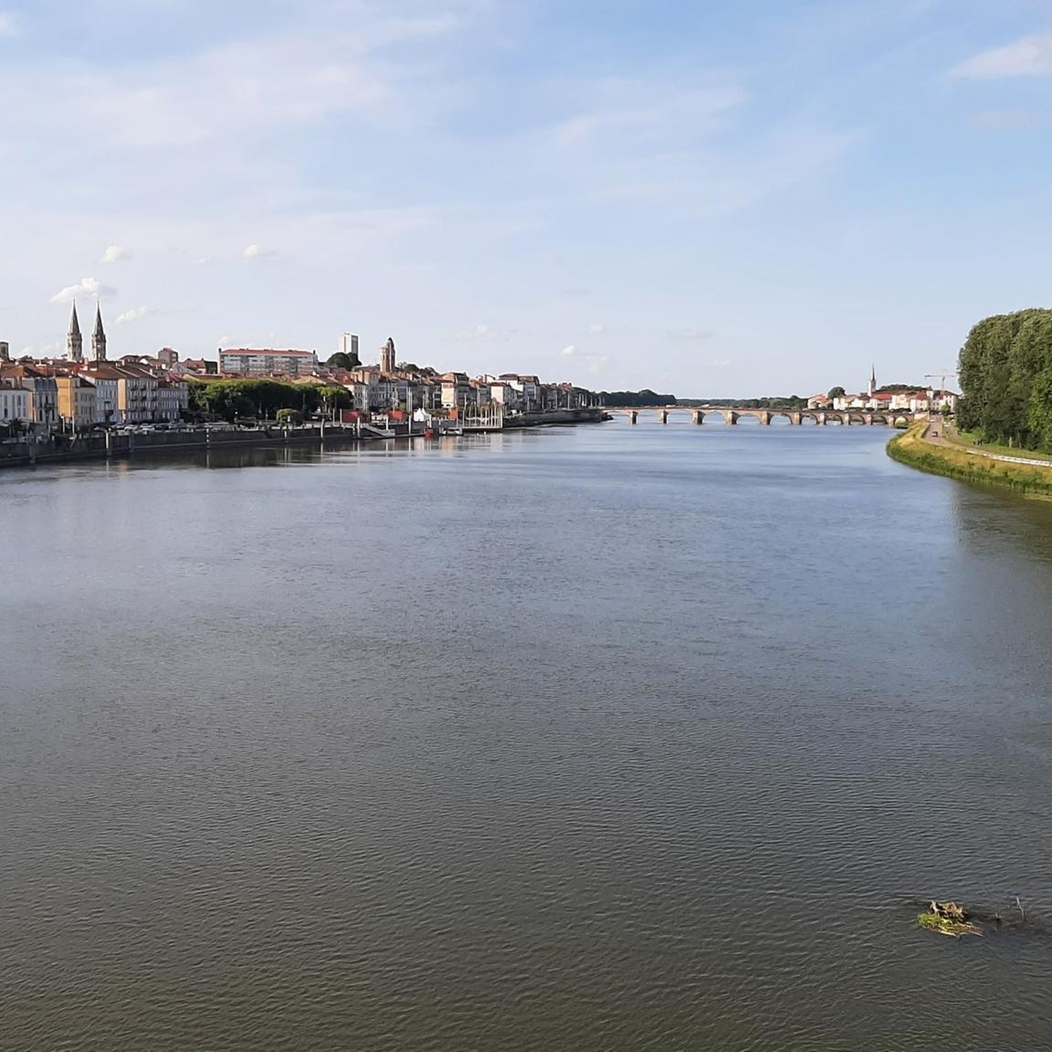
Road cycling routes in this area often pass by significant natural features and landmarks. You can enjoy views of the Veyle River, which flows through the commune, and the broader Ain department is known for its beautiful countryside. Routes often lead towards Mâcon, where you can experience the view of Mâcon and the Saône from the François Mitterand bridge. The notable Roche de Solutré is also a prominent landmark visible on several routes, such as the Saint-Laurent Bridge (Mâcon) – Roche de Solutré loop from Pont-de-Veyle.
Are there road cycling routes suitable for families or beginners?
Yes, the region offers routes suitable for all fitness levels, including easy rides perfect for families or beginners. There are 102 easy routes available. An example is the Saint-Laurent Bridge – Berges de la Saône loop from Pont-de-Veyle, which is an easy 34.6 km ride with moderate elevation, offering a pleasant experience along the Saône River.
Are there any circular road cycling routes in the area?
Many of the road cycling routes around Saint-Jean-sur-Veyle are designed as loops, allowing you to start and finish in the same location. Examples include the popular View of Roche Solutré – View of La Roche de Solutré loop from Saint-Jean-sur-Veyle and the Montépin Castle loop from Pont-de-Veyle.
What is the best time of year for road cycling in Saint-Jean-sur-Veyle?
The Auvergne-Rhône-Alpes region, where Saint-Jean-sur-Veyle is located, generally offers pleasant cycling conditions from spring through early autumn. The summer months are particularly appealing, with the option to combine cycling with a refreshing stop at the Cormoranche Lake Leisure Center, which features supervised swimming and picnic areas.
Where can cyclists find parking near the routes in Saint-Jean-sur-Veyle?
While specific parking areas for cyclists are not detailed, Saint-Jean-sur-Veyle and nearby towns like Pont-de-Veyle, which serve as starting points for many routes, typically offer public parking facilities. It's advisable to check local signage upon arrival for the most convenient options.
Is public transport available to reach Saint-Jean-sur-Veyle with a bike?
Information on specific public transport options for bikes to Saint-Jean-sur-Veyle is limited. However, the region is well-connected by road, and Mâcon, just 8 km away, is a larger city with more transport links. Cyclists often travel by car to reach starting points for routes in this area.
Are there places to stop for refreshments or accommodation for cyclists?
Saint-Jean-sur-Veyle, though a small commune, is part of a region that welcomes visitors. Nearby Mâcon offers a wider range of cafes, pubs, and accommodation options. The Cormoranche Lake Leisure Center also provides picnic areas and barbecues, perfect for a break during a ride.
What do other road cyclists appreciate most about the routes around Saint-Jean-sur-Veyle?
The road cycling routes around Saint-Jean-sur-Veyle are highly rated by the komoot community, with an average score of 4.4 stars from over 150 reviews. Cyclists often praise the varied terrain, the scenic views of the countryside and the Veyle River, and the proximity to attractions like Mâcon and the Roche de Solutré, which add cultural and natural interest to their rides.
Are there any challenging road cycling routes for experienced riders?
Yes, for experienced riders seeking a challenge, the region offers 105 difficult routes. An example is the Col de la Grange du Bois – Col de Gerbet loop from Pont-de-Veyle, a moderate route that covers nearly 65 km with an elevation gain of approximately 892 meters, providing a more demanding experience.
Most popular routes around Saint-Jean-Sur-Veyle
Most popular attractions around Saint-Jean-Sur-Veyle

Get inspired with the komoot mobile app


Explore more
Browse the best Road cycling routes in other regions.
