The best cycling routes around Vandeins
4.4
(140)
929
riders
102
rides
Touring cycling routes around Vandeins are situated in a rural commune within the Ain department of eastern France, offering a serene setting for exploration. The immediate area features gently rolling to relatively flat terrain, with elevations ranging from 194 to 251 meters, making it suitable for relaxed cycling. The landscape primarily consists of agricultural lands and small woodlands, providing a tranquil cycling experience away from heavy traffic. Vandeins serves as a peaceful base for accessing the more diverse and extensive…
Last updated: June 27, 2026
4.6
(5)
9
riders
69.4km
04:08
380m
380m
Moderate bike ride. Good fitness required. Mostly paved surfaces. Suitable for all skill levels.
5.0
(1)
6
riders
12.9km
00:47
110m
110m
Easy bike ride. Great for any fitness level. Mostly paved surfaces. Suitable for all skill levels.

Sign up for free
1.0
(1)
4
riders
74.9km
04:26
330m
330m
Moderate bike ride. Good fitness required. Mostly paved surfaces. Suitable for all skill levels.
4
riders
46.0km
02:49
240m
240m
Moderate bike ride. Good fitness required. Mostly paved surfaces. Suitable for all skill levels.
5.0
(1)
4
riders
16.8km
01:02
130m
130m
Easy bike ride. Great for any fitness level. Mostly paved surfaces. Suitable for all skill levels.
Get access to more routes and recommendations from other explorers.
Sign up for free
Already have an account?
Our route recommendations are based on thousands of hikes, rides, and runs completed by other people on komoot.
Start today with a free account
Your next adventure awaits.
Login or Signup



Tips from the Community

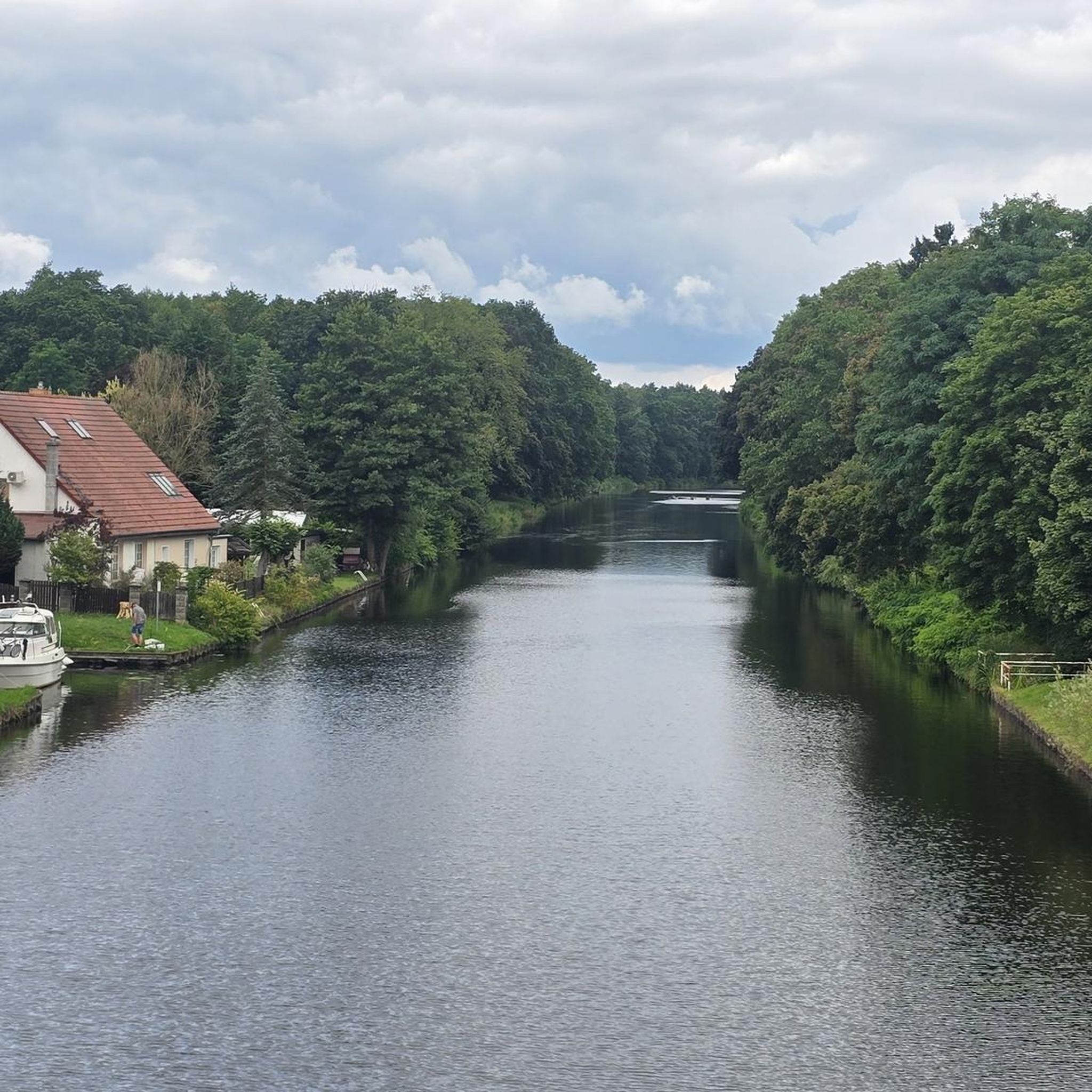
An idyllic, paved cycle path directly on the riverbank. It is a section of the well-known French long-distance cycle route „La Voie Bleue - Moselle-Saône Radweg" (Route V50) along the Saône. The entire long-distance cycle route covers around 700 kilometers from the Luxembourg border town of Apach (near the tripoint) to Lyon. The Saône section follows the natural meanders of the Saône, passing meadows, historic villages, and well-known wine-growing regions such as Mâcon. The route is mostly flat on former towpaths.
0
0
An idyllic, asphalted cycle path right on the riverbank. This is a section of the well-known French long-distance cycle route "La Voie Bleue - Moselle-Saône Radweg" (Route V50) along the Saône. The entire long-distance cycle route runs for around 700 kilometers from the French border town of Apach (near the tripoint) to Lyon. The Saône section follows the natural meanders of the Saône, passing meadows, historic villages, and well-known wine-growing regions such as Mâcon. The route runs mostly flat on former towpaths.
0
0
The Plan d'Eau de Fleurville (also known as Gravière de Fleurville) is a beautiful recreational and natural lake in the Saône-et-Loire department. The body of water is located directly on the border of the municipalities of Saint-Albain and Fleurville on the Saône. It is a former gravel pit that has been renatured and is today an important refuge for biodiversity as well as a popular excursion destination. The lake is equipped with picnic tables, fishing piers, and observation points. It is an excellent place for hiking, cycling (near the Voie Bleue cycle path), and birdwatching (e.g. for storks and migratory birds).
0
0
The Berges de la Saône (the riverbank promenade of the Saône River) is a modernized riverbank section in the Burgundy region of France, near the road du Pont Vert. This paved riverside path is a popular section of the well-known La Voie Bleue cycle route (Moselle-Saône cycle route) and serves as a recreational and event area for both pedestrians and cyclists.
1
0
The Esplanade Lamartine forms the green heart of the Mâcon waterfront, directly on the Saône. The area is named after the famous French poet, writer, and politician Alphonse de Lamartine, who was born in Mâcon in 1790. A striking bronze statue in his honor dominates the square. The large, white "MACON" lettering from your photo is a very popular photo motif for tourists. It stands on a green strip directly on the Esplanade and offers the river as well as the rows of houses opposite as a backdrop.
1
0
The Saint-Laurent Bridge (Pont Saint-Laurent) is a historic stone bridge that spans the Saône River. It connects the town of Mâcon in the Saône-et-Loire department with the municipality of Saint-Laurent-sur-Saône in the Ain department. Initial wooden structures were already built by the Romans. The current stone bridge dates back to the 11th century in its core and is considered the oldest bridge over the Saône. The structure consists of twelve stone arches. On one of the pillars, there is a statue of Saint Nicholas, the patron saint of boatmen. It is one of the few historic structures in the region that survived the demolitions of World War II unscathed.
1
0
The ruins of the former cathedral Vieux-Saint-Vincent (Old Saint-Vincent) in the historic Saint-Vincent quarter in Mâcon. The structure originally dates from the 11th century (Romanesque) and was extended in the 13th century in the Gothic style. It was the main church of the historic Diocese of Mâcon. During the French Revolution, the cathedral was declared national property. The nave and choir were subsequently methodically demolished and the stones sold as building material. Essentially, the two striking towers of the west facade, the narthex, and an artful Romanesque tympanum have been preserved.
0
0

Along the Saône runs the unfortunately often unpaved, patchy Voie Bleu ("Blue Way"). Incidentally, there is only one Voie Bleu, unlike the Voies Vertes. From Wikivoyage.
1
0
Frequently Asked Questions
How many touring cycling routes are available around Vandeins?
There are over 90 touring cycling routes around Vandeins, offering a wide range of options for exploring the rural landscapes of the Ain department. These routes cater to various skill levels, with a good mix of easy and moderate paths.
What kind of terrain can I expect on touring cycling routes near Vandeins?
The immediate area around Vandeins features gently rolling to relatively flat terrain, with elevations typically ranging from 194 to 251 meters. You'll primarily cycle through peaceful agricultural lands and small woodlands, providing a tranquil experience away from heavy traffic. For more challenging rides with significant elevation, the wider Ain department offers access to the Jura mountains and passes like the Grand Colombier.
Are there easy touring cycling routes suitable for beginners or families in Vandeins?
Yes, Vandeins offers over 40 easy touring cycling routes, making it a great destination for beginners or families looking for relaxed rides. These routes typically traverse quiet country roads and agricultural lands. An example of an easy route is the Church of Notre-Dame de Vandeins loop from Chaveyriat, which covers about 12.9 km with minimal elevation gain.
What is the best time of year for touring cycling in Vandeins?
The best time for touring cycling in Vandeins, and the wider Ain department, is generally during spring (April to June) and autumn (September to October). During these seasons, the weather is typically mild and pleasant, and the landscapes are particularly picturesque. Summer can also be enjoyable, though it may be warmer, especially in July and August.
Are there any circular touring cycling routes around Vandeins?
Yes, many of the touring cycling routes around Vandeins are designed as loops, allowing you to start and end at the same point. For instance, the Attignat_Viriat – Lake Montrevel-en-Bresse loop from Polliat is a popular circular route that takes you through agricultural lands to the lake.
What interesting landmarks or attractions can I see along touring cycling routes near Vandeins?
While cycling around Vandeins, you can explore several local points of interest. Consider visiting La Poype des Fées, a historical reconstruction of a motte-and-bailey castle, or the traditional Moulin des Vernes watermill. For a more refined experience, the nearby Georges Blanc Village in Vonnas offers gourmet dining and other amenities.
What do other touring cyclists enjoy most about cycling in Vandeins?
The touring cycling routes around Vandeins are highly rated by the komoot community, with an average score of 4.3 stars from over 150 reviews. Cyclists often praise the tranquil rural character, the peaceful country roads, and the scenic views of agricultural lands and small woodlands. The area is appreciated for its gentle terrain, making it accessible for various fitness levels.
Are there any longer touring cycling routes for experienced riders?
Yes, for more experienced riders seeking longer distances, Vandeins serves as a gateway to the broader Ain department's extensive cycling network. Within the immediate vicinity, routes like the Historic center of Mâcon – Panoramic View of the Saône loop from Mézériat offer a substantial ride of nearly 69 km with moderate elevation changes, providing panoramic views of the Saône.
Can I find routes that offer scenic viewpoints around Vandeins?
Many routes around Vandeins offer pleasant scenic views, particularly of the agricultural landscapes and the tranquil countryside. The Historic center of Mâcon – Panoramic View of the Saône loop from Mézériat, for example, is specifically highlighted for its panoramic views of the Saône river loop.
Are there routes that connect to larger regional cycling networks like the Ain à Vélo?
While Vandeins itself is a rural commune, its location within the Ain department means you are close to the region's extensive cycling opportunities. The Ain à Vélo network, which includes routes like the GTJ® (Grande Traversée du Jura) and features 18 cycling passes, is accessible from the wider area, offering diverse terrain and challenging ascents for those looking to explore beyond Vandeins' immediate surroundings.
Are there any routes that pass by lakes or water bodies?
Yes, some routes in the vicinity of Vandeins will take you past local water bodies. For instance, the Attignat_Viriat – Lake Montrevel-en-Bresse loop from Polliat is a popular option that leads directly to Lake Montrevel-en-Bresse, offering a refreshing stop during your ride.
Most popular attractions around Vandeins

Get inspired with the komoot mobile app


Explore more
Browse the best Cycling routes in other regions.
