The best walks and hikes around Champrenault
4.1
(62)
345
hikers
5
hikes
Hiking around Champrenault offers a diverse landscape for outdoor exploration in the Côte-d'Or department. The region is characterized by notable cliffs such as Falaise de Saffres and Baulme-la-Roche, alongside stream valleys and local hills like Mount Tasselot. Trails often lead through varied terrain, including forested areas and open countryside, providing opportunities to experience the local environment. The network of routes caters to different hiking preferences, from easier paths to more challenging moderate excursions.
Best hiking trails around Champrenault
- The most…
Last updated: July 6, 2026
4.7
(15)
55
hikers
3.86km
01:14
150m
150m
Easy hike. Great for any fitness level. Easily-accessible paths. Suitable for all skill levels.
4.6
(12)
56
hikers
16.6km
04:29
220m
220m
Explore the origins of France's famous Seine River on this moderate 10.3-mile loop hike through Burgundy's woodlands and countryside.

Sign up for free
4.5
(8)
68
hikers
Moderate hike. Good fitness required. Easily-accessible paths. Suitable for all skill levels.
4.3
(7)
58
hikers
16.1km
04:41
420m
420m
Moderate hike. Good fitness required. Easily-accessible paths. Suitable for all skill levels.
2.5
(2)
15
hikers
6.13km
01:40
90m
90m
Easy hike. Great for any fitness level. Easily-accessible paths. Suitable for all skill levels.
Our route recommendations are based on thousands of hikes, rides, and runs completed by other people on komoot.
Start today with a free account
Your next adventure awaits.
Login or Signup



Tips from the Community

A bucolic, clean, well-maintained, and shaded spot, with tables and trash cans for picnicking. It's officially a Paris commune, but it looks nothing like Paris.
0
0

There's a signposted and very beautiful circular trail that includes the source of the Seine. Learn more on the official website here: https://www.cotedor-randonnee.com/
1
0

Wikipedia reports: "The source of the Seine is located on the plateau of Langres, 25 km north-west of Dijon in the Côte-d'Or department in the Bourgogne-Franche-Comté region, 470 m above sea level. A special feature is that the sources of the Seine were the property of the city of Paris from 1864 onwards. An artificial grotto was built a year later to protect the main source and a statue of a nymph was erected to symbolize the river. Paris has since returned the property to the region. Near the source are the remains of a Gallo-Roman temple in which a Dea Sequana (Latin goddess of the Seine) was worshipped. The archaeological finds from this are now in the archaeological department of the Musée des Beaux-Arts in Dijon."
2
1

A beautiful view of the village of Baulme-la-Roche. The village has several architectural monuments (several farms, a fountain and a church).
0
0

The Seine is a river 777 km long and flows into the English Channel.
4
0

To be honest, there is not much going on here, only nature and many fields, now and then a little forest, it is constantly uphill and downhill.
0
0

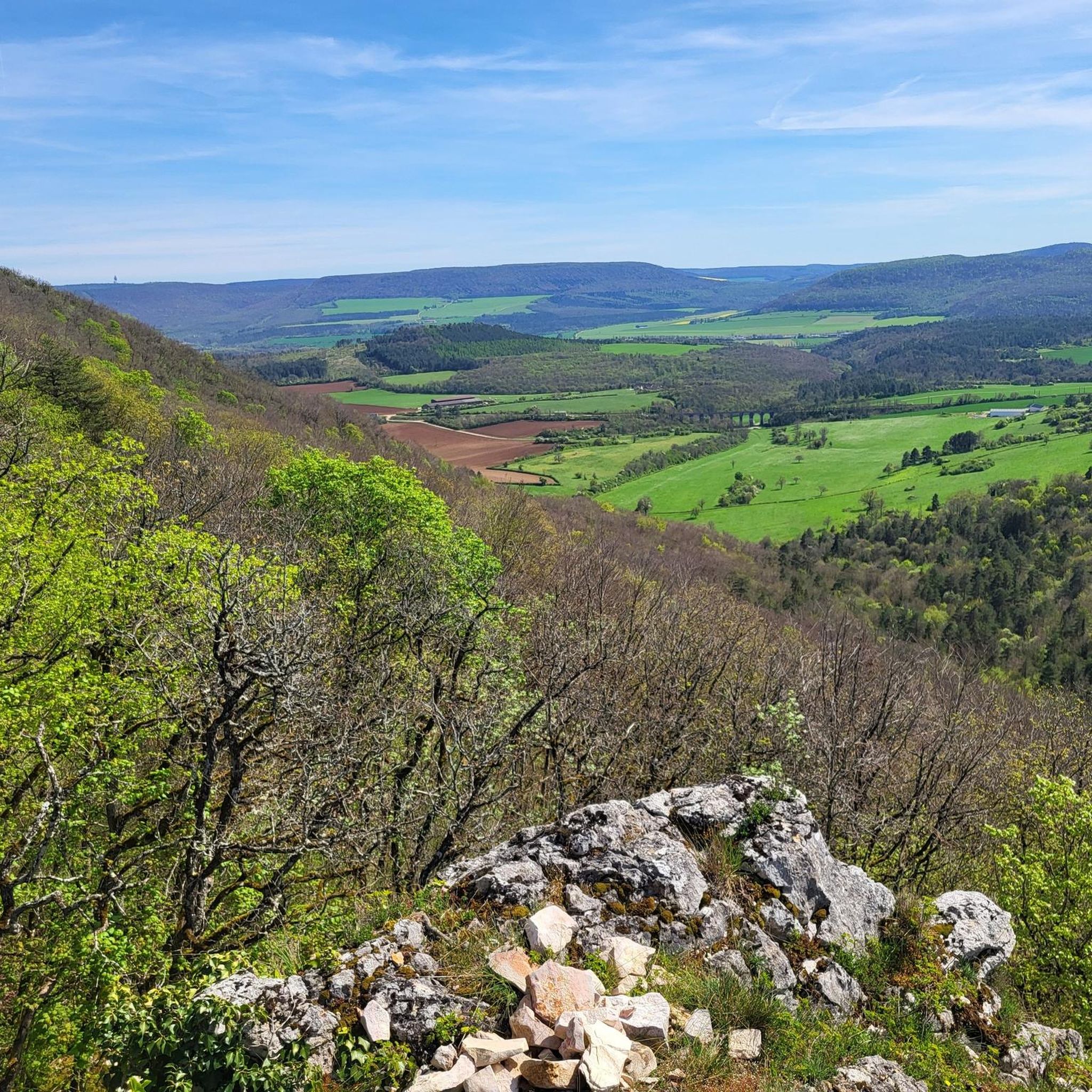
Impressive rocks with magnificent views
1
0

Impressive view of the cliffs from the village below.
1
0
Frequently Asked Questions
How many hiking trails are available around Champrenault?
There are over 7 hiking routes in the Champrenault region, offering a variety of experiences from easy strolls to more challenging moderate excursions.
Are there easy hiking trails suitable for beginners in Champrenault?
Yes, Champrenault offers several easy trails. An excellent option is the Falaise de Saffres loop from Saffres, which is 3.2 miles (5.1 km) long and provides views of the Saffres cliffs.
What are the typical lengths and durations of hikes in Champrenault?
Hikes in Champrenault vary in length and duration. Easy trails like the Falaise de Saffres loop from Saffres can be completed in about 1 hour 26 minutes, while moderate routes such as the Baulme-la-Roche Stream – Baulme-la-Roche Cliff loop from Blaisy-Bas can take around 4 hours 41 minutes for 10 miles (16.1 km).
Are there any circular hiking routes in Champrenault?
Yes, many trails in Champrenault are circular. Examples include the Mount Tasselot loop from Trouhaut, which is 8.8 miles (14.1 km), and the Castle loop from Villeberny, covering 5 miles (8 km).
What kind of natural landmarks or viewpoints can I expect to see on the trails?
The region features notable cliffs like Falaise de Saffres and Baulme-la-Roche. You can find stunning views such as the Panorama of the Baulme‑la‑Roche Rocks and explore the Falaise de Saffres itself.
Are there any historical sites or attractions near the hiking trails?
Yes, the area around Champrenault has historical points of interest. You might encounter sites like the Château de Blaisy-Haut or the Château de Salmaise loop from Verrey, which incorporates a castle into its route.
What do other hikers say about the trails in Champrenault?
The trails in Champrenault are highly regarded by the komoot community, with an average rating of 4.0 stars from over 60 reviews. Hikers often praise the diverse terrain, including stream valleys, cliff formations, and local hills.
Are there any advanced or challenging hiking routes in Champrenault?
While there are no routes classified as 'difficult,' Champrenault offers several moderate trails that provide a good challenge. These include the Baulme-la-Roche Stream – Baulme-la-Roche Cliff loop from Blaisy-Bas and the Mount Tasselot loop from Trouhaut.
Is Champrenault suitable for family-friendly hikes?
Yes, the region has trails suitable for families. The easier routes, such as the Falaise de Saffres loop from Saffres, are a good choice for shorter outings with children.
What is the best season for hiking in Champrenault?
The diverse landscape of Champrenault, with its cliffs and streams, makes it enjoyable for hiking during spring, summer, and autumn. Spring offers lush greenery, summer provides warmer weather, and autumn brings beautiful foliage. Always check local weather conditions before heading out.
Are dogs allowed on the hiking trails in Champrenault?
Generally, dogs are welcome on many hiking trails in the Champrenault region, especially if kept on a leash. However, it's always advisable to check specific trail regulations or local signage, particularly in nature reserves or protected areas, to ensure a pleasant experience for everyone.
Where can I find parking for hiking trails in Champrenault?
Parking availability varies by trailhead. Many routes, especially those starting from villages like Saffres, Blaisy-Bas, or Trouhaut, typically have designated parking areas nearby. It's recommended to check the starting point of your chosen route for specific parking information.
Most popular routes around Champrenault
Most popular attractions around Champrenault

Get inspired with the komoot mobile app


Explore more
Browse the best Hikes in other regions.
