The best walks and hikes around Roz-Sur-Couesnon
4.4
(846)
10,200
hikers
22
hikes
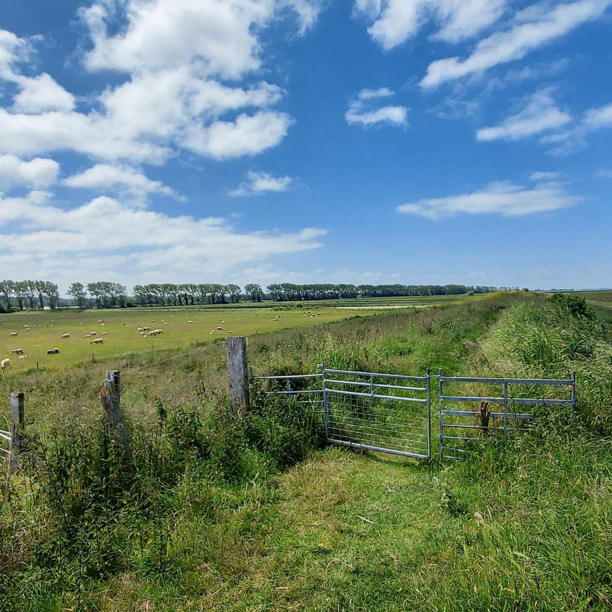
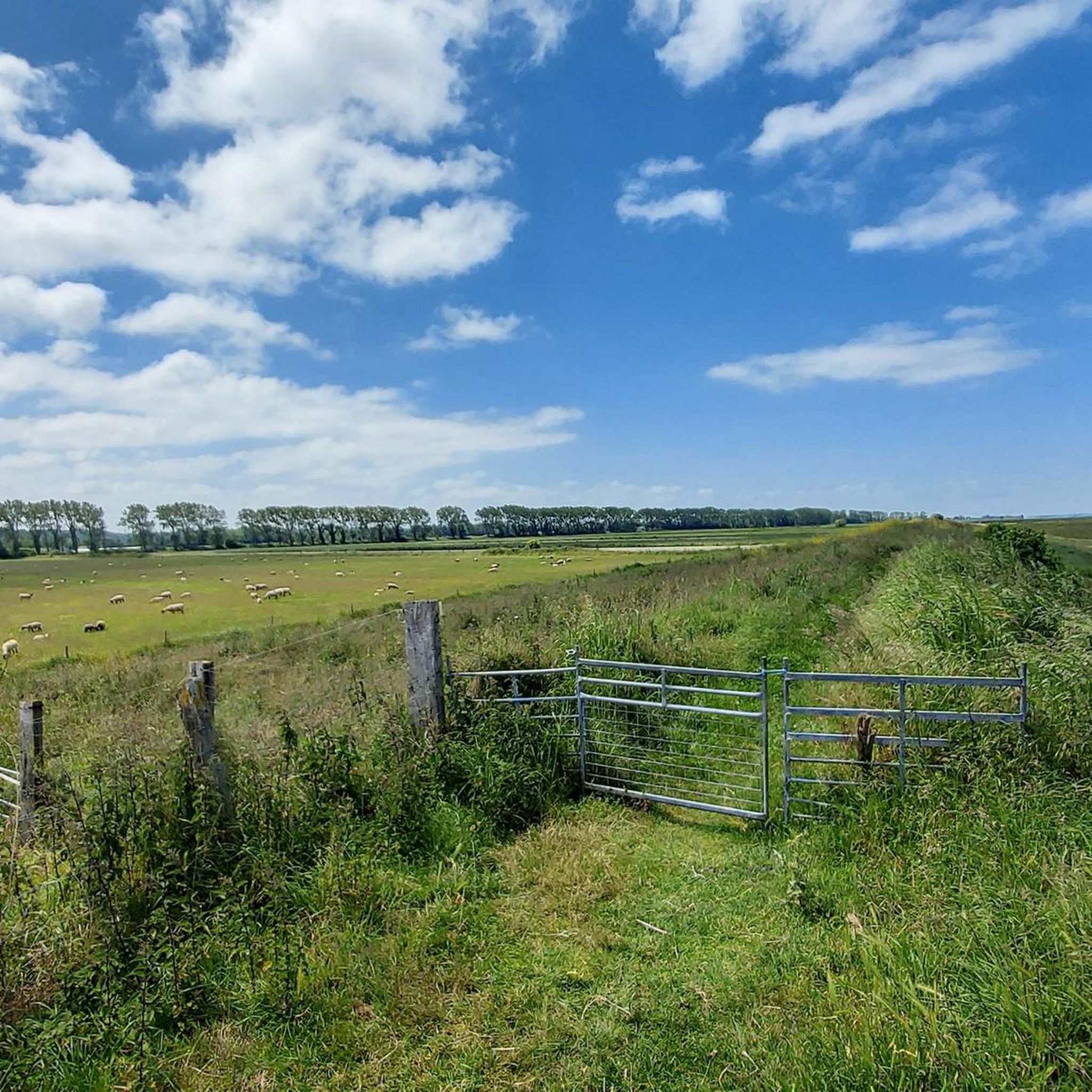
Hiking around Roz-Sur-Couesnon offers routes through a landscape shaped by its proximity to the Mont Saint-Michel Bay. The terrain is generally flat, characterized by coastal paths, estuarine environments, and open fields. Elevation gains are typically minimal, making many trails accessible. The region provides views across the bay and its unique natural features.
Best hiking trails around Roz-Sur-Couesnon
- The most popular hiking route is View of Mont Saint-Michel – View of Mont Saint-Michel loop from Les Cotterets, a 14.9 miles…
Last updated: August 15, 2026
4.5
(13)
108
hikers
Hard hike. Very good fitness required. Easily-accessible paths. Suitable for all skill levels.
4.0
(1)
17
hikers
12.6km
03:24
160m
170m
Moderate hike. Good fitness required. Easily-accessible paths. Suitable for all skill levels.

Sign up for free
5.0
(2)
13
hikers
8.93km
02:27
150m
150m
Moderate hike. Good fitness required. Easily-accessible paths. Suitable for all skill levels.
4.0
(1)
11
hikers
Hard hike. Very good fitness required. Easily-accessible paths. Suitable for all skill levels.
4.0
(4)
11
hikers
21.1km
05:20
50m
40m
Hard hike. Very good fitness required. Easily-accessible paths. Suitable for all skill levels.
Get access to more routes and recommendations from other explorers.
Sign up for free
Already have an account?
Our route recommendations are based on thousands of hikes, rides, and runs completed by other people on komoot.
Start today with a free account
Your next adventure awaits.
Login or Signup

Tips from the Community

Mont-Saint-Michel is a world-famous rocky island and commune on the border between Normandy and Brittany in France. Crowned by a monumental, medieval Benedictine abbey, this architectural marvel has been a UNESCO World Heritage site since 1979. The bay of the mount is also known for Europe's strongest tides, with a tidal range of up to 14 meters.
1
0

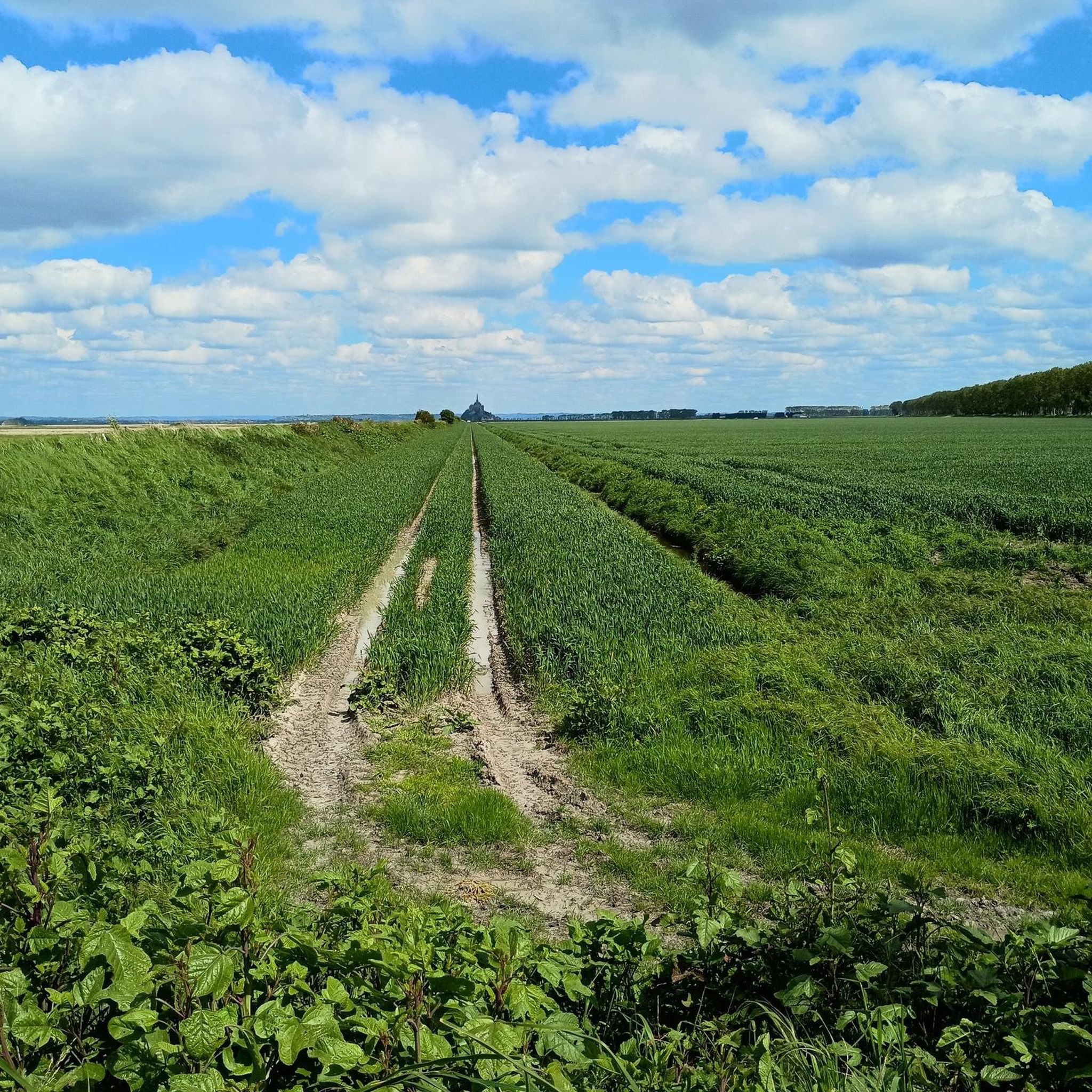
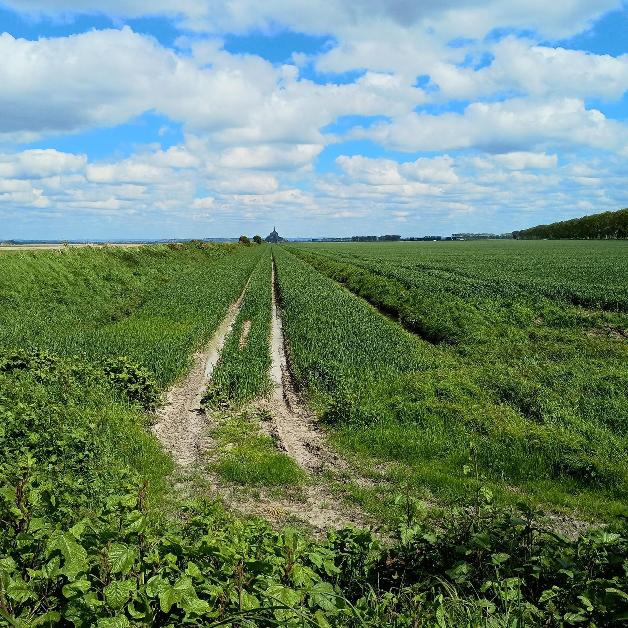
The footpath along the Couesnon to the dam already offers an impressive view of Mont-Saint-Michel. From here, the path with an unobstructed view leads across the salt marshes and the bay, with the landmark of Normandy impressively rising against the wide landscape. Especially in calm weather and with changing light, atmospheric views emerge of Mont-Saint-Michel, the course of the Couesnon river, and the tide-shaped surroundings.
10
0
The Couesnon dam (Barrage du Couesnon) was completed in 2009 and is part of the measures to preserve the bay of Mont-Saint-Michel. The facility regulates the water flow of the Couesnon and supports the natural removal of sediments by the tides. This is intended to counteract the increasing silting up of the bay and preserve the special character of Mont-Saint-Michel as a tidal island. The dam also offers a popular viewpoint with a view of Mont-Saint-Michel and the surrounding salt marshes.
1
0
The weir on the river **Couesnon** in front of Mont-Saint-Michel is part of a major project to restore its original island character. It regulates the flow of the Couesnon and helps transport sediment deposited in the bay back out to sea. At the same time, the structure is a popular promenade and viewpoint with an impressive view of Mont-Saint-Michel and the tide-shaped landscape.
35
0

From there it looks the strongest !!!
1
0

If there's a remarkable site that's worth a detour, it's Mont St Michel!
1
0


The dam trail is great for riding, but be careful, there are rocks on the way down. My tire was completely flat afterward.
0
0
Frequently Asked Questions
How many hiking trails are available around Roz-Sur-Couesnon?
There are over 20 hiking routes available around Roz-Sur-Couesnon, offering a variety of options for different skill levels and preferences. The komoot community has explored nearly 9,300 of these trails.
Are there easy hiking trails suitable for beginners or families in Roz-Sur-Couesnon?
Yes, Roz-Sur-Couesnon offers 7 easy hiking trails that are suitable for beginners or families. These routes typically feature minimal elevation gain and pleasant coastal or estuarine scenery. While specific family-friendly routes aren't detailed here, look for shorter, flatter options on komoot.
What kind of scenery can I expect on hikes around Roz-Sur-Couesnon?
Hiking around Roz-Sur-Couesnon is defined by its coastal paths, estuarine landscapes, and panoramic views of Mont Saint-Michel. The terrain is generally flat, offering expansive vistas across the bay and its unique natural features.
What are some notable landmarks or attractions to see while hiking near Roz-Sur-Couesnon?
Many trails offer views of the iconic Mont Saint-Michel. Other points of interest include the Saint Aubert Chapel, the scenic Grouin du Sud viewpoint, and the Bec d'Andaine beach. You can also see the Moulin de la Saline, an old salt mill.
Are there any circular hiking routes in the area?
Yes, many of the routes around Roz-Sur-Couesnon are circular. For example, the View of Mont Saint Michel loop from Roz-sur-Couesnon is a moderate 7.8-mile (12.6 km) trail that offers coastal views with Mont Saint-Michel vistas.
What is the best season for hiking in Roz-Sur-Couesnon?
The coastal climate of the Mont Saint-Michel Bay makes spring and autumn particularly pleasant for hiking, with milder temperatures and fewer crowds. Summer can also be enjoyable, though it may be busier. Always check local weather forecasts before heading out.
Are dogs allowed on the hiking trails around Roz-Sur-Couesnon?
Generally, dogs are welcome on many hiking trails in the region, especially on coastal paths and in natural areas. However, it's always recommended to keep them on a leash, particularly in areas with wildlife or near livestock, and to check specific trail regulations for any restrictions.
What do other hikers enjoy most about hiking in Roz-Sur-Couesnon?
The area is highly rated by the komoot community, with an average score of 4.4 stars from over 700 reviews. Hikers often praise the continuous, expansive views of Mont Saint-Michel and the unique estuarine environment.
Are there any trails that follow the Couesnon Dam?
Yes, the Couesnon Dam – View of Mont Saint-Michel loop from Roz-sur-Couesnon is a difficult 15.0-mile (24.1 km) path that follows the Couesnon Dam, providing continuous views of the bay and Mont Saint-Michel.
What is the typical duration for hikes in Roz-Sur-Couesnon?
Hike durations vary significantly. Shorter, easy trails might take a couple of hours, while longer, more challenging routes like the Panoramic view of Mont – Saint Martin Church loop from Les Cotterets can take over 7 hours to complete, covering distances up to 16.8 miles (27 km).
Are there opportunities for wildlife spotting on the trails?
Given the estuarine environments and coastal paths, Roz-Sur-Couesnon offers good opportunities for birdwatching and observing coastal wildlife. Keep an eye out for various bird species that frequent the bay area.
Most popular routes around Roz-Sur-Couesnon
Most popular attractions around Roz-Sur-Couesnon

Get inspired with the komoot mobile app


Explore more
Browse the best Hikes in other regions.
