The best road cycling routes around Sougéal
4.5
(44)
1,502
riders
102
rides
Road cycling routes around Sougéal offer diverse terrain, from the tranquil wetlands of the Marais de Sougéal to the nearby Forêt de Broualan. The region's landscape is characterized by its proximity to the Bay of Mont-Saint-Michel, providing scenic views and varied elevation. While many routes feature well-maintained paved surfaces ideal for road bikes, some paths may include moderate climbs. This area provides a compelling destination for road cyclists seeking a mix of natural beauty and engaging routes.
Best road cycling…
Last updated: May 24, 2026
4.7
(3)
179
riders
Moderate road ride. Good fitness required. Some segments of this route may be unpaved and difficult to ride.
5.0
(1)
26
riders
Moderate road ride. Good fitness required. Some segments of this route may be unpaved and difficult to ride.

Sign up for free
19
riders
Moderate road ride. Great for any fitness level. Some segments of this route may be unpaved and difficult to ride.
19
riders
Moderate road ride. Good fitness required. Some segments of this route may be unpaved and difficult to ride.
27
riders
14.0km
00:34
20m
20m
Easy road ride. Great for any fitness level. Mostly well-paved surfaces and easy to ride.
Get access to more routes and recommendations from other explorers.
Sign up for free
Already have an account?
Our route recommendations are based on thousands of hikes, rides, and runs completed by other people on komoot.
Start today with a free account
Your next adventure awaits.
Login or Signup

Tips from the Community

Parts of the route along the sea do not exist or are forbidden for bicycles
0
0

Old priory attached to Mont Saint Michel, the ultimate stage for pilgrims before the Merveille.
0
0

This picnic area is shared with car and camper drivers, but that doesn't matter.
1
0
At 3 km long, this is the largest sandy beach in Saint-Malo. Walking along this beach, you can reach Intra-Muros in Paramé. Sillon Beach includes Grande Plage, Hoguette Beach, and Rochebonne Beach. La Digue was built from 1883 to 1913 on an old sandbar (the Sillon) that once connected Paramé to the walled city and provided the only dry-land access at low tide. Originally, a strip of sand was covered with dunes that grew higher and higher as one moved toward Rochebonne, with only a succession of windmills remaining. The first causeway was built in 1509, rebuilt and widened several times... Le Digue, 1,671 meters long, runs along Grande Plage and offers a pleasant stroll, lined with numerous villas built towards the end of the 19th century. Along the Sillon, a line of breakwaters protects the seawall from the force of the waves. Built in the early 19th century based on an idea by the civil engineer Robinault de St-Servan, the oak breakwaters have a depth at least equal to, or even greater than, their visible height.
2
0

A must-see with the miller as your guide
0
0

one of the tide mills on the Rance, worth the detour
0
0

Going back up towards St-Malo, a pretty path to the left (Rance valley) allows you to partly avoid the D117.
0
0

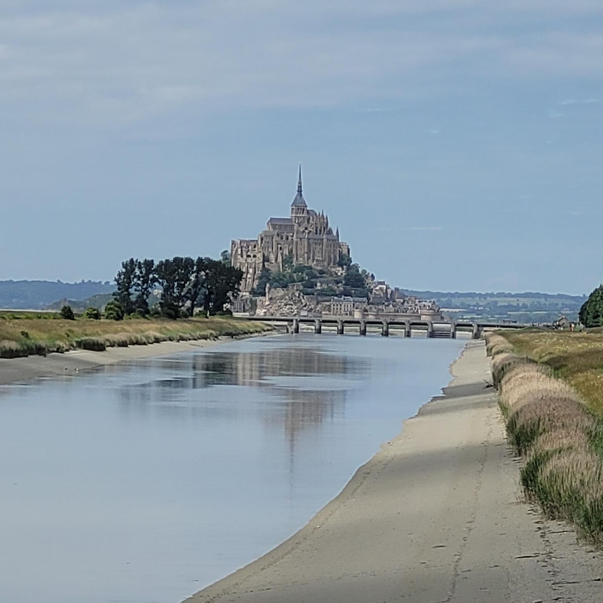
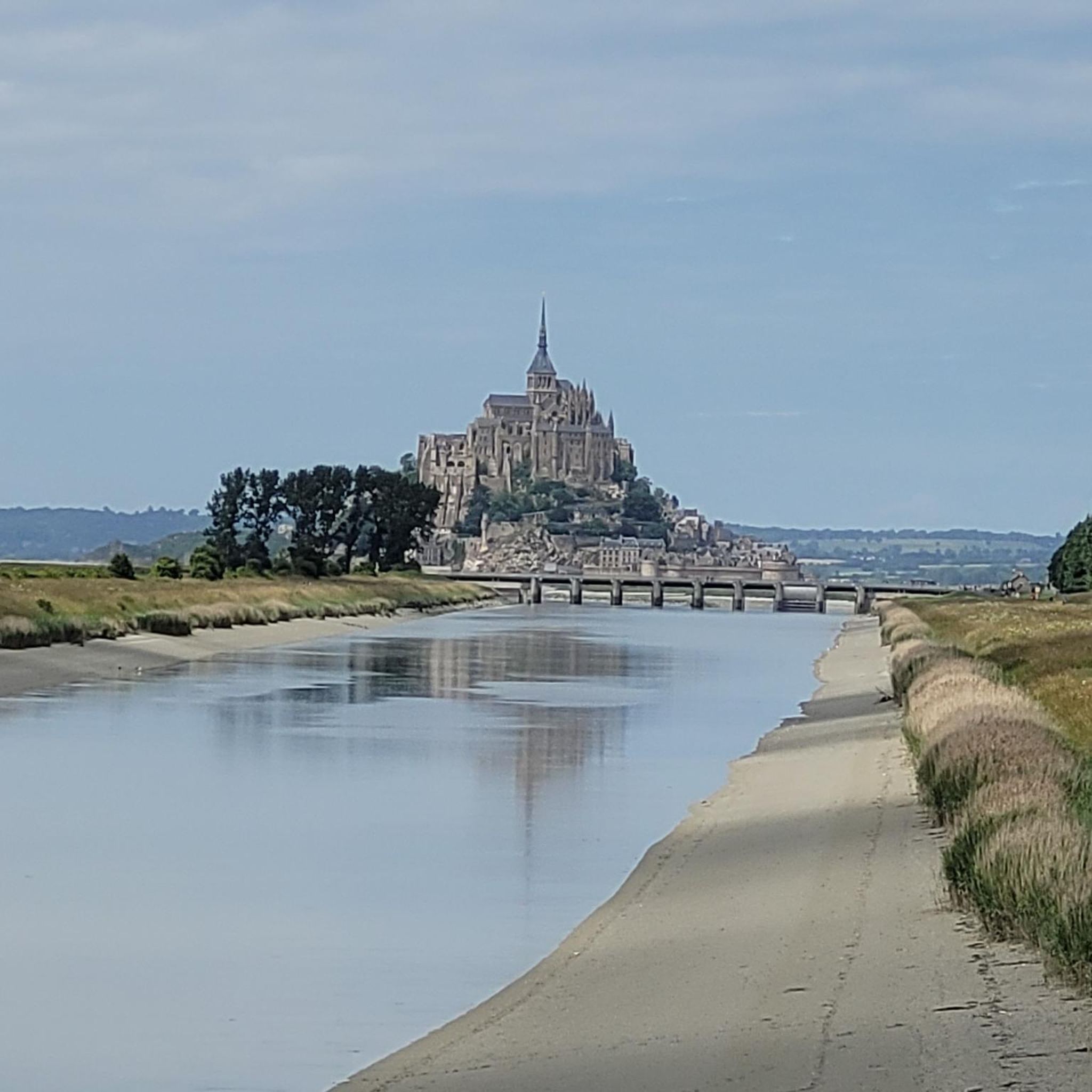
a very beautiful view of the mountain during the whole ascent
1
0
Frequently Asked Questions
How many road cycling routes are available around Sougéal?
There are nearly 100 road cycling routes available around Sougéal, catering to various skill levels. You'll find options ranging from easy rides to more challenging excursions.
What kind of terrain can I expect on road cycling routes in Sougéal?
Road cycling in Sougéal offers diverse terrain, from the tranquil wetlands of the Marais de Sougéal to the nearby Forêt de Broualan. The region's landscape is characterized by its proximity to the Bay of Mont-Saint-Michel, providing scenic views and varied elevation. Many routes feature well-maintained paved surfaces ideal for road bikes, though some paths may include moderate climbs.
What is the best time of year for road biking in Sougéal?
The region around Sougéal is generally pleasant for road cycling from spring through autumn. Spring offers lush greenery and blooming landscapes, while autumn provides cooler temperatures and beautiful foliage. Summer is also suitable, but it's advisable to start earlier in the day to avoid the midday heat.
Are there road cycling routes suitable for beginners in Sougéal?
Yes, Sougéal offers several easy road cycling routes perfect for beginners or those looking for a relaxed ride. For example, The Couesnon at Beauvoir loop from Pontorson-Mont-Saint-Michel is an easy 14.4 km route with minimal elevation gain, ideal for a gentle introduction to the area's cycling paths.
Are there challenging road cycling routes for experienced riders in Sougéal?
For experienced riders seeking a challenge, Sougéal and its surroundings offer routes with significant elevation gains. While most routes are moderate, some can reach up to 3,000 feet of elevation, providing a demanding workout amidst scenic landscapes. You can find a few difficult routes in the area for a more intense experience.
What scenic viewpoints or landmarks can I see along road cycling routes in Sougéal?
Many routes offer captivating views, especially towards the iconic Mont Saint-Michel. You can also pass by the Couesnon at Beauvoir, the Pont d'Orson, and enjoy the Breathtaking view of Mont Saint-Michel. The Duchesse Anne dike and the Cycle path along the Couesnon River are also notable points of interest.
Are there any natural features to explore while road cycling in Sougéal?
Absolutely. The region is rich in natural beauty. You can cycle near the serene Marais de Sougéal, a regional nature reserve known for its biodiversity. The nearby L'étang des Pas-Gérault is another tranquil spot for wildlife observation, and the Forêt de Broualan offers peaceful, wooded surroundings.
Are there road cycling routes that are loop trails around Sougéal?
Yes, many road cycling routes around Sougéal are designed as loops, allowing you to start and finish at the same point. For instance, the Mont-Dol – Saint-Suliac loop from Pontorson-Mont-Saint-Michel is a popular moderate loop exploring coastal areas and charming villages.
Can I find cafes or places to stop for refreshments along road cycling routes?
Yes, some routes are designed with refreshment stops in mind. The Chappe Telegraph – Café-pause opportunity! loop from Pontorson-Mont-Saint-Michel is a moderate 64.1 km route specifically highlighting a cafe stop, allowing you to refuel and relax during your ride.
What do other road cyclists enjoy the most about road cycling in Sougéal?
The road cycling routes in Sougéal are highly rated by the komoot community, with an average score of 4.7 stars from over 30 reviews. Cyclists often praise the diverse terrain, the stunning views towards Mont Saint-Michel, and the well-maintained paved surfaces that make for an enjoyable ride through the region's natural beauty.
Are there any long-distance road cycling routes from Sougéal?
Yes, for those seeking longer excursions, there are several options. The Sélune Riverbank – View of Mont Saint-Michel loop from Pontorson-Mont-Saint-Michel is a substantial 104.3 km route offering expansive views. Another option is The dam on the Couesnon – View of Mont Saint-Michel loop from Pontorson-Mont-Saint-Michel, which is 84.0 km long.
Most popular attractions around Sougéal

Get inspired with the komoot mobile app


Explore more
Browse the best Road cycling routes in other regions.
