The best road cycling routes around Saint-Maurice-Sur-Dargoire
4.5
(275)
4,727
riders
149
rides
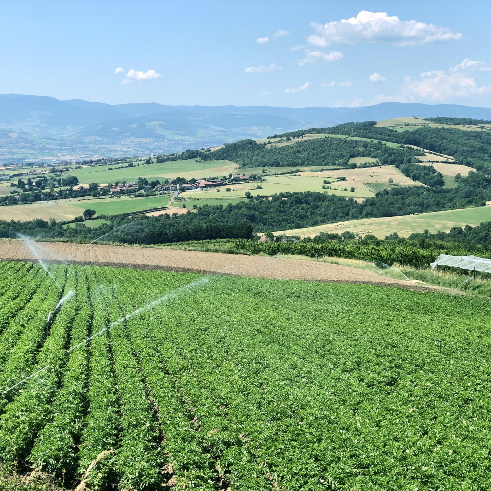
Road cycling routes around Saint-Maurice-Sur-Dargoire are characterized by the varied landscapes of the Monts du Lyonnais and the Pilat Regional Natural Park. The region features small roads and rolling lanes that traverse a rural backdrop of farm hamlets. Cyclists encounter diverse terrain with numerous climbs, offering elevations ranging from 147 to over 1200 meters. The area provides scenic panoramas of the Pilat massif and the Monts du Lyonnais.
Best road cycling routes around Saint-Maurice-Sur-Dargoire
- The most popular road cycling route…
Last updated: November 1, 2026
4.0
(1)
29
riders
43.4km
02:20
810m
820m
Moderate road ride. Good fitness required. Mostly well-paved surfaces and easy to ride.
5.0
(2)
26
riders
43.6km
02:17
820m
820m
Moderate road ride. Good fitness required. Mostly well-paved surfaces and easy to ride.

50
riders
35.4km
01:38
440m
440m
Moderate road ride. Good fitness required. Mostly well-paved surfaces and easy to ride.
28
riders
29.2km
01:40
610m
610m
Moderate road ride. Good fitness required. Some segments of this route may be unpaved and difficult to ride.
5.0
(2)
36
riders
65.9km
03:27
1,240m
1,240m
Hard road ride. Very good fitness required. Mostly well-paved surfaces and easy to ride.
Get access to more routes and recommendations from other explorers.
Already have an account?
Our route recommendations are based on thousands of hikes, rides, and runs completed by other people on komoot.
Start today with a free account
Your next adventure awaits.

Tips from the Community

Throughout the route the view is magnificent, be careful in September hunting season is open, be visible and stay on the marked paths.
0
0

Opening hours are available on the town hall website. Check it out!
0
0

magnificent view of the valley and its orchards
0
0


The Saint-Vincent chapel is the oldest Romanesque chapel in the Rhône department. From its promontory, the panoramic view of the Lyon region, the Alps, and Mont du Pilat is spectacular.
0
0

The oldest parts date from the 15th century.
0
0
Small square in front of the church offering a bar and public toilets.
0
0
Frequently Asked Questions
What kind of terrain can I expect when road cycling around Saint-Maurice-Sur-Dargoire?
The region offers a diverse landscape, primarily characterized by the rolling lanes and small roads of the Monts du Lyonnais and the Pilat Regional Natural Park. You'll cycle through a rural backdrop of farm hamlets, encountering varied terrain with numerous climbs. Elevations can range significantly, providing options for different fitness levels.
How many road cycling routes are available in the Saint-Maurice-Sur-Dargoire area?
There are over 150 road cycling routes available around Saint-Maurice-Sur-Dargoire. These routes cater to various skill levels, with 10 easy, 93 moderate, and 47 difficult options to explore.
Are there any challenging road cycling routes with significant elevation gain?
Yes, the area is known for its climbs. For a challenging ride, consider the Yzeron – Col des Brosses loop from Chabanière. This difficult route covers 44.5 miles (71.7 km) and features over 1150 meters of elevation gain, taking approximately 3 hours and 33 minutes to complete.
What are some scenic viewpoints or landmarks I can see while cycling?
The elevated terrain around Saint-Maurice-sur-Dargoire provides stunning perspectives of the Pilat massif and the Monts du Lyonnais. You can also discover historical sites like remnants of the Roman aqueduct of Gier, such as the Jurieux aqueduct and the Pont des Granges. For specific natural and man-made monuments, consider routes that pass near Madonne de la Croix-Régis or Les Roches de Marlin.
Are there any moderate road cycling routes that offer good views?
Absolutely. The Saint Vincent Chapel – View of Rontalon loop from Saint-Didier-sous-Riverie is a moderate 27.1-mile (43.6 km) path that offers beautiful views towards Rontalon and traverses varied terrain. Another great option is the Croix Régis Climb – Régis Cross loop from Châteauneuf, a moderate 35.4 km route with over 435 meters of elevation gain.
What do other road cyclists think about the routes in Saint-Maurice-Sur-Dargoire?
The routes in Saint-Maurice-Sur-Dargoire are highly rated by the komoot community, with an average score of 4.5 stars from over 200 reviews. More than 3800 road cyclists have used komoot to explore the area, often praising the varied terrain and scenic panoramas of the Monts du Lyonnais and Pilat Regional Natural Park.
Are there any circular road cycling routes in the area?
Yes, many routes in the region are designed as loops. For example, the Grenouze Pass – Pavezin Pass loop from Trèves is a moderate 25.4-mile (40.9 km) circular trail that takes you through two notable passes. Another option is the Saint Peter's Church, Mornant – Sainte Catherine loop from Mornant, a moderate 29.2 km route.
What is the best time of year for road cycling in Saint-Maurice-Sur-Dargoire?
The region, being part of the Auvergne-Rhône-Alpes, generally offers pleasant cycling conditions from spring through early autumn. The 'small roads and rolling lanes' are enjoyable when the weather is mild, allowing for clear views of the Monts du Lyonnais and Pilat massif. Always check local weather forecasts before heading out.
Are there any natural features like waterfalls or valleys to explore?
Yes, the nearby Bozançon Valley is a significant natural area featuring picturesque waterfalls and vestiges of Roman aqueducts. While primarily known for hiking, its natural beauty can be appreciated from surrounding cycling routes, offering a scenic backdrop to your ride.
Can I find cycling-friendly amenities like cafes or accommodation in the area?
The rural backdrop of farm hamlets and nearby villages like Riverie and Sainte-Croix-en-Jarez (listed among the most beautiful villages in France) suggest that local amenities, including cafes and accommodation, are available. These charming villages often cater to visitors exploring the region's natural beauty and historical sites.
Is the area suitable for family-friendly road cycling?
While the region offers diverse paths, including some with significant climbs, the presence of 'small roads and rolling lanes' and options for various ability levels suggests that some routes could be suitable for families. Look for routes categorized as 'easy' or 'moderate' with lower elevation gains for a more relaxed family experience.
Where can I find information about public transport or parking for cyclists?
Specific details on public transport directly to Saint-Maurice-sur-Dargoire for cyclists or dedicated cycling parking facilities are not extensively detailed in general regional information. However, as a popular cycling destination, local villages and towns often have public parking areas. For detailed public transport options, it's best to consult regional transport websites for the Auvergne-Rhône-Alpes region.
Most popular routes around Saint-Maurice-Sur-Dargoire
Most popular attractions around Saint-Maurice-Sur-Dargoire

Get inspired with the komoot mobile app


Explore more
Browse the best Road cycling routes in other regions.
