The best walks and hikes around Rochefort-Sur-Brévon
4.8
(25)
137
hikers
20
hikes
Hiking trails around Rochefort-Sur-Brévon traverse a landscape characterized by rolling hills, forested areas, and river valleys. The region features moderate elevation changes, with routes often following natural contours and offering views of the surrounding countryside. This area provides a mix of terrain suitable for various hiking experiences.
Best hiking trails around Rochefort-Sur-Brévon
- The most popular hiking route is Rochefort-sur-Brévon – Rochefort-sur-Brevon loop from Rochefort-sur-Brévon, a 5.8 miles (9.3 km) moderate trail that takes 2 hours 37 minutes to complete,…
Last updated: May 21, 2026
4.8
(6)
33
hikers
Moderate hike. Good fitness required. Easily-accessible paths. Suitable for all skill levels.
4.5
(4)
20
hikers
8.23km
02:19
170m
160m
Moderate hike. Good fitness required. Easily-accessible paths. Suitable for all skill levels.

Sign up for free
4.8
(4)
15
hikers
9.25km
02:37
200m
200m
Moderate hike. Good fitness required. Easily-accessible paths. Suitable for all skill levels.
4.3
(3)
13
hikers
14.2km
03:57
270m
270m
Moderate hike. Good fitness required. Easily-accessible paths. Suitable for all skill levels.
4
hikers
4.88km
01:23
100m
110m
Easy hike. Great for any fitness level. Easily-accessible paths. Suitable for all skill levels.
Get access to more routes and recommendations from other explorers.
Sign up for free
Already have an account?
Our route recommendations are based on thousands of hikes, rides, and runs completed by other people on komoot.
Start today with a free account
Your next adventure awaits.
Login or Signup
Popular around Rochefort-Sur-Brévon

Tips from the Community

Be surprised by the singing of the birds
0
0
Historical monument from the 15th century
0
0
There are numerous picnic areas with tables and benches
0
0

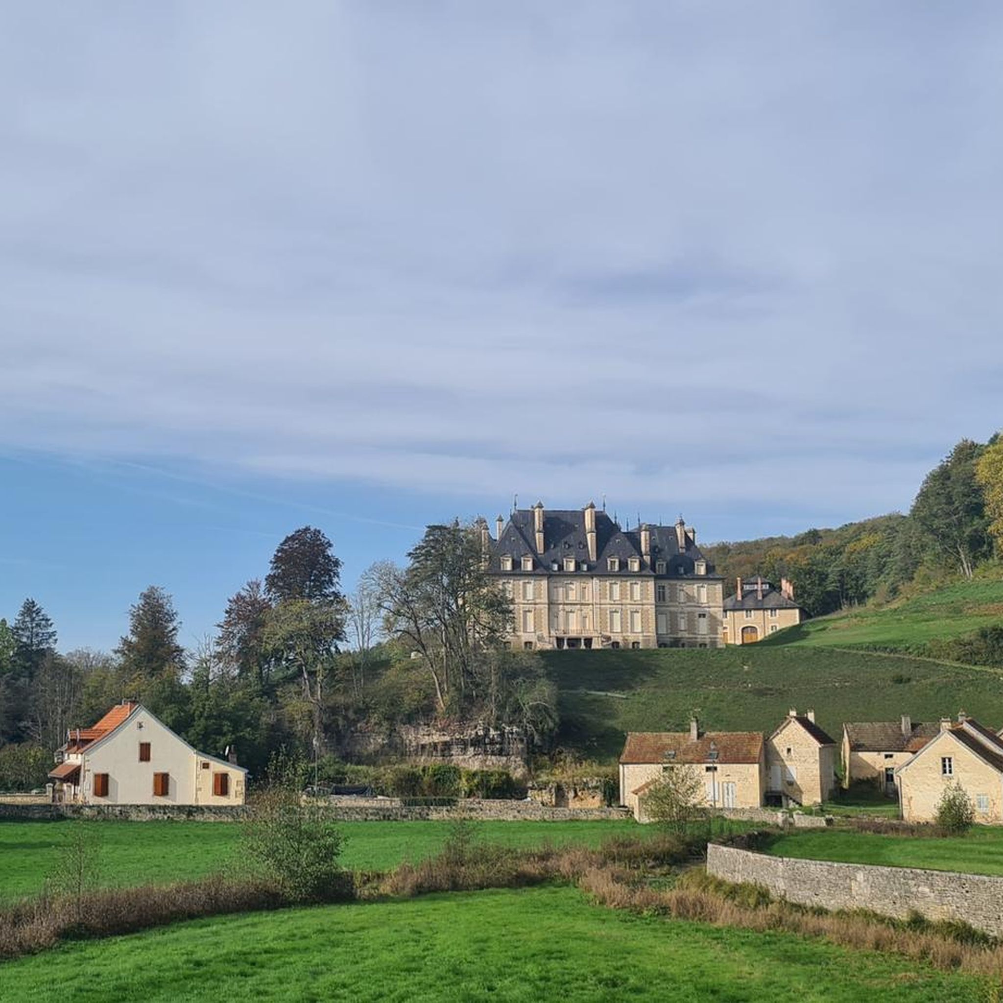
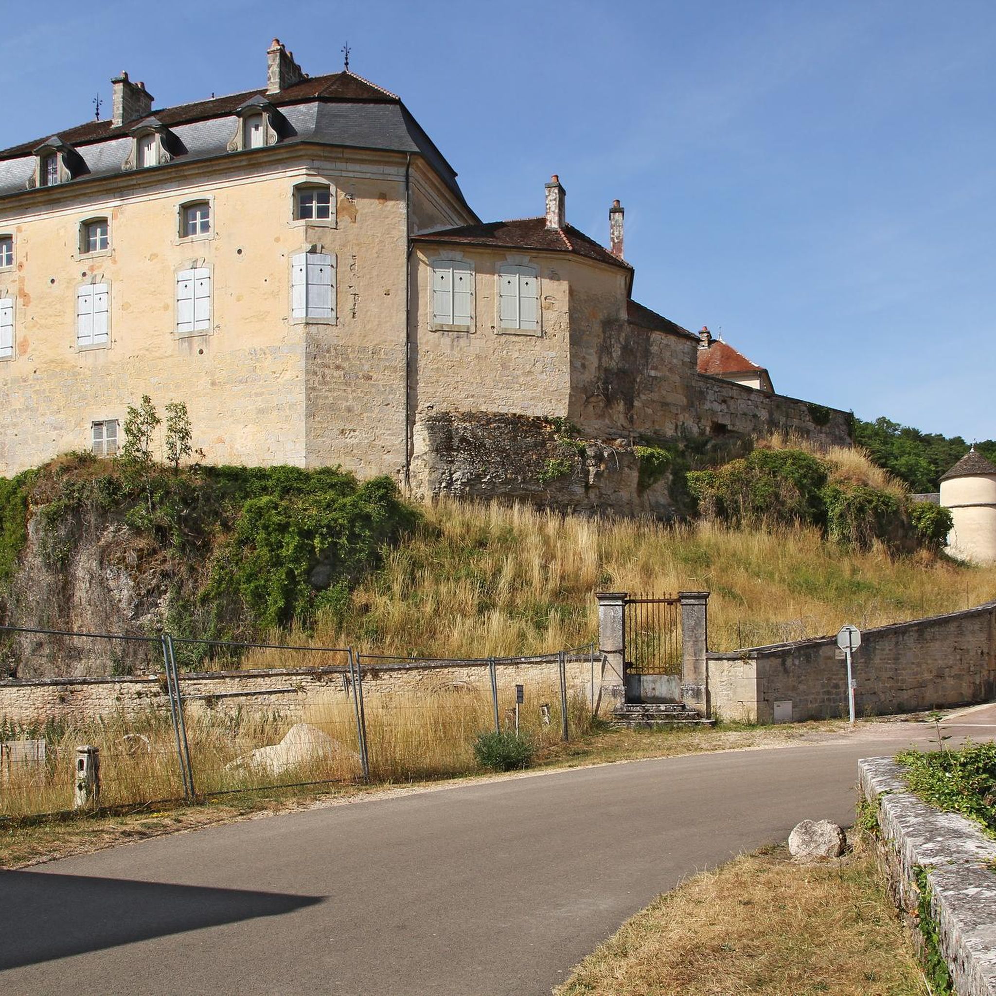
This village is located in lush greenery in the heart of the National Forest Park, in a preserved valley. You will not find more than 40 inhabitants in the town. You can admire its very beautiful castle, which is private and therefore not open to visitors.
0
0

This village is located in lush greenery in the heart of the National Forest Park, in a preserved valley. You will not find more than 40 inhabitants in the town. You will be able to admire its very beautiful castle, which is private and therefore not open to visitors.
1
0


Château sitting above Rochefort-sur-Brévon. Not open to the public
0
0
Frequently Asked Questions
How many hiking trails are available around Rochefort-Sur-Brévon?
There are 19 hiking trails around Rochefort-Sur-Brévon. These routes offer a variety of experiences, from easy strolls to more challenging treks through the region's rolling hills and forested areas.
Are there any easy or beginner-friendly hiking routes in Rochefort-Sur-Brévon?
Yes, Rochefort-Sur-Brévon offers several easy routes suitable for beginners. For example, the Château de Quemigny-sur-Seine loop from Quemigny-sur-Seine is an easy 4.8 km (3 miles) trail that takes approximately 1 hour 22 minutes to complete, offering gentle terrain and scenic views.
What is the best time of year for hiking in Rochefort-Sur-Brévon?
The best time for hiking in Rochefort-Sur-Brévon is generally from spring to autumn (April to October). During these months, the weather is typically mild, and the natural landscape, including the forests and river valleys, is at its most vibrant. Winter hiking is possible, but some paths might be muddy or slippery.
Are there any circular hiking routes around Rochefort-Sur-Brévon?
Yes, many of the trails in the region are circular, allowing you to start and end at the same point. A popular option is the Rochefort-sur-Brévon – Rochefort-sur-Brevon loop from Rochefort-sur-Brévon, a moderate 9.3 km (5.8 miles) route that takes about 2 hours 37 minutes.
What kind of terrain can I expect on hikes in Rochefort-Sur-Brévon?
The hiking trails around Rochefort-Sur-Brévon feature a diverse landscape of rolling hills, dense forested areas, and picturesque river valleys. You can expect moderate elevation changes, with paths often following natural contours and offering varied surfaces, from forest tracks to riverside paths.
What are some interesting places to see along the hiking trails?
Hikers can discover several notable attractions. You might encounter historical structures like the Rochefort-sur-Brévon Castle or Rocheprise Castle. The region also features charming bridges such as Pont Brémur and the Stone Bridge over the Seine at Vaurois, as well as natural beauty like the Forêt de Châtillon.
Are there any family-friendly walks suitable for children?
Yes, the region offers several shorter and easier routes that are great for families. The Château de Quemigny-sur-Seine loop from Quemigny-sur-Seine is an easy 4.8 km (3 miles) trail, perfect for a family outing. Look for routes marked as 'easy' for the most suitable options.
What do other hikers enjoy most about hiking in Rochefort-Sur-Brévon?
The area is highly rated by the komoot community, with an average score of 4.8 stars from over 20 reviews. Hikers often praise the tranquil natural settings, the well-maintained paths, and the opportunities to experience the local flora and fauna, particularly on routes like the Birdsong Trail loop from Plateau de Langres.
Are there any hikes that offer views of the Plateau de Langres?
Yes, the region is part of the Plateau de Langres, and many trails offer views or traverse this area. The Birdsong Trail loop from Plateau de Langres is a moderate 8.1 km (5.1 miles) path specifically designed to showcase the natural settings and wildlife of the plateau.
How long do hikes typically take around Rochefort-Sur-Brévon?
Hike durations vary depending on the route's length and difficulty. Easy trails, like the 4.8 km (3 miles) Château de Quemigny-sur-Seine loop, can take around 1 hour 22 minutes. Moderate routes, such as the 9.3 km (5.8 miles) Rochefort-sur-Brévon – Rochefort-sur-Brevon loop from Beaulieu, typically take about 2 hours 37 minutes. Longer moderate trails, like the 13.8 km (8.6 miles) Source of the Coquille – Cirque de la Coquille loop, can take nearly 4 hours.
Is parking available at the trailheads in Rochefort-Sur-Brévon?
While specific parking details vary by trailhead, many routes in the Rochefort-Sur-Brévon area, especially those starting from villages or popular points, typically have designated parking areas nearby. It's advisable to check the individual tour details on komoot for specific parking information before you go.
Most popular attractions around Rochefort-Sur-Brévon

Get inspired with the komoot mobile app


Explore more
Browse the best Hikes in other regions.
