The best road cycling routes around Replonges
4.4
(168)
4,814
riders
536
rides
Road cycling around Replonges, situated in France's Ain department, offers diverse landscapes for cyclists. The region features varied terrain, from the gentle plains of the Saône River valley to the challenging climbs of the Mâconnais vineyards and surrounding hills. Riders can explore picturesque routes through charming villages and along riverbanks, with elevations ranging from flat sections to demanding ascents. This area provides a comprehensive network of routes suitable for various road cycling preferences.
Best road cycling routes around Replonges
- The…
Last updated: July 4, 2026
4.7
(6)
93
riders
46.7km
02:05
100m
100m
Moderate road ride. Good fitness required. Some segments of this route may be unpaved and difficult to ride.
5.0
(2)
44
riders
Moderate road ride. Great for any fitness level. Some segments of this route may be unpaved and difficult to ride.

Sign up for free
10
riders
30.6km
01:23
230m
230m
Easy road ride. Great for any fitness level. Mostly well-paved surfaces and easy to ride.
2
riders
38.2km
01:36
190m
200m
Easy road ride. Great for any fitness level. Mostly well-paved surfaces and easy to ride.
4.0
(1)
6
riders
43.4km
01:52
160m
160m
Moderate road ride. Great for any fitness level. Some segments of this route may be unpaved and difficult to ride.
Get access to more routes and recommendations from other explorers.
Sign up for free
Already have an account?
Our route recommendations are based on thousands of hikes, rides, and runs completed by other people on komoot.
Start today with a free account
Your next adventure awaits.
Login or Signup

Tips from the Community

An idyllic, paved cycle path directly on the riverbank. It is a section of the well-known French long-distance cycle route „La Voie Bleue - Moselle-Saône Radweg" (Route V50) along the Saône. The entire long-distance cycle route covers around 700 kilometers from the Luxembourg border town of Apach (near the tripoint) to Lyon. The Saône section follows the natural meanders of the Saône, passing meadows, historic villages, and well-known wine-growing regions such as Mâcon. The route is mostly flat on former towpaths.
0
0
An idyllic, asphalted cycle path right on the riverbank. This is a section of the well-known French long-distance cycle route "La Voie Bleue - Moselle-Saône Radweg" (Route V50) along the Saône. The entire long-distance cycle route runs for around 700 kilometers from the French border town of Apach (near the tripoint) to Lyon. The Saône section follows the natural meanders of the Saône, passing meadows, historic villages, and well-known wine-growing regions such as Mâcon. The route runs mostly flat on former towpaths.
0
0
The Plan d'Eau de Fleurville (also known as Gravière de Fleurville) is a beautiful recreational and natural lake in the Saône-et-Loire department. The body of water is located directly on the border of the municipalities of Saint-Albain and Fleurville on the Saône. It is a former gravel pit that has been renatured and is today an important refuge for biodiversity as well as a popular excursion destination. The lake is equipped with picnic tables, fishing piers, and observation points. It is an excellent place for hiking, cycling (near the Voie Bleue cycle path), and birdwatching (e.g. for storks and migratory birds).
0
0
The Berges de la Saône (the riverbank promenade of the Saône River) is a modernized riverbank section in the Burgundy region of France, near the road du Pont Vert. This paved riverside path is a popular section of the well-known La Voie Bleue cycle route (Moselle-Saône cycle route) and serves as a recreational and event area for both pedestrians and cyclists.
1
0
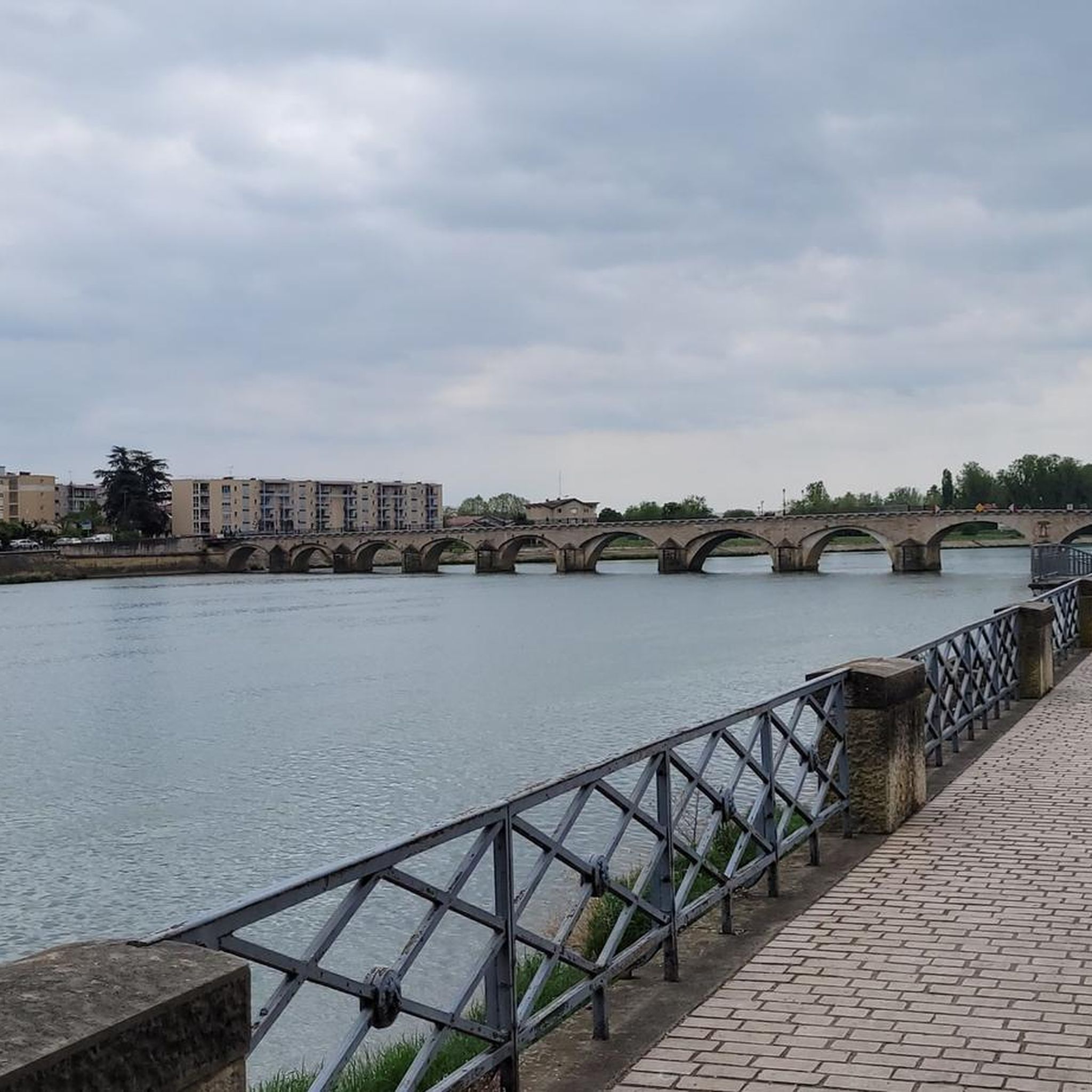
The Saint-Laurent Bridge (Pont Saint-Laurent) is a historic stone bridge that spans the Saône River. It connects the town of Mâcon in the Saône-et-Loire department with the municipality of Saint-Laurent-sur-Saône in the Ain department. Initial wooden structures were already built by the Romans. The current stone bridge dates back to the 11th century in its core and is considered the oldest bridge over the Saône. The structure consists of twelve stone arches. On one of the pillars, there is a statue of Saint Nicholas, the patron saint of boatmen. It is one of the few historic structures in the region that survived the demolitions of World War II unscathed.
1
0
The Voie Verte (Green Way) is a former, paved railway line. At the starting point in Charnay-lès-Mâcon is the Vélo-Gare du Mâconnais - a former train station, which today serves as a tourist office and bicycle rental.
1
0

Along the Saône runs the unfortunately often unpaved, patchy Voie Bleu ("Blue Way"). Incidentally, there is only one Voie Bleu, unlike the Voies Vertes. From Wikivoyage.
1
0

True to Bresse architecture, the Domain des Saveurs - Les Planons has been listed as a Historic Monument since 1938. It was built in 1490 and operated until 1992. With its Saracen chimney, vast outbuildings, circulation galleries and spacious courtyard, the farm is a remarkable example of typical Bresse architecture.
0
0
Frequently Asked Questions
How many road cycling routes are available around Replonges?
The Replonges area, situated in the Ain department, offers a comprehensive network of over 500 road cycling routes. These routes cater to various skill levels, from easy rides along river plains to challenging ascents in the Mâconnais hills.
What kind of terrain can I expect when road cycling near Replonges?
You'll find a diverse topography around Replonges. The region features gentle plains along the Saône River, ideal for relaxed rides, alongside more challenging climbs through the Mâconnais vineyards and surrounding hills. This variety ensures options for all preferences, from flat sections to demanding ascents.
Are there any easy road cycling routes suitable for beginners or families?
Yes, the region offers several easy routes perfect for beginners or family cycling. For instance, The floodplain meadows of the Saône valley - loop provides a serene, flat experience with views of the Saône River. The Ain department is known for its greenways and easy loops, making it suitable for all ages and skill levels.
Where can I find challenging road cycling routes with significant elevation gain?
For more challenging rides, head towards the Mâconnais hills. Routes like Col de Gerbet Loop from Mâcon and Col de la Grange du Bois – Col de Gerbet loop from Mâcon-Ville feature significant elevation gain, offering demanding ascents and rewarding views.
What are some notable landmarks or attractions I can see along the cycling routes?
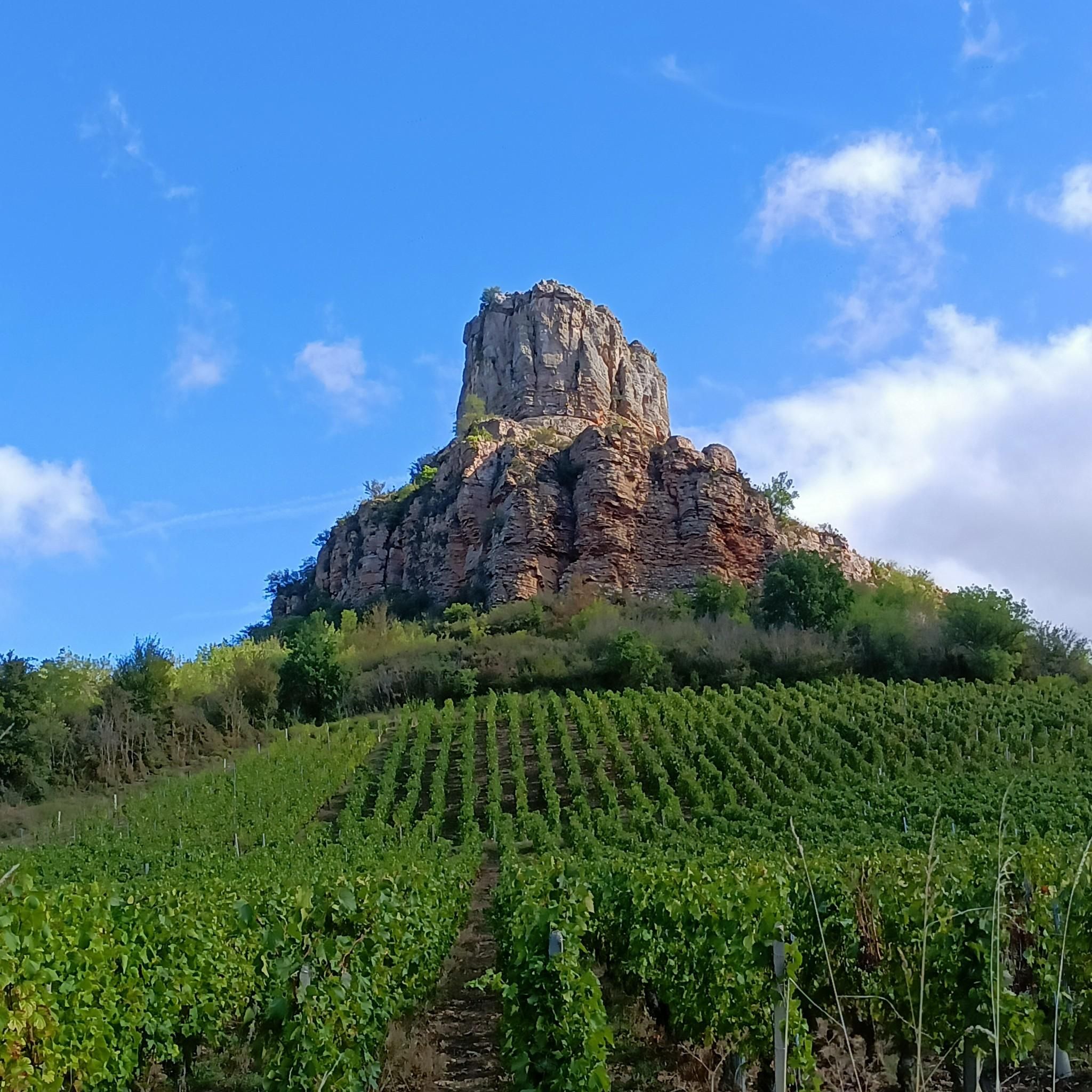
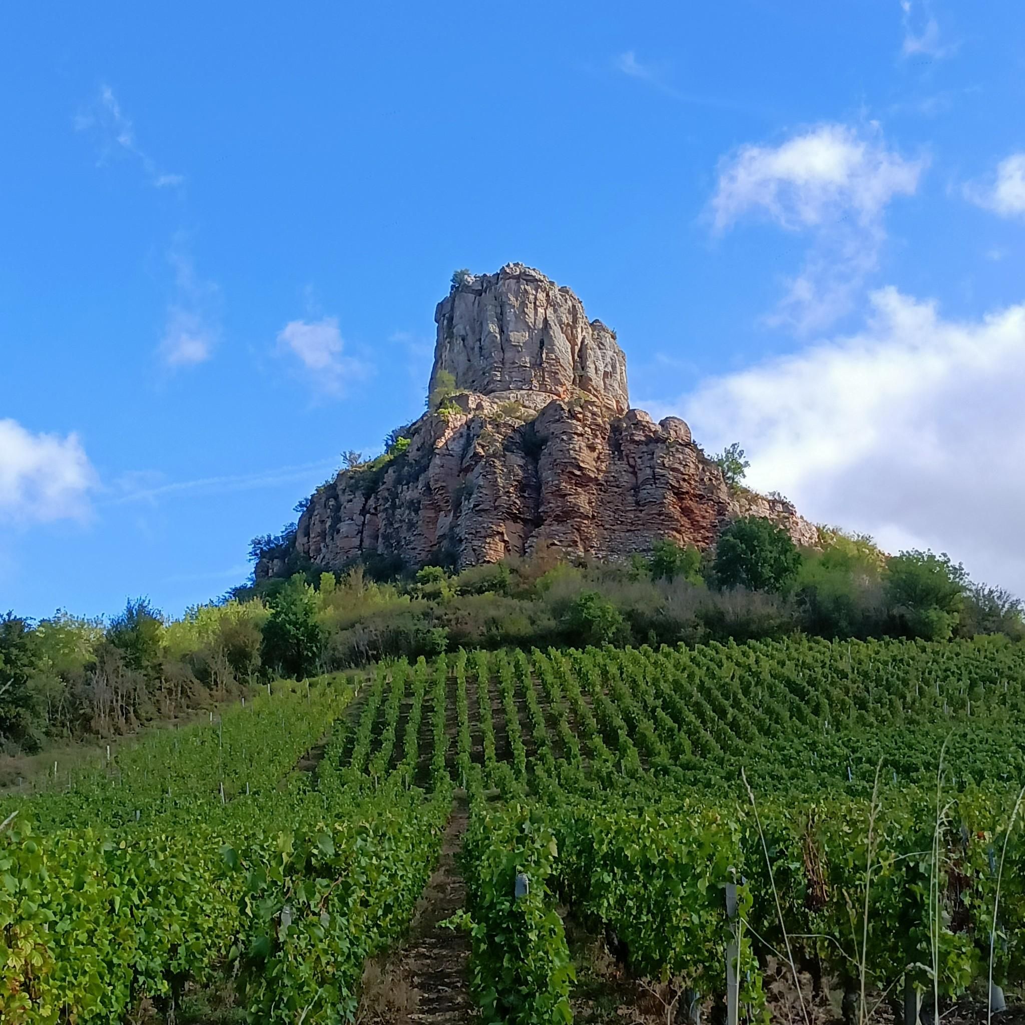
Several interesting landmarks are accessible from the cycling routes. You can encounter natural monuments like the famous Roche de Solutré and Vergisson Rock. Cyclists can also enjoy scenic views, such as the View of Mâcon and the Saône from the François Mitterand bridge, or visit the Cormoranche Lake Leisure Center.
What do other road cyclists think about the routes in Replonges?
The road cycling routes around Replonges are highly regarded by the komoot community, holding an average rating of 4.4 stars from over 150 reviews. Cyclists often praise the varied terrain, from the peaceful river plains to the scenic Mâconnais vineyards, and the well-maintained network of routes.
Are there long-distance cycling paths near Replonges?
Yes, Replonges is conveniently located near significant long-distance cycling paths. The Ain region benefits from well-known routes like the ViaRhôna and the Voie Bleue, which often follow the Saône River, providing extensive and generally flatter options for cyclists looking for longer journeys.
When is the best time of year for road cycling in the Replonges region?
The best time for road cycling in the Replonges region is generally from spring to autumn. During these seasons, the weather is most favorable, offering pleasant temperatures for exploring the diverse landscapes, from the river plains to the vineyard-covered hills.
Are there any circular road cycling routes starting near Replonges?
Yes, many routes in the area are designed as loops, allowing you to start and finish in the same location. Examples include Col de Gerbet Loop from Mâcon and Mâcon and Bresse Countryside Loop, which offer varied experiences through the region's landscapes.
Is the Replonges area well-equipped for cyclists, with amenities like cafes or accommodation?
The Ain region, including the area around Replonges, is noted for its cyclist-friendly infrastructure. You'll find well-maintained roads and signposted routes. Additionally, there are
Are there options for moderate-difficulty road cycling routes?
Absolutely. The region offers a substantial number of moderate routes, perfect for cyclists looking for a balanced challenge. A popular choice is the Mâcon and Bresse Countryside Loop, which takes you through picturesque landscapes without overly strenuous climbs.
Most popular attractions around Replonges

Get inspired with the komoot mobile app


Explore more
Browse the best Road cycling routes in other regions.
