The best walks and hikes around Mallerey
4.5
(84)
603
hikers
74
hikes
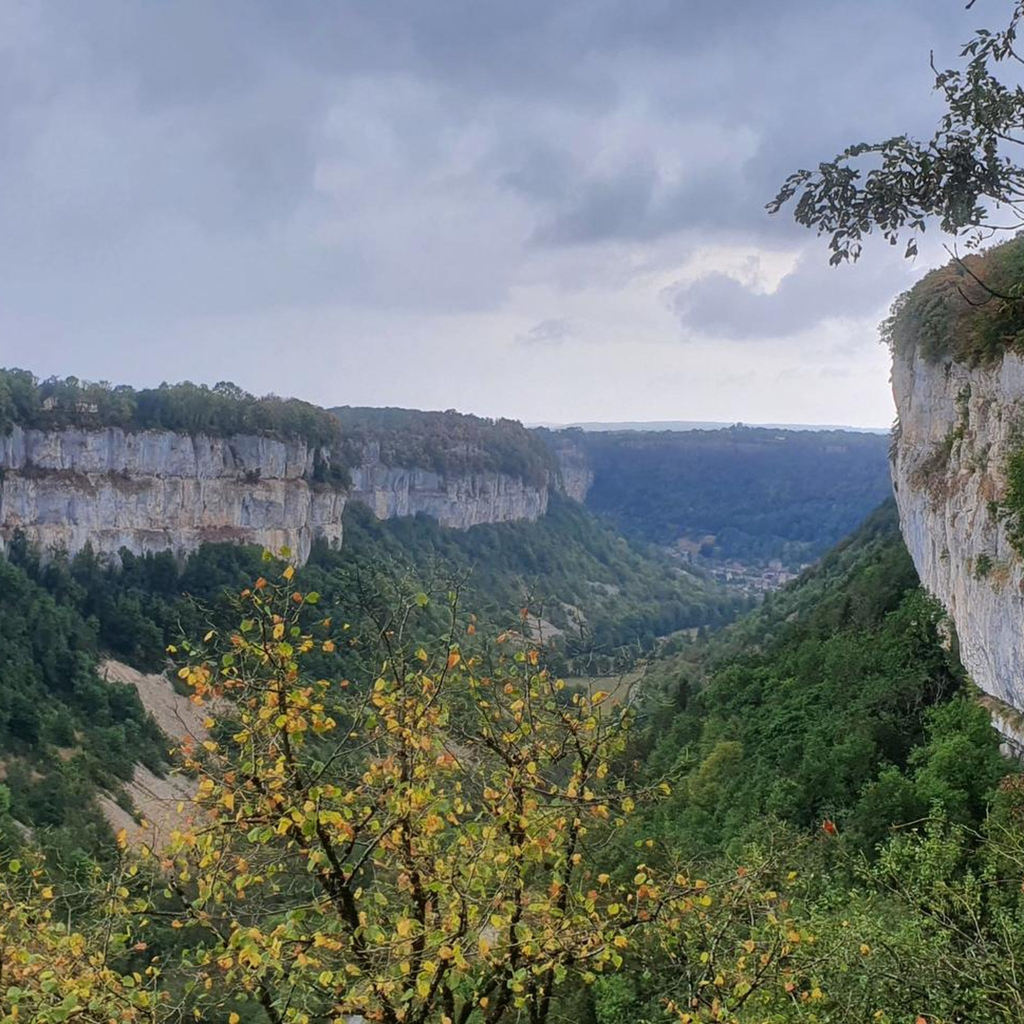
Hiking around Mallerey offers diverse routes through a landscape characterized by varied terrain. The region features prominent viewpoints like Montorient and Pointe de la Vuarde, alongside the Revermont ridges. These natural features provide a mix of elevations and scenic vistas for hikers. The area's trails are well-suited for exploring the local environment.
Best hiking trails around Mallerey
- The most popular hiking route is Montorient Viewpoint – The Revermont ridges loop from Geruge, a 7.4 miles (11.9 km) trail that…
Last updated: May 25, 2026
4.5
(2)
13
hikers
17.3km
05:08
510m
510m
Hard hike. Very good fitness required. Easily-accessible paths. Suitable for all skill levels.
5.0
(4)
23
hikers
13.4km
03:58
400m
400m
Moderate hike. Good fitness required. Easily-accessible paths. Suitable for all skill levels.

Sign up for free
5.0
(1)
13
hikers
13.6km
03:50
290m
290m
Moderate hike. Good fitness required. Easily-accessible paths. Suitable for all skill levels.
5.0
(1)
3
hikers
4.49km
01:22
150m
160m
Easy hike. Great for any fitness level. Easily-accessible paths. Suitable for all skill levels.
5
hikers
12.2km
03:30
290m
290m
Moderate hike. Good fitness required. Easily-accessible paths. Suitable for all skill levels.
Get access to more routes and recommendations from other explorers.
Sign up for free
Already have an account?
Our route recommendations are based on thousands of hikes, rides, and runs completed by other people on komoot.
Start today with a free account
Your next adventure awaits.
Login or Signup



Tips from the Community

Visited in winter with Kïara my dog, very pretty trail
0
0

Beautiful resting place with wonderful views.
1
0

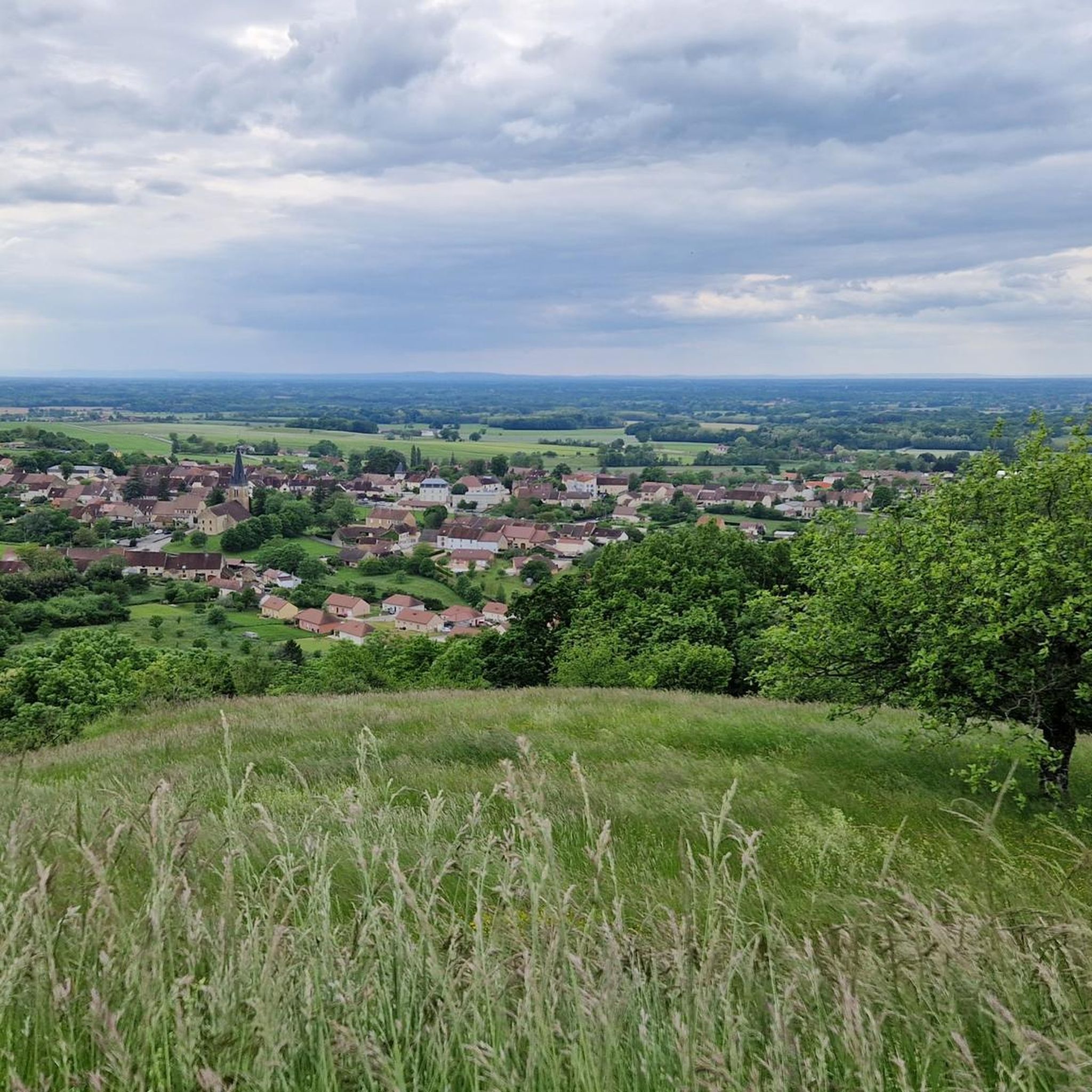
The Montorient belvedere offers an unobstructed 180 degree view. From there you can see Lons-le-Saunier. An orientation table allows you to find your bearings. It is an ideal place for a break or a picnic.
1
0
This ridge path offers a breathtaking view of the Bresse. You progress here in the middle of green meadows. I recommend that you stop at the Vuarde belvedere where the panorama is the clearest.
1
0

beautiful path through a forest of trees thickly overgrown with moss. Slippery when wet!
0
0

Nice view on Lons le Saunier and surroundings with pic nic table
2
0

Well secured even in front of the camera by a high wall is this beautiful privately owned castle. Although not much is visible from the castle, the place is well worth it.
6
1
Frequently Asked Questions
How many hiking trails are available around Mallerey?
There are over 80 hiking routes around Mallerey, catering to various skill levels. You'll find 39 easy routes, 37 moderate trails, and 4 more challenging options to explore the region's varied terrain.
Are there any family-friendly hiking options in Mallerey?
Yes, Mallerey offers several easy routes suitable for families. A good option is the Montorient Viewpoint loop from Courbouzon, which is 4.2 km long and takes about 1 hour 20 minutes, offering accessible views.
What kind of views can I expect on hikes around Mallerey?
The hiking trails around Mallerey are known for prominent viewpoints and scenic ridges. You can expect expansive vistas from locations like Montorient Viewpoint and Pointe de la Vuarde, often overlooking the Revermont ridges and the surrounding landscape.
Are there any challenging hikes for experienced trekkers?
For experienced trekkers seeking a challenge, Mallerey offers more demanding routes. Consider the Château de Gevingey – Montorient Viewpoint loop from Gevingey. This difficult 17.3 km trail involves significant elevation gain and takes over 5 hours to complete.
Are there circular hiking routes available?
Yes, many routes around Mallerey are circular, allowing you to start and end at the same point. Examples include the Montorient Viewpoint – The Revermont ridges loop from Geruge, a moderate 11.9 km trail, and the Pointe de la Vuarde loop from Saint-Laurent-la-Roche, which is 6.3 km.
What do other hikers enjoy most about the trails in Mallerey?
The trails in Mallerey are highly rated by the komoot community, with an average score of 4.5 stars from over 70 reviews. Hikers often praise the diverse terrain, the scenic viewpoints like Montorient, and the well-suited paths for exploring the local environment.
Are there any notable landmarks or attractions to see near the hiking trails?
While hiking, you can discover several points of interest. The Montorient Viewpoint is a prominent natural landmark. Nearby, you might also explore the town of Montaigu or the larger settlement of Lons-le-Saunier.
Is public transport available to access hiking trailheads in Mallerey?
Information on specific public transport links directly to every trailhead in Mallerey is limited. However, for the broader region, it's advisable to check local bus services or regional transport options that might connect to nearby villages or towns, from which you can then access the trails.
Are there specific parking facilities for hikers?
While specific parking facilities for each trailhead are not detailed, many routes, particularly those starting from villages like Geruge or Saint-Laurent-la-Roche, typically have designated parking areas or roadside parking available. It's always recommended to check local signage upon arrival.
What is the best time of year to go hiking in Mallerey?
The region around Mallerey, similar to Melleray, generally offers good hiking conditions throughout much of the year. Spring and autumn provide pleasant temperatures and vibrant scenery, while summer is also popular, though it can be warmer. Winter hiking is possible but may require appropriate gear for colder conditions.
Are dogs allowed on the hiking trails in Mallerey?
Generally, dogs are welcome on hiking trails in many natural areas, provided they are kept under control, especially around wildlife or livestock. Specific regulations can vary, so it's always best to check for any local signage or restrictions at the trailhead before setting out with your dog.
Can I find cafes or accommodation near the hiking routes?
While the immediate trailheads might not always have amenities, the villages and towns surrounding Mallerey, such as Saint-Laurent-la-Roche or Geruge, are likely to offer local cafes, restaurants, or accommodation options. For a wider selection, larger towns like Lons-le-Saunier would be a good choice.
Most popular attractions around Mallerey

Get inspired with the komoot mobile app


Explore more
Browse the best Hikes in other regions.
