The best walks and hikes around Tart-Le-Haut
4.0
(19)
161
hikers
39
hikes
Hiking around Tart-Le-Haut offers a network of trails through the flat, agricultural landscapes of the region. The terrain is characterized by gentle riverine paths and routes connecting local villages and points of interest. With minimal elevation changes, the area is well-suited for accessible outdoor exploration.
Best hiking trails around Tart-Le-Haut
- The most popular hiking route is View of Château de Longecourt loop from Longecourt-en-Plaine, a 5.0 miles (8.0 km) trail that takes 2 hours 1 minute to complete. This…
Last updated: July 6, 2026
4.0
(2)
12
hikers
10.4km
02:37
20m
20m
Moderate hike. Good fitness required. Easily-accessible paths. Suitable for all skill levels.
4.0
(1)
5
hikers
11.1km
02:49
20m
20m
Moderate hike. Good fitness required. Easily-accessible paths. Suitable for all skill levels.

Sign up for free
8
hikers
4.51km
01:08
10m
10m
Easy hike. Great for any fitness level. Easily-accessible paths. Suitable for all skill levels.
4
hikers
6.33km
01:36
10m
10m
Easy hike. Great for any fitness level. Easily-accessible paths. Suitable for all skill levels.
5.0
(1)
3
hikers
7.00km
01:46
10m
10m
Easy hike. Great for any fitness level. Easily-accessible paths. Suitable for all skill levels.
Get access to more routes and recommendations from other explorers.
Sign up for free
Already have an account?
Our route recommendations are based on thousands of hikes, rides, and runs completed by other people on komoot.
Start today with a free account
Your next adventure awaits.
Login or Signup


Tips from the Community

Listed as a historical monument, the Château de Longecourt is built of brick and stone. Today it is a charming guest house with 5 bedrooms and a suite.
0
0

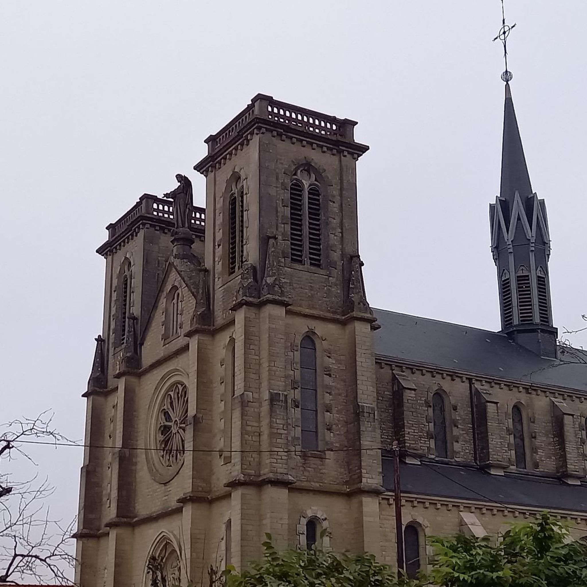
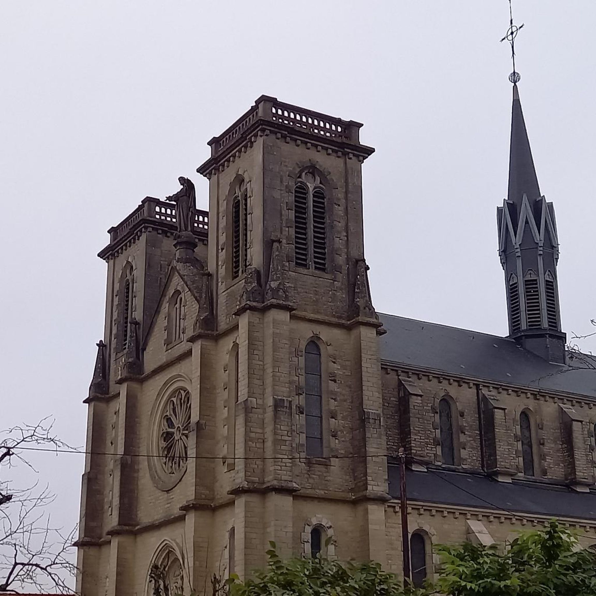
A small town with plenty of attractions. The town offers a 4km walking trail to discover its heritage: thirteen sites are listed, and signs telling their history are located in front of them. In the town center: - 19th-century Saint Rémi Church - Dumesnil Castle, Chapel, and Dovecote - beautiful building with a fresco on its roof (near the church, former hunting lodge of the Dukes of Burgundy) - Magnin Castle and its park
2
0


Located right next to the Catholic Church
0
0
Frequently Asked Questions
How many hiking trails are available around Tart-Le-Haut?
There are over 30 hiking trails around Tart-Le-Haut, offering a variety of options for different abilities. You'll find a good mix of easy and moderate routes, with 21 easy trails and 13 moderate ones.
What kind of terrain can I expect on hikes in Tart-Le-Haut?
The terrain around Tart-Le-Haut is generally flat, characterized by agricultural landscapes and gentle riverine paths. There are minimal elevation changes, making the area well-suited for accessible outdoor exploration.
Are there family-friendly hiking options in Tart-Le-Haut?
Yes, the flat and gentle nature of the trails makes many routes around Tart-Le-Haut suitable for families. For an easy walk through village surroundings, consider the Genlis Town Hall loop from Genlis, which is about 3.9 miles (6.3 km) long.
Are dogs allowed on the hiking trails in Tart-Le-Haut?
Most trails in the Tart-Le-Haut region are generally dog-friendly, especially those through agricultural areas and along river paths. However, it's always recommended to keep dogs on a leash, particularly near livestock or in populated areas, and to clean up after them.
What are some interesting places to see along the hiking trails?
While hiking, you can explore several points of interest. Consider visiting Saint-Jean-de-Losne, a charming settlement, or the Canal du Rhône au Rhin Entrance and Lock. The Port of Saint-Jean-de-Losne is also a notable spot.
Are there circular hiking routes available?
Yes, many of the trails around Tart-Le-Haut are designed as loops, offering convenient circular routes. An example is the Brazey-en-Plaine loop from Brazey-en-Plaine, an easy 4.3-mile (7.0 km) hike.
What is the best time of year to go hiking in Tart-Le-Haut?
The best time to hike in Tart-Le-Haut is typically during spring, summer, and early autumn. These seasons offer pleasant weather for exploring the flat, open landscapes and riverine paths. Winter hiking is also possible, but trails may be muddy or frosty.
Are there any moderate hikes for those looking for a bit more challenge?
Yes, there are several moderate routes. The Port of St-Jean-de-Losne loop from Montot is a moderate 6.9-mile (11.1 km) path that explores the area around the port. Another option is the Brazey-en-Plaine loop from Montot, which is 5.2 miles (8.4 km) long.
What do other hikers enjoy most about hiking in Tart-Le-Haut?
The area is highly rated by the komoot community, with an average score of 4.3 stars. Reviewers often praise the quiet agricultural landscapes, the gentle riverine paths, and the accessibility of the trails for various fitness levels.
Where can I find parking for hiking trails in Tart-Le-Haut?
While specific parking areas for each trail are not always signposted, you can generally find parking in the villages where the routes begin, such as Longecourt-en-Plaine, Montot, or Genlis. Look for public parking lots or designated roadside spaces.
Are there any hikes that offer views of historical sites?
Yes, for a hike with historical views, consider the View of Château de Longecourt loop from Longecourt-en-Plaine. This 5.0-mile (8.0 km) moderate trail offers scenic views of the historic Château de Longecourt.
Most popular routes around Tart-Le-Haut
Most popular attractions around Tart-Le-Haut

Get inspired with the komoot mobile app


Explore more
Browse the best Hikes in other regions.
