The best walks and hikes around Crasville-La-Mallet
4.5
(1244)
6,366
hikers
107
hikes
Hiking around Crasville-La-Mallet offers a diverse landscape characterized by the proximity to the Normandy coast and inland river valleys. The region features a mix of rural paths, lakeside trails, and routes along waterways like the Durdent and La Veules. Elevation changes are generally gentle, making many paths accessible for various fitness levels. The terrain often includes agricultural land, small woodlands, and coastal sections.
Best hiking trails around Crasville-La-Mallet
- The most popular hiking route is Lake Caniel loop from Canouville,…
Last updated: October 25, 2026
4.7
(7)
134
hikers
3.51km
00:54
20m
20m
Easy hike. Easily walkable paths.
3.9
(15)
34
hikers
11.6km
03:03
90m
90m
Moderate hike. Good fitness required. Easily walkable paths.

4.6
(7)
43
hikers
18.9km
04:56
130m
130m
Moderate hike. Good fitness required. Easily walkable paths.
5.0
(3)
22
hikers
21.5km
05:47
270m
270m
Hard hike. Very good fitness required. Easily walkable paths.
5.0
(2)
9
hikers
13.8km
03:36
100m
100m
Moderate hike. Good fitness required. Easily walkable paths.
Get access to more routes and recommendations from other explorers.
Already have an account?
Our route recommendations are based on thousands of hikes, rides, and runs completed by other people on komoot.
Start today with a free account
Your next adventure awaits.


Tips from the Community


An old Norman half-timbered house by the harbor. The front view is inaccessible or difficult to access due to construction workers on the street. However, the inner courtyard is also well preserved and bears witness to the carpentry skills of our ancestors.
4
0
Harbor entrance, today at low tide.
4
0
One of the typical narrow streets found in many places in Normandy
4
0

Itinerary with almost no roads (mainly dirt and coastal paths through fields and small sections of departmental and municipal roads) in very pretty natural environments. Especially the beach and the surroundings of Saint-Aubin-sur-Mer! However, some sad old fly-tipping and rarer more recent ones on the coastal paths and other points can be annoying. Also pay attention to the weather on the day of the outing and the previous days because some sections can become very muddy + some passages in the vegetation can transform, with growth, into slightly narrower and difficult to use spaces (mainly coastal paths). The erosion of the cliff seems to be accelerating in some parts and could make access to certain areas of the coastal paths more complex or even cut off in the (fairly) near future. Allow a good seven hours (minimum) in total with a few short breaks.
1
0


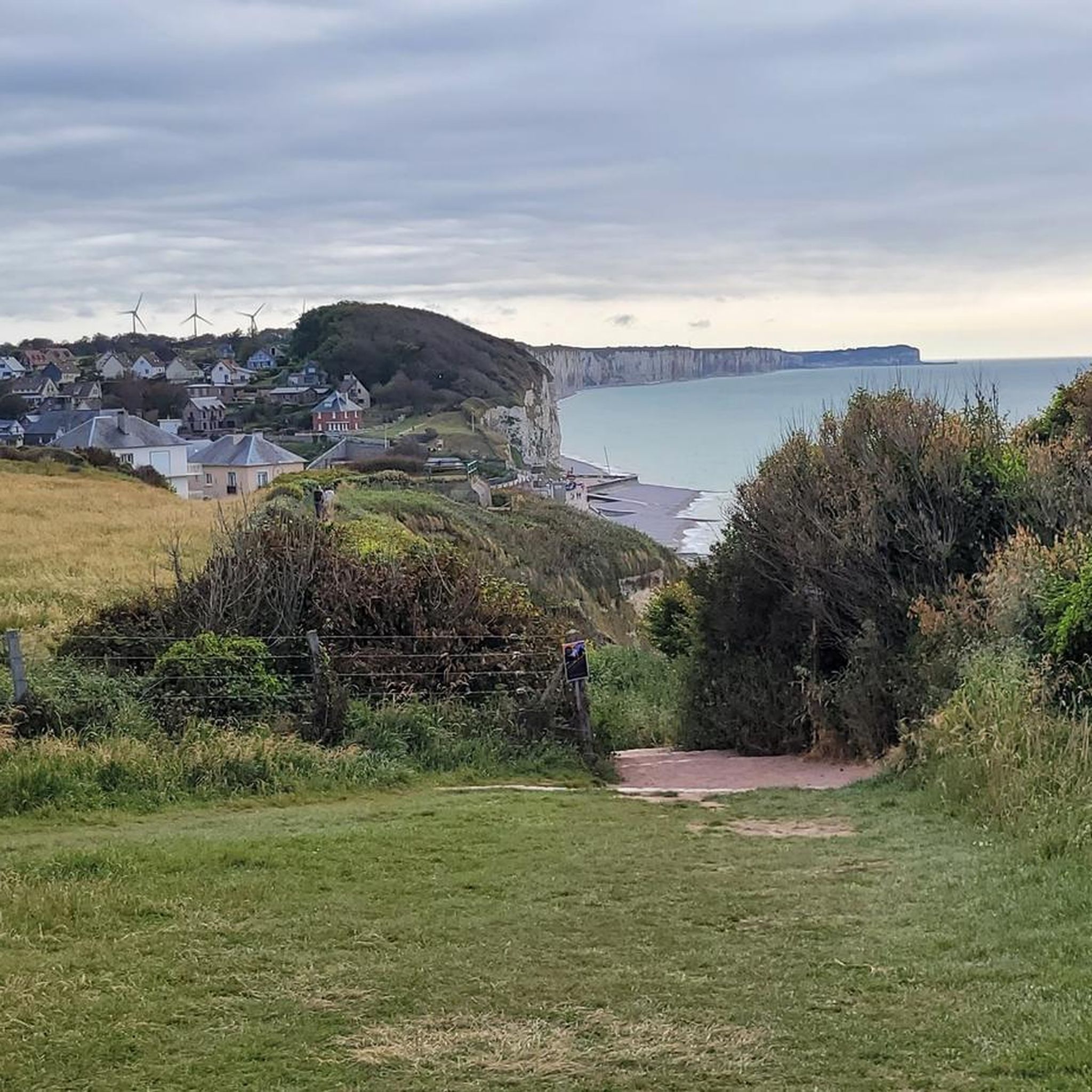
From this point of view, you can admire the town of Veules-les-Roses and its river, the Veules, famous for being the shortest in France. You can even see it flow into the sea nearby.
3
0
Frequently Asked Questions
How many hiking trails are available around Crasville-La-Mallet?
There are over 95 hiking routes around Crasville-La-Mallet, offering a wide range of options from easy strolls to more challenging treks. The region's diverse landscape includes coastal paths, river valleys, and rural trails.
Are there many easy hiking routes suitable for beginners in the Crasville-La-Mallet area?
Yes, Crasville-La-Mallet offers a good selection of easy routes. Approximately 42 of the trails are rated as easy, featuring gentle elevation changes and well-maintained paths. A pleasant option is the Lake Caniel loop from Canouville, which is a short and scenic walk around the lake.
What kind of natural attractions can I expect to see on hikes near Crasville-La-Mallet?
The region boasts a mix of natural beauty, from the dramatic Cliffs of Sotteville-sur-Mer Coastal Path to serene river valleys. You can also find scenic spots like the View of the cliffs at Veulettes and the unique Question Mark Viewpoint, offering picturesque vistas of the landscape.
Are there any circular hiking routes around Crasville-La-Mallet?
Many of the trails in the area are circular, allowing you to start and end at the same point. For example, the Market Mill – La Veules loop from Manneville-ès-Plains is a popular moderate circular route that explores the rural landscape and follows sections of the La Veules river.
What do other hikers say about the trails in Crasville-La-Mallet?
The hiking trails around Crasville-La-Mallet are highly regarded by the komoot community, with an average rating of 4.4 stars from over 900 reviews. Hikers often praise the varied terrain, from tranquil lakeside paths to charming rural landscapes, and the accessibility of routes for different fitness levels.
Are there any historical landmarks or castles to visit while hiking in the region?
Yes, the area around Crasville-La-Mallet is dotted with historical sites. You can explore beautiful castles such as the Château de Mesnil Geoffroy or the Château de Janville and its gardens. These often provide interesting detours or starting points for walks.
What is the best season for hiking around Crasville-La-Mallet?
The region is enjoyable for hiking throughout much of the year. Spring and autumn offer pleasant temperatures and beautiful scenery, with blooming flowers or vibrant fall foliage. Summer is also popular, especially for coastal walks, while winter can provide crisp, quiet trails, though some paths might be muddy after rain.
Are there any longer, more challenging hikes available?
While many routes are easy to moderate, there are options for longer hikes. For instance, the La Veules – Market Mill loop from Angiens is a moderate 11.7-mile (18.8 km) trail that takes nearly 5 hours to complete, leading through river valleys and countryside.
Can I find trails that offer coastal views or access to beaches?
Absolutely. Given its proximity to the Normandy coast, many trails offer stunning coastal vistas. The Mouth of the Durdent – Veulettes-sur-Mer Beach loop from Vittefleur is a great option that takes you along the coast and to Veulettes-sur-Mer beach.
Are there any hikes that follow rivers or lakes?
Yes, the region is characterized by its river valleys. You can find routes that trace waterways like the Durdent and La Veules. The La Durdent in Vittefleur – Lake Caniel loop from Cany-Barville is a moderate trail that combines river and lakeside scenery.
Is parking generally available at trailheads in Crasville-La-Mallet?
Parking availability varies by trailhead. Many villages and popular starting points for hikes, especially those near attractions or larger towns, typically offer designated parking areas. It's advisable to check specific route details on komoot for information on parking at your chosen starting point.
What kind of terrain should I expect on the trails?
The terrain around Crasville-La-Mallet is quite varied. You'll encounter rural paths through agricultural land, sections through small woodlands, and trails along riverbanks and lakesides. Coastal routes feature cliff-top paths. Most paths are generally well-trodden, but some can be muddy after rain, especially in wooded or riverside areas.
Most popular routes around Crasville-La-Mallet
Most popular attractions around Crasville-La-Mallet

Get inspired with the komoot mobile app


Explore more
Browse the best Hikes in other regions.
