The best walks and hikes around Saint-Jeannet
4.6
(636)
4,891
hikers
30
hikes
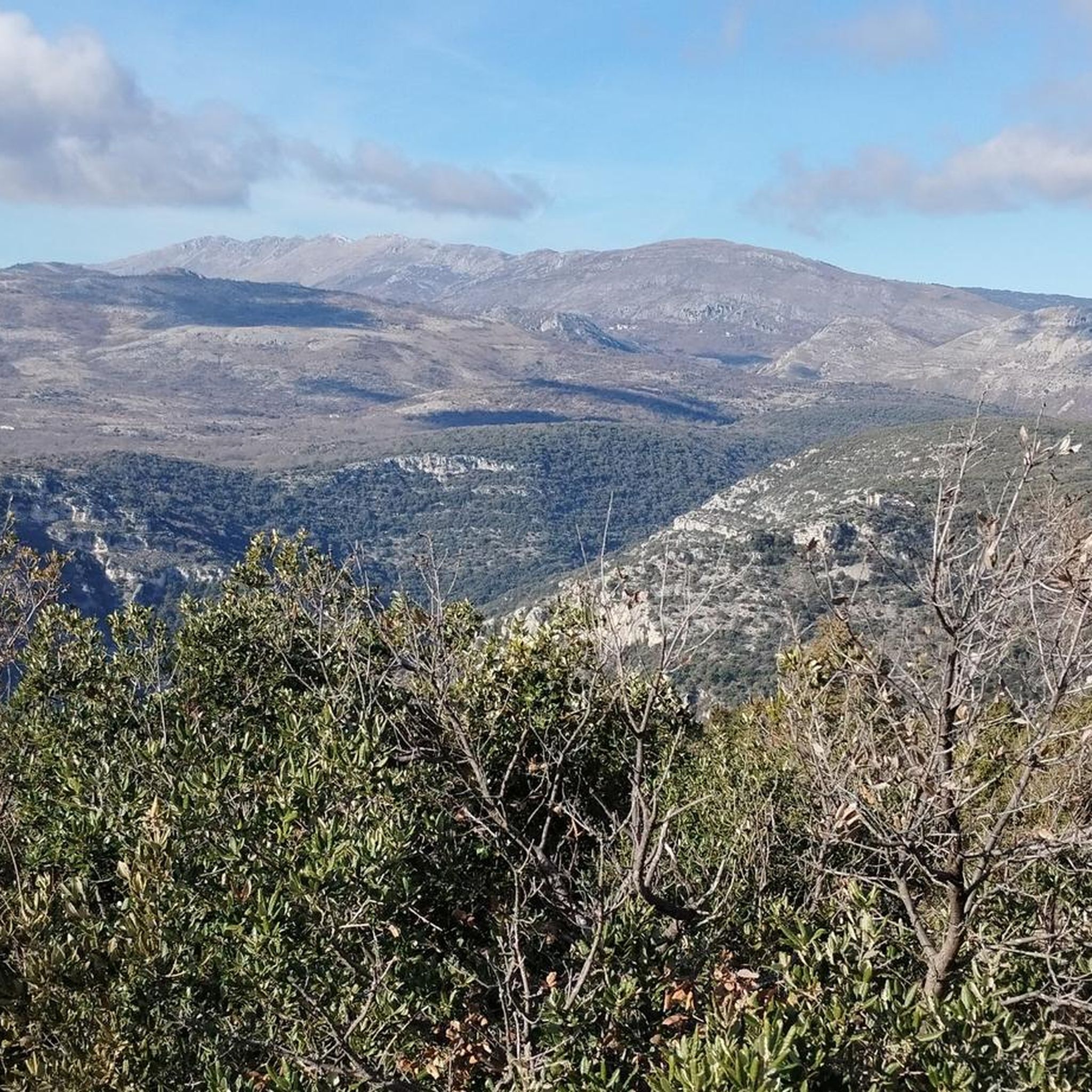
Hiking around Saint-Jeannet offers diverse terrain within the Alpes-Maritimes, characterized by dramatic limestone cliffs and varied natural features. The dominant landmark is the Baou de Saint-Jeannet, an 800-meter cliff providing extensive panoramic views. The region is part of the Préalpes d'Azur, known for its rich biodiversity and a network of trails. Hikers can explore a mix of rocky tracks, forested paths, and open areas with significant elevation changes.
Best hiking trails around Saint-Jeannet
- The most popular hiking route is Le…
Last updated: October 10, 2026
4.8
(94)
553
hikers
6.69km
02:26
420m
420m
Moderate hike. Good fitness required. Easily-accessible paths. Suitable for all skill levels.
4.8
(102)
543
hikers
7.61km
02:39
410m
410m
Moderate hike. Good fitness required. Easily-accessible paths. Suitable for all skill levels.

4.7
(79)
511
hikers
10.3km
03:36
550m
550m
Moderate hike. Good fitness required. Easily-accessible paths. Suitable for all skill levels.
5.0
(3)
52
hikers
9.12km
03:26
520m
520m
Moderate hike. Good fitness required. Mostly accessible paths. Sure-footedness required.
4.0
(2)
25
hikers
Moderate hike. Good fitness required. Mostly accessible paths. Sure-footedness required.
Get access to more routes and recommendations from other explorers.
Already have an account?
Our route recommendations are based on thousands of hikes, rides, and runs completed by other people on komoot.
Start today with a free account
Your next adventure awaits.
Other adventures around Saint-Jeannet

Tips from the Community

The ruins are now inaccessible and the same applies to the path that passes underneath. You have to take the path that goes down just before the ruins to get back down to St-Jeannet.
0
0

A somewhat rough and thorny path that connects the two viewpoints, but the scenery is very beautiful.
0
0
The path exists, but there are several signs marking it as a private path and warning of dogs. We dared to walk past the barrier and the chain, but we didn't want to climb over the gate. Instead, we had to take a long detour. My recommendation is to approach from the residential area in Vence (Chemin du Riou).
2
0
To the left is the mountain, straight ahead is the waterfall.
0
0

Perched at an altitude of 480 meters, the Notre-Dame des Baous Chapel dates from the 17th century. It offers a breathtaking view of the Var valley and the Mediterranean. A must-see site before or after a hike, just a few steps from Saint-Jeannet!
0
0
The Baou de Saint-Jeannet peaks at 802 meters, offering a spectacular view of the Côte d'Azur and the Nice hinterland. This limestone massif is popular with hikers and climbers for its numerous climbing routes and steep trails.
3
1

Le Baou des Noirs will take you to the top of a rocky cliff which offers breathtaking views of the Côte d'Azur and the surrounding mountains. You will also be able to see the Baou des Blancs, another popular summit.
2
0
If you're looking for a scenic and rewarding race near Vence, you can try the Baou des Blancs circuit. This trail will take you to the top of a small, flat-topped mountain, from where you can enjoy stunning views of the city and surrounding landscape. The Baou des Blancs owes its name to the white penitents of the Middle Ages, who wore white robes as a sign of repentance. You'll pass through karst landscapes and scrubland flora, and you might even spot some wildlife along the way. Le Baou des Blancs is an ideal place to discover the beauty and history of the Provence region.
2
0
Frequently Asked Questions
How many hiking trails are available around Saint-Jeannet?
Saint-Jeannet offers a wide variety of hiking experiences, with over 30 trails available. These routes cater to different skill levels, from easy strolls to more challenging ascents, all set against the dramatic backdrop of the Préalpes d'Azur.
What kind of terrain can I expect on hikes in Saint-Jeannet?
The terrain around Saint-Jeannet is diverse, characterized by dramatic limestone cliffs, rocky tracks, and forested paths. You'll encounter significant elevation changes, especially on trails leading to the summit of the Baou de Saint-Jeannet, offering a stimulating challenge and expansive views.
Are there any circular hiking routes in Saint-Jeannet?
Yes, Saint-Jeannet features several circular routes. A popular option is the Village of Saint-Jeannet – Baou of Saint-Jeannet loop from Saint-Jeannet, which is 7.0 miles (11.2 km) long and typically takes around 3 hours 58 minutes to complete. This route allows you to explore both the village and the iconic Baou.
What are some notable natural features or landmarks to see while hiking?
The dominant natural landmark is the Baou de Saint-Jeannet, an immense cliff offering breathtaking panoramic views. You can also explore hidden caves and the ruins of ancient sheepfolds along trails like the Sentier du Baou. Other notable features include the 600-year-old oak tree on top of Baou de la Gaude and the secluded chapel on the Plateau Notre-Dame-des-Grâces. For a specific natural monument, consider visiting the Castle Waterfall nearby.
Are there any family-friendly hiking options in Saint-Jeannet?
While many trails involve elevation, there are options suitable for families. The region offers a mix of easy and moderate routes. For instance, the Village of Saint-Jeannet – Notre-Dame des Baous Chapel loop from Saint-Jeannet is a moderate 8.5 km (5.3 miles) trail that takes about 2 hours 40 minutes, offering varied terrain without extreme difficulty.
What is the best time of year to go hiking in Saint-Jeannet?
Saint-Jeannet is an excellent destination for outdoor activities year-round. However, spring and autumn generally offer the most pleasant temperatures for hiking, with lush landscapes in spring and vibrant colors in autumn. Summer can be warm, so early morning or late afternoon hikes are recommended, while winter offers crisp air and clear views, though some higher paths might be cooler.
Where can I park when hiking in Saint-Jeannet?
Parking is generally available in and around the village of Saint-Jeannet, which serves as a common starting point for many trails. Specific parking areas are often indicated near trailheads, especially for popular routes leading to the Baou. It's advisable to arrive early during peak seasons to secure a spot.
What do other hikers say about the trails in Saint-Jeannet?
The hiking routes in Saint-Jeannet are highly regarded by the komoot community, with an average rating of 4.6 stars from over 500 reviews. Hikers often praise the stunning panoramic views from the Baou, the diverse natural features, and the well-maintained paths that offer a rewarding experience for various skill levels.
Are there any historical sites or ruins to explore on the trails?
Yes, several trails offer glimpses into the region's history. You can find the ruins of ancient sheepfolds, such as the ruined stone house of Le Castellet, along routes like the Castellet Circuit. Other paths lead to the ruins of Castellaras, exploring the pastoral dry-stone heritage of the area and even revealing Ligurian and Roman traces.
Can I find a waterfall near the hiking trails in Saint-Jeannet?
Yes, there is a notable waterfall in the vicinity. The Castle Waterfall is an attraction that can be visited, offering a refreshing natural sight not far from the hiking areas.
What is the typical duration for a hike in Saint-Jeannet?
Hike durations vary significantly depending on the route and your pace. Shorter, easier trails might take around 1.5 to 2 hours, while moderate ascents like Le Baou de Saint-Jeannet typically take about 2 hours 39 minutes for 4.7 miles (7.6 km). Longer loops can extend to nearly 4 hours or more, such as the 7.0 miles (11.2 km) Village of Saint-Jeannet – Baou of Saint-Jeannet loop from Saint-Jeannet.
Most popular routes around Saint-Jeannet
Most popular attractions around Saint-Jeannet

Get inspired with the komoot mobile app


Explore more
Browse the best Hikes in other regions.
